Maryland highway system

Last updated
I-95.svg US 40.svg MD Route 16.svg
Standard route signs in Maryland
Highway names
Interstates Interstate X (I-X)
US Highways U.S. Route X (US X)
State Maryland Route X (MD X)
System links

The Maryland highway system is a network of highways owned and maintained by the U.S. state of Maryland. In addition to the nationally numbered Interstate Highways and U.S. Highways, the highway system consists of a network of Maryland state-numbered highways. All three types of highways together provide access to all incorporated and unincorporated areas in all 23 counties of Maryland as well as the independent city of Baltimore.

Contents

Highway systems

Interstate highways

Maryland has 16 Interstate highways, including six primary Interstates and ten auxiliary Interstates. The longest Interstate in Maryland is Interstate 95, while the shortest Interstate is I-295. Maryland also contains an unsigned Interstate, I-595; a former Interstate, I-170; and an intracounty Interstate, I-97, which is also the shortest primary highway in the Interstate Highway System.

U.S. highways

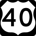
Maryland has 14 U.S. Highways, including seven primary U.S. Highways and seven auxiliary U.S. highways. The longest U.S. highway in Maryland is U.S. Route 40, while the shortest U.S. highway is US 522. Maryland also contains six former U.S. highways.

Maryland state highways

Maryland has a unitary system of numbered state highways with numbers between 2 and 999. The longest Maryland state highway is Maryland Route 2, while several state highways are less than 0.5 mi (0.80 km) in length. Most of the shortest highways are unsigned. Several state highways have multiple disjoint segments that are denoted internally by suffixes, encompassing either old alignments of a major highway or a collection of service roads related to a particular highway.

Other systems

Welcome sign along Interstate 81 Maryland.JPG
Welcome sign along Interstate 81

There are other systems of highways in Maryland that are not marked but are numbered internally.

Highway agencies

Maryland State Highway Administration

The vast majority of Interstate, U.S., and state highways are constructed by and maintained by the Maryland State Highway Administration (MDSHA).

Maryland Transportation Authority

All toll facilities in the state and limited access highways within Baltimore except I-83 are constructed and maintained by the Maryland Transportation Authority (MdTA).

Other agencies

All U.S. and state highways and I-83 within Baltimore are maintained by the Baltimore City Department of Transportation. Portions of U.S. and state highways within particular cities and towns are maintained by the respective municipalities.

See also

Related Research Articles

Interstate Highway System Network of freeways in the United States

The Dwight D. Eisenhower National System of Interstate and Defense Highways, commonly known as the Interstate Highway System, is a network of controlled-access highways that forms part of the National Highway System in the United States. The system extends throughout the contiguous United States and has routes in Hawaii, Alaska, and Puerto Rico.

Baltimore–Washington Parkway Highway in Maryland, United States

The Baltimore–Washington Parkway is a highway in the U.S. state of Maryland, running southwest from Baltimore to Washington, D.C. The road begins at an interchange with U.S. Route 50 (US 50) near Cheverly in Prince George's County at the Washington, D.C. border, and continues northeast as a parkway maintained by the National Park Service (NPS) to MD 175 near Fort Meade, serving many federal institutions. This portion of the parkway is dedicated to Gladys Noon Spellman, a representative of Maryland's 5th congressional district, and has the unsigned Maryland Route 295 (MD 295) designation. Commercial vehicles, including trucks, are prohibited within this stretch. This section is administered by the NPS's Greenbelt Park unit. After leaving park service boundaries the highway is maintained by the state and signed with the MD 295 designation. This section of the parkway passes near Baltimore–Washington International Thurgood Marshall Airport. Upon entering Baltimore, the Baltimore Department of Transportation takes over maintenance of the road and it continues north to an interchange with Interstate 95 (I-95). Here, the Baltimore–Washington Parkway ends and MD 295 continues north unsigned on Russell Street, which carries the route north into downtown Baltimore. In downtown Baltimore, MD 295 follows Paca Street northbound and Greene Street southbound before ending at US 40.

Interstate 895 (I-895) is an Interstate Highway in the U.S. state of Maryland. Known as the Harbor Tunnel Thruway, the highway runs 14.87 miles (23.93 km) between one junction with I-95 in Elkridge and another interchange with I-95 on the east side of Baltimore. I-895 is a toll road that crosses the Patapsco River estuary via the Baltimore Harbor Tunnel, connecting U.S. Route 1, I-695, and the Baltimore–Washington Parkway in the southwestern suburbs of Baltimore with US 40 on the east side of Baltimore. In conjunction with a pair of spurs, unsigned I-895A and I-895B, I-895 provides access to the tunnel from I-97 and Maryland Route 2 in Glen Burnie. The highway is designed for through traffic by having partial interchanges that require vehicles from almost all starting points to pass through the tunnel and the tunnel toll plaza, where a $4 toll is charged to passenger vehicles, before exiting the facility.

The state highway system of the U.S. state of Oregon is a network of highways that are owned and maintained by the Highway Division of the Oregon Department of Transportation (ODOT).

Cabin John Parkway is an automobile parkway in the U.S. state of Maryland. The parkway runs 1.50 miles (2.41 km) from Clara Barton Parkway in Cabin John north to Interstate 495 (I-495) in Bethesda in southwestern Montgomery County. Cabin John Parkway is a four-lane freeway that serves as a connector between Clara Barton Parkway in the direction of Washington and I-495 in the direction of Rockville and Silver Spring. The parkway was constructed in the mid-1960s and passes under the historic Union Arch Bridge, the longest masonry arch span in America.

The state highway system of the U.S. state of Virginia is a network of roads maintained by the Virginia Department of Transportation (VDOT). As of 2006, the VDOT maintains 57,867 miles (93,128 km) of state highways, making it the third-largest system in the United States.

The New Hampshire Highway System is the public roads system of the U.S. state of New Hampshire containing approximately 17,029 miles (27,406 km) maintained by the New Hampshire Department of Transportation (NHDOT). All public roads in the state are called "highways", thus there is no technical distinction between a "road" or a "highway" in New Hampshire.

Interstate 95 (I-95) in Maryland is a major highway that runs 109.01 miles (175.43 km) diagonally from southwest to northeast, entering from the District of Columbia and Virginia at the Woodrow Wilson Bridge, to Maryland's border with Delaware. It is also the longest interstate highway within Maryland. The route is one of the most traveled Interstate Highways in Maryland, especially between Baltimore and Washington, D.C., despite alternate routes along the corridor, such as the Baltimore–Washington Parkway, U.S. Route 1, and US 29. Portions of the highway, including the Fort McHenry Tunnel and the Millard E. Tydings Memorial Bridge, are tolled.

Maryland Route 337

Maryland Route 337 is a state highway in the U.S. state of Maryland. Known for most of its length as Allentown Road, the highway runs 3.41 miles (5.49 km) from MD 5 in Camp Springs east to MD 4 near Forestville. MD 337 runs along the southern end of Morningside and the northern edge of Andrews Air Force Base and provides access to several entrances to the military base. The state highway runs concurrently with the easternmost portion of Suitland Parkway. The parkway stretch of MD 337 is maintained by the National Park Service (NPS) instead of the Maryland State Highway Administration (MDSHA). MD 337 was constructed in the mid- to late 1910s along a course further south than the modern highway. The highway was moved to its present alignment to make way for the construction of Andrews Air Force Base during World War II. The easternmost part of the highway was constructed as Suitland Parkway. The Allentown Road portion of MD 337 was expanded to a multi-lane divided highway in the late 1970s and early 1980s. The Suitland Parkway segment was expanded to a divided highway in the mid-1990s. MDSHA plans to build an interchange at MD 337's eastern terminus with MD 4.

Unsigned highway Highways that do not identify the route number

An unsigned highway is a highway that has been assigned a route number, but does not bear road markings that would conventionally be used to identify the route with that number. Highways are left unsigned for a variety of reasons, and examples are found throughout the world. Depending on the policy of the agency that maintains the highway, and the reason for not signing the route, the route may instead be signed a different designation from its actual number, with small inventory markers for internal use, or with nothing at all.

The Mississippi State Highway System is a network of roads that are maintained by the Mississippi Department of Transportation (MDOT). This network includes Interstate, U.S., and state highways.