
Maryland Route 108 is a state highway in the U.S. state of Maryland. The highway runs 34.23 miles (55.09 km) from MD 27 in Damascus east to MD 175 in Columbia. MD 108 is an S-shaped highway that winds through northern Montgomery County and central Howard County. The highway connects the Montgomery County communities of Laytonsville, Olney, Sandy Spring, and Ashton with the Howard County villages of Highland and Clarksville. MD 108 serves as the northern edge of Columbia and connects several of the planned community's suburban villages.
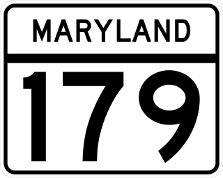
Maryland Route 179 is a state highway in the U.S. state of Maryland. Known for most of its length as St. Margarets Road, the highway runs 3.16 miles (5.09 km) from MD 648 near Annapolis east to the end of state maintenance in Cape St. Claire. MD 179 serves a suburban area near the southern end of the Broadneck Peninsula of northeastern Anne Arundel County. The state highway was paved in the 1920s from its western end to Skidmore near Sandy Point. MD 179 was truncated at what is now U.S. Route 50 /US 301 when their predecessor highway replaced the stretch to Skidmore in the early 1940s. MD 179 was extended into Cape St. Claire in the early 1990s.

Maryland Route 282 is a state highway in the U.S. state of Maryland. The highway runs 12.43 miles (20.00 km) from Crystal Beach east to the Delaware state line in Warwick, where the highway continues east as Delaware Route 299. MD 282 is the primary east–west highway of the Sassafras Neck between the Sassafras River and Bohemia River, connecting Crystal Beach, Earleville, and Warwick with MD 213 in Cecilton in southern Cecil County. The state highway was paved in Warwick by 1910 and constructed from Warwick to Cecilton in the late 1910s. West of Cecilton, what is today MD 282 consists of part of former MD 283, which ran from Crystal Beach to Earleville. MD 282 was constructed to Earleville in the early 1920s and extended a short distance west of Earleville in the late 1920s. MD 283 was constructed in the late 1920s and early 1930s. MD 282 was extended west to Crystal Beach along MD 283 in 1959. The highway from Cecilton to Crystal Beach was reconstructed in the late 1960s.

Maryland Route 216 is a state highway in the U.S. state of Maryland. Known for most of its length as Scaggsville Road, the highway runs 8.73 miles (14.05 km) from MD 108 at Highland east to MD 198 in Laurel. MD 216 connects Highland, Fulton, Scaggsville, and North Laurel in southern Howard County with Laurel in far northern Prince George's County. The highway connects those communities with Interstate 95 (I-95) and U.S. Route 29.

Maryland Route 80 is a state highway in the U.S. state of Maryland. Known for most of its length as Fingerboard Road, the highway runs 14.79 miles (23.80 km) from MD 85 in Buckeystown east to MD 27 near Damascus. MD 80 connects Buckeystown and Urbana in southern Frederick County with Damascus in far northern Montgomery County. At the suburban community of Urbana, the route has junctions with Interstate 270 (I-270) and MD 355. MD 80 was constructed between MD 27 and MD 75 in the mid- to late 1920s. The highway was built from Urbana to MD 75 in the mid-1930s and from Buckeystown to Urbana in the late 1930s. MD 80 was relocated at its western end in the mid-1970s and relocated and expanded through Urbana in the 2000s.
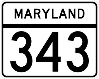
Maryland Route 343 is a state highway in the U.S. state of Maryland. Known for most of its length as Hudson Road, the state highway runs 11.29 miles (18.17 km) from Hudson in northwestern Dorchester County east to U.S. Route 50 in Cambridge. MD 343 was paved in the late 1920s and early 1930s. The state highway originally passed through downtown Cambridge, ending just west of its present terminus. After the original Choptank River Bridge was completed in the mid-1930s, MD 343 was truncated to Sunburst Highway. In the mid-1950s, the state highway was rerouted along Washington Street to Race Street, where it ended at MD 16. Finally, MD 343 was extended to its present terminus when MD 16 bypassed Cambridge in the late 1960s.
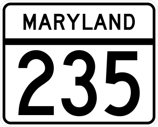
Maryland Route 235 (MD 235) is a state highway in the U.S. state of Maryland. Known as Three Notch Road, the state highway runs 30.63 miles (49.29 km) between its southern intersection with MD 5 in Ridge and its northern intersection with MD 5 near Mechanicsville. While the southern part of the state highway is a two-lane undivided rural road, the northern part of MD 235 is a four- to six-lane divided highway connecting Naval Air Station Patuxent River and the Washington, D.C., metro area in conjunction with MD 5. Three Notch Road has been the main highway between northern St. Mary's County and Point Lookout since the colonial era. The highway was reconstructed as the modern MD 235 between 1923 and 1938. The state highway was then completely rebuilt during World War II to serve the recently established NAS Patuxent River. Between 1960 and 1985, MD 235 was converted into a four-lane divided highway to the west and north of the military base. In the face of increasing activity at the base, the highway adjacent to NAS Patuxent River was expanded to six lanes in the early 2000s.

Maryland Route 38 is a state highway in the U.S. state of Maryland. Known as Kitzmiller Road, the state highway runs 5.67 miles (9.12 km) from the West Virginia state line at the North Branch Potomac River in Kitzmiller, where the highway continues south as West Virginia Route 42, north to MD 135 on top of Backbone Mountain. MD 38 connects Kitzmiller with the rest of Garrett County and across the North Branch Potomac River to Blaine and Elk Garden in western Mineral County. The state highway was constructed in the late 1920s and early 1930s. MD 38 originally ran from U.S. Route 219 near Thayerville through Deer Park and Altamont to Kitzmiller. The state highway was truncated at Backbone Mountain when MD 135 was extended west to Oakland in the mid-1950s.
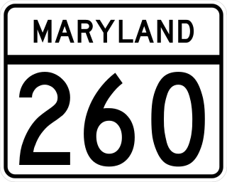
Maryland Route 260 is a state highway in the U.S. state of Maryland. Known as Chesapeake Beach Road, the highway runs 8.51 miles (13.70 km) from MD 4 at Lyons Creek east to MD 261 in Chesapeake Beach. MD 260 connects the twin towns of Chesapeake Beach and North Beach in northern Calvert County with highways to Upper Marlboro, Washington, Annapolis, and Baltimore. Much of the highway follows part of the course of the former Chesapeake Beach Railway, which ended service in the mid-1930s. MD 260 was constructed in the early 1920s from MD 2 south of Owings east to Chesapeake Beach. The highway was extended west to what is now MD 4 south of Dunkirk in the early 1930s. MD 260 was relocated to a road built on the railroad right-of-way from Lyons Creek through Owings in the mid-1950s.

Maryland Route 229 is a state highway in the U.S. state of Maryland. Known as Bensville Road, the state highway runs 5.25 miles (8.45 km) from MD 227 near Pomfret north to MD 228 near Bennsville. MD 229 passes through the community of Bennsville in northern Charles County. The state highway was originally constructed as part of MD 228 in the late 1920s. When MD 228 was extended west to Accokeek in the mid 1990s, MD 229 was assigned to Bensville Road.
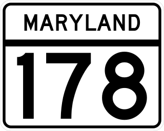
Maryland Route 178 is a state highway in the U.S. state of Maryland. Known as Generals Highway, the highway runs 8.06 miles (12.97 km) from MD 450 in Parole north to Veterans Highway near Millersville. MD 178 connects Annapolis with Crownsville in central Anne Arundel County. The highway is indirectly named for George Washington, who traveled the highway in 1783 on his way to Annapolis to resign his commission in the Continental Army at the conclusion of the American Revolutionary War. MD 178 was planned as early as 1910 as part of a western route between Baltimore and Annapolis. However, most of the highway south of MD 3 was not built until the early 1930s. The portion south of MD 3 served as a primary segment in the western corridor connecting Baltimore–Annapolis, until the construction of Interstate 97 (I-97) in the late 1980s.
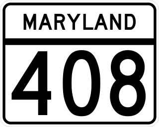
Maryland Route 408 is a state highway in the U.S. state of Maryland. Known as Mount Zion-Marlboro Road, the highway runs 5.62 miles (9.04 km) from MD 4 at Waysons Corner east to MD 2 and MD 422 in Lothian. MD 408 is the old alignment of MD 4 in southern Anne Arundel County. The highway was constructed in the late 1910s and became the easternmost part of MD 4 in 1927. The highway received its present designation in the mid-1960s when MD 4 was rerouted south into Calvert County. MD 408's western end was relocated when MD 4 was upgraded to a freeway through Waysons Corner in the early 1990s. MD 408 was also applied to the old sections of MD 4 between Andrews Air Force Base and Upper Marlboro in Prince George's County. The number was assigned after the MD 4 freeway was completed in the mid-1960s. The Prince George's County portions of MD 408 were transferred to county maintenance in the late 1970s except the section through Upper Marlboro, which became MD 725.

Maryland Route 208 is a state highway in the U.S. state of Maryland. The highway runs 1.86 miles (2.99 km) from U.S. Route 1 Alternate in Cottage City north to MD 500 in Hyattsville. MD 208 connects the northwestern Prince George's County suburbs of Cottage City, Colmar Manor, Brentwood, and Hyattsville. The highway was built in the late 1910s and early 1920s and originally passed through Mount Rainier. The portion of MD 208 between US 1 Alt. and US 1 was originally MD 206; the northern portion of the highway was originally part of MD 209 and then MD 410. MD 208 was extended to MD 500 and removed from Mount Rainier in the late 1950s, and extended south through Cottage City around 1970.

Maryland Route 244 is a state highway in the U.S. state of Maryland. Known for most of its length as Medleys Neck Road, the state highway runs 10.48 miles (16.87 km) from MD 5 near Leonardtown south to MD 249 in Valley Lee. MD 244 parallels MD 5 in central St. Mary's County, serving several communities on Medleys Neck between Breton Bay and the St. Mary's River, including Beauvue. The state highway was constructed as part of three different state highways—MD 244 from Leonardtown, MD 250 from Valley Lee, and MD 251 through Drayden—between the late 1920s and late 1930s. MD 244 assumed the courses of MD 250 and MD 251 in the mid-1940s. The portion of MD 244 east of MD 249 was removed from the state highway system in the mid-1980s.

Maryland Route 858 is a collection of unsigned state highways in the U.S. state of Maryland. These four highways are old segments of MD 67 between Rohrersville and Boonsboro in southeastern Washington County. These highways were designated when MD 67 was relocated in the early 1960s. The longest segment is MD 858F, which runs exactly 1 mile (1.6 km) between a pair of intersections with MD 67 in Rohrersville. In addition to the four existing highways, there are several county-maintained segments of old MD 67 between Rohrersville and Boonsboro and at Gapland, Brownsville, and Weverton south of Rohrersville.
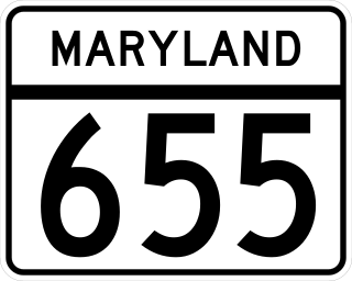
Maryland Route 655 is a state highway in the U.S. state of Maryland. The unsigned highway runs 1.86 miles (2.99 km) from MD 28 east and south to Carrolton Road in the Norbeck area of eastern Montgomery County. MD 655 is an L-shaped route with east–west and north–south segments that parallel MD 28 and MD 97, respectively. The highway and its auxiliary routes form parts of service roads along MD 28 and MD 97. The route follows what were two of the original state roads constructed in the early 1910s. MD 655 was assigned to the north–south segment when MD 97 was relocated in the late 1960s. The highway was extended west when MD 28 was relocated in the early 1980s.


