Route 110, consisting of State Route 110 (SR 110) and Interstate 110 (I-110), is a state and auxiliary Interstate Highway in the Los Angeles metropolitan area of the US state of California. The entire route connects San Pedro and the Port of Los Angeles with Downtown Los Angeles and Pasadena. The southern segment from San Pedro to I-10 in downtown Los Angeles is signed as I-110, while the northern segment to Pasadena is signed as SR 110. The entire length of I-110, as well as SR 110 south of the Four Level Interchange with US Route 101 (US 101), is the Harbor Freeway, and SR 110 north from US 101 to Pasadena is the historic Arroyo Seco Parkway, the first freeway in the western United States. I-110 is one of two 3-digit interstate designations to appear on opposite coasts; I-280 in California and New Jersey is the other.
U.S. Route 98 is an east–west United States Highway in the Southeastern United States that runs from western Mississippi to southern Florida. It was established in 1933 as a route between Pensacola and Apalachicola, Florida, and has since been extended westward into Mississippi and eastward across the Florida Peninsula. It runs along much of the Gulf Coast between Mobile, Alabama, and Crystal River, Florida, including extensive sections closely following the coast between Mobile and St. Marks, Florida. The highway's western terminus is with US 84 in Meadville, Mississippi. Its eastern terminus is Palm Beach, Florida, at State Road A1A (SR A1A) near the Mar-a-Lago resort.
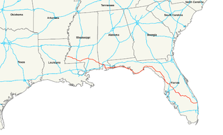
Interstate 110 (I-110) is a 4.1-mile (6.6 km) freeway spur route in Biloxi, Mississippi, running south from I-10 to U.S. Route 90 (US 90). It is one of very few places on the Interstate Highway System utilizing a drawbridge. The southbound control city is Biloxi, with a series of bridges out over the Gulf of Mexico at the southern terminus. There is no northbound control city; the road is marked with trailblazers reading "TO I-10" instead. It ran entirely concurrently with Mississippi Highway 15 (MS 15), until MS 15 was truncated to I-10.
Interstate 14 (I-14), also known as the "14th Amendment Highway", the Gulf Coast Strategic Highway, and the Central Texas Corridor, is an Interstate Highway that is currently located entirely in Central Texas, following U.S. Route 190 (US 190). The portion of the route that has been constructed and signed to date, the Central Texas Corridor along US 190 west of Interstate 35 was officially designated as I-14 by the Fixing America's Surface Transportation Act (FAST) Act, signed by President Barack Obama on December 14, 2015.
The Massachusetts State Highway System in the U.S. Commonwealth of Massachusetts is a system of state-numbered routes assigned and marked by the highway division of the Massachusetts Department of Transportation (MassDOT). U.S. Highways and Interstate Highways are included in the system; the only overlaps are with the end-to-end U.S. Route 3 and Route 3 and the far-apart Interstate 295, shared with Rhode Island, and Route 295, shared with New York State. A state highway in Massachusetts is a road maintained by the state, which may or may not have a number. Not all numbered routes are maintained or owned by the state.
Mississippi Highway 469 is a state highway in central Mississippi, located in Simpson and Rankin counties. The route starts at MS 28 near Georgetown, and it travels north through western Simpson County. The road enters the community of Harrisville and enters Rankin County soon after. It intersects U.S. Route 49 in Florence, and it ends at MS 468 near Whitfield. The route was designated in 1953, and it was extended southwards to MS 20 in 1956. By 1960, all of the route was paved with asphalt.
Louisiana Highway 1 (LA 1) is a state highway in Louisiana. At 431.88 miles (695.04 km), it is the longest numbered highway of any class in Louisiana. It runs diagonally across the state, connecting the oil and gas fields near the island of Grand Isle with the northwest corner of the state, north of Shreveport.
Mississippi Highway 22 is a state highway in central Mississippi, United States. It runs from east to west for approximately 43 miles (69 km), serving only two counties: Madison and Hinds, while connecting the towns of Edwards, Flora, and Canton.

The Mississippi Department of Transportation (MDOT) is the organization in charge of developing and maintaining all state and federal roadways in the U.S. state of Mississippi. In addition to highways, the department also has a limited role in supporting Mississippi's public transportation system, ports and waterways system, aeronautics and railroads. MDOT is headquartered in downtown Jackson.
The Maryland highway system is a network of highways owned and maintained by the U.S. state of Maryland. In addition to the nationally numbered Interstate Highways and U.S. Highways, the highway system consists of a network of Maryland state-numbered highways. All three types of highways together provide access to all incorporated and unincorporated areas in all 23 counties of Maryland as well as the independent city of Baltimore.

U.S. Highway 65 (US 65) is a part of the United States Numbered Highway System that spans 966 miles (1,555 km) from Clayton, Louisiana to Albert Lea, Minnesota. Within the state of Louisiana, the highway travels 100.77 miles (162.17 km) from the national southern terminus at US 425/LA 15 in Clayton to the Arkansas state line north of Lake Providence.

The Arkansas Highway System is made up of all the highways designated as Interstates, U.S. Highways and State Highways in the US state of Arkansas. The system is maintained by the Arkansas Department of Transportation (ArDOT), known as the Arkansas State Highway Department (AHD) until 1977 and the Arkansas State Highway and Transportation Department (AHTD) from 1977 to 2017. The system contains 16,442.90 miles (26,462.28 km) of Interstates, U.S. Routes, state highways, and special routes. The shortest members are unsigned state highways Arkansas Highway 806 and Arkansas Highway 885, both 0.09 miles (0.14 km) in length. The longest route is U.S. Route 67, which runs 296.95 miles (477.89 km) from Texarkana to Missouri.
Nissan Parkway is a short divided highway in central Mississippi. The road starts at Mississippi Highway 22. It travels east to an interchange with Interstate 55 (I-55) and intersects a road leading to a Nissan assembly plant. The parkway then continues eastward to its eastern terminus at U.S. Route 51 and MS 16. Nissan Parkway was constructed in 2002 from MS 22 to I-55, after being proposed in one year before. The road was extended to its current eastern terminus by 2003.
Mississippi Highway 41 (MS 41) is a state highway in northeastern Mississippi. The route starts at U.S. Route 45 and US 278 north of Wren and travels westwards. It then intersects US 45 Alt. east of Okolona. The road enters Okolona, and intersects MS 32 and MS 245. MS 41 then turns northwest and travels toward Pontotoc. Once inside the city, the route turns north at MS 15 and travels through downtown Pontotoc. MS 41 ends at its intersection with MS 9 and MS 338. The route that became MS 41 was first used as an Indian trail. The route was designated by 1932 from Amory to Pontotoc, and it was truncated from Amory to US 45 by 1955. The entirety of MS 41 was paved by 1958.
Magnolia Way, officially designated as Mississippi Highway 780, is a short unsigned state highway in northeastern Mississippi. The road starts at County Road 203, and travels southeastward as a frontage road of the concurrence of Interstate 22 (I-22) and U.S. Route 78. It intersects the entrance of the Toyota Motor Manufacturing Mississippi (TMMMS), located near Blue Springs. Magnolia Way ends at its intersection with MS 9 south of Sherman. Construction of the road began in 2007 to serve TMMMS, and it opened on August 24, 2009, two years before the manufacturing plant opened.
Mississippi Highway 462 is a state highway in western Mississippi. The route starts at U.S. Route 61 near Port Gibson, and it travels eastward. The road then turns northeastward, and the route ends at Willows Road and Old Port Gibson Road near Willows. MS 462 was designated around 1958, as a gravel road extending eastward from US 61 near Port Gibson. The road was extended to MS 461 from 1960 to 1963, then to the Natchez Trace Parkway from 1967 to 1998.
Mississippi Highway 403 is a state highway in central Mississippi. The route starts at U.S. Route 82 and MS 15 in Mathiston, and it travels north away from the town. It then turns east near Natchez Trace Parkway and then travels below it. MS 403 ends at the intersection of Clarkson Road and Old US 82 near a county highway maintenance barn. The route was designated by 1960, after a paved road extending from Mathiston was constructed around 1958. An extension northwards to MS 50 and MS 341 existed from 1960 to 1967.
Mississippi Highway 245 is a state highway located in the U.S. state of Mississippi. It is the designation for two separate sections of the old U.S. Route 45 Alternate that the state continues to maintain. The Crawford section, designated in 2007, runs south to north from US 45 Alt. back to US 45 Alt. in Lowndes County. The other section's southern terminus is at US 45 Alt. south of Okolona in Chickasaw County and the northern terminus is at MS 145 in Shannon in Lee County. Along the way this section intersects MS 41 and the eastern terminus of MS 32 in Okolona. The section from Chickasaw County to Lee County was designated in 1998, after the completion of a four-lane bypass for US 45 Alt..


