Louisiana State Highways | |
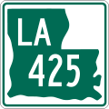
---|---|
System information | |
Length | 16,698.41 mi [1] (26,873.49 km) |
Formed | 1955 renumbering [2] |
Notes | Since 2008, La DOTD has been replacing the green-and-white state highway markers with a black-and-white version using the same design. [3] The new shields have a black background, white silhouette, black letters and numbers, and no frame outline (see photo below for comparison). |
Highway names | |
State | Louisiana Highway X (LA X) |
Special routes: | Louisiana Highway X Alternate (LA X Alt.); Louisiana Highway X Business (LA X Bus.); Louisiana Highway X Bypass (LA X Byp.); Louisiana Highway X Spur (LA X Spur); Louisiana Highway X Truck (LA X Truck) |
System links | |
|
The state highways in the U.S. state of Louisiana are owned and maintained by the Louisiana Department of Transportation and Development (La DOTD).
Number | Length (mi) | Length (km) | Southern or western terminus | Northern or eastern terminus | Formed | Removed | Notes | |
---|---|---|---|---|---|---|---|---|
LA 1 | 431.877 | 695.039 | Bayou Rigaud in Grand Isle | SH 77 northwest of Rodessa at the Texas state line | 1955 | current | Longest highway in Louisiana. | |
LA 2 | 189.490 | 304.955 | SH 49 west of Trees at the Texas state line | US 65 north of Lake Providence | 1955 | current | ||
LA 3 | 35.705 | 57.462 | I-20, US 71, and LA 72 in Bossier City | AR 29 at the Arkansas state line north of Plain Dealing | 1955 | current | ||
LA 4 | 164.537 | 264.797 | US 71 north of Loggy Bayou | LA 605 in Newellton | 1955 | current | ||
LA 5 | 28.361 | 45.643 | US 84 in Logansport | LA 175 at Kingston | 1955 | current | ||
LA 6 | 54.518 | 87.738 | SH 21 at the Texas state line southwest of Many | US 71 and US 84 in Clarence | 1955 | current | ||
LA 7 | 72.9 | 117.3 | US 71 in Coushatta | Arkansas state line at Springhill | 1955 | 1994 | Became US 371 | |
LA 8 | 156.273 | 251.497 | SH 63 at the Texas state line west of Burr Ferry | US 425/LA 15 in Sicily Island | 1955 | current | ||
LA 9 | 100.005 | 160.942 | US 71/US 84 in Campti | US 63/US 167 in Junction City | 1955 | current | ||
LA 10 | 255.505 | 411.195 | US 171 south of Leesville | Mississippi state line east of Bogalusa | 1955 | current | ||
LA 12 | 34.368 | 55.310 | Texas state line west of Starks | US 171 and US 190 in Ragley | 1955 | current | ||
LA 13 | 63.993 | 102.987 | LA 14 west of Kaplan | US 167 in Turkey Creek | 1955 | current | ||
LA 14 | 100.197 | 161.251 | US 90 and US 171 in Lake Charles | LA 182 in New Iberia | 1955 | current | ||
LA 15 | 194.102 | 312.377 | LA 1 and LA 970 northwest of Lettsworth | US 63/US 167 in Lillie | 1955 | current | ||
LA 16 | 110.234 | 177.404 | LA 22 south of French Settlement | LA 21 in Sun | 1955 | current | ||
LA 17 | 66.717 | 107.371 | US 425/LA 15, LA 4, and LA 130 in Winnsboro | Arkansas state line at Kilbourne | 1955 | current | ||
LA 18 | 80.118 | 128.937 | LA 1 and LA 3089 in Donaldsonville | US 90 Bus. and LA 23 in Gretna | 1955 | current | ||
LA 19 | 33.897 | 54.552 | US 61 in Baton Rouge | Mississippi state line north of Norwood | 1955 | current | ||
LA 20 | 36.656 | 58.992 | LA 182 in Gibson | LA 18 in Vacherie | 1955 | current | ||
LA 21 | 52.023 | 83.723 | LA 22 and LA 1077 in Madisonville | Mississippi state line north of Angie | 1955 | current | ||
LA 22 | 71.239 | 114.648 | LA 75 and LA 942 in Darrow | US 190 in Mandeville | 1955 | current | ||
LA 23 | 73.638 | 118.509 | Jump Basin Road in Venice | LA 428 in Gretna | 1955 | current | ||
LA 24 | 35.667 | 57.400 | LA 20 in Schriever | LA 3235 in Larose | 1955 | current | ||
LA 25 | 38.720 | 62.314 | US 190 in Covington | Mississippi state line north of Warnerton | 1955 | current | ||
LA 26 | 75.911 | 122.167 | US 171/US 190 southeast of DeRidder | LA 14 in Lake Arthur | 1955 | current | ||
LA 27 | 132.424 | 213.116 | LA 14 at Holmwood | US 171 and US 190 in DeRidder | 1955 | current | ||
LA 28 | 87.347 | 140.571 | US 171 and LA 8 in Leesville | US 84 west of Jonesville | 1955 | current | ||
LA 29 | 54.141 | 87.131 | LA 13 north of Eunice | LA 114 west of Moreauville | 1955 | current | ||
LA 30 | 27.842 | 44.807 | I-10 in Baton Rouge | US 61 and LA 431 east of Gonzales | 1955 | current | ||
LA 31 | 54.577 | 87.833 | LA 182 in New Iberia | LA 182 in Opelousas | 1955 | current | ||
LA 32 | 0.5 | 0.80 | LA 30 | Louisiana State Capitol building in Baton Rouge | 1955 | 1957 | c.||
LA 33 | 43.901 | 70.652 | US 80 in Ruston | Arkansas state line north of Marion | 1955 | current | ||
LA 34 | 86.010 | 138.420 | US 71 and LA 1239-2 in Montgomery | US 80/LA 15 in West Monroe | 1955 | current | ||
LA 35 | 52.197 | 84.003 | LA 82 north of Forked Island | US 190 in Lawtell | 1955 | current | ||
LA 36 | 18.939 | 30.479 | LA 21 east of Covington | LA 41 northwest of Pearl River | 1955 | current | ||
LA 37 | 42.687 | 68.698 | US 61/US 190 in Baton Rouge | LA 10 in Greensburg | 1955 | current | ||
LA 38 | 48.573 | 78.171 | LA 10 in Coleman Town | LA 430 south of Hackley | 1955 | current | ||
LA 39 | 54.327 | 87.431 | Parish Road 15 in Pointe à la Hache | I-10 in New Orleans | 1955 | current | ||
LA 40 | 53.282 | 85.749 | LA 43 southeast of Montpelier | LA 41 in Bush | 1955 | current | ||
LA 41 | 23.074 | 37.134 | US 11 and LA 3081 in Pearl River | LA 21 in Bush | 1955 | current | ||
LA 42 | 47.880 | 77.055 | LA 30 in Baton Rouge | LA 22 and LA 1037 in Springfield | 1955 | current | ||
LA 43 | 44.380 | 71.423 | LA 42 west of Springfield | Mississippi state line north of Easleyville | 1955 | current | ||
LA 44 | 49.970 | 80.419 | LA 42 in Prairieville | US 61 in LaPlace | 1955 | current | ||
LA 45 | 22.602 | 36.374 | Bayou Barataria in Lafitte | LA 18 in Marrero | 1955 | current | ||
LA 46 | 29.535 | 47.532 | LA 39 and LA 3021 in New Orleans | Shell Beach | 1955 | current | ||
LA 47 | 16.305 | 26.240 | Chalmette | New Orleans | 1955 | current | ||
LA 48 | 20.960 | 33.732 | US 61 in Norco | US 90 and LA 3152 in Elmwood | 1955 | current | ||
LA 49 | 3.916 | 6.302 | US 61 | Kenner | 1955 | current | ||
LA 50 | 0.850 | 1.368 | LA 48 (River Road) at the Mississippi River | US 61 (Airline Highway) | 1955 | current | ||
LA 52 | 2.731 | 4.395 | US 90 and LA 633 in Boutte | LA 18 in Luling | 1955 | current | ||
LA 53 | 1.634 | 2.630 | LA 44 (River Road) and LA 640 opposite the defunct Edgard–Reserve Ferry | US 61 (West Airline Highway) | 1955 | current | ||
LA 54 | 2.343 | 3.771 | LA 44 | US 61 in Garyville | 1955 | current | ||
LA 55 | 14.094 | 22.682 | Montegut | LA 24 in Bourg | 1955 | current | ||
LA 56 | 25.495 | 41.030 | Cocodrie | LA 24 in Houma | 1955 | current | ||
LA 57 | 25.053 | 40.319 | LA 56 north of Cocodrie | LA 24 in Houma | 1955 | current | ||
LA 58 | 1.614 | 2.597 | LA 56 in Chauvin | LA 55 in Montegut | 1955 | current | ||
LA 59 | 11.793 | 18.979 | US 190 in Mandeville | LA 21 north of Abita Springs | 1955 | current | ||
LA 60 | 16.047 | 25.825 | LA 16 in Enon | LA 10 in Bogalusa | 1955 | current | ||
LA 62 | 11.863 | 19.092 | LA 10 in Sheridan | Mississippi state line north of State Line | 1955 | current | ||
LA 63 | 52.48 | 84.46 | LA 63 east of French Settlement | LA 67 in Clinton | 1955 | current | ||
LA 64 | 20.355 | 32.758 | LA 964 in Zachary | LA 16 and LA 1026 north of Denham Springs | 1955 | current | ||
LA 64-1 | 1.983 | 3.191 | US 61 in East Baton Rouge Parish | Barnett Road in East Baton Rouge Parish | 2015 | current | Former LA 64 | |
LA 66 | 19.620 | 31.575 | Louisiana State Penitentiary at Angola | US 61 north of St. Francisville | 1955 | current | ||
LA 67 | 43.60 | 70.17 | LA 73 in Baton Rouge | Mississippi state line north of Clinton | 1955 | current | ||
LA 68 | 19.252 | 30.983 | US 61 north of Port Hudson | LA 19 in Wilson | 1955 | current | ||
LA 69 | 15.381 | 24.753 | LA 70 in Grand Bayou | LA 1 northwest of White Castle | 1955 | current | ||
LA 70 | 51.084 | 82.212 | US 90, US 90 Bus., and LA 182 in Morgan City | LA 22 in Sorrento | 1955 | current | ||
LA 72 | 2.492 | 4.010 | Bossier City | US 79/US 80 in Bossier City | 1955 | current | ||
LA 73 | 26.318 | 42.355 | LA 75 in Geismar | LA 30 in Baton Rouge | 1955 | current | ||
LA 74 | 10.683 | 17.193 | LA 75 in St. Gabriel | US 61 north of Gonzales | 1955 | current | ||
LA 75 | 46.703 | 75.161 | Bayou Pigeon | LA 22 and LA 942 in Darrow | 1955 | current | ||
LA 76 | 25.477 | 41.001 | LA 77 in Maringouin | LA 1 and LA 987-4 in Port Allen | 1955 | current | ||
LA 77 | 49.136 | 79.077 | LA 1 in Plaquemine | LA 10 north of Fordoche | 1955 | current | ||
LA 78 | 7.558 | 12.163 | US 190 and LA 411 in Livonia | LA 1 in Parlange | 1955 | current | ||
LA 81 | 8.825 | 14.202 | LA 77 in Livonia | LA 77 in Fordoche | 1955 | current | ||
LA 82 | 143.139 | 230.360 | Texas state line west of Cameron | Vermilion–Lafayette | 1955 | current | ||
LA 83 | 34.013 | 54.739 | LA 14 in New Iberia | LA 182 in Baldwin | 1955 | current | ||
LA 85 | 7.826 | 12.595 | LA 83 in Lydia | LA 182 in Jeanerette | 1955 | current | ||
LA 86 | 16.436 | 26.451 | LA 182 in New Iberia | LA 31 north of New Iberia | 1955 | current | ||
LA 87 | 42.011 | 67.610 | LA 86 in New Iberia | Centerville | 1955 | current | ||
LA 88 | 5.393 | 8.679 | LA 89 at Lozes | LA 182 northwest of New Iberia | 1955 | current | ||
LA 89 | 12.731 | 20.489 | LA 14 in Delcambre | First Street and Church Street in Youngsville | 1955 | current | ||
LA 89-1 | 5.053 | 8.132 | Iberia Street in Milton | US 90/LA 182 in Lafayette | 2013 | current | Former LA 89 | |
LA 91 | 49.58 | 79.79 | Gueydan | LA 13 in Eunice | 1955 | current | exit 76 on I-10 | |
LA 92 | 40.723 | 65.537 | US 90 east of Mermentau | LA 339 in Youngsville | 1955 | current | ||
LA 92-1 | 10.188 | 16.396 | Iberia Street and Young Street in Milton | LA 347 south of St. Martinville | 2013 | current | Former LA 92 | |
LA 93 | 23.427 | 37.702 | US 90 in Scott | LA 31 in Arnaudville | 1955 | current | ||
LA 93-1 | 1.819 | 2.927 | LA 342 in Lafayette | Rue de Belier near Lafayette | 2021 | current | Former LA 93 | |
LA 94 | 7.943 | 12.783 | US 90 and US 167 in Lafayette | LA 328 in Breaux Bridge | 1955 | current | ||
LA 95 | 42.12 | 67.79 | US 90 in Duson | LA 104 in Mamou | 1955 | current | exit 92 on I-10 | |
LA 96 | 19.543 | 31.451 | LA 182 in Broussard | LA 352 east of Catahoula | 1955 | current | ||
LA 97 | 21.553 | 34.686 | US 90 and LA 102 in Jennings | US 190 east of Basile | 1955 | current | ||
LA 98 | 47.751 | 76.848 | LA 97 and LA 1123 west of Iota | Lafayette–St. Martin parish line east of Carencro | 1955 | current | ||
LA 99 | 32.438 | 52.204 | LA 14 west of Lake Arthur | US 190 east of Kinder | 1955 | current | ||
|
Number | Length (mi) | Length (km) | Southern or western terminus | Northern or eastern terminus | Formed | Removed | Notes | |
---|---|---|---|---|---|---|---|---|
LA 100 | 14.831 | 23.868 | LA 97 in Evangeline | LA 13 in Crowley | 1955 | current | ||
LA 101 | 17.278 | 27.806 | LA 14 in Hayes | LA 383 north of Iowa | 1955 | current | Was portions of SR 1156, SR 728, SR 744 and SR 24-D (former SR 24 and US 165) before 1955 | |
LA 102 | 35.367 | 56.918 | US 165 in Fenton | LA 26 north of Lake Arthur | 1955 | current | Was portions of SR 105, SR 735, SR 2030, SR 702, SR 701/SR 703 and SR 731 before 1955 | |
LA 103 | 39.388 | 63.389 | US 190 west of Lawtell | LA 31 in Leonville | 1955 | current | Was portions of SR 571, SR 119, SR 487, SR 214/SR 279 and SR 238 before 1955 | |
LA 104 | 41.374 | 66.585 | LA 26 southeast of Oberlin | US 190 in Opelousas | 1955 | current | Was portions of SR 120, SR 26 and SR 219 before 1955 | |
LA 105 | 38.577 | 62.084 | Krotz Springs | LA 1 in Simmesport | 1955 | current | ||
LA 106 | 24.202 | 38.949 | LA 10 east of Oakdale | LA 29 south of Bunkie | 1955 | current | Was portions of SR 482 and SR 23 before 1955 | |
LA 107 | 64.957 | 104.538 | US 71 in Morrow | US 167/LA 28 in Pineville | 1955 | current | Was portions of SR 92, C-1472, C-1471, SR 5, SR 57 and SR 57-D before 1955 | |
LA 108 | 24.866 | 40.018 | I-10 in Vinton | US 90 in Sulphur | 1955 | current | Was portions of SR 381, SR 382 (one portion later became C-2102), SR 104 and C-1352 before 1955; section through Vinton removed around 1982 | |
LA 109 | 39.931 | 64.263 | US 90/LA 3112 southwest of Vinton | LA 27 at Juanita | 1955 | current | Was portions of SR 121, SR 143, and SR 287 before 1955 | |
LA 110 | 25.154 | 40.481 | US 190 in Merryville | US 171/US 190 in Longville | 1955 | current | ||
LA 111 | 45.722 | 73.582 | US 190 in Junction | LA 117 northeast of Leesville | 1955 | current | Was portions of SR 138, SR 143 and SR 414 before 1955 | |
LA 112 | 80.899 | 130.194 | US 171/US 190 east of DeRidder | US 71/US 167 in Lecompte | 1955 | current | ||
LA 113 | 54.492 | 87.696 | US 190 in Reeves | US 165 and LA 497 in Glenmora | 1955 | current | ||
LA 114 | 20.86 | 33.57 | LA 1 in Echo | LA 1/LA 451 east of Moreauville | 1955 | current | Was portions of SR 30, SR 72 and SR 299 before 1955 | |
LA 115 | 60.70 | 97.69 | LA 106 west of St. Landry | LA 28 north of Deville | 1955 | current | exit 53 on I-49 | |
LA 116 | 8.39 | 13.50 | US 165 in Pineville | LA 28 east of Pineville | 1955 | current | Was SR 309 before 1955 | |
LA 117 | 41.52 | 66.82 | LA 8 and LA 1213 in Leesville | LA 6 east of Robeline | 1955 | current | ||
LA 118 | 26.89 | 43.28 | US 171 in Florien | Kisatchie | 1955 | current | ||
LA 119 | 28.64 | 46.09 | LA 8 at Flatwoods | LA 1 in Natchez | 1955 | current | exit 119 on I-49 | |
LA 120 | 36.24 | 58.32 | US 171 in Zwolle LA 117 in Provencal | South of Robeline LA 1 and LA 494 south of Natchez | 1955 | current | exit 127 on I-49 | |
LA 121 | 46.83 | 75.37 | LA 8 at Slagle | LA 1 west of Boyce | 1955 | current | ||
LA 122 | 26.09 | 41.99 | US 71/LA 1239-1 in Montgomery | LA 123 in Dry Prong | 1955 | current | Was SR 162 and SR 475 before 1955 | |
LA 123 | 15.97 | 25.70 | LA 8 east of Colfax | US 165 east of Breezy Hill | 1955 | current | Was SR 617 before 1955 | |
LA 124 | 91.94 | 147.96 | US 84 east of Winnfield | LA 3102 at Argo | 1955 | current | ||
LA 125 | 12.49 | 20.10 | US 165 in Tullos | US 165 northeast of Olla | 1955 | current | Was Route C-2113 before 1955; spur to Urania now LA 3259 | |
LA 126 | 97.87 | 157.51 | LA 9 in Reidhimer | LA 124 north of Jonesville | 1955 | current | ||
LA 127 | 54.68 | 88.00 | Kitterlin Bay | LA 126 east of Sikes | 1955 | current | ||
LA 128 | 42.08 | 67.72 | LA 4 east of Fort Necessity | LA 605/LA 897-4 in St. Joseph | 1955 | current | ||
LA 129 | 32.51 | 52.32 | Red River south of Acme | US 84 west of Ferriday | 1955 | current | ||
LA 130 | 7.34 | 11.81 | LA 135 north of Liddieville | US 425/LA 4/LA 15/LA 17 in Winnsboro | 1955 | current | Was SR 239 before 1955 | |
LA 131 | 6.79 | 10.93 | LA 15 at St. Genevieve | US 84/US 425 in Vidalia | 1955 | current | Was the northern portion of SR 49 before 1955 | |
LA 132 | 32.91 | 52.96 | LA 133 north of Buckner | LA 17 north of Bakers | 1955 | current | ||
LA 133 | 45.46 | 73.16 | LA 4 northeast of Columbia | US 425 south of Oak Ridge | 1955 | current | Was a portion of SR 47 before 1955; originally ran to Mer Rouge, but this section became US 425 in 2005; exit 132 on I-20 | |
LA 134 | 65.68 | 105.70 | US 165 south of Sterlington | US 65 just outside Lake Providence | 1955 | current | ||
LA 135 | 34.22 | 55.07 | LA 4 in Fort Necessity | US 425 south of Rayville | 1955 | current | ||
LA 136 | 3.49 | 5.62 | LA 134 in Fairbanks | US 165/LA 2 in Sterlington | 1955 | current | Was Route C-1604 before 1955 | |
LA 137 | 18.08 | 29.10 | LA 15 north of Mangham | LA 135 | 1955 | 2005 | Was SR 47 before 1955, redesigned as US 425 | |
LA 138 | 12.75 | 20.52 | LA 134 south of Collinston | US 165/US 425/LA 2 in Mer Rouge | 1955 | current | Was SR 47 and Route C-1557 before 1955 | |
LA 139 | 20.21 | 32.52 | US 80 in Monroe | US 165/US 425/LA 2/LA 593 in Bastrop | 1955 | current | Was SR 14 before 1955; originally ran from Bastrop to the Arkansas state line (replacing SR 204), but this section became a portion of US 425 in 1989 | |
LA 140 | 14.77 | 23.77 | US 425 in Log Cabin | US 165/LA 599 in Bonita | 1955 | current | Was routes C-1484, C-1485 and C-1486 before 1955 | |
LA 141 | 4.07 | 6.55 | LA 75 in St. Gabriel St. Gabriel | St. Gabriel LA 75 in St. Gabriel | 1955 | current | Was SR 410 before 1955; gap in route since the 1990s | |
LA 142 | 8.76 | 14.10 | US 425 north of Bastrop | AR 133 at Arkansas state line northwest of Beekman | 1955 | current | Was Route C-1490 before 1955 | |
LA 143 | 39.94 | 64.28 | LA 34 in West Monroe | LA 33 in Marion | 1955 | current | ||
LA 144 | 9.97 | 16.05 | LA 34 in Eros | LA 151 at Calhoun | 1955 | current | ||
LA 145 | 17.88 | 28.78 | LA 146 southeast of Ruston | LA 15 northeast of Downsville | 1955 | current | exit 93 on I-20 | |
LA 146 | 56.60 | 91.09 | US 79/LA 9 in Homer | LA 4 in Chatham | 1955 | current | ||
LA 147 | 39.76 | 63.99 | LA 34 just north of the Jackson Parish – Winn Parish line | LA 9 in Arcadia | 1955 | current | ||
LA 148 | 15.65 | 25.19 | US 167/LA 818 at Clay Point southwest of Eros | LA 146 at Vernon Ouachita Parish line | 1955 | current | ||
LA 149 | 2.74 | 4.41 | US 80 near Grambling Corners | Parish Road 333 and R.W.E. Jones Drive | 1955 | current | Was a portion of Route C-1792 before 1955 | |
LA 150 | 8.83 | 14.21 | US 80/LA 563 in Simsboro | US 80/US 167/LA 146 in Ruston | 1955 | current | ||
LA 151 | 56.15 | 90.36 | US 80/US 80 Truck/LA 9 in Arcadia | LA 546 at Cadeville | 1955 | current | exit 69 on I-20 | |
LA 152 | 10.19 | 16.40 | LA 2 east of Lisbon | LA 151 west of Dubach | 1955 | current | ||
LA 153 | 22.57 | 36.32 | LA 9/LA 156 in Creston | LA 4/LA 507 in Castor | 1955 | current | ||
LA 154 | 53.09 | 85.44 | US 71 at Elm Grove | LA 9 and LA 518 in Athens | 1955 | current | exit 61 on I-20 | |
LA 155 | 60.60 | 97.53 | US 71/US 371 in Coushatta | LA 146 east of Quitman | 1955 | current | ||
LA 156 | 26.92 | 43.32 | LA 9/ LA 153 in Creston | US 167 north of Winnfield | 1955 | current | ||
LA 157 | 79.37 | 127.73 | US 71 at McDade | LA 159/LA 615 north of Shongaloo | 1955 | current | exit 33 on I-20 | |
LA 158 | 6.34 | 10.20 | LA 8 in Colfax | Local road north of Colfax | 1955 | current | Section south of US 71 was SR 1/SR 5 (later Route C-2116) before 1955 | |
LA 159 | 31.76 | 51.11 | I-20 and US 371 in Minden | Arkansas state line north of Shongaloo | 1955 | current | exit 47 on I-20 with US 371 | |
LA 160 | 34.24 | 55.10 | north of Benton | LA 2/LA 159 at Leton | 1955 | current | ||
LA 161 | 4.30 | 6.92 | LA 2 Alt. in Gordon | AR 15 at Arkansas state line northeast of Gordon | 1955 | current | Was a portion of SR 557 before 1955 | |
LA 162 | 9.01 | 14.50 | LA 3 in Benton | LA 157 at Midway | 1955 | current | ||
LA 163 | 9.14 | 14.71 | Lake Bistineau State Park | LA 164 in Doyline | 1955 | current | ||
LA 164 | 12.78 | 20.57 | US 79/US 80 north of Haughton | US 371 in Sibley | 1955 | current | ||
LA 166 | — | — | Southwest of Doyline | Near Lake Bistineau | 1955 | 1960 | ||
LA 168 | 7.25 | 11.67 | LA 1 in Rodessa | US 71 in Ida | 1955 | current | ||
LA 169 | 45.92 | 73.90 | LA 172 west of Keachi | US 71 south of Belcher | 1955 | current | ||
LA 170 | 14.23 | 22.90 | Texas state line west of Vivian | US 71/LA 3049 in Gilliam | 1955 | current | ||
LA 172 | 8.48 | 13.65 | Texas state line west of Keachi | LA 5/LA 789 in Keachi | 1955 | current | ||
LA 173 | 19.29 | 31.04 | LA 1 in Shreveport | LA 3049 at Dixie | 1955 | current | exit 221 on I-49; exit 5 on I-220 | |
LA 174 | 31.79 | 51.16 | LA 191 west of Converse | LA 1 at Lake End | 1955 | current | exit 155 on I-49 | |
LA 175 | 63.93 | 102.89 | US 171 northwest of Many | LA 1 southeast of Shreveport | 1955 | current | exit 186 on I-49 | |
LA 176 | 4.74 | 7.63 | US 90/US 167 in Lafayette | LA 98 in Carencro | 1955 | current | Was SR 675 and Route C-1384 before 1955; originally ran from US 90/US 167 to LA 94, but the section from Simcoe and Surrey Streets to US 90/US 167 became US 167 around 1964; extended to LA 98 (replacing LA 728-1) in 2009 | |
LA 177 | 17.13 | 27.57 | LA 175 north of Pleasant Hill | US 84/LA 1 at Gahagan | 1955 | current | exit 162 on I-49 concurrent with US 371 | |
LA 178 | 10.63 | 17.11 | LA 95 in Church Point | LA 93/LA 182 in Sunset | 1955 | current | ||
LA 179 | — | — | US 84 | US 71 in Coushatta | 1955 | 1994 | Redesignated as US 371 | |
LA 180 | 0.12 | 0.19 | US 71 in Pineville | US 165 in Pineville | 1955 | current | ||
LA 181 | 4.22 | 6.79 | LA 115 in Lone Pine | US 71 in Cheneyville | 1955 | current | Was the northern portion of SR 271 before 1955 | |
LA 182 | 174.31 | 280.52 | LA 29 in Whiteville | US 90 north of Raceland | 1955 | current | ||
LA 182-1 | 1.029 | 1.656 | LA 89-1/LA 182 in Lafayette | Bernard Road in Broussard | 2015 | 2022 | Former routing of LA 182 through Broussard | |
LA 182-2 | 1.342 | 2.160 | De Porres Street in Broussard | LA 182 in Broussard | 2015 | 2022 | Former routing of LA 182 through Broussard | |
LA 183 | 9.93 | 15.98 | I-20/Richland PR 202 at Holly Ridge | LA 134 west of Epps | 1955 | current | exit 145 on I-20 | |
LA 184 | 3.38 | 5.44 | LA 8/LA 28 east of US 171 in Leesville | Pendleton Drive (Fort Johnson) | 1955 | current | Was Route C-2040 before 1955 | |
LA 185 | 1.04 | 1.67 | Barksdale Air Force Base in Bossier City | LA 72 | 1955 | 2013 | Was Route C-1333 before 1955 | |
LA 191 | 75.33 | 121.23 | Texas state line west of Leesville | US 84 east of Logansport | 1975 | current | ||
|
Number | Length (mi) | Length (km) | Southern or western terminus | Northern or eastern terminus | Formed | Removed | Notes | |
---|---|---|---|---|---|---|---|---|
LA 300 | 15.05 | 24.22 | Delacroix | LA 39 and LA 46 at Sebastopol | 1955 | current | ||
LA 301 | 2.98 | 4.80 | Bayou Villars | LA 45 north of Jean Lafitte | 1955 | current | Was a portion of SR 1307 before 1955; southern portion now LA 3257 | |
LA 302 | 0.28 | 0.45 | LA 3257 in Barataria | LA 45 in Jean Lafitte | 1955 | current | Was Route C-2060 before 1955 | |
LA 303 | 1.27 | 2.04 | LA 45/LA 3134 | Vendome Canal in Jean Lafitte | 1955 | current | Was SR 1235 before 1955 | |
LA 304 | 7.05 | 11.35 | LA 308 in Laurel Grove | LA 20 in Chackbay | 1955 | current | Was SR 486 before 1955 | |
LA 305 | — | — | — | — | — | — | ||
LA 306 | 8.58 | 13.81 | Bayou Gauche | LA 631 in Paradis | 1955 | current | Was SR 669 before 1955 | |
LA 307 | 19.35 | 31.14 | LA 20 east of Chackbay | LA 182 in Raceland | 1955 | current | Was SR 486 before 1955 | |
LA 308 | 82.19 | 132.27 | LA 1 in Golden Meadow | LA 3089 in Donaldsonville | 1955 | current | ||
LA 309 | 8.45 | 13.60 | LA 20 at Chacahoula | LA 1 in Brule | 1955 | current | Was SR 28 before 1955 | |
LA 310 | 0.06 | 0.097 | LA 1 near Larose | LA 308 | 1955 | 2013 | Was Route C-2198 before 1955; decommissioned due to completion of LA 657 extension | |
LA 311 | 13.62 | 21.92 | LA 182/LA 312/LA 3197 in Houma | LA 24 in Schriever | 1955 | current | ||
LA 312 | 1.24 | 2.00 | LA 182/LA 311/LA 3197 | LA 24 in Houma | 1955 | current | Was SR 1092 (former SR 2) before 1955 | |
LA 313 | — | — | — | — | — | — | ||
LA 314 | — | — | — | — | — | 2004 | ||
LA 315 | 20.31 | 32.69 | Theriot | LA 182 and LA 3197 in Houma | 1955 | current | ||
LA 316 | 16.90 | 27.20 | LA 24 in Gray | LA 24 in Bourg | 1955 | current | ||
LA 317 | 17.26 | 27.78 | Burns Point | LA 182 in Centerville | 1955 | current | Was SR 60 before 1955 | |
LA 318 | 4.66 | 7.50 | LA 83 west of Baldwin | LA 182 at Sorrel | 1955 | current | Was SR 912 before 1955 | |
LA 319 | 8.03 | 12.92 | Cypremort Point | LA 83 in Louisa | — | — | ||
LA 320 | 2.40 | 3.86 | LA 182 in Oliver | LA 86 just south of Bayou Teche | — | — | ||
LA 321 | 3.60 | 5.79 | LA 351 near Ruth | LA 347 | — | — | ||
LA 322 | 1.27 | 2.04 | LA 182 | LA 87 in Franklin | 1955 | current | Was SR 900 and Route C-1898 before 1955 | |
LA 323 | 0.48 | 0.77 | Irish Bend Road | LA 87 at Oaklawn | 1955 | current | Was Route C-1899 before 1955 | |
LA 324 | 0.13 | 0.21 | LA 326 | LA 87 in Charenton | 1955 | current | Was a portion of SR 129 before 1955 | |
LA 325 | 4.4 | 7.1 | LA 23 in Venice | LA 23 in Boothville | 1955 | 1970 | Was Route C-2168 before 1955 | |
LA 326 | 3.81 | 6.13 | LA 182 in Baldwin | Chitimacha Trail | — | — | ||
LA 327 | 15.36 | 24.72 | LA 75 near St. Gabriel | LA 30 in Baton Rouge | — | — | ||
LA 328 | 7.82 | 12.59 | LA 347 in Breaux Bridge | LA 347 in Cecilia | — | — | exit 109 on I-10 | |
LA 329 | 6.05 | 9.74 | Avery Island | New Iberia | — | — | ||
LA 330 | 17.20 | 27.68 | Abbeville | Delcambre | — | — | ||
LA 331 | 6.07 | 9.77 | Boston | Erath | 1955 | current | ||
LA 332 | 3.50 | 5.63 | LA 91 near Gueydan | End state maintenance southwest of Gueydan | — | — | ||
LA 333 | 7.87 | 12.67 | Intracoastal City | Esther | — | — | ||
LA 334 | — | — | — | — | — | — | ||
LA 335 | 17.58 | 28.29 | LA 3093 | Abbeville | — | — | ||
LA 336 | 0.94 | 1.51 | Breaux Bridge | — | — | — | ||
LA 337 | — | — | — | — | — | 2004 | ||
LA 338 | 7.49 | 12.05 | Abbeville | Charon | — | — | ||
LA 339 | 13.567 | 21.834 | LA 14 Business in Erath | LA 3073 in Lafayette | 1955 | current | Was SR 148, SR 680 and SR 236 before 1955 | |
LA 340 | — | — | — | — | — | — | ||
LA 341 | 4.2 | 6.8 | LA 31 opposite Bayou Teche | LA 31 | 1955 | current | Was SR 355 before 1955 | |
LA 342 | 12.45 | 20.04 | LA 35 south of Rayne | LA 93 in Lafayette | 1955 | current | ||
LA 343 | 29.04 | 46.74 | LA 14 west of Abbeville | LA 356 at Bristol | 1955 | current | ||
LA 344 | 6.44 | 10.36 | Morbihan | Loreauville | — | — | ||
LA 345 | 6.54 | 10.53 | Loreauville | St. Martinville | — | — | ||
LA 346 | 11.77 | 18.94 | LA 513 in Oxford | LA 177 south of Evelyn | 1955 | current | ||
LA 347 | 40.7 | 65.5 | Daspit | Leonville | — | — | exit 115 on I-10 | |
LA 348 | 6.82 | 10.98 | LA 549 at Conway | LA 33 southwest of Marion | 1955 | current | ||
LA 349 | 3.44 | 5.54 | Henderson | — | — | — | ||
LA 350 | 0.41 | 0.66 | LA 31 in Parks | LA 347 in Parks | 1955 | current | ||
LA 351 | 0.71 | 1.14 | LA 31 | LA 347 | 1955 | current | ||
LA 352 | 25.79 | 41.50 | Lake Fausse Pointe State Park | Henderson | — | — | ||
LA 353 | 12.66 | 20.37 | Lafayette | St. Martinville | — | — | ||
LA 354 | 2.31 | 3.72 | LA 94 near Breaux Bridge | LA 31 near Cecilia | — | — | Unsigned since 2015 | |
LA 355 | 0.24 | 0.39 | LA 31 | LA 347 | 1955 | current | ||
LA 356 | 5.78 | 9.30 | Church Point | Cankton | — | — | ||
LA 357 | 9.51 | 15.30 | Church Point | Opelousas | — | — | ||
LA 358 | 15.24 | 24.53 | Prudhomme | Shuteston | — | — | ||
LA 359 | 8.81 | 14.18 | Port Barre | Lebeau | — | — | ||
LA 360 | 8.30 | 13.36 | Palmetto | Bayou Current | — | — | ||
LA 361 | 20.09 | 32.33 | Lebeau | Evergreen | — | — | ||
LA 362 | 5.02 | 8.08 | Evergreen | Cottonport | — | — | ||
LA 363 | 9.29 | 14.95 | Ville Platte | Grand Prairie | — | — | ||
LA 364 | 0.06 | 0.097 | LA 1 near Matthews | LA 308 | 1955 | 2004 | Was Route C-2074 before 1955; decommissioned due to completion of LA 654 extension | |
LA 365 | 20.91 | 33.65 | LA 370 east of Iota | LA 98 east of Mire | 1955 | current | ||
LA 366 | 0.80 | 1.29 | US 165 | LA 8 in Pollock | 1955 | current | ||
LA 367 | 17.35 | 27.92 | LA 98 near Rayne | US 190 near Eunice | — | — | ||
LA 368 | 12.56 | 20.21 | LA 13 near Mowata | LA 97 | — | — | ||
LA 369 | — | — | — | — | — | — | ||
LA 370 | 23.45 | 37.74 | LA 91/LA 98 in Iota | LA 35 in Church Point | — | — | ||
LA 371 | 10.380 | 16.705 | US 190 in Basile | LA 104 near Basile | 1955 | 1994 | Redesignated as LA 3277 to avoid confusion with US 371 | |
LA 372 | 8.95 | 14.40 | Bond | Oakdale | — | — | ||
LA 373 | — | — | — | — | — | 1964 | ||
LA 374 | 9.97 | 16.05 | LA 3277 | Lanse Meg Road | — | — | ||
LA 375 | — | — | — | — | — | 1991 | ||
LA 376 | 19.10 | 30.74 | Bond Road | US 167 near Ville Platte | — | — | ||
LA 377 | 14.12 | 22.72 | Grant | Pitkin | — | — | ||
LA 378 | 7.96 | 12.81 | I-10 in Westlake | US 171 in Moss Bluff | 1955 | current | ||
LA 379 | 8.01 | 12.89 | Westlake | — | — | — | ||
LA 380 | 9.89 | 15.92 | LA 99 south of Welsh | LA 26 in Lake Arthur | 1955 | current | ||
LA 381 | — | — | — | — | — | 1963 | ||
LA 382 | 9.38 | 15.10 | LA 380 east of Thornwell | US 90 east of Welsh | 1955 | current | ||
LA 383 | 25.69 | 41.34 | US 90 in Iowa | US 190 in Kinder | — | — | exit 43 on I-10 | |
LA 384 | 34.33 | 55.25 | Cameron Prairie NWR | Lake Charles | — | — | ||
LA 385 | 14.91 | 24.00 | Cameron Parish | Lake Charles | — | — | exit 6 on I-210 | |
LA 386 | 4.71 | 7.58 | Iberville Parish | — | — | — | ||
LA 387 | 2.5 | 4.0 | LA 23 in Belle Chasse | End state maintenance near U.S. Naval Ammunition Depot in Belle Chasse | 1955 | 1950 | c.Was a portion of SR 996 before 1955 | |
LA 388 | — | — | — | — | — | — | ||
LA 389 | 38.25 | 61.56 | DeQuincy | Merryville | — | — | ||
LA 390 | 2.77 | 4.46 | Maggie Hebert Road | LA 27 in Hackberry | 1955 | current | ||
LA 391 | — | — | — | — | — | — | ||
LA 392 | 21.73 | 34.97 | South Toledo Bend State Park | Hornbeck | — | — | ||
LA 393 | — | — | — | — | — | 1963 | ||
LA 394 | 15.69 | 25.25 | DeRidder | Dry Creek | — | — | ||
LA 395 | 19.56 | 31.48 | Roanoke | Elton | — | — | exit 59 on I-10 | |
LA 396 | — | — | — | — | — | — | ||
LA 397 | 19.37 | 31.17 | Calcasieu Parish | — | — | — | exit 36 on I-10 | |
LA 398 | 10.42 | 16.77 | Assumption Parish | Labadieville | — | — | ||
LA 399 | 15.54 | 25.01 | LA 112 northwest of Sugartown | Fullerton | 1955 | current | ||
|
Number | Length (mi) | Length (km) | Southern or western terminus | Northern or eastern terminus | Formed | Removed | Notes | |
---|---|---|---|---|---|---|---|---|
LA 400 | 5.746 | 9.247 | Attakapas Landing | LA 1 north of Supreme | 1955 | current | ||
LA 401 | 9.407 | 15.139 | Lake Verret in Attakapas Landing | LA 1 in Napoleonville | 1955 | current | ||
LA 402 | 5.070 | 8.159 | Brusle St. Vincent | LA 308 north of Napoleonville | 1955 | current | ||
LA 403 | 2.878 | 4.632 | LA 402 at Brusle St. Vincent | LA 308 at Paincourtville | 1955 | current | ||
LA 404 | 8.230 | 13.245 | LA 75 at Choctaw | LA 69 at Samstown | 1955 | current | ||
LA 405 | 29.346 | 47.228 | LA 1 west of Donaldsonville | LA 1 and LA 75 in Plaquemine | 1955 | current | ||
LA 406 | 6.002 | 9.659 | LA 23 in Belle Chasse | New Orleans | 1955 | current | ||
LA 407 | 2.556 | 4.113 | LA 406 | LA 428 in New Orleans | 1955 | current | ||
LA 408 | 12.281 | 19.764 | Baton Rouge | LA 37/LA 64 in Central | 1955 | current | ||
LA 409 | 11.256 | 18.115 | LA 64 in Central | LA 959 at Blairstown | 1955 | current | ||
LA 410 | 8.176 | 13.158 | LA 408 | LA 64 in Central | 1955 | current | Along Blackwater Road | |
LA 411 | 11.515 | 18.532 | LA 76 in Rosedale | US 190 and LA 78 in Livonia | 1955 | current | ||
LA 412 | 9.938 | 15.994 | LA 964 west of Slaughter | LA 67 east of Slaughter | 1955 | current | ||
LA 413 | 23.741 | 38.207 | LA 76 south of Erwinville | LA 1 Bus. in New Roads | 1955 | current | ||
LA 414 | 10.550 | 16.979 | LA 413 north of Lakeland | LA 413 at Ventress | 1955 | current | ||
LA 415 | 25.801 | 41.523 | I-10 west of Port Allen | LA 413 east of New Roads | 1955 | current | ||
LA 416 | 7.247 | 11.663 | LA 1 at Knapp | LA 415 at Hermitage | 1955 | current | ||
LA 417 | 24.281 | 39.076 | LA 10 at Red Cross | LA 418 at Legonier | 1955 | current | ||
LA 418 | 21.898 | 35.241 | LA 417 north of Quinton | LA 1 at Legonier | 1955 | current | ||
LA 419 | 7.359 | 11.843 | LA 417 at Quinton | Lacour | 1955 | current | ||
LA 420 | 7.895 | 12.706 | LA 1/LA 10 east of Morganza | LA 10 and LA 10 Bus. north of New Roads | 1955 | current | ||
LA 421 | 15.821 | 25.461 | LA 10 west of Jackson | US 61 north of St. Francisville | 1955 | current | ||
LA 422 | 12.123 | 19.510 | LA 19 in Norwood | LA 67 at Felps | 1955 | current | ||
LA 423 | 2.427 | 3.906 | LA 19 | LA 67 between Baton Rouge and Baker | 1955 | current | Along Thomas Road | |
LA 424 | 11.858 | 19.084 | LA 62 north of Pine | LA 62 north of State Line | 1955 | current | ||
LA 425 | 1.986 | 3.196 | LA 30 near Gardere | LA 427 in Essen | 1955 | 1961 | ||
LA 426 | 7.390 | 11.893 | LA 73 in Baton Rouge | US 190 between Baton Rouge and Denham Springs | 1955 | current | Was a portion of SR 7 (later SR 7-D) from 1921-1955 | |
LA 427 | 14.574 | 23.455 | LA 73 in Baton Rouge | LA 73 at Hope Villa | 1955 | current | ||
LA 428 | 8.817 | 14.190 | LA 23 near Belle Chasse | LA 407 in New Orleans | 1955 | current | ||
LA 429 | 10.190 | 16.399 | LA 73 west of Gonzales | LA 22 north of Sorrento | 1955 | current | ||
LA 430 | 10.091 | 16.240 | LA 25 in Franklinton | LA 438 at Hackley | 1955 | current | ||
LA 431 | 9.60 | 15.45 | St. Amant | Port Vincent | — | — | ||
LA 432 | 8.54 | 13.74 | Woodland | Chipola | — | — | ||
LA 433 | 14.83 | 23.87 | US 190 west of Slidell | US 90 east of Slidell | 1955 | current | ||
LA 434 | 10.66 | 17.16 | South of US 190 in Lacombe | LA 36 between Abita Springs and Hickory | 1955 | current | ||
LA 435 | 11.47 | 18.46 | LA 36/LA 59 in Abita Springs | LA 41 in Talisheek | 1955 | current | ||
LA 436 | 26.14 | 42.07 | Franklinton | Varnado | — | — | ||
LA 437 | 20.63 | 33.20 | Covington | Zona | — | — | ||
LA 438 | 37.78 | 60.80 | Mt. Hermon | Angie | — | — | ||
LA 439 | 12.71 | 20.45 | Sheridan | Bogalusa | — | — | ||
LA 440 | 27.56 | 44.35 | LA 441 north of Greensburg | LA 10 west of Franklinton | 1955 | current | exit 57 on I-55 | |
LA 441 | 43.744 | 70.399 | LA 42 west of Springfield | Mississippi state line north of Easleyville | 1955 | current | ||
LA 442 | 23.22 | 37.37 | LA 63 north of Livingston | LA 40 and LA 443 north of Hammond | 1955 | current | ||
LA 443 | 8.30 | 13.36 | US 190 in Hammond | LA 40 and LA 442 south of Loranger | 1955 | current | Along Morris Road | |
LA 444 | 14.76 | 23.75 | LA 16 in French Settlement | LA 22 in Killian | 1955 | current | ||
LA 445 | 24.58 | 39.56 | LA 22 near Ponchatoula | LA 16 east of Amite | 1955 | current | ||
LA 446 | — | — | — | — | — | 1965 | ||
LA 447 | 20.19 | 32.49 | LA 16 in Port Vincent | LA 63 north of Walker | 1955 | current | ||
LA 448 | 8.59 | 13.82 | LA 37 north of Grangeville | LA 10 at Darlington | 1955 | current | ||
LA 449 | 23.73 | 38.19 | US 190 in Walker | LA 37 southwest of Greensburg | 1955 | current | ||
LA 450 | 27.69 | 44.56 | Folsom | Mt. Hermon | — | — | ||
LA 451 | 30.07 | 48.39 | Moreauville | Hamburg | — | — | ||
LA 452 | 13.70 | 22.05 | Marksville | Brouillette | — | — | ||
LA 453 | 3.12 | 5.02 | LA 1 | LA 107 in Moncla | — | — | ||
LA 454 | 13.75 | 22.13 | LA 107 at Cedar Grove | LA 107 and LA 115 in Effie | 1955 | current | ||
LA 455 | — | — | — | — | — | 1965 | ||
LA 456 | 7.12 | 11.46 | US 71 at Loyd | LA 470 at Lamourie | 1955 | current | Former portion of US 71 | |
LA 457 | 19.62 | 31.58 | Lecompte | Echo | — | — | ||
LA 458 | 5.45 | 8.77 | Pitkin | Fullerton | — | — | ||
LA 459 | 11.16 | 17.96 | Jena | Aimwell | — | — | ||
LA 460 | 7.21 | 11.60 | LA 127 in Nebo | US 84 and LA 8 at Whitehall | 1955 | current | ||
LA 461 | 4.85 | 7.81 | Calcasieu | Hineston | — | — | ||
LA 462 | 9.43 | 15.18 | LA 113 near Westport | Junction with Osborne Road | — | — | ||
LA 463 | 17.32 | 27.87 | Pitkin | Afeman | — | — | ||
LA 464 | 19.80 | 31.87 | Merryville | Caney | — | — | ||
LA 465 | 30.77 | 49.52 | Kurthwood | Otis | — | — | ||
LA 466 | 0.85 | 1.37 | LA 18 (Lafayette Street) in Gretna | LA 23 (Franklin Avenue) | 1972 | current | Along 5th and Kepler Streets | |
LA 466-1 | — | — | — | — | 1955 | — | Was a portion of SR 996 before 1955 | |
LA 466-2 | — | — | — | — | 1955 | — | Was a portion of SR 30-D before 1955 | |
LA 466-3 | — | — | — | — | 1955 | — | Was a portion of SR 2-D (later SR 2084) before 1955 | |
LA 466-4 | — | — | — | — | 1955 | — | Was a portion of SR 1241 before 1955 | |
LA 466-5 | — | — | — | — | 1955 | — | Was a portion of SR 1240 before 1955 | |
LA 466-6 | — | — | — | — | 1955 | — | Was a portion of SR 1241 before 1955 | |
LA 466-7 | — | — | — | — | 1955 | 1961 | Was a portion of SR 30-E before 1955 | |
LA 466-8 | — | — | — | — | 1955 | 1962 | Was a portion of SR 1239 before 1955 | |
LA 466-9 | — | — | — | — | 1955 | — | Was a portion of Route C-1474 before 1955 | |
LA 466-10 | — | — | — | — | 1955 | 1972 | Was portions of SR 30-D and SR 30-E before 1955; shortened to LA 23 and renumbered to LA 466 | |
LA 466-11 | — | — | — | — | 1955 | — | Was a portion of SR 1237 before 1955 | |
LA 466-12 | — | — | — | — | 1955 | — | Was a portion of SR 1238 before 1955 | |
LA 466-13 | — | — | — | — | 1955 | — | Was a portion of SR 451 before 1955 | |
LA 466-14 | — | — | — | — | 1955 | — | Was a portion of SR 456 before 1955 | |
LA 466-15 | — | — | — | — | 1955 | — | Was a portion of SR 1236 before 1955 | |
LA 466-16 | — | — | — | — | 1955 | — | Was a portion of Route C-1474 before 1955 | |
LA 467 | 9.18 | 14.77 | US 171 in Leesville | LA 10 in Fort Johnson South | — | — | ||
LA 468 | 5.80 | 9.33 | US 171 in Leesville | LA 8 | — | — | ||
LA 469 | 2.45 | 3.94 | K Avenue in Fort Johnson North | LA 8 | — | — | ||
LA 470 | 4.21 | 6.78 | Lamourie | Chambers | — | — | ||
LA 471 | 17.65 | 28.40 | US 71 north of Colfax | LA 34 west of Atlanta | 1955 | current | Former portion of SR 5 before 1955 | |
LA 472 | 20.24 | 32.57 | US 167 at Williana | US 167 southeast of Winnfield | 1955 | current | Was SR 232 before 1955 | |
LA 473 | 8.27 | 13.31 | Toro | Hornbeck | — | — | ||
LA 474 | 7.82 | 12.59 | Negreet | Florien | — | — | ||
LA 475 | 0.63 | 1.01 | LA 191 in Zwolle | LA 482 in Zwolle | — | — | ||
LA 476 | 14.05 | 22.61 | LA 191 in Negreet | LA 6 | — | — | ||
LA 477 | 7.83 | 12.60 | near the Red River in St. Maurice | US 84 | — | — | ||
LA 478 | 20.87 | 33.59 | Vowells Mill | LA 1 in Natchitoches | 1955 | current | Was SR 609 and SR 432 before 1955 | |
LA 479 | 7.78 | 12.52 | Chestnut | Goldonna | — | — | ||
LA 480 | 24.5 | 39.4 | Coushatta | Clear Lake | — | — | ||
LA 481 | 10.97 | 17.65 | LA 191 at the Sabine Parish line | US 84 | — | — | ||
LA 482 | 7.47 | 12.02 | Toledo Bend Reservoir | Zwolle | — | — | ||
LA 483 | 16.46 | 26.49 | US 171 in Noble | LA 175 in Pelican | 1955 | current | ||
LA 484 | 9.75 | 15.69 | LA 119 | LA 494 | — | — | ||
LA 485 | 17.13 | 27.57 | Robeline | Powhatan | — | — | exit 148 on I-49 | |
LA 486 | 14.18 | 22.82 | Clarence | Black Lake | — | — | ||
LA 487 | 10.00 | 16.09 | Marthaville | Ajax | — | — | ||
LA 488 | 17.15 | 27.60 | Lisso | Alexandria | — | — | ||
LA 489 | 8.38 | 13.49 | LA 465 | Northern boundary at artillery range | — | — | ||
LA 490 | 14.96 | 24.08 | Janie | Red River east of Marco | 1955 | current | Was SR 431 before 1955 | |
LA 491 | 7.28 | 11.72 | LA 495 near Cloutierville | Local road at top of levee near Odra | — | — | ||
LA 492 | 5.61 | 9.03 | LA 8 south of Colfax | US 71 at Bagdad | 1955 | current | Former portion of US 71 | |
LA 493 | 5.81 | 9.35 | Montrose | Melrose | — | — | ||
LA 494 | 15.07 | 24.25 | Cypress | Natchitoches | — | — | ||
LA 495 | 4.28 | 6.89 | LA 1 near Cloutierville | LA 1 | — | — | ||
LA 496 | 10.67 | 17.17 | LA 121 at McNutt | US 71/US 165/LA 28 in Alexandria | 1955 | current | ||
LA 497 | 8.39 | 13.50 | Glenmora | Forest Hill | — | — | ||
LA 498 | 5.12 | 8.24 | Old Boyce Road | US 71/US 165 in Alexandria | — | — | exit 90 on I-49 | |
LA 499 | 31.80 | 51.18 | Joyce | Zoar | — | — | ||
|
Number | Length (mi) | Length (km) | Southern or western terminus | Northern or eastern terminus | Formed | Removed | Notes | |
---|---|---|---|---|---|---|---|---|
LA 500 | 24.59 | 39.57 | US 167 at Packton | US 84 west of Jena | 1955 | current | ||
LA 501 | 30.75 | 49.49 | Winnfield | Friendship | — | — | ||
LA 502 | 1.52 | 2.45 | US 165 | LA 500 in Georgetown | 1955 | current | ||
LA 503 | 8.75 | 14.08 | Summerville | Nickel | — | — | ||
LA 504 | 4.28 | 6.89 | Natchitoches | — | — | — | ||
LA 505 | 25.24 | 40.62 | US 167 at Tannehill | LA 4 in Weston | 1955 | current | ||
LA 506 | 18.35 | 29.53 | LA 124 in LaSalle Parish | Hebron Rd in Caldwell Parish | — | — | ||
LA 507 | 60.38 | 97.17 | Messick | Simsboro | — | — | exit 77 on I-20 | |
LA 508 | 6.81 | 10.96 | Bienville | — | — | — | ||
LA 509 | 16.40 | 26.39 | Mansfield | Westdale | — | — | exit 177 on I-49 | |
LA 510 | 9.46 | 15.22 | De Soto Parish | — | — | — | ||
LA 511 | 17.92 | 28.84 | Greenwood | Bossier City | — | — | ||
LA 512 | 6.01 | 9.67 | Benson | Pelican | — | — | ||
LA 513 | 14.86 | 23.91 | Pelican | Mansfield | — | — | ||
LA 514 | 12.19 | 19.62 | East Point | Womack | — | — | ||
LA 515 | 11.72 | 18.86 | Red River Parish | Bossier Parish | — | — | ||
LA 516 | 20.41 | 32.85 | Ringgold | Bryceland | — | — | ||
LA 517 | 6.03 | 9.70 | Mount Lebanon | Bryceland | — | — | ||
LA 518 | 29.67 | 47.75 | Minden | Lisbon | — | — | ||
LA 519 | 9.00 | 14.48 | Arcadia | Marsalis | — | — | ||
LA 520 | 16.18 | 26.04 | US 79 in Homer | LA 161 northeast of Gordon | 1955 | current | ||
LA 521 | 10.43 | 16.79 | Leton | Millerton | — | — | ||
LA 522 | 3.80 | 6.12 | Mansfield | — | — | — | ||
LA 523 | 5.88 | 9.46 | LA 1 | LA 511 in Shreveport | 1955 | current | ||
LA 524 | 9.88 | 15.90 | US 165 north of Pollock | North of LA 123 in Breezy Hill | 1955 | current | ||
LA 525 | 10.05 | 16.17 | Spring Ridge | Shreveport | — | — | ||
LA 526 | 15.99 | 25.73 | Shreveport | — | — | — | exit 199 on I-49; exit 8 on I-20 | |
LA 527 | 13.55 | 21.81 | US 71 at Taylortown | LA 163 south of Lake Bistineau State Park | 1955 | current | ||
LA 528 | 11.20 | 18.02 | Bossier Parish | Dixie Inn | — | — | ||
LA 529 | 6.74 | 10.85 | Ivan | — | — | — | ||
LA 530 | 10.23 | 16.46 | Oil City | Belcher | — | — | exit 228 on I-49 | |
LA 531 | 14.45 | 23.26 | Heflin | Minden | — | — | exit 49 on I-20 | |
LA 532 | 5.15 | 8.29 | Dubberly | Nine Forks | — | — | exit 52 on I-20 | |
LA 533 | 7.44 | 11.97 | Claiborne Parish | — | — | — | ||
LA 534 | 20.40 | 32.83 | Kisatchie National Forest | Haynesville | — | — | ||
LA 535 | — | — | — | — | — | 1964 | ||
LA 536 | — | — | — | — | — | 1964 | ||
LA 537 | 11.82 | 19.02 | Plain Dealing | — | — | — | ||
LA 538 | 23.41 | 37.67 | Shreveport | Caddo | — | — | ||
LA 539 | — | — | — | — | — | 1994 | ||
LA 540 | 8.19 | 13.18 | Ruple | Homer | — | — | ||
LA 541 | 9.72 | 15.64 | LA 18 in Avondale | LA 18 in Harvey | 1955 | current | ||
LA 542 | 8.30 | 13.36 | Jonesboro | — | — | — | ||
LA 543 | 4.42 | 7.11 | Rogers | Vaughn | — | — | ||
LA 544 | 15.39 | 24.77 | Western Lincoln Parish | Ruston | — | — | exit 84 on I-20 | |
LA 545 | 17.60 | 28.32 | Lincoln Parish | — | — | — | ||
LA 546 | 10.75 | 17.30 | LA 34 northeast of Eros | US 80 and LA 15 west of Monroe | 1955 | current | ||
LA 547 | 3.06 | 4.92 | Clarks | — | — | — | ||
LA 548 | 7.79 | 12.54 | Chatham | — | — | — | ||
LA 549 | 15.54 | 25.01 | LA 15 north of Farmerville | Arkansas state line north of Oakland | 1955 | current | ||
LA 550 | 18.89 | 30.40 | LA 2 east of Bernice | Arkansas state line north of Laran | 1955 | current | ||
LA 551 | 9.33 | 15.02 | LA 33 in Marion | LA 549 in Oakland | 1955 | current | ||
LA 552 | 12.27 | 19.75 | Union Parish | — | — | — | ||
LA 553 | 12.82 | 20.63 | US 165 in Monroe | LA 2 in Sterlington | 1955 | current | ||
LA 554 | 8.02 | 12.91 | US 165 and LA 2 at Perryville | LA 138 southwest of Collinston | 1955 | current | ||
LA 555 | 12.38 | 19.92 | Franklin Parish | — | — | — | ||
LA 556 | 8.05 | 12.96 | Choudrant | Indian Village | — | — | ||
LA 557 | 14.72 | 23.69 | Vixen | Summit | — | — | ||
LA 558 | 5.94 | 9.56 | LA 15 in Mount Union | Arkansas state line at Lockhart | 1955 | current | Along Iron Mountain Road | |
LA 559 | 13.83 | 22.26 | Enterprise | Columbia | — | — | ||
LA 560-1 | 0.17 | 0.27 | New Orleans and Gulf Coast Railway tracks | LA 541 in Marrero | 1955 | 2010 | ||
LA 560-2 | 0.17 | 0.27 | LA 18 in Marrero | LA 541 | 1955 | current | ||
LA 560-3 | 0.71 | 1.14 | LA 45 in Marrero | LA 18 | 1955 | 2010 | ||
LA 560-4 | 0.85 | 1.37 | LA 45/LA 3134 bridge over Bayou Barataria at Crown Point | LA 45 | 1955 | current | Was SR 1306 before 1955 | |
LA 561 | 11.78 | 18.96 | Hebert | Richland Parish | — | — | ||
LA 562 | 26.80 | 43.13 | Fort Necessity | Wisner | — | — | ||
LA 563 | 13.38 | 21.53 | Simsboro | — | — | — | exit 78 on I-20 | |
LA 564 | 4.86 | 7.82 | Catahoula Parish | — | — | — | ||
LA 565 | 28.54 | 45.93 | Wildsville | Deer Park | — | — | ||
LA 566 | 30.09 | 48.43 | US 84 at Elkhorn | LA 568/LA 570 south of Waterproof | 1955 | current | ||
LA 567 | 3.26 | 5.25 | Lee Bayou | — | — | — | ||
LA 568 | 32.5 | 52.3 | Ferriday | Avondale | — | — | ||
LA 569 | 12.24 | 19.70 | Spokane | Lake St. John | — | — | ||
LA 570 | 4.16 | 6.69 | Waterproof | — | — | — | ||
LA 571 | 12.13 | 19.52 | LA 566 north of Clayton | LA 566 west of Waterproof | 1955 | current | ||
LA 572 | 10.33 | 16.62 | Gilbert | Talbot Landing | — | — | ||
LA 573 | 21.35 | 34.36 | Goldman | Saranac | 1955 | current | ||
LA 574-1 | 0.66 | 1.06 | Collins Lane in Grand Isle | Caminada Bay | 1955 | current | ||
LA 574-2 | 0.10 | 0.16 | Gulf of Mexico | LA 1 in Grand Isle | 1955 | 1987 | ||
LA 574-3 | 0.41 | 0.66 | LA 1 in Grand Isle | Bayou Rigaud | 1955 | current | ||
LA 574-4 | 0.40 | 0.64 | LA 1 in Grand Isle | Bayou Rigaud | 1955 | current | ||
LA 574-5 | 0.31 | 0.50 | LA 1 in Grand Isle | Medical Ave | 1955 | current | ||
LA 574-6 | 0.31 | 0.50 | LA 1 in Grand Isle | Bayou Rigaud | 1955 | current | ||
LA 574-7 | 0.25 | 0.40 | LA 1 in Grand Isle | Louisiana Avenue | 1955 | current | ||
LA 574-8 | 0.28 | 0.45 | LA 1 in Grand Isle | Louisiana Avenue | 1955 | current | ||
LA 574-9 | 0.18 | 0.29 | LA 1 in Grand Isle | Wolkpak Avenue | 1955 | current | ||
LA 574-10 | 0.29 | 0.47 | LA 1 in Grand Isle | Louisiana Avenue | 1955 | 1972 | Renumbered LA 3150 | |
LA 574-11 | 1.1 | 1.8 | LA 1 in Grand Isle | LA 1 in Grand Isle | 1955 | 1972 | Renumbered LA 3151 | |
LA 574-12 | 0.90 | 1.45 | LA 1 in Grand Isle | Barataria Pass | 1955 | — | ||
LA 575 | 14.82 | 23.85 | Newellton | Somerset | — | — | ||
LA 576 | 17.08 | 27.49 | Charlieville | Mangham | — | — | ||
LA 577 | 61.20 | 98.49 | Baskin | Darnell | — | — | exit 157 on I-20 | |
LA 578 | 7.71 | 12.41 | Crowville | — | — | — | ||
LA 579 | 12.86 | 20.70 | Waverly | Monticello | — | — | ||
LA 580 | 12.30 | 19.79 | Monticello | Alsatia | — | — | ||
LA 581 | 6.94 | 11.17 | Waddell | Transylvania | — | — | ||
LA 582 | 16.93 | 27.25 | Redwing | Lake Providence | — | — | ||
LA 583 | 10.47 | 16.85 | Bee Bayou | Hegwood Island | — | — | exit 141 on I-20 | |
LA 584 | 8.01 | 12.89 | LA 135 | East of LA 3048 | 1955 | current | ||
LA 585 | 46.48 | 74.80 | LA 134 west of Epps | US 65 at Gassoway | 1955 | current | ||
LA 586 | 7 | 11 | Concord | Terry | — | — | ||
LA 587 | 4.63 | 7.45 | Oak Grove | — | — | — | ||
LA 588 | 17.40 | 28.00 | East Carroll Parish | — | — | — | ||
LA 589 | 12.99 | 20.91 | East Carroll Parish | — | — | — | ||
LA 590 | 5.85 | 9.41 | Morehouse Parish | — | — | — | ||
LA 591 | 9.04 | 14.55 | Morehouse Parish | — | — | — | ||
LA 592 | 3.88 | 6.24 | Bastrop | — | — | — | ||
LA 593 | 17.23 | 27.73 | LA 138 in Collinston | US 425 north of Bastrop | 1955 | current | ||
LA 594 | 13.54 | 21.79 | LA 15 in Monroe | LA 139 in Swartz | 1955 | current | ||
LA 595 | 3.41 | 5.49 | US 80 and LA 133 in Start | Richland–Morehouse parish line | 1955 | current | ||
LA 596 | 10.70 | 17.22 | US 65 in Lake Providence | US 65 at Panola | 1955 | current | ||
LA 597 | 2.04 | 3.28 | Forest | — | — | — | ||
LA 598 | — | — | — | — | — | 1974 | ||
LA 599 | 13.14 | 21.15 | Morehouse Parish | — | — | — | ||
|
Number | Length (mi) | Length (km) | Southern or western terminus | Northern or eastern terminus | Formed | Removed | Notes | |
---|---|---|---|---|---|---|---|---|
LA 600 | 4.74 | 7.63 | Parhams | Lismore | — | — | ||
LA 601 | 1.713 | 2.757 | Crothers Drive in Richmond | US 65 in Tallulah | 1976 | current | ||
LA 602 | 13.768 | 22.157 | US 80 in Richmond | US 80 in Mound | 1960 | 2013 | Remaining sections became LA 602-1 and LA 602-2 | |
LA 602-1 | 1.913 | 3.079 | I-20 in Richmond | US 80 in Richmond | 2013 | current | Former LA 602; exit 173 on I-20 | |
LA 602-2 | 0.935 | 1.505 | I-20 in Mound | US 80 in Mound | 2013 | current | Former LA 602; exit 182 on I-20 | |
LA 603 | 19.34 | 31.12 | Quimby | Richmond | — | — | ||
LA 604 | 9.22 | 14.84 | St. Joseph | Lake Bruin | — | — | ||
LA 605 | 19.63 | 31.59 | LA 128 and LA 897-1 in St. Joseph | US 65 north of Newellton | 1955 | current | ||
LA 606 | 10.32 | 16.61 | Lake Bruin | — | — | — | ||
LA 607 | 0.19 | 0.31 | US 65 | LA 605 north of Lake Bruin | 1955 | current | ||
LA 608 | 21.77 | 35.04 | Lake St. Joseph | Balmoral | — | — | ||
LA 609 | 3.76 | 6.05 | Dunn | — | — | — | exit 148 on I-20 | |
LA 610 | 9.79 | 15.76 | Swampers | — | — | — | ||
LA 611-1 | 2.5 | 4.0 | Jefferson Heights Avenue in Jefferson | Jefferson Parish/Orleans Parish Line | 1955 | current | Was most of SR 459 and SR 1232 before 1955 | |
LA 611-2 | 0.52 | 0.84 | LA 611-1 in Jefferson | US 90/LA 48 | 1955 | 2010 | Was SR 1234 before 1955; now Central Avenue | |
LA 611-3 | 0.34 | 0.55 | LA 611-1 in Jefferson | US 90 | 1955 | current | Originally ran to US 61, but shortened to a rail line in 1957; shortened again in 1984 due to LA 3139 extension; section north of the rail line became LA 3261 in 2002 | |
LA 611-4 | 0.59 | 0.95 | LA 611-1 in Jefferson | Dead end at New Orleans Public Belt Railroad tracks south of LA 3139 (Earhart Expressway) | 1955 | 2010 | Was SR 1231 before 1955; one portion became LA 3262 in 2002; now Labarre Road | |
LA 611-5 | 0.55 | 0.89 | LA 611-1 in Jefferson | US 90 | 1955 | 2010 | Was SR 1233 before 1955; now Brooklyn Avenue | |
LA 611-6 | 0.05 | 0.080 | US 90 | Former LA 611-5 (Brooklyn Avenue) | 1955 | 2010 | Was SR 1243D (later SR 1795) before 1955; now Cicero Avenue | |
LA 611-7 | 0.80 | 1.29 | LA 611-1 in Jefferson | US 90 | 1955 | 1974 | Was SR 1274 before 1955; now Dakin Street | |
LA 611-8 | 0.82 | 1.32 | LA 611-1 in Jefferson | US 90 | 1955 | 2010 | Was SR 458 before 1955; now Monticello Avenue | |
LA 611-9 | 3.6 | 5.8 | US 61 (Airline Drive) and Severn Avenue in Metairie | I-10 at Pontchartrain Boulevard in New Orleans | 1955 | current | Was SR 1 from 1921-1926 and US 61 from 1926 to 1928-1929 and again from 1933-1935 | |
LA 611-10 | 0.50 | 0.80 | US 61 in Metairie | West Metairie Avenue | 1955 | 1972 | Was SR 1245 before 1955; became LA 3152 | |
LA 611-11 | 0.5 | 0.80 | US 61 in Metairie | West Metairie Avenue | 1955 | 1972 | Was SR 1246 before 1955; became LA 3153 | |
LA 611-12 | 3.0 | 4.8 | LA 48 in Harahan | US 61 in Metairie | 1955 | 1972 | Became LA 3154 | |
LA 611-13 | 0.30 | 0.48 | Russell Street in River Ridge | US 61 in Metairie | 1955 | 1972 | Was SR 2220 before 1955; became LA 3155 | |
LA 612 | 3.60 | 5.79 | Bossier City | Sligo | — | — | ||
LA 613-1 | 0.37 | 0.60 | Chickasaw Street in Bucktown | 17th Street Canal Bridge at the Jefferson Parish-Orleans Parish line | 1955 | 2010 | Was portions of SR 33 and Route C-1337 before 1955 | |
LA 613-2 | 3.7 | 6.0 | South Carrollton Avenue | N.O. Hammond Highway at West End | 1955 | 1957 | c.Was a portion of SR 33 before 1955 | |
LA 613-3 | 0.97 | 1.56 | Dreux Avenue in New Orleans | Southline Drive, now Leon C. Simon Drive | 1955 | 1950 | c.Was a portion of Route C-1452 before 1955 | |
LA 613-4 | 0.19 | 0.31 | Old Gentilly Road in New Orleans | US 90 (Chef Menteur Highway) | 1955 | 1950 | c.||
LA 614 | 5.71 | 9.19 | Haughton | — | — | — | ||
LA 615 | 10.34 | 16.64 | LA 157 and LA 159 north of Shongaloo | US 79 in Haynesville | 1955 | current | ||
LA 616 | 6.20 | 9.98 | Claiborne | West Monroe | — | — | ||
LA 617 | 3.33 | 5.36 | West Monroe | — | — | — | exit 114 on I-20 | |
LA 618 | 5.92 | 9.53 | Winnsboro | — | — | — | ||
LA 619 | 2.2 | 3.5 | LA 46 in Shell Beach | Dead end near Doulluts Canal east of Shell Beach | 1955 | 1960 | Was Route C-1492 before 1955 | |
LA 620 | 7.06 | 11.36 | LA 413 in Erwinville | LA 415 northwest of Port Allen | 1955 | current | Was a portion of SR 30 before 1955 | |
LA 621 | 6.81 | 10.96 | LA 73 in Prairieville | LA 431 at Brignac | 1955 | current | ||
LA 622 | 4.83 | 7.77 | Mangham | — | — | — | ||
LA 623 | 4.94 | 7.95 | Ball | — | — | — | ||
LA 624 | 5.80 | 9.33 | LA 46 in Yscloskey | End state maintenance southwest of Mississippi River Gulf Outlet Canal | 1955 | current | ||
LA 625 | 0.25 | 0.40 | LA 46 | Dead end at Bayou Yscloskey | 1955 | current | Along Maple Street, was Route C-2073 before 1955 | |
LA 626 | 2.56 | 4.12 | LA 48 in St. Rose | US 61 at the northeast corner of Destrehan | 1955 | current | Along St. Rose Avenue | |
LA 627 | 1.14 | 1.83 | LA 48 near Norco | US 61 (Airline Highway) | 1955 | current | Along Prospect Avenue, was SR 682 before 1955 | |
LA 628 | 8.04 | 12.94 | LA 44 in LaPlace | US 61 in Montz | 1955 | current | ||
LA 629 | 0.67 | 1.08 | LA 18 in Killona | Texas and Pacific Railway crossing | 1955 | 1960 | c.Was SR 659 before 1955 | |
LA 630 | 0.94 | 1.51 | Texas and Pacific Railway crossing | LA 18 in Killona | 1955 | 1957 | c.Was SR 660 before 1955 | |
LA 631 | 9.0 | 14.5 | US 90 in Des Allemands | LA 52 in Boutte | 1955 | current | ||
LA 632 | 5.63 | 9.06 | LA 631 in Des Allemands | Paradis Canal in Bayou Gauche | 1955 | current | ||
LA 633 | 2.78 | 4.47 | Local road at Grand Bayou | US 90 and LA 52 in Boutte | 1955 | current | Along Magnolia Ridge Road | |
LA 634 | 0.25 | 0.40 | US 90 | LA 631 near Des Allemands | 1955 | 1960 | c.Was Route C-1522 before 1955 | |
LA 635 | 0.26 | 0.42 | LA 631 (Old Spanish Trail) near Des Allemands | US 90 | 1955 | current | Was Route C-1520 before 1955 | |
LA 636-1 | 0.74 | 1.19 | LA 628 in LaPlace | US 61 | 1955 | current | ||
LA 636-2 | — | — | — | — | 1955 | 1981 | ||
LA 636-3 | 1.66 | 2.67 | LA 44 in LaPlace | LA 628 | 1955 | current | ||
LA 637 | 1.48 | 2.38 | LA 44 (River Road) | US 61 (Airline Highway) in Reserve | 1955 | current | Along West 10th Street | |
LA 637-1 | — | — | — | — | — | 1976 | ||
LA 637-2 | — | — | — | — | — | — | ||
LA 637-3 | — | — | — | — | — | — | ||
LA 637-4 | — | — | — | — | — | — | ||
LA 637-5 | — | — | — | — | — | — | ||
LA 637-6 | — | — | — | — | — | — | ||
LA 638 | — | — | — | — | — | — | ||
LA 639 | 0.40 | 0.64 | North of Union Pacific rail line | LA 18 west of Edgard | 1955 | current | Unsigned since 2015 | |
LA 640 | 2.37 | 3.81 | LA 3127 in Edgard | LA 44 and LA 53 in Reserve | 1955 | current | ||
LA 641 | 6.9 | 11.1 | LA 44 in Lutcher | I-10 north of Gramercy | 1955 | current | ||
LA 642 | 3.75 | 6.04 | LA 44 at Remy | End state maintenance northeast of C. Louque Street | 1955 | current | ||
LA 643 | 2.854 | 4.593 | LA 20 | Lower Vacherie, near the St. James–St. John the Baptist parish line | 1955 | current | ||
LA 644 | 1.76 | 2.83 | LA 20 | LA 643 in Lower Vacherie | 1955 | current | ||
LA 645 | 2.25 | 3.62 | Labadieville | — | 1955 | 2021 | ||
LA 646 | 3.3 | 5.3 | LA 308 near Thibodaux | End state maintenance at Lafourche-Assumption parish line | 1955 | 1975 | Was Route C-1338 before 1955 | |
LA 647 | 8.3 | 13.4 | LA 20 in Chackbay | Sanchez Road | 1955 | 1964 | ||
LA 648 | 2.343 | 3.771 | LA 20 south of Thibodaux | LA 308 east of Thibodaux | 1955 | current | ||
LA 649 | 0.070 | 0.113 | LA 1 | LA 308 in St. Charles | 1955 | current | Was Route C-2137 before 1955 | |
LA 650 | 3.5 | 5.6 | LA 316 near Gray | LA 24 near Schriever | 1955 | 1980 | ||
LA 651 | 1.3 | 2.1 | LA 308 near Raceland | Texas and New Orleans Railroad crossing | 1955 | 1975 | Was SR 891 before 1955 | |
LA 652 | 3.72 | 5.99 | Bayou Cut Off | LA 182 in Raceland | 1955 | current | ||
LA 653 | 2.58 | 4.15 | Eagle Island Road south of Bayou du Mar | LA 182 in Raceland | 1955 | current | ||
LA 654 | 5.51 | 8.87 | LA 1 in Mathews | Company Canal bridge northwest of Gheens | 1955 | current | ||
LA 655 | 0.620 | 0.998 | Main and Vacherie Streets in Lockport | LA 308 in Rita | 1955 | 2019 | ||
LA 656 | 1.5 | 2.4 | LA 316 (Bayou Blue Road) along the remains of Lake Long Bayou | West of the Company Canal and Lake Long | 1955 | 1993 | Was Route C-1798 before 1955 | |
LA 657 | 2.51 | 4.04 | LA 3235 in Larose | End state maintenance north of Pump Station 7 Road | 1955 | current | ||
LA 658 | 0.69 | 1.11 | LA 20 near Schriever | LA 20 | 1955 | 1973 | Was Route C-1982 before 1955 | |
LA 659 | 4.42 | 7.11 | LA 24 in Houma | LA 24 at Presquille | 1955 | current | ||
LA 660 | 8.32 | 13.39 | LA 24 in Gray | LA 316 northeast of Houma | 1955 | current | Along Coteau Road | |
LA 661 | 2.61 | 4.20 | LA 315 south of Houma | LA 24 in Houma | 1955 | current | ||
LA 662 | 11.2 | 18.0 | Begin state maintenance on Oilfield Road | LA 183 in Zacarter | 1955 | current | ||
LA 663 | 1.87 | 3.01 | Bayou L'Ourse | — | — | — | ||
LA 664 | 0.82 | 1.32 | LA 311 (Little Bayou Black Drive) | Houma–Bayou Cane line | 1955 | current | Was Route C-2190 before 1955 | |
LA 665 | 9.88 | 15.90 | LA 55 in Montegut | Dead end at Cutoff Canal | 1955 | current | ||
LA 666 | — | — | — | — | — | 1961 | ||
LA 667 | — | — | — | — | — | 1961 | ||
LA 668 | 6.58 | 10.59 | Julien | Jeanerette | — | — | ||
LA 669 | — | — | — | — | — | — | ||
LA 670 | 0.24 | 0.39 | LA 182 in Adeline | LA 87 | 1955 | current | ||
LA 671 | 1.71 | 2.75 | LA 668 between Jeanerette and unincorporated Iberia Parish | LA 87 | 1955 | current | ||
LA 672 | — | — | — | — | — | — | ||
LA 673 | 0.73 | 1.17 | M.A. Patout & Son, a sugar mill | LA 85 | 1955 | current | ||
LA 674 | 11.58 | 18.64 | Jeanerette | New Iberia | — | — | ||
LA 675 | 4.07 | 6.55 | New Iberia | — | — | — | ||
LA 676 | 2.56 | 4.12 | Charlotte | Norbert | — | — | ||
LA 677 | 3.86 | 6.21 | New Iberia | Morbihan | — | — | ||
LA 678 | 4.70 | 7.56 | Cecilia | — | — | — | ||
LA 679 | 7.20 | 11.59 | Coteau Holmes | — | — | — | ||
LA 680 | 4.49 | 7.23 | St. Martin Parish | Iberia Parish | — | — | ||
LA 681 | — | — | — | — | — | — | ||
LA 682 | 2.20 | 3.54 | Jefferson Island | — | — | — | ||
LA 683 | — | — | — | — | — | — | ||
LA 684 | — | — | — | — | — | — | ||
LA 685 | 7.70 | 12.39 | Tigre Lagoon | Erath | — | — | ||
LA 686 | 7.78 | 12.52 | Cecilia | Arnaudville | — | — | ||
LA 687 | — | — | — | — | — | 1964 | ||
LA 688 | 1.38 | 2.22 | LA 689 near Henry | LA 331 near Boston | 1955 | current | ||
LA 689 | 0.50 | 0.80 | LA 688 near Henry | LA 330 | 1955 | current | ||
LA 690 | 2.62 | 4.22 | Mouton Cove | — | — | — | ||
LA 691 | — | — | — | — | — | 1993 | ||
LA 692 | — | — | — | — | — | 1993 | ||
LA 693 | 3.14 | 5.05 | — | — | 1955 | 2018 | c.||
LA 694 | 3.42 | 5.50 | Perry | — | — | — | ||
LA 695 | 3.05 | 4.91 | Nunez | — | — | — | ||
LA 696 | 9.12 | 14.68 | LA 35 in Kaplan | US 167 north of Abbeville | 1955 | current | ||
LA 697 | 3.557 | 5.724 | LA 343 | US 167 north of Abbeville | 1955 | current | ||
LA 698 | — | — | — | — | — | — | ||
LA 699 | 12.04 | 19.38 | LA 92 north of Kaplan | US 167 south of Maurice | 1955 | current | ||
|
Number | Length (mi) | Length (km) | Southern or western terminus | Northern or eastern terminus | Formed | Removed | Notes | |
---|---|---|---|---|---|---|---|---|
LA 700 | 10.69 | 17.20 | LA 35 north of Kaplan | LA 342 | 1955 | current | ||
LA 701 | — | — | — | — | — | — | ||
LA 702 | — | — | — | — | — | — | ||
LA 703 | — | — | — | — | — | — | ||
LA 704 | — | — | — | — | — | 1961 | ||
LA 705 | 1.66 | 2.67 | Acadia Parish line | LA 35 west of Indian Bayou | 1955 | current | ||
LA 706 | — | — | — | — | — | — | ||
LA 707 | — | — | — | — | — | 1993 | ||
LA 708 | 3.84 | 6.18 | Kaplan | — | — | — | ||
LA 709 | — | — | — | — | — | 1998 | ||
LA 710 | — | — | — | — | — | 1998 | ||
LA 711 | 2.02 | 3.25 | Gueydan | — | — | — | ||
LA 712 | 2.00 | 3.22 | LA 14 in Wright | Tom Road | 1955 | current | Was Route C-1574 before 1955 | |
LA 713 | 3.55 | 5.71 | Gueydan | — | — | — | ||
LA 714 | 2.18 | 3.51 | Riceville | — | — | — | ||
LA 715 | — | — | — | — | — | — | ||
LA 716 | — | — | — | — | — | 1993 | ||
LA 717 | 11.84 | 19.05 | LA 14 west of Gueydan | LA 14 south of Lake Arthur | 1955 | current | ||
LA 718 | — | — | — | — | — | 1990 | ||
LA 719 | 5.23 | 8.42 | LA 342 west of Ridge | US 90 in Duson | 1955 | current | ||
LA 720 | 5.06 | 8.14 | Acadia Parish line | LA 343 south of Duson | 1955 | current | ||
LA 721 | — | — | — | — | — | 1990 | ||
LA 722 | — | — | — | — | — | 1977 | ||
LA 723 | 9.24 | 14.87 | Ossun | Lafayette | — | — | ||
LA 724 | 11.40 | 18.35 | Lafayette | Ossun | — | — | ||
LA 725 | 1.02 | 1.64 | Lafayette | — | — | — | ||
LA 726 | 1.13 | 1.82 | LA 182 | I-49 and US 167 in Carencro | 1955 | current | ||
LA 727 | — | — | — | — | — | 1966 | ||
LA 728-1 | — | — | — | — | — | 2009 | ||
LA 728-2 | — | — | — | — | — | — | ||
LA 728-3 | — | — | — | — | — | 1975 | ||
LA 728-4 | — | — | — | — | — | — | ||
LA 728-5 | — | — | — | — | — | — | ||
LA 728-6 | — | — | — | — | — | — | ||
LA 728-7 | — | — | — | — | — | — | ||
LA 728-8 | — | — | — | — | — | 2009 | ||
LA 729 | 0.73 | 1.17 | US 90 Business | US 90 in Lafayette | 1955 | current | ||
LA 730 | — | — | — | — | — | — | ||
LA 731 | 1.145 | 1.843 | Kol Drive in Broussard | LA 182-2 in Broussard | 1955 | 2021 | ||
LA 732 | — | — | — | — | — | — | ||
LA 733 | 4.41 | 7.10 | Milton | Lafayette | — | — | ||
LA 734 | 1.01 | 1.63 | — | — | 1955 | 2013 | ||
LA 735 | — | — | — | — | — | — | ||
LA 736 | — | — | — | — | — | 2002 | ||
LA 737 | 3.00 | 4.83 | Coteau Rodaire | Portage | — | — | ||
LA 738 | — | — | — | — | — | — | ||
LA 739 | — | — | — | — | — | — | ||
LA 740 | 0.43 | 0.69 | LA 347 in Arnaudville | Northern town limits | 1955 | current | ||
LA 741 | 6.68 | 10.75 | Leonville | Port Barre | — | — | ||
LA 742 | 5.07 | 8.16 | Opelousas | Port Barre | — | — | ||
LA 743 | 8.42 | 13.55 | Gibbs | Washington | — | — | ||
LA 744 | 0.75 | 1.21 | I-49 and US 167 | LA 743 southeast of Washington | 1955 | current | ||
LA 745 | 3.32 | 5.34 | Washington | Beggs | — | — | ||
LA 746 | 1.59 | 2.56 | Dead end at Camp Thistlethwaite | LA 745 north of Washington | 1955 | current | ||
LA 747 | — | — | — | — | — | — | ||
LA 748 | 5.77 | 9.29 | Ville Platte | Grand Prairie | — | — | ||
LA 749 | 4.27 | 6.87 | Opelousas | — | — | — | ||
LA 750 | 3.7 | 6.0 | US 190 near Swords | LA 35 near Lawtell | 1955 | 1957 | c.||
LA 751 | 5.726 | 9.215 | LA 35 | LA 752 north of Church Point | 1955 | current | ||
LA 752 | 5.361 | 8.628 | US 190 at Swords | LA 35 south of Lawtell | 1955 | current | ||
LA 753 | 1.5 | 2.4 | LA 357 | US 167 near Opelousas | 1955 | 1957 | c.||
LA 754 | 7.793 | 12.542 | LA 95 south of Church Point | LA 182 west of Sunset | 1955 | current | ||
LA 755 | 5.143 | 8.277 | LA 368 south of Eunice | LA 91 in Eunice | 1955 | current | ||
LA 756-1 | — | — | — | — | 1955 | 1957 | c.||
LA 756-2 | — | — | — | — | 1955 | 1957 | c.||
LA 756-3 | — | — | — | — | 1955 | 1957 | c.||
LA 757 | 7.573 | 12.188 | LA 3277 northeast of Basile | LA 91 in Eunice | 1955 | current | ||
LA 758 | 4.642 | 7.471 | US 190/LA 95 and LA 95 Spur east of Eunice | LA 95 south of Chataignier | 1955 | current | ||
LA 759 | 0.492 | 0.792 | Bourque Road | LA 357 in Lewisburg | 1955 | current | ||
LA 760-1 | 1.215 | 1.955 | LA 93 | Schools of the Sacred Heart in Grand Coteau | 1955 | current | ||
LA 760-2 | 0.823 | 1.324 | LA 182 (Napoleon Avenue) in Sunset | LA 93 (East Martin Luther King, Jr. Drive) in Sunset | 1955 | current | ||
LA 761 | 2.538 | 4.085 | LA 365 southwest of Cankton | LA 93 south of Cankton | 1955 | current | ||
LA 762 | 1.0 | 1.6 | — | — | 1955 | 1957 | c.||
LA 763 | 2.348 | 3.779 | LA 191 south of Stanley | US 84 in Stanley | 1955 | current | ||
LA 764 | 3.669 | 5.905 | US 84 in Logansport | Marshall Road and State Line Road | 1955 | current | Along Marshall Road | |
LA 765 | 2.208 | 3.553 | Texas state line | LA 764 north of Logansport | 1955 | current | ||
LA 766 | 2.0 | 3.2 | LA 172 in Keachi | Keachi Road | 1955 | 1961 | ||
LA 767 | 0.402 | 0.647 | LA 169 | LA 538 in Mooringsport | 1955 | current | ||
LA 768 | 1.5 | 2.4 | — | — | 1955 | 1969 | ||
LA 769 | 6.3 | 10.1 | LA 1 in Myrtis | US 71 in Mira | 1955 | 1970 | ||
LA 770 | 1.892 | 3.045 | Troyville (or Rebel) Road and Industrial Park 30 | LA 127 south of Olla | 1955 | current | ||
LA 771 | 4.516 | 7.268 | LA 503 | End state maintenance north of Jena | 1955 | current | ||
LA 772 | 10.623 | 17.096 | LA 8 west of Jena | Routon Road and Pritchard Road | 1955 | current | ||
LA 773 | 3.117 | 5.016 | Alonzo Road | LA 8 southwest of Jena | 1955 | current | ||
LA 774 | 1.844 | 2.968 | LA 8 | LA 773 southwest of Jena | 1955 | current | ||
LA 775 | 2.3 | 3.7 | LA 774 | LA 773 near Jena | 1955 | 1973 | ||
LA 776 | 3.834 | 6.170 | Rock Bar Road and Russell's Landing Road | LA 127 east of Catahoula Lake | 1955 | current | ||
LA 777 | 1.022 | 1.645 | Indian Bluff Road south of Jena | LA 127 | 1955 | current | ||
LA 778 | 3.167 | 5.097 | US 84 in Midway | LA 127 in Jena | 1955 | current | ||
LA 779 | 1.1 | 1.8 | New Union Church | US 165 near Tullos | 1955 | 1957 | c.||
LA 780 | 4.9 | 7.9 | LA 168 near Ida | US 71 near Ida | 1955 | 1957 | c.||
LA 781 | 0.9 | 1.4 | US 190 | LA 104 near Opelousas | 1955 | 1957 | c.||
LA 782-1 | 1.3 | 2.1 | — | — | 1955 | 2000 | ||
LA 782-2 | 1.54 | 2.48 | — | — | 1955 | current | ||
LA 782-3 | 0.4 | 0.64 | — | — | 1955 | 1967 | ||
LA 783 | 16.756 | 26.966 | US 71 north of Coushatta | US 371 south of Ringgold | 1955 | current | ||
LA 784 | 6.353 | 10.224 | US 71/US 84 east of Coushatta | LA 507 south of Martin | 1955 | current | ||
LA 785 | 3.8 | 6.1 | LA 538 near Blanchard | Between Fish Lake and Egan Lake | 1955 | 1957 | c.||
LA 786 | 5.125 | 8.248 | US 371 west of Martin | LA 507 in Martin | 1955 | current | ||
LA 787 | 3.542 | 5.700 | LA 507 south of Martin | LA 155 in Martin | 1955 | current | ||
LA 788 | 2.280 | 3.669 | LA 514 in Hall Summit | US 371 southeast of Hall Summit | 1955 | current | ||
LA 789 | 8.687 | 13.980 | LA 5 and LA 172 in Keachi | LA 169 south of Spring Ridge | 1955 | current | ||
LA 790 | 3.808 | 6.128 | LA 4 | US 371 south of Ringgold | 1955 | current | ||
LA 791 | 4.5 | 7.2 | Webster–Bienville parish line | LA 7 north of Ringgold | 1955 | 1957 | c.||
LA 792 | 15.852 | 25.511 | LA 4 in Castor | LA 531 in Heflin | 1955 | current | ||
LA 793 | 5.247 | 8.444 | Black Lake Bottom Road | LA 154 southeast of Mount Lebanon | 1955 | current | ||
LA 794 | 7.218 | 11.616 | LA 793 southwest of Mount Lebanon | LA 154 in Gibsland | 1955 | current | ||
LA 795 | 4.492 | 7.229 | LA 793 southwest of Mount Lebanon | LA 154 north of Mount Lebanon | 1955 | current | ||
LA 796 | 2.897 | 4.662 | LA 508 | LA 155 east of Bienville | 1955 | current | ||
LA 797 | 3.792 | 6.103 | LA 507 northeast of Bienville | LA 147 east of Bryceland | 1955 | current | ||
LA 798-1 | 0.230 | 0.370 | US 80/LA 9 and LA 519 at Beech Street in Arcadia | LA 151 | 1955 | current | Co-signed as US 80 Truck | |
LA 798-2 | 1.651 | 2.657 | LA 9 in Arcadia | LA 151 | 1955 | current | ||
LA 798-3 | 0.458 | 0.737 | — | — | 1955 | current | ||
LA 799 | 0.158 | 0.254 | US 80 and LA 154 | US 80 in Gibsland | 1955 | current | ||
LA 799-1 | — | — | — | — | 1955 | 1957 | ||
LA 799-2 | — | — | — | — | 1955 | 1957 | ||
|
Number | Length (mi) | Length (km) | Southern or western terminus | Northern or eastern terminus | Formed | Removed | Notes | |
---|---|---|---|---|---|---|---|---|
LA 800 | 0.50 | 0.80 | — | — | 1955 | 1957 | c.Now part of LA 527 | |
LA 801 | 5.1 | 8.2 | LA 166 near Doyline | LA 163 in Doyline | 1955 | 1960 | ||
LA 802 | 3.770 | 6.067 | US 371 south of Cullen | LA 2 northeast of Sarepta | 1955 | current | ||
LA 803-1 | 0.563 | 0.906 | US 371 | LA 157 at Main and Reynolds Streets in Springhill | 1955 | current | ||
LA 803-2 | 2.2 | 3.5 | LA 803-1 in Springhill | US 371 in Cullen | 1955 | 1960 | ||
LA 803-3 | 1.3 | 2.1 | — | — | 1955 | 1957 | c.Absorbed into LA 803-2 | |
LA 804 | 0.5 | 0.80 | US 79/US 80 | US 80 in Minden | 1955 | 1957 | c.||
LA 805 | 0.480 | 0.772 | LA 154/LA 518 | LA 9 in Athens | 1955 | current | ||
LA 806 | 2.971 | 4.781 | Robinson Lane | LA 2 east of Homer | 1955 | current | Along Arizona Road | |
LA 807 | 0.234 | 0.377 | LA 2 Alt. | Holly Circle in Haynesville | 1955 | current | ||
LA 808 | 7.589 | 12.213 | LA 615 northeast of Shongaloo | LA 615 in Haynesville | 1955 | current | ||
LA 809 | — | — | — | — | 1955 | 2012 | ||
LA 810 | 8.320 | 13.390 | LA 505 east of Jonesboro | LA 34 south of Chatham | 1955 | current | ||
LA 811 | 9.544 | 15.360 | LA 4 east of Jonesboro | US 167 north of Hodge | 1955 | current | ||
LA 812 | 0.28 | 0.45 | LA 811 | Zion Rest Primitive Baptist Church east of Jonesboro | 1955 | 2012 | ||
LA 813-1 | 0.5 | 0.80 | US 167 | LA 147 in Jonesboro | 1955 | 2004 | Became a portion of US 167 | |
LA 813-2 | 2.0 | 3.2 | Bear Creek west of Jonesboro | US 167 | 1955 | 1959 | ||
LA 813-3 | 2.510 | 4.039 | US 167 in Hodge | LA 542 | 1955 | current | ||
LA 814 | 2.5 | 4.0 | LA 4 | CC Camp Road and May Road | 1955 | 1959 | c.||
LA 815 | 3.738 | 6.016 | LA 147 | LA 507 southeast of Simboro | 1955 | current | ||
LA 816 | 3.2 | 5.1 | LA 563 near Simboro | Mondy Road and Madden Road | 1955 | 1961 | ||
LA 817-1 | 0.5 | 0.80 | US 80/LA 507 in Jonesboro | Cranford Street | 1955 | 1959 | Now part of LA 507 | |
LA 817-2 | 0.35 | 0.56 | — | — | 1955 | 2008 | ||
LA 817-3 | 0.096 | 0.154 | LA 507 in Simboro | Tiger Drive | 1955 | current | ||
LA 818 | 8.724 | 14.040 | US 167/LA 148 at Clay | LA 150 in Ruston | 1955 | current | ||
LA 820 | 6.724 | 10.821 | LA 145 in Choudrant | LA 33/LA 822 at Cedarton | 1955 | current | ||
LA 821 | 8.186 | 13.174 | LA 33 north of Ruston | LA 145 in Sibley | 1955 | current | ||
LA 822 | 21.971 | 35.359 | LA 146 northwest of Vienna | LA 145 in Downsville | 1955 | current | ||
LA 824-1 | 0.236 | 0.380 | LA 151 in Dubach | LA 824-2 | 1955 | current | ||
LA 824-2 | 7.9 | 12.7 | US 63/US 167 in Dubach | LA 824-1 | 1955 | current | ||
LA 824-3 | 0.070 | 0.113 | US 63/US 167 in Dubach | LA 151 | 1955 | current | ||
LA 825 | 7.1 | 11.4 | LA 15 in Spearsville | Arkansas state line east of Junction City | 1955 | 1967 | ||
LA 826 | 2.106 | 3.389 | LA 33 in Sadie | Huttig Road in Litroe | 1955 | current | ||
LA 827 | 5.516 | 8.877 | LA 143 in Marion | Dean Church Road and Dean Haile Road | 1955 | current | ||
LA 828 | 7.9 | 12.7 | Farmerville corporate limits | LA 2 east of Farmerville | 1955 | current | ||
LA 829 | 4.1 | 6.6 | Missouri Pacific Railroad crossing | LA 142 near Beekman | 1955 | 1961 | ||
LA 830-1 | 2.821 | 4.540 | US 425 in Bastrop | LA 592 | 1955 | current | ||
LA 830-2 | 2.950 | 4.748 | US 425 in Bastrop | AL&M Railroad crossing | 1955 | current | ||
LA 830-3 | 3.581 | 5.763 | US 425 in Bastrop | US 165/US 425/LA 2 | 1955 | current | ||
LA 830-4 | 1.720 | 2.768 | US 165/US 425/LA 2 in Bastrop | LA 830-3 | 1955 | current | ||
LA 830-5 | 0.8 | 1.3 | US 165/LA 2 in Bastrop | LA 139 | 1955 | 1957 | c.||
LA 830-5 | 1.436 | 2.311 | LA 593 in Bastrop | US 165/US 425/LA 2 | 1970 | current | ||
LA 830-6 | 1.535 | 2.470 | US 165/US 425/LA 2 in Bastrop | US 425 | 1970 | current | ||
LA 831 | 3.1 | 5.0 | — | — | 1955 | 1957 | c.||
LA 832 | 2.9 | 4.7 | US 165 | LA 599 south of Bonita | 1955 | 1961 | ||
LA 833 | 4.910 | 7.902 | LA 140 west of Bonita | US 165 in Jones | 1955 | current | ||
LA 834 | 9.626 | 15.492 | LA 591 west of Jones | US 165 and LA 835 in Jones | 1955 | current | ||
LA 835 | 12.094 | 19.463 | US 165/LA 834 in Jones | LA 585 southwest of Kilbourne | 1955 | current | ||
LA 836 | 3.5 | 5.6 | US 165 north of Jones | LA 835 east of Jones | 1955 | 1962 | ||
LA 837 | 4.587 | 7.382 | LA 151 at Carlton | LA 151 at Pleasant Valley | 1955 | current | ||
LA 838 | 9.170 | 14.758 | LA 546 northeast of Cadeville | LA 617 south of West Monroe | 1955 | current | ||
LA 839 | 3.6 | 5.8 | Pine Bluff Road | LA 557 at Luna | 1955 | 1957 | c.||
LA 840-1 | 1.214 | 1.954 | LA 3033 | LA 34 south of West Monroe | 1955 | current | ||
LA 840-2 | 1.1 | 1.8 | LA 34 | Phillips Street in West Monroe | 1955 | 1957 | c.||
LA 840-3 | 1.8 | 2.9 | LA 34 | US 80/LA 15 in West Monroe | 1955 | 1962 | ||
LA 840-4 | 0.7 | 1.1 | US 165 | Vernon Street in Monroe | 1955 | 1957 | c.||
LA 840-5 | 0.7 | 1.1 | South 26th Street | US 80 and US 165 at the intersection of Louisville Avenue, Powell Avenue, and Island Road in Monroe | 1955 | 1957 | c.||
LA 840-6 | 3.970 | 6.389 | US 80/US 165 Bus | US 165 in Monroe | 1955 | current | Was SR 1927 before 1955 | |
LA 841 | 9.430 | 15.176 | US 165 | LA 15 south of Monroe | 1955 | current | ||
LA 842 | 2.3 | 3.7 | US 165 south of Kelly | LA 506 in Kelly | 1955 | 1970 | ||
LA 843 | 5.983 | 9.629 | LA 124 east of Olla | LA 506 in Kelly | 1955 | current | ||
LA 844 | 3.079 | 4.955 | US 165 south of Clarks | US 165 between Clarks and Grayson | 1955 | current | ||
LA 845 | 1.938 | 3.119 | LA 547 in Clarks | LA 126 west of Grayson | 1955 | current | ||
LA 846 | 19.136 | 30.796 | Countrywood Drive | Pine Bluff Road at Caldwell-Ouachita parish line | 1955 | current | ||
LA 847 | 5.462 | 8.790 | US 165 north of Columbia | LA 133 northwest of Hebert | 1955 | current | ||
LA 848 | 4.949 | 7.965 | Carson Road southeast of Hebert | LA 561 in Hebert | 1955 | current | ||
LA 849 | 12.791 | 20.585 | LA 506 east of Kelly | US 165 south of Columbia | 1955 | current | ||
LA 850 | 8.980 | 14.452 | LA 849 south of Grayson | LA 4 north of Grayson | 1955 | current | ||
LA 851 | 2.574 | 4.142 | LA 126 | LA 849 southeast of Grayson | 1955 | current | ||
LA 852 | 4.988 | 8.027 | US 80 in Rayville | LA 583 northeast of Rayville | 1955 | current | ||
LA 853 | 0.80 | 1.29 | Horn Road | Ashley Avenue in Rayville | 1955 | 1957 | c.||
LA 854 | 9.418 | 15.157 | LA 183 north of Holly Ridge | LA 17 north of Delhi | 1955 | current | ||
LA 855 | 1.782 | 2.868 | McGowen Road and Deerman Road | LA 17 north of Delhi | 1955 | current | ||
LA 856 | 4.055 | 6.526 | US 425/LA 15 north of Mangham | Local road northeast of Mangham | 1955 | current | ||
LA 857 | 4.810 | 7.741 | US 425/LA 15 in Baskin | LA 132 northeast of Baskin | 1955 | current | ||
LA 858 | 4.397 | 7.076 | Ray Walters Road | LA 17 north of Crowville | 1955 | current | ||
LA 859 | 4.192 | 6.746 | LA 858 | LA 132 north of Crowville | 1955 | current | ||
LA 860 | 3.086 | 4.966 | Union Church Road and Johnny Ford Road | LA 577 at Warsaw Ferry | 1955 | current | ||
LA 861 | 3.032 | 4.880 | LA 17 | Dead end at Bayou Macon northeast of Crowville | 1955 | current | ||
LA 862 | 0.997 | 1.605 | LA 610 | Local road east of Swampers | 1955 | current | ||
LA 863 | 2.377 | 3.825 | LA 4 | LA 578 east of Winnsboro | 1955 | current | ||
LA 864 | 0.964 | 1.551 | US 425/LA 15 | LA 4/LA 17 in Winnsboro | 1955 | current | ||
LA 865 | 7.948 | 12.791 | LA 4 south of Winnsboro | Courthouse Road and Cowart Road | 1955 | current | Gap in route between US 425/LA 17 and LA 4/LA 17 | |
LA 866 | 0.980 | 1.577 | LA 3210 | Stuckey Lane south of Winnsboro | 1955 | current | ||
LA 867 | 3.502 | 5.636 | US 425/LA 15 south of Baskin | LA 577 east of Baskin | 1955 | current | ||
LA 868 | 2.227 | 3.584 | US 425/LA 15 in Winnsboro | LA 867 southeast of Baskin | 1955 | current | ||
LA 869 | 3.795 | 6.107 | LA 618 northwest of Winnsboro | LA 618 northwest of Winnsboro | 1955 | current | Loop | |
LA 870 | 0.937 | 1.508 | LA 135 | Ogden Cemetery Loop west of Winnsboro | 1955 | current | ||
LA 871 | 3.019 | 4.859 | Sanders Road | LA 562 at Fort Necessity | 1955 | current | ||
LA 872 | 1.6 | 2.6 | — | — | 1955 | 1977 | ||
LA 873 | 1.274 | 2.050 | Homestead Lane and John Dailey Road | LA 562 at Extension | 1955 | current | ||
LA 874 | 3.012 | 4.847 | Jigger Point Road and Slick Williams Road | LA 128 at Jigger | 1955 | current | ||
LA 875 | 9.189 | 14.788 | LA 562 southwest of Wisner | US 425/LA 15 north of Wisner | 1955 | current | ||
LA 876 | 5.118 | 8.237 | LA 875 west of Wisner | LA 128 west of Gilbert | 1955 | current | ||
LA 877 | 14.293 | 23.002 | LA 17 south of Epps | LA 134 southwest of Lake Providence | 1955 | current | ||
LA 878 | 3.350 | 5.391 | LA 2 | LA 585/LA 587 west of Oak Grove | 1955 | current | ||
LA 879 | 5.681 | 9.143 | LA 585 at Fiske | LA 2 in Oak Grove | 1955 | current | ||
LA 880 | 2.490 | 4.007 | LA 17 south of Kilbourne | LA 585 east of Kilbourne | 1955 | current | ||
LA 881 | 5.744 | 9.244 | LA 134 | LA 581 west of Transylvania | 1955 | current | ||
LA 882 | 7.922 | 12.749 | LA 134 southwest of Lake Providence | LA 134 southwest of Lake Providence | 1955 | current | Loop | |
LA 883-1 | 1.77 | 2.85 | LA 134 in Lake Providence | US 65 | 1955 | current | ||
LA 883-2 | 7.922 | 12.749 | LA 883-1 | US 65 in Lake Providence | 1955 | current | ||
LA 884 | 11.9 | 19.2 | Tensas River | US 65 south of Tallulah | 1955 | 1957 | c.||
LA 885 | 1.6 | 2.6 | LA 603 east of Afton | Bayou Vidal | 1955 | 1977 | ||
LA 886 | 4.2 | 6.8 | LA 605 north of Newellton | LA 608 northeast of Newellton | 1955 | 1957 | c.||
LA 887 | 7.922 | 12.749 | LA 134 southwest of Lake Providence | LA 134 southwest of Lake Providence | 1955 | current | Loop | |
LA 888 | 19.831 | 31.915 | LA 4 west of Newellton | LA 605 north of Newellton | 1955 | current | ||
LA 889 | 1.5 | 2.4 | — | — | 1955 | 1960 | ||
LA 890 | 3.2 | 5.1 | — | — | 1955 | 1960 | c.||
LA 891 | 2.0 | 3.2 | — | — | 1955 | 1960 | ||
LA 892 | 6.547 | 10.536 | LA 573 | LA 568 west of St. Joseph | 1955 | current | ||
LA 893 | 1.6 | 2.6 | Tensas River | LA 573 at Cooter Point | 1955 | 1957 | c.||
LA 894 | 3.2 | 5.1 | — | — | 1955 | 1957 | c.||
LA 895 | 2.0 | 3.2 | — | — | 1955 | 1957 | c.||
LA 896 | 0.781 | 1.257 | US 65 | LA 568 north of Waterproof | 1955 | current | ||
LA 897-1 | 1.63 | 2.62 | — | — | 1955 | current | ||
LA 897-2 | 0.35 | 0.56 | LA 897-3/LA 897-6 at Hancock Street in St. Joseph | LA 128 | 1955 | current | ||
LA 897-3 | 0.28 | 0.45 | LA 897-2/LA 897-6 at 4th Street in St. Joseph | LA 897-1 | 1955 | current | ||
LA 897-4 | 0.13 | 0.21 | LA 897-5 in St. Joseph | LA 897-1 | 1955 | current | ||
LA 897-5 | 0.05 | 0.080 | LA 897-4 | LA 897-3 in St. Joseph | 1955 | current | ||
LA 897-6 | 1.21 | 1.95 | LA 128 in St. Joseph | LA 897-2/LA 897-3 at 4th Street | 1955 | current | ||
LA 898 | 0.332 | 0.534 | US 65 at Somerset | US 65 at Somerset | 1955 | current | Loop | |
LA 899 | 2.5 | 4.0 | LA 566 | US 65 north of Clayton | 1955 | 1957 | c.||
|
Number | Length (mi) | Length (km) | Southern or western terminus | Northern or eastern terminus | Formed | Removed | Notes | |
---|---|---|---|---|---|---|---|---|
LA 900 | 4.275 | 6.880 | LA 568 northeast of Ferriday | US 65 in Clayton | 1955 | current | ||
LA 901 | 3.9 | 6.3 | — | — | 1955 | 1976 | ||
LA 902 | 2.6 | 4.2 | — | — | 1955 | 1957 | c.||
LA 903 | 1.478 | 2.379 | Doty Road and Country Store Road | US 425/LA 15 in Ferriday | 1955 | current | ||
LA 904 | 0.80 | 1.29 | — | — | 1955 | 1957 | c.||
LA 905 | 3.3 | 5.3 | — | — | 1955 | 1957 | c.||
LA 906 | 2.402 | 3.866 | LA 129/LA 565 in Monterey | Island Road | 1955 | current | ||
LA 907 | 5.158 | 8.301 | LA 129 | Herbert Crouch Road west of Monterey | 1955 | current | ||
LA 908 | 3.444 | 5.543 | Levee Road | LA 907 west of Monterey | 1955 | current | ||
LA 909 | 5.350 | 8.610 | LA 129 north of Acme | LA 129 in New Era | 1955 | current | ||
LA 910 | 2.784 | 4.480 | Dora Knapp Road and Black Hawk-Acme Levee Road | LA 15 at Shaw | 1955 | current | Along Dora Knapp Road | |
LA 911 | 16.4 | 26.4 | LA 131 at Slocum | LA 131 at Deer Park | 1955 | 1961 | ||
LA 912 | 0.10 | 0.16 | — | — | 1955 | 1999 | ||
LA 913 | 8.169 | 13.147 | LA 8 in Leland | US 425/LA 15 at Peck | 1955 | current | ||
LA 914 | 1.883 | 3.030 | LA 913 south of Norris Springs | LA 8 west of Sicily Island | 1955 | current | ||
LA 915 | 2.657 | 4.276 | Bend Road | LA 916 northeast of Norris Springs | 1955 | current | ||
LA 916 | 3.539 | 5.695 | LA 8 west of Sicily Island | LA 913 north of Norris Springs | 1955 | current | ||
LA 917 | 0.60 | 0.97 | — | — | 1955 | 1978 | ||
LA 918 | 1.2 | 1.9 | — | — | 1955 | 1957 | c.||
LA 919 | 1.0 | 1.6 | — | — | 1955 | 1978 | ||
LA 920 | 0.1 | 0.16 | — | — | 1955 | 1973 | ||
LA 921 | 13.034 | 20.976 | Tensas Road southwest of Maitland | Crawford Road north of Foules | 1955 | current | ||
LA 922 | 2.041 | 3.285 | Local road in Harrisonburg | Local road east of Harrisonburg | 1955 | current | ||
LA 923 | 10.318 | 16.605 | Little River Road | LA 124 at Wallace Ridge. | 1955 | current | ||
LA 924 | 4.7 | 7.6 | — | — | 1955 | 1957 | c.||
LA 925 | 1.0 | 1.6 | LA 124 south of Jonesville | LA 124 south of Jonesville | 1955 | 1965 | Loop off LA 124 | |
LA 926 | 2.2 | 3.5 | — | — | 1955 | 1965 | ||
LA 927 | 1.111 | 1.788 | US 84 | LA 124 in Jonesville | 1957 | c.current | Former LA 927-1 and LA 927-13 | |
LA 928 | 5.689 | 9.156 | LA 74 west of Dutchtown | LA 427 northwest of Prairieville | 1955 | current | Along Bluff Road | |
LA 929 | 3.5 | 5.6 | US 61 in Prairieville | LA 42 at Hobart | 1955 | 1990 | ||
LA 930 | 1.752 | 2.820 | — | — | 1955 | 2019 | ||
LA 931 | 5.295 | 8.521 | LA 44 north of Gonzales | LA 431 south of Port Vincent | 1955 | current | ||
LA 932 | 2.2 | 3.5 | — | — | 1955 | 2000 | ||
LA 933 | 4.475 | 7.202 | LA 44 north of Gonzales | LA 42 west of Port Vincent | 1955 | current | ||
LA 934 | 5.544 | 8.922 | LA 44 north of Gonzales | Gold Place Road and Gaudin Drive | 1955 | current | ||
LA 935 | 7.574 | 12.189 | LA 44 in Gonzales | LA 22 north of Sorrento | 1955 | current | ||
LA 936 | 3.777 | 6.078 | LA 22 north of Sorrento | LA 22 at Acy | 1955 | current | ||
LA 937 | 1.745 | 2.808 | LA 936 south of Acy | LA 22 east of Acy | 1955 | current | ||
LA 938 | 2.285 | 3.677 | LA 74 north of Gonzales | LA 44 in Gonzales | 1955 | current | ||
LA 939 | 1.214 | 1.954 | LA 44 | US 61 in Gonzales | 1955 | current | ||
LA 940 | 0.999 | 1.608 | South Darla Avenue | LA 44 in Gonzales | 1955 | current | ||
LA 941 | 4.317 | 6.948 | LA 44 south of Gonzales | LA 30 east of Gonzales | 1955 | current | ||
LA 942 | 5.101 | 8.209 | LA 22 and LA 75 in Darrow | LA 44 in Burnside | 1955 | current | ||
LA 943 | 7.817 | 12.580 | LA 308 southwest of Donaldsonville | LA 1 west of Donaldsonville | 1955 | current | ||
LA 944 | 2.560 | 4.120 | LA 1 | LA 943 west of Donaldsonville | 1955 | current | ||
LA 945 | 1.463 | 2.354 | LA 308 | LA 3089 in Donaldsonville | 1955 | current | ||
LA 946 | 5.211 | 8.386 | LA 37 in Baton Rouge | LA 408 in Central | 1955 | current | ||
LA 947 | 2.0 | 3.2 | US 190 | LA 37 east of Baton Rouge | 1955 | 1957 | c.||
LA 948 | 0.350 | 0.563 | US 61 and LA 42 | LA 73 southeast of Baton Rouge | 1955 | current | ||
LA 949 | 0.90 | 1.45 | LA 425 | LA 427 south of Baton Rouge | 1955 | 1960 | ||
LA 950 | 16.3 | 26.2 | — | — | 1955 | 1960 | ||
LA 951 | 2.6 | 4.2 | — | — | 1955 | 2008 | ||
LA 952 | 10.193 | 16.404 | LA 10 in Jackson | LA 68 in Wilson | 1955 | current | ||
LA 953 | 0.331 | 0.533 | Elliott Lane | LA 10 in McManus | 1955 | current | ||
LA 954 | 0.992 | 1.596 | US 61 | LA 964 northwest of Zachary | 1955 | current | ||
LA 955 | 17.110 | 27.536 | LA 412 west of Slaughter | LA 10 west of Clinton | 1955 | current | ||
LA 956 | 3.965 | 6.381 | LA 412 east of Slaughter | LA 19 in Ethel | 1955 | current | ||
LA 957 | 2.720 | 4.377 | LA 412 | LA 955 northeast of Slaughter | 1955 | current | ||
LA 958 | 3.736 | 6.013 | East Baton Rouge Parish line | LA 959 east of Slaughter | 1955 | current | ||
LA 959 | 9.991 | 16.079 | LA 67 northeast of Olive Branch | LA 63 northwest of Bluff Creek | 1955 | current | ||
LA 960 | 5.011 | 8.064 | LA 63 at Bluff Creek | North of Three Knotch Road | 1955 | current | ||
LA 961 | 2.519 | 4.054 | LA 10 | East of Sandy Creek bridge northeast of Clinton | 1955 | current | ||
LA 962 | 2.4 | 3.9 | — | — | 1955 | 1963 | ||
LA 963 | 5.402 | 8.694 | LA 68 northeast of Jackson | LA 10 west of Clinton | 1955 | current | ||
LA 964 | 19.100 | 30.738 | US 61 north of Baton Rouge | Hood Container of Louisiana entrance gate | 1955 | current | ||
LA 965 | 9.669 | 15.561 | Powell Station Road | LA 10 west of Jackson | 1955 | current | ||
LA 966 | 6.720 | 10.815 | US 61 | LA 965 east of St. Francisville | 1955 | current | ||
LA 967 | 5.311 | 8.547 | LA 421 northeast of Spillman | Mississippi state line north of Cornor | 1955 | current | ||
LA 968 | 0.617 | 0.993 | Highland Road | LA 66 south of Weyanoke. | 1955 | current | ||
LA 969 | 1.307 | 2.103 | LA 66 | Mississippi state line northwest of Weyanoke | 1955 | current | ||
LA 970 | 9.447 | 15.203 | LA 417 at Jacoby | LA 418 northwest of Torras | 1955 | current | ||
LA 971 | 3.874 | 6.235 | LA 1 at Lettsworth | LA 418 at Williamsport | 1955 | current | ||
LA 972 | 2.266 | 3.647 | LA 1 near Lacour | LA 419 at Lacour | 1955 | current | ||
LA 973 | 1.120 | 1.802 | Ben Sterling Road | LA 417 south of Quinton | 1955 | current | ||
LA 974 | 0.8 | 1.3 | — | — | 1955 | 1959 | c.||
LA 975 | 17.897 | 28.802 | South of I-10 in Iberville Parish | US 190 near Krotz Springs | 1955 | current | ||
LA 976 | 0.617 | 0.993 | LA 81 | US 190 west of Livonia | 1955 | current | ||
LA 977 | 4.663 | 7.504 | LA 411 east of Maringouin | LA 77 south of Livonia | 1955 | current | ||
LA 978 | 4.674 | 7.522 | US 190 east of Livonia | LA 1 in Oscar | 1955 | current | ||
LA 979 | 2.527 | 4.067 | LA 78 north of Livonia | LA 978 east of Livonia | 1955 | current | ||
LA 980 | 0.70 | 1.13 | LA 1 | LA 10 in New Roads | 1955 | 1972 | ||
LA 981 | 8.191 | 13.182 | LA 415 east of New Roads | LA 420 north of New Roads | 1955 | current | ||
LA 982 | 2.590 | 4.168 | LA 415 in Arbroth | LA 416 in Glynn | 1955 | current | ||
LA 983 | 9.304 | 14.973 | US 190/LA 1 southeast of Erwinville | LA 414 at Chenal | 1955 | current | ||
LA 984 | 6.437 | 10.359 | LA 620 northeast of Erwinville | LA 415 south of Arbroth | 1955 | current | ||
LA 985 | 1.223 | 1.968 | LA 983 southeast of Bueche | LA 415 at Alfords | 1955 | current | ||
LA 986 | 9.346 | 15.041 | LA 76 and LA 415 west of Port Allen | LA 415 north of Lobdell Station | 1955 | current | ||
LA 987-1 | 0.21 | 0.34 | LA 1 | LA 986 in Port Allen | 1955 | current | ||
LA 987-2 | 0.58 | 0.93 | LA 1 | LA 986 in Port Allen | 1955 | 2015 | ||
LA 987-3 | 2.94 | 4.73 | LA 415 | LA 986 in Port Allen | 1955 | current | ||
LA 987-4 | 0.50 | 0.80 | LA 1 in Port Allen | LA 987-5 | 1955 | current | ||
LA 987-5 | 0.70 | 1.13 | LA 987-6 | LA 987-4 in Port Allen | 1955 | 1972 | ||
LA 987-6 | 0.45 | 0.72 | LA 987-5 | LA 987-4 in Port Allen | 1955 | 1972 | ||
LA 988 | 10.977 | 17.666 | LA 1 in Plaquemine | LA 1 south of Port Allen | 1955 | current | ||
LA 989-1 | 5.430 | 8.739 | Dead end at the Gulf Intracoastal Waterway | LA 988 | 1955 | current | ||
LA 989-2 | 2.000 | 3.219 | LA 989-1 | LA 988 | 1955 | current | ||
LA 990 | 1.065 | 1.714 | Main Street and Ed Lejeune Street | LA 988 in Addis | 1955 | current | Was SR 133 before 1955 | |
LA 991 | 5.904 | 9.502 | LA 75 east of Plaquemine | LA 327 in St. Gabriel | 1955 | current | ||
LA 992 | 2.722 | 4.381 | LA 1 in Plaquemine | LA 75 | 1955 | current | ||
LA 993 | 7.104 | 11.433 | Lone Star Road | LA 69/LA 405 west of White Castle | 1955 | current | ||
LA 994 | 1.171 | 1.885 | Intersection of Ourso Road and Ridge Road | LA 993 southwest of White Castle | 1955 | current | ||
LA 995 | 2.833 | 4.559 | LA 69 | Private road south of White Castle | 1955 | current | ||
LA 996 | 6.013 | 9.677 | LA 70 east of Grand Bayou | LA 69 north of the Iberville Parish line | 1955 | current | ||
LA 997 | 13.048 | 20.999 | LA 70 west of Belle River | LA 75 in Bayou Pigeon | 1955 | current | ||
LA 998 | 0.865 | 1.392 | Union Pacific rail line | LA 308 north of Paincourtville | 1955 | current | ||
LA 999 | 1.290 | 2.076 | Lula Sugar Factory | LA 1 north of Paincourtville | 1955 | current | ||
|
Number | Length (mi) | Length (km) | Southern or western terminus | Northern or eastern terminus | Formed | Removed | Notes | |
---|---|---|---|---|---|---|---|---|
LA 1000 | 2.921 | 4.701 | LA 996 south of Bruly St. Martin | LA 1 north of Paincourtville | 1955 | current | ||
LA 1001 | 0.880 | 1.416 | LA 1000 southeast of Bruly St. Martin | LA 996 at Bruly St. Martin | 1955 | current | Along Douglas Road | |
LA 1002 | 1.7 | 2.7 | LA 1000 | LA 1 north of Paincourtville | 1955 | 1993 | ||
LA 1003 | 2.145 | 3.452 | LA 70 north of Paincourtville | LA 1 in Klotzville | 1955 | current | ||
LA 1004 | 2.958 | 4.760 | LA 403 north of Brusle St. Vincent | LA 70 northwest of Paincourtville | 1955 | current | ||
LA 1005 | 1.579 | 2.541 | LA 1004 at Westfield | LA 1 in Paincourtville | 1955 | current | ||
LA 1006 | 3.556 | 5.723 | LA 401 southwest of Napoleonville | LA 402 east of Brusle St. Vincent | 1955 | current | ||
LA 1007 | 0.908 | 1.461 | LA 1006 at Glenwood | LA 1 north of Napoleonville | 1955 | current | ||
LA 1008 | 1.157 | 1.862 | LA 1006 east of Elm Hall | LA 308 east of Napoleonville | 1955 | current | ||
LA 1009 | 2.2 | 3.5 | Wildwood Road and Hardtime Road in Cancienne | LA 1 south of Napoleonville | 1955 | 1991 | ||
LA 1010 | 9.485 | 15.265 | LA 398 south of Labadieville | LA 308 southeast of Napoleonville | 1955 | current | ||
LA 1011 | 6.341 | 10.205 | LA 400 northeast of Attakapas Landing | LA 308 east of Supreme | 1955 | current | ||
LA 1012 | 1.841 | 2.963 | Dead end south of Himalaya Canal | LA 1011 west of Supreme | 1955 | current | ||
LA 1013 | 0.566 | 0.911 | LA 398 at Brule Labadieville | Dead end east of LA 398 | 1955 | current | ||
LA 1014 | 4.996 | 8.040 | LA 308 | North of Labadieville | 1955 | current | ||
LA 1015-1 | 0.66 | 1.06 | LA 70 | near Pierre Bay | 1955 | current | ||
LA 1015-2 | 0.76 | 1.22 | LA 70 | near Pierre Bay | 1955 | current | ||
LA 1016-1 | 2.88 | 4.63 | LA 70 | Lake Verret | 1955 | current | ||
LA 1016-2 | 3.61 | 5.81 | near Michel Road | point just past LA 70 | 1955 | current | ||
LA 1017 | 1.394 | 2.243 | West of Lake Louis | LA 8 in Sicily Island | 1955 | current | ||
LA 1018-1 | 0.10 | 0.16 | LA 124 | Catahoula Street | 1955 | current | ||
LA 1018-2 | 0.07 | 0.11 | LA 8 | LA 1018-1 | 1955 | current | ||
LA 1019 | 12.797 | 20.595 | LA 64 north of Denham Springs | LA 63 east of Oldfield | 1955 | current | ||
LA 1020 | 1.997 | 3.214 | LA 1019 west of Watson | Dead end near Amite River | 1955 | current | Along Bend Road | |
LA 1021 | 0.19 | 0.31 | — | — | 1955 | 1957 | c.||
LA 1022 | 1.821 | 2.931 | LA 1019 | LA 16 northeast of Watson | 1955 | current | ||
LA 1023 | 4.007 | 6.449 | LA 1019 west of Friendship | LA 63 east of Weiss | 1955 | current | Along Reinninger Road | |
LA 1024 | 13.975 | 22.491 | LA 1019 southwest of Watson | US 190 in Walker | 1955 | current | ||
LA 1025 | 6.266 | 10.084 | LA 16 north of Denham Springs | LA 447 north of Walker | 1955 | current | Along Arnold Road | |
LA 1026 | 10.079 | 16.221 | LA 16 southeast of Denham Springs | LA 16 and LA 64 north of Denham Springs | 1955 | current | ||
LA 1027 | 0.310 | 0.499 | US 190/LA 1026 west of Walker | Burgess Avenue in Walker | 1955 | current | ||
LA 1028 | 1.813 | 2.918 | LA 16 | LA 64 north of Denham Springs | 1955 | current | Along Old River Road | |
LA 1029 | 1.586 | 2.552 | US 190 in Walker | LA 447 north of Walker | 1955 | current | ||
LA 1030 | 0.428 | 0.689 | Denham Springs city limit | LA 1026 northeast of Denham Springs | 1955 | current | Along Cockerham Road | |
LA 1031 | 1.174 | 1.889 | US 190/LA 16 | Cockerham Road in Denham Springs | 1955 | current | ||
LA 1032 | 10.296 | 16.570 | LA 16 northwest of Port Vincent | US 190 in Denham Springs | 1955 | current | ||
LA 1033 | 1.408 | 2.266 | LA 1032 | LA 16 northwest of Port Vincent | 1955 | current | ||
LA 1034 | 1.540 | 2.478 | LA 1032 | LA 16 south of Denham Springs | 1955 | current | ||
LA 1035-1 | 0.27 | 0.43 | South of Iowa Street in Livingston | US 190/LA 63 | 1955 | current | ||
LA 1035-2 | 0.28 | 0.45 | South of Iowa Street in Livingston | US 190/LA 63 | 1955 | current | ||
LA 1035-3 | 0.07 | 0.11 | LA 1035-2 in Livingston | LA 1035-1 | 1955 | current | ||
LA 1035-4 | 0.53 | 0.85 | LA 1035-1 | US 190 in Livingston | 1955 | current | ||
LA 1036 | 16.744 | 26.947 | LA 441 in Holden | LA 441 in Montpelier | 1955 | current | ||
LA 1037 | 8.764 | 14.104 | North of Tickfaw State Park | Natalbany River in Springfield | 1955 | current | ||
LA 1038 | 0.909 | 1.463 | Carter Cemetery Road and Coates Road | LA 22/LA 1037 in Springfield | 1955 | current | Along Carter Cemetery Road | |
LA 1039 | 3.417 | 5.499 | Black Lake Club Road | LA 22 east of Maurepas | 1955 | current | ||
LA 1040 | 6.001 | 9.658 | LA 43 south of Albany | US 51 in Hammond | 1955 | current | Was SR 7-D (former SR 7 and US 190) before 1955 | |
LA 1041 | 5.349 | 8.608 | LA 16 and LA 449 in Pine Grove | LA 1036 west of Montpelier | 1955 | current | ||
LA 1042 | 5.544 | 8.922 | Parish Road 1042 west of Greensburg | LA 37 in Greensburg | 1955 | current | ||
LA 1043 | 7.460 | 12.006 | LA 10 east of Darlington | LA 43 at Liverpool | 1955 | current | ||
LA 1044 | 5.705 | 9.181 | LA 432 in Chipola | Mississippi state line north of Chipola | 1955 | current | ||
LA 1045 | 7.310 | 11.764 | LA 43 south of Greensburg | LA 16 west of Amite City | 1955 | current | ||
LA 1046 | 5.458 | 8.784 | LA 441 north of Hillsdale | LA 1045 west of Amite City | 1955 | current | ||
LA 1047 | 5.015 | 8.071 | LA 441 southeast of Greensburg | LA 1046 at Kedron | 1955 | current | ||
LA 1048 | 4.982 | 8.018 | LA 1047 southeast of Greensburg | US 51/LA 10 north of Roseland | 1955 | current | ||
LA 1049 | 5.520 | 8.884 | LA 440 west of Tangipahoa | LA 38 in Kentwood | 1955 | current | ||
LA 1050 | 4.966 | 7.992 | LA 440 in Tangipahoa | LA 38 west of Kentwood | 1955 | current | Was SR 1056 and SR 33-D (former SR 33 and US 51) before 1955 | |
LA 1051 | 3.180 | 5.118 | LA 1050 north of Tangipahoa | LA 1049 in Kentwood | 1955 | current | Was a portion of SR 33-D before 1955 | |
LA 1052 | 0.20 | 0.32 | US 51 | Camp Moore Condederate Museum and Cemetery north of Tangipahoa | 1955 | 2000 | Was Route C-2219 (formerly SR 406) before 1955 | |
LA 1053 | 5.555 | 8.940 | US 51 in Kentwood | Mississippi state line west of Osyka, MS | 1955 | current | Was SR 1057 before 1955 | |
LA 1054 | 33.267 | 53.538 | LA 40 east of Independence | US 51 at Greenlaw | 1955 | current | ||
LA 1055 | 15.661 | 25.204 | LA 1054 east of Greenlaw | LA 438 east of Mt. Hermon | 1955 | current | ||
LA 1056 | 13.553 | 21.811 | LA 38 east of Spring Creek | LA 440 at Richardson | 1955 | current | ||
LA 1057 | 10.226 | 16.457 | LA 440 and LA 1054 east of Tangipahoa | LA 440 east of Bailey | 1955 | current | ||
LA 1058 | 5.425 | 8.731 | LA 10 northeast of Roseland | LA 440 north of Chesbrough | 1955 | current | ||
LA 1059 | 1.326 | 2.134 | Bond Road and South River Road | LA 1058 south of Chesbrough | 1955 | current | ||
LA 1060 | 2.3 | 3.7 | US 51 at Arcola | Natalbany Creek northwest of Arcola | 1955 | 1957 | c.||
LA 1061 | 17.569 | 28.275 | LA 1054 east of Roseland | LA 38 and LA 1054 north of Spring Creek | 1955 | current | ||
LA 1062 | 6.034 | 9.711 | LA 40 in Loranger | LA 445 south of Husser | 1955 | current | ||
LA 1063 | 6.612 | 10.641 | LA 442 west of Tickfaw | US 51 and LA 1065 in Independence | 1955 | current | ||
LA 1064 | 9.271 | 14.920 | LA 43 north of Albany | LA 443 north of Hammond | 1955 | current | Was SR 1079 before 1955 | |
LA 1065 | 10.990 | 17.687 | US 190 in Hammond | US 51 and LA 1063 in Independence | 1955 | current | ||
LA 1066 | 1.7 | 2.7 | US 51/US 190 and LA 36 | US 51 in Hammond | 1955 | 1957 | c.||
LA 1067 | 3.5 | 5.6 | LA 3158 | US 190 east of Hammond | 1955 | 2000 | ||
LA 1068 | 2.851 | 4.588 | LA 73 Baton Rouge | LA 426 Baton Rouge | 1955 | 2017 | Drusilla Lane | |
LA 1069 | 0.630 | 1.014 | LA 436 | LA 430 in Franklinton | 1955 | current | ||
LA 1070 | 2.851 | 4.588 | LA 424 | LA 438 north of Pine | 1955 | current | ||
LA 1071 | 5.060 | 8.143 | LA 21 in Angie | Jones Creek Road and LA 1071 northeast of Varnado | 1955 | current | ||
LA 1072 | 12.913 | 20.781 | LA 16 south of Franklinton | LA 60 in Plainview | 1955 | current | ||
LA 1073 | 1.652 | 2.659 | LA 16 | LA 60 east of Enon | 1955 | current | ||
LA 1074 | 5.845 | 9.407 | LA 16 west of Sun | LA 1075 in Rio | 1955 | current | ||
LA 1075 | 6.145 | 9.889 | LA 21 north of Sun | Bogalusa city limit | 1955 | current | ||
LA 1076 | 0.70 | 1.13 | LA 21 | LA 10 in Bogalusa | 1955 | 1957 | c.||
LA 1077 | 20.612 | 33.172 | Lake Pontchartrain in Madisonville | LA 25 south of Folsom | 1955 | current | Was SR 188, Route C-1723 and Route C-1724 before 1955 | |
LA 1078 | 5.142 | 8.275 | LA 1077 | LA 25 south of Folsom | 1955 | current | ||
LA 1079 | 1.397 | 2.248 | near Madison Parish line | LA 888 at Westwood | 1955 | current | ||
LA 1080 | 3.1 | 5.0 | Bogue Falaya River | Graci Road | 1955 | 2007 | ||
LA 1081 | 5.722 | 9.209 | LA 437 north of Covington | LA 437 north of Covington | 1955 | current | Loop | |
LA 1082 | 8.321 | 13.391 | LA 21 northeast of Covington | LA 40 west of Bush | 1955 | current | Along Old Military Road | |
LA 1083 | 8.300 | 13.358 | Allen Road and Lowe Davis Road | LA 40 west of Bush | 1955 | current | ||
LA 1084 | 1.494 | 2.404 | LA 21 northeast of Covington | LA 1083 south of Waldheim | 1955 | current | ||
LA 1085 | 4.409 | 7.096 | LA 22 west of Madisonville | LA 1077 north of Madisonville | 1955 | current | ||
LA 1086 | 0.60 | 0.97 | LA 21LA 21 in Covington | LA 21 in Covington | 1955 | 1957 | c.Loop off LA 21 | |
LA 1087 | 2.3 | 3.7 | North Causeway Boulevard | US 190 and LA 59 in Mandeville | 1955 | 2007 | ||
LA 1088 | 9.750 | 15.691 | LA 59 north of Mandeville | LA 36 west of Hickory | 1955 | current | ||
LA 1089 | 1.5 | 2.4 | Lake Pontchartrain | US 190 near Fontainebleau State Park | 1955 | 2008 | Was never signed | |
LA 1090 | 4.520 | 7.274 | US 190 east of Slidell | I-59 and US 11 south of Pearl River | 1955 | current | ||
LA 1091 | 5.151 | 8.290 | US 190 in Slidell | US 11 south of Pearl River | 1955 | current | ||
LA 1092 | 3.7 | 6.0 | US 11/US 190 in Slidell | LA 1090 | 1955 | 1971 | Became a portion of US 190 | |
LA 1093-1 | 0.83 | 1.34 | US 190 and LA 434 in Lacombe | Jackson Street | 1955 | current | ||
LA 1093-2 | 0.25 | 0.40 | US 190 in Lacombe | LA 1093-1 | 1955 | 1987 | ||
LA 1093-3 | 0.5 | 0.80 | US 190 in Lacombe | LA 1093-1 | 1955 | current | ||
LA 1094 | 2.5 | 4.0 | LA 573 at Mayflower | Crooked Bayou Road and Doc Case Road | 1955 | 1957 | c.||
LA 1095 | 1.1 | 1.8 | LA 722 east of Rayne | LA 98 northeast of Rayne | 1955 | 1962 | Became a portion of LA 98 | |
LA 1096 | 3.629 | 5.840 | LA 95 near Duson | LA 95 north of Duson | 1955 | current | Loop off LA 95 | |
LA 1097 | 2.232 | 3.592 | LA 98 at Arceneaux | LA 95 south of Mire | 1955 | current | ||
LA 1098 | 2.742 | 4.413 | LA 95 north of Mire | LA 365 east of Higginbotham | 1955 | current | ||
LA 1099 | 0.775 | 1.247 | LA 1098 | LA 365 southeast of Higginbotham | 1955 | current | ||
|
Number | Length (mi) | Length (km) | Southern or western terminus | Northern or eastern terminus | Formed | Removed | Notes | |
---|---|---|---|---|---|---|---|---|
LA 1100 | 2.124 | 3.418 | LA 98 east of Castille | LA 95 south of Higginhotham | 1955 | current | Along Higginbotham Highway | |
LA 1101 | 4.299 | 6.919 | LA 98 in Castille | LA 365 east of Branch | 1955 | current | ||
LA 1102 | 1.120 | 1.802 | LA 35 south of Branch | LA 1101 southeast of Branch | 1955 | current | Along J. E. Pelton Road | |
LA 1103 | 3.1 | 5.0 | LA 365 west of Higginbotham | LA 95 north of Higginbotham | 1955 | 1961 | ||
LA 1104 | 1.085 | 1.746 | LA 178 in Church Point | LA 754 east of Church Point | 1955 | current | ||
LA 1105 | 5.686 | 9.151 | LA 367 southwest of Richard | LA 95 northwest of Church Point | 1955 | current | ||
LA 1106 | 2.004 | 3.225 | Gumpoint Road | LA 367 southwest of Richard | 1955 | current | Along Henry Bieber Road | |
LA 1107 | 1.054 | 1.696 | LA 367 west of Richard | LA 370/LA 1105 at Richard | 1955 | current | Along Richard School Road | |
LA 1108 | 2.634 | 4.239 | LA 95 northwest of Church Point | LA 358 at Pitreville | 1955 | current | ||
LA 1109 | 3.012 | 4.847 | LA 98 east of Maxie | LA 365 northeast of Maxie | 1955 | current | ||
LA 1110 | 2.906 | 4.677 | LA 98 east of Maxie | LA 367 at Link | 1955 | current | Along Providence Highway | |
LA 1111 | 6.009 | 9.671 | LA 13/LA 13 Truck in Crowley | LA 98 west of Roberts Cove | 1955 | current | ||
LA 1112 | 3.021 | 4.862 | LA 1111 north of Crowley | LA 1111 north of Crowley | 1955 | 2018 | Loop off LA 1111 | |
LA 1113 | 1.283 | 2.065 | LA 98 at Roberts Cove | LA 367 northeast of Roberts Cove | 1955 | current | ||
LA 1114 | 2.0 | 3.2 | — | — | 1955 | 1957 | c.||
LA 1115 | 8.830 | 14.211 | LA 91 south of Morse | LA 13 east of Lyons Point | 1955 | current | Along Lyons Point Highway | |
LA 1116 | 2.8 | 4.5 | — | — | 1955 | 1957 | c.||
LA 1117 | 6.0 | 9.7 | LA 92 east of Mermentau | US 90 in Estherwood | 1955 | 1963 | ||
LA 1118 | 1.7 | 2.7 | — | — | 1955 | 1963 | ||
LA 1119 | 1.006 | 1.619 | Legros Road | LA 92 south of Mermentau | 1955 | current | Was Route C-1566 before 1955 | |
LA 1120 | 6.208 | 9.991 | LA 91/LA 100 east of Egan | LA 98 east of Iota | 1955 | current | ||
LA 1121 | 1.517 | 2.441 | LA 100 at Lawson | LA 13 north of Crowley | 1955 | current | Was SR 26-D before 1955 | |
LA 1122 | 7.2 | 11.6 | LA 91 south of Iota | LA 13 at Ellis | 1955 | 1961 | ||
LA 1123 | 5.582 | 8.983 | LA 97/LA 98 west of Iota | LA 97 northwest of Iota | 1955 | current | ||
LA 1124 | 3.863 | 6.217 | LA 92 east of Morse | US 90 in Estherwood | 1955 | current | ||
LA 1125 | 2.8 | 4.5 | — | — | 1955 | 1963 | ||
LA 1126 | 12.202 | 19.637 | LA 99 south of Welsh | US 90 southeast of Jennings | 1955 | current | ||
LA 1127 | 6.8 | 10.9 | — | — | 1955 | 1963 | ||
LA 1128 | 1.5 | 2.4 | — | — | 1955 | 1973 | ||
LA 1129 | 5.368 | 8.639 | LA 40 | Louisiana Tung Road north of Covington | 1955 | current | ||
LA 1130 | 1.491 | 2.400 | US 190 in Elton | LA 26 east of Elton | 1955 | current | ||
LA 1131 | 3.081 | 4.958 | Simons Road and Ardoin Cove Road | US 90 west of Welsh | 1955 | current | ||
LA 1132 | 1.8 | 2.9 | — | — | 1955 | 1973 | ||
LA 1133 | 4.278 | 6.885 | LA 27/LA 108 | LA 108 in Carlyss | 1955 | current | ||
LA 1134 | 3.5 | 5.6 | LA 108 south of Hollywood | US 90 in Maplewood | 1955 | 1962 | ||
LA 1135 | 4.1 | 6.6 | LA 384 south of Lake Charles | LA 384 south of Lake Charles | 1955 | 1962 | Loop off LA 384 | |
LA 1136 | 6.1 | 9.8 | LA 385 at Prairieland | LA 397 southwest of Holmwood | 1955 | 1963 | ||
LA 1137 | 4.7 | 7.6 | — | — | 1955 | 1957 | c.Southern portion later became LA 191 | |
LA 1138-1 | 0.416 | 0.669 | LA 1138-2 | L'Auberge Casino Resort in Lake Charles | 2009 | current | exit 4 on I-210 with LA 1138-2 | |
LA 1138-1 | 0.3 | 0.48 | I-10/US 90 frontage road south of Westlake | LA 379 in Westlake | 1955 | 1964 | Designation reused in 2009 | |
LA 1138-2 | 3.847 | 6.191 | LA 384 in Lake Charles | LA 385 | 1955 | current | exit 4 on I-210 with LA 1138-1 | |
LA 1138-3 | 0.612 | 0.985 | LA 14 in Lake Charles | I-210 | 1955 | current | exit 10 on I-210 | |
LA 1138-4 | 0.8 | 1.3 | North Prater Street | US 171 in Lake Charles | 1955 | 1975 | ||
LA 1138-5 | 0.8 | 1.3 | North Prater Street | US 171 in Lake Charles | 1955 | 1975 | ||
LA 1139 | 2.1 | 3.4 | — | — | 1955 | 1957 | c.||
LA 1140 | 0.20 | 0.32 | — | — | 1955 | 1957 | c.||
LA 1141 | 1.521 | 2.448 | Dead end at Calcasieu Ship Channel | LA 27/LA 82 in Cameron | 1955 | current | Gap in route across Calcasieu Pass | |
LA 1142 | 0.843 | 1.357 | Gayle Street and Broussard Beach Road | LA 27/LA 82 in Cameron | 1955 | current | Along Beach Road | |
LA 1143 | 7.156 | 11.516 | LA 27/LA 82 at Creole | East Creole Road, Chenier Perdue Road, and Muria Road | 1955 | current | ||
LA 1144 | 6.855 | 11.032 | LA 384 | Dead end at Number Three Canal southeast of Grand Lake | 1955 | current | Along Big Pasture Road | |
LA 1145 | 1.412 | 2.272 | LA 76 west of Port Allen | US 190/LA 1 at Westover | 1955 | current | Was Route C-1409 before 1955 | |
LA 1146 | 7.826 | 12.595 | LA 112 east of DeRidder | US 171 in Rosepine | 1955 | current | ||
LA 1147 | 9.269 | 14.917 | LA 113 at Bundick | LA 26 east of DeRidder | 1955 | current | ||
LA 1148 | 4.064 | 6.540 | Point southwest of Addis | LA 988 north of Plaquemine | 1955 | current | ||
LA 1149 | 10.1 | 16.3 | Jefferson Davis–Allen parish line | US 165 in Kinder | 1955 | 1963 | Became a portion of LA 383 | |
LA 1150 | 0.222 | 0.357 | 10th Street | US 165 in Kinder | 1955 | current | ||
LA 1151 | 4.703 | 7.569 | Cole Road and Nursery Road | LA 26 in Oberlin | 1955 | current | ||
LA 1152 | 1.458 | 2.346 | US 165 in Oakdale | US 165 in Oakdale | 1955 | current | Loop off US 165 | |
LA 1153 | 5.454 | 8.777 | US 165 in Oakdale | US 165 at Pawnee | 1955 | current | ||
LA 1154 | 1.0 | 1.6 | LA 1153 | Allen–Rapides parish line | 1955 | 1969 | ||
LA 1155 | 3.5 | 5.6 | Flat Creek bridge | LA 26 west of Mittie | 1955 | 1977 | ||
LA 1156 | 3.217 | 5.177 | LA 112 in Elizabeth | Bay City Road | 1955 | current | ||
LA 1157-1 | 2.026 | 3.261 | Wilburton Lane west of Basile | LA 3277 at Fusilier Avenue | 1955 | current | ||
LA 1157-2 | 0.307 | 0.494 | US 190 on the Evangeline–Acadia parish line | LA 1157-1 near Basile | 1955 | current | ||
LA 1158 | 1.446 | 2.327 | LA 3277 | Hunter Road and Christ Road north of Basile | 1955 | current | ||
LA 1159 | 1.511 | 2.432 | LA 1158 | Aguillard Road beyond Ruby Road north of Basile | 1955 | current | Along Aguillard Road | |
LA 1160 | 2.800 | 4.506 | Bieber Road and Mike Lane | LA 104/LA 3149 in Mamou | 1955 | current | ||
LA 1161 | 7.096 | 11.420 | LA 104 east of Mamou | LA 29 south of Ville Platte | 1955 | current | Along Pine Point Road | |
LA 1162 | 1.602 | 2.578 | Keith Duplechian Road | LA 29 southwest of Chataignier | 1955 | current | ||
LA 1163 | 5.185 | 8.344 | LA 29/LA 95 in Chataignier | LA 104 in Point Blue | 1955 | current | ||
LA 1164 | 1.035 | 1.666 | LA 1163 | LA 29 north of Chataignier | 1955 | current | ||
LA 1165 | 3.800 | 6.116 | LA 29 | LA 104 northeast of Chataignier | 1955 | current | ||
LA 1166 | 1.684 | 2.710 | LA 1165 | LA 104 northeast of Chataignier | 1955 | current | ||
LA 1167 | 1.079 | 1.736 | LA 104 | L'Anse De Cavailer Road near Batier Road northeast of Chataignier | 1955 | current | ||
LA 1168 | 5.931 | 9.545 | US 167/LA 10 in Ville Platte | Bayou Grand Louis bridge at the Evangeline–St. Landry parish line southeast of Ville Platte | 1955 | current | Along Belaire Cove Road | |
LA 1169 | 1.155 | 1.859 | LA 748 | LA 363 east of Ville Platte | 1955 | current | ||
LA 1170 | 2.0 | 3.2 | LA 363 | LA 29 northeast of Ville Platte | 1955 | 1988 | Became a portion of LA 29 | |
LA 1171 | 4.364 | 7.023 | LA 29 in Ville Platte | Cazan Lake Road north of Tate Cove | 1955 | current | ||
LA 1172 | 4.792 | 7.712 | LA 376 north of Vidrine | LA 13 south of Pine Prairie | 1955 | current | ||
LA 1173 | 1.6 | 2.6 | Lake Chicot | LA 106 west of St. Landry | 1955 | 2002 | ||
LA 1174 | 0.192 | 0.309 | LA 29/LA 95/LA 29 in Chataignier | LA 29/LA 95 in Chataignier | 1955 | current | ||
LA 1175 | 0.854 | 1.374 | LA 29 west of Gold Dust | Walton Lane in Gold Dust | 1955 | current | ||
LA 1176 | 8.163 | 13.137 | LA 115 west of Bunkie | US 71 southeast of Bunkie | 1955 | current | ||
LA 1177 | 2.942 | 4.735 | US 71 northwest of Bunkie | US 71 in Bunkie | 1955 | current | ||
LA 1178 | 7.472 | 12.025 | US 71 northwest of Morrow | LA 29 in Evergreen | 1955 | current | ||
LA 1179 | 6.546 | 10.535 | LA 107 southwest of Plaucheville | LA 107 southeast of Plaucheville | 1955 | current | ||
LA 1180 | 4.060 | 6.534 | Spring Bayou Road | LA 107 south of Plaucheville | 1955 | current | ||
LA 1181 | 5.571 | 8.966 | LA 107 in Plaucheville | eastern side of Bayou Des Glaises Diversion Channel bridge | 1955 | current | ||
LA 1182 | 2.434 | 3.917 | LA 1181 northeast of Plaucheville | LA 1181 northeast of Plaucheville | 1955 | current | Loop | |
LA 1183 | 6.535 | 10.517 | LA 105 in Odenburg | LA 1 west of Simmesport | 1955 | current | ||
LA 1184 | 3.284 | 5.285 | LA 29 west of Cottonport | LA 29 west of Cottonport | 1955 | current | Loop | |
LA 1185 | 3.595 | 5.786 | LA 107 north of Cottonport | LA 114 southeast of Mansura | 1955 | current | ||
LA 1186 | 1.318 | 2.121 | LA 114 in Mansura | LA 1 east of Mansura | 1955 | current | ||
LA 1187 | 4.971 | 8.000 | LA 114 west of Mansura | LA 114 | 1955 | current | Loop | |
LA 1188 | 2.613 | 4.205 | LA 115 southwest of Hessmer | LA 114 west of Hessmer | 1955 | current | ||
LA 1189 | 0.635 | 1.022 | LA 115 | LA 452 in Marksville | 1955 | current | Along Acton Road | |
LA 1190 | 1.576 | 2.536 | LA 107/LA 115 in Marksville | Little River Road east of Marksville | 1955 | current | Along Spring Bayou Road | |
LA 1191 | 1.739 | 2.799 | LA 1 | LA 107/LA 115 north of Marksville | 1955 | current | ||
LA 1192 | 7.912 | 12.733 | LA 1 northwest of Marksville | LA 107/LA 115 in Marksville | 1955 | current | ||
LA 1193 | 2.340 | 3.766 | LA 453 | LA 107/LA 115 northwest of Marksville | 1955 | current | ||
LA 1194 | 3.421 | 5.506 | LA 1 in Fifth Ward | Island Road and Little California Road | 1955 | current | ||
LA 1195 | 1.503 | 2.419 | LA 1 in Fifth Ward | H. Dauzat Road and River Road | 1955 | current | ||
LA 1196 | 8.355 | 13.446 | LA 107/LA 115 in Effie | Vick Road in Dunlap | 1955 | current | ||
LA 1197 | 4.2 | 6.8 | — | — | 1955 | 1957 | c.||
LA 1198 | 1.076 | 1.732 | LA 1 at Richland | LA 457 north of Richland | 1955 | current | Along Hathorne Road | |
LA 1199 | 6.827 | 10.987 | LA 112 in Elmer | LA 121 in Otis | 1955 | current | ||
|
Number | Length (mi) | Length (km) | Southern or western terminus | Northern or eastern terminus | Formed | Removed | Notes | |
---|---|---|---|---|---|---|---|---|
LA 1200 | 9.998 | 16.090 | Parker Road and Miller Road | LA 1 in Boyce | 1955 | current | ||
LA 1201 | 0.144 | 0.232 | Johnson Street | LA 121 in Hot Wells | 1955 | current | Along Alexander Street | |
LA 1202 | 4.8 | 7.7 | LA 496 east of McNutt | LA 496 at Weil | 1955 | 1998 | ||
LA 1203 | 4.722 | 7.599 | Rigolette Road | US 167 frontage road north of Pineville | 1955 | current | ||
LA 1204 | 4.004 | 6.444 | LA 3225 in Tioga | LA 623 in Ball | 1955 | current | ||
LA 1205 | 3.775 | 6.075 | LA 28 at Libuse | Philadelphia Road beyond Libuse Czech Cemetery | 1955 | current | Along Philadelphia Road | |
LA 1206 | 7.425 | 11.949 | LA 115 in Deville | LA 115 in Deville | 1955 | current | Loop | |
LA 1207 | 6.858 | 11.037 | LA 28 in Holloway | LA 1206 east of Deville | 1955 | current | ||
LA 1208-1 | 1.804 | 2.903 | I-49 frontage road in Alexandria | LA 1 | 1955 | current | ||
LA 1208-2 | 0.443 | 0.713 | Horseshoe Drive in Alexandria | US 71 | 1955 | current | ||
LA 1208-3 | 3.570 | 5.745 | LA 488 | US 165 Bus./LA 1/LA 28 Bus. at Bolton Avenue in Alexandria | 1955 | current | ||
LA 1208-4 | 1.688 | 2.717 | Old Baton Rouge Highway | Hudson Boulevard in Alexandria | 2010 | current | ||
LA 1208-4 | 1.70 | 2.74 | LA 1 | US 71/US 165 in Alexandria | 1955 | 2006 | Designation reused in 2010 | |
LA 1208-5 | 0.212 | 0.341 | US 71 and US 165 at Masonic Circle | Masonic Drive in Alexandria | 2010 | current | ||
LA 1208-5 | — | — | — | — | 1955 | 1957 | c.Designation reused in 2010 | |
LA 1208-6 | 0.50 | 0.80 | US 165 Byp | US 165 | 1955 | 1957 | c.||
LA 1209 | 2.439 | 3.925 | Baker Avenue | LA 19 in Zachary | 1955 | 2021 | ||
LA 1210 | 1 | 1.6 | LA 13 in Crowley | End state maintenance | 1955 | 1957 | c.||
LA 1211 | 4.837 | 7.784 | Savage Forks Road | US 171 in New Llano | 1955 | current | ||
LA 1212 | 2.09 | 3.36 | US 171 | LA 8 in Leesville | 1955 | 2006 | ||
LA 1213 | 0.460 | 0.740 | US 171 | LA 8/LA 28/LA 117 in Leesville | 1955 | current | Along Kurthwood Road | |
LA 1214 | 4.0 | 6.4 | LA 8 in Slagle | LA 28 east of Slagle | 1955 | 1975 | Became a portion of LA 121 | |
LA 1215 | 4.035 | 6.494 | Dead end at Toledo Bend Reservoir | LA 191 south of Zwolle | 1955 | current | ||
LA 1216 | 9.024 | 14.523 | US 171 in Zwolle | LA 175 north of Many | 1955 | current | ||
LA 1217 | 5.294 | 8.520 | LA 6 in Many | Marthaville Road and Patton Road | 1955 | current | ||
LA 1218 | 2.809 | 4.521 | LA 191 west of Noble | US 171 in Noble | 1955 | current | ||
LA 1219 | — | — | — | — | 1955 | 1981 | Became a portion of LA 191 | |
LA 1220 | 2.902 | 4.670 | LA 119 in Bermuda | eastern end of Little River bridge | 1955 | current | ||
LA 1221 | 3.883 | 6.249 | LA 120 in Bethany | Bethany Highway Extension and Leo Jennings Road | 1955 | current | ||
LA 1222 | 2.208 | 3.553 | LA 485 | Posey Road northeast of Robeline | 1955 | current | ||
LA 1223 | 1.143 | 1.839 | LA 1 Bus. | LA 6 Bus. in Natchitoches | 1955 | current | ||
LA 1224 | 2.033 | 3.272 | LA 1 Bus. | Blanchard Road in Natchitoches | 1955 | current | ||
LA 1225 | 4.231 | 6.809 | US 71 at Luella | LA 6 in Clarence | 1955 | current | ||
LA 1226 | 9.328 | 15.012 | LA 1225 south of Clarence | Goldonna Road, Trichel Camp Road, and Mammy Trail | 1955 | current | ||
LA 1227 | 0.611 | 0.983 | LA 1226 | Dead end at Saline Bayou northeast of Clarence | 1955 | current | ||
LA 1228 | 10.289 | 16.559 | Buddy Taylor Road | US 84 west of Winnfield | 1955 | current | ||
LA 1229 | 2.058 | 3.312 | LA 34 | Parish Road 775 north of Atlanta | 1955 | current | ||
LA 1230 | 7.581 | 12.200 | LA 472 north of Zion | LA 500 in Georgetown | 1955 | current | Was SR 619 before 1955 | |
LA 1232 | 7.313 | 11.769 | LA 501 north of Calvin | LA 156 north of Winnfield | 1955 | current | ||
LA 1233 | 9.603 | 15.455 | LA 156 east of Goldonna | LA 126 at Pine Ridge | 1955 | current | ||
LA 1234 | 3.540 | 5.697 | LA 505 in Gansville | LA 126 west of Dodson | 1955 | current | ||
LA 1235 | 3.415 | 5.496 | LA 126 in Dodson | Transport Road and Braxton Road | 1955 | current | ||
LA 1236 | 4.769 | 7.675 | US 167 south of Dodson | LA 34 southeast of Dodson | 1955 | current | ||
LA 1237 | 1.188 | 1.912 | Jake Creel Road | LA 126 and LA 499 in Sikes | 1955 | current | ||
LA 1238 | 2.694 | 4.336 | Beech Creek Church Road and Weatherford Road | LA 127 southeast of Hickory Valley | 1955 | current | ||
LA 1239-1 | 1.046 | 1.683 | Creola Street in Montgomery | US 71 and LA 122 in Montgomery | 1955 | current | Was portions of SR 1105 and SR 1 (later SR 1-D) before 1955 | |
LA 1239-2 | 0.299 | 0.481 | LA 1239-1 | US 71 and LA 34 | 1955 | current | Was a portion of SR 1105 before 1955 | |
LA 1240 | 7.478 | 12.035 | US 71 northwest of Aloha | LA 122 in Verda | 1955 | current | Was Route C-1432 before 1955 | |
LA 1241 | 4.794 | 7.715 | US 71 southeast of Rock Hill | US 167 in Prospect | 1955 | current | ||
LA 1242 | 0.198 | 0.319 | LA 3210 in Chase | Willie Hill Road | 1998 | current | ||
LA 1243 | 3.253 | 5.235 | LA 488 southwest of Alexandria | LA 28 in Alexandria | 1998 | current | ||
LA 1244 | 0.77 | 1.24 | LA 31 | I-49 frontage road in Opelousas | 1998 | 2003 | Former portion of LA 31 | |
LA 1245 | 0.430 | 0.692 | LA 300 | LA 46 east of Poydras | 2002 | current | Along Access Road | |
LA 1246 | 0.247 | 0.398 | Woodlawn Road | LA 82 north of Abbeville | 1998 | current | Along Lulu Road | |
LA 1247 | 1.587 | 2.554 | LA 1010 at Brule | LA 308 in Labadieville | 1999 | current | Former portion of LA 398 | |
LA 1248 | 5.914 | 9.518 | LA 30 | I-10 in Baton Rouge | 2001 | 2020 | Bluebonnet Blvd | |
LA 1249 | 3.455 | 5.560 | LA 22 east of Springfield | LA 1040 west of Hammond | 2000 | current | ||
LA 1250 | 0.705 | 1.135 | US 165 Bus. | US 167 frontage road in Pineville | 2001 | current | Former portion of LA 107 | |
LA 1251 | 0.068 | 0.109 | LA 1 | LA 75 in Plaquemine | 2001 | current | ||
LA 1252 | 6.000 | 9.656 | I-49 frontage road north of Carencro | Lafayette–St. Martin parish line northeast of Carencro | 2002 | current | Former portion of LA 726 | |
LA 1253 | 0.550 | 0.885 | Morrison Road and Downman Road | I-10 in New Orleans | 2002 | current | Was SR 2200 before 1955 and LA 3021 from 1955-2002 | |
LA 1254 | 0.472 | 0.760 | Dead end at US 167 right-of-way | US 165 and US 165 Bus. in Pineville | 2002 | current | Former portion of LA 1203 | |
LA 1255 | 0.135 | 0.217 | US 167 to the western side of the Kansas City Southern Railway overpass in Jonesboro | South Hudson Avenue | 2004 | current | Along South Hudson Avenue; former US 167 | |
LA 1256 | 2.298 | 3.698 | LA 27/LA 108 in Carlyss | I-10 in Sulphur | 2003 | current | Former LA 27 Bus. | |
LA 1257 | 0.650 | 1.046 | US 425 | Entrance of Chemin-A-Haut State Park northeast of Bastrop | 2006 | current | ||
LA 1258 | 0.316 | 0.509 | LA 498 in Alexandria | Old Boyce Road | 2007 | current | Along Old Boyce Road | |
LA 1259 | 0.617 | 0.993 | Government Drive and South River Road | LA 3002 in Denham Springs | 2009 | current | ||
LA 1260 | 1.663 | 2.676 | Vermilion River at Bancker | LA 330 | 2008 | 2015 | Former portion of LA 690 | |
LA 1261 | 2.263 | 3.642 | LA 23 | Peters Road south of Belle Chasse | 2015 | current | Along Peters Road | |
LA 1262 | 0.525 | 0.845 | Broad Street | I-10/US 90 in Lake Charles | 2011 | current | Along North Lakeshore Drive | |
LA 1263 | 1.860 | 2.993 | Ferdinand Street | US 61 and LA 10 in St. Francisville | 2011 | 2018 | Former portion of LA 10 | |
LA 1264 | 0.824 | 1.326 | Leon C. Simon Drive, Lakeshore Drive, and Leroy Johnson Drive in New Orleans | Leon C. Simon Drive, Stars and Stripes Boulevard, and Downman Road | 2012 | current | ||
LA 1265 | 1.671 | 2.689 | Thomas Sanders Road | LA 153 south of Ashland | 2014 | current | ||
LA 1266 | 2.076 | 3.341 | Palmetto Island State Park entrance | LA 690 south of Abbeville | 2015 | current | Along Pleasant Drive | |
LA 1267 | — | — | Barksdale Air Force Base | I-220 in Shreveport | 2023 | current | Construction started 2019, partly opened 2023, will be fully completed in December 2025; exit 17b on I-220; future exit 26 on I-20 | |
|
Number | Length (mi) | Length (km) | Southern or western terminus | Northern or eastern terminus | Formed | Removed | Notes | |
---|---|---|---|---|---|---|---|---|
LA 3000 | 1.354 | 2.179 | Ramah | LA 76 west of Rosedale | 1955 | current | ||
LA 3001 | 0.89 | 1.43 | Goldridge | — | — | — | ||
LA 3002 | 2.54 | 4.09 | LA 1034 | US 190/LA 16 in Denham Springs | 1955 | current | Along Range Avenue | |
LA 3003 | 1.72 | 2.77 | LA 1032 | LA 16 in Denham Springs | 1955 | current | ||
LA 3004 | — | — | — | — | 1955 | 1989 | ||
LA 3005 | 3.55 | 5.71 | Simsboro | Grambling | — | — | ||
LA 3006 | 2.53 | 4.07 | LA 19 | LA 67 in Baker | 1955 | current | Along Lavey Lane | |
LA 3007 | 3.52 | 5.66 | Ebenezer | — | — | — | ||
LA 3008 | 8.25 | 13.28 | — | — | — | — | ||
LA 3009 | 2.96 | 4.76 | — | — | — | — | ||
LA 3010 | — | — | — | — | — | 1961 | ||
LA 3011 | 1.50 | 2.41 | PR 63 | LA 57 | 1955 | current | Along Grand Caillou Road | |
LA 3012 | 1.46 | 2.35 | Ruston | — | — | — | ||
LA 3013 | — | — | — | — | — | 2004 | ||
LA 3014 | 0.57 | 0.92 | US 371 | LA 160 in Cotton Valley | 1955 | current | ||
LA 3015 | 18.90 | 30.42 | Longstreet | Grand Cane | — | — | ||
LA 3016 | — | — | — | — | — | 1964 | ||
LA 3017 | 9.10 | 14.65 | LA 18 in Harvey | LA 23 in Belle Chasse | 1955 | current | ||
LA 3018 | 0.73 | 1.17 | US 90 Business (Westbank Expressway) | LA 18 (4th Street) | 1955 | current | Along Destrehan Avenue; was Route C-2052 before 1955 | |
LA 3019 | 0.48 | 0.77 | East side of the 17th Street Canal bridge | I-10/I-610 | 1955 | current | Was a portion of Route C-2200 before 1955 | |
LA 3020 | 3.18 | 5.12 | Lake Charles | — | — | — | ||
LA 3021 | 1.84 | 2.96 | LA 39/LA 46 | US 90 (Gentilly Boulevard) | 1955 | current | Along Elysian Fields Avenue in New Orleans; was a portion of Route C-2200 before 1955 | |
LA 3022 | — | — | — | — | — | 1960 | ||
LA 3023 | — | — | — | — | — | 1960 | ||
LA 3024 | 3.19 | 5.13 | Maryland | — | — | — | ||
LA 3025 | 3.77 | 6.07 | Lafayette | — | — | — | ||
LA 3026 | — | — | — | — | — | 1981 | ||
LA 3027 | — | — | — | — | — | 1960 | ||
LA 3028 | — | — | — | — | — | 1960 | ||
LA 3029 | — | — | — | — | — | 1960 | ||
LA 3030 | — | — | — | — | — | 1968 | ||
LA 3031 | — | — | — | — | — | 1968 | ||
LA 3032 | 2.32 | 3.73 | Shreveport | Bossier City | — | — | ||
LA 3033 | 7.08 | 11.39 | Lapine | Brownsville | — | — | ||
LA 3034 | 3.53 | 5.68 | LA 408 | LA 37/LA 64 in Central | 1955 | current | ||
LA 3035 | — | — | — | — | — | 1987 | ||
LA 3036 | 1.19 | 1.92 | Shreveport | — | — | — | ||
LA 3037 | 2.30 | 3.70 | Jonesville | — | — | — | ||
LA 3038 | 0.64 | 1.03 | Gonzales | — | — | — | ||
LA 3039 | 6.49 | 10.44 | Parks | Patin | — | — | ||
LA 3040 | 6.27 | 10.09 | LA 24 in Bayou Cane | LA 661 in Houma | 1955 | current | ||
LA 3041 | 1.34 | 2.16 | — | — | — | — | ||
LA 3042 | 11.13 | 17.91 | Ville Platte | St. Landry | — | — | ||
LA 3043 | 6.88 | 11.07 | Prairie Ronde | Opelousas | — | — | ||
LA 3044 | 2.47 | 3.98 | — | — | — | — | ||
LA 3045 | 0.49 | 0.79 | Baton Rouge | — | — | — | exit 1E on I-110 | |
LA 3046 | 0.96 | 1.54 | US 90 in Jefferson | US 61 in Metairie | 1957 | current | ||
LA 3047 | — | — | — | — | — | 1961 | ||
LA 3048 | 6.45 | 10.38 | Rayville | — | — | — | ||
LA 3049 | 22.76 | 36.63 | US 71/LA 1 in Shreveport | US 71 in Gilliam | 1955 | current | ||
LA 3050 | 1.59 | 2.56 | Morganza | — | — | — | ||
LA 3051 | 6.11 | 9.83 | Bastrop | — | — | — | ||
LA 3052 | 11.0 | 17.7 | LA 311 near Gray | US 90 and LA 3198 south of Raceland | 1962 | c.1997 | c.Temporary designation for relocation of US 167 and US 90; route now US 90 | |
LA 3053 | — | — | — | — | — | — | ||
LA 3054 | 1.22 | 1.96 | Alexandria | — | — | — | ||
LA 3055 | 0.59 | 0.95 | Jennings | — | — | — | ||
LA 3056 | 4.21 | 6.78 | — | — | — | — | ||
LA 3057 | 2.46 | 3.96 | US 61 in St. Francisville | US 61 in St. Francisville | 1959 | 2018 | Loop off US 61 | |
LA 3059 | 11.42 | 18.38 | Moss Bluff | Iowa | — | — | ||
LA 3060 | 1.16 | 1.87 | US 90 | LA 18 (River Road) in Luling | 1960 | current | Along Barton Avenue | |
LA 3061 | 5.29 | 8.51 | Ruston | — | — | — | ||
LA 3062 | 4.94 | 7.95 | Homer | — | — | — | ||
LA 3063 | 4.80 | 7.72 | Vinton | — | — | — | exit 7 on I-10 | |
LA 3064 | 1.86 | 2.99 | former LA 42 (Burbank Dr) | LA 73 (Jefferson Highway) in Baton Rouge | 1960 | current | Along Staring Lane and Essen Lane; extended south from Perkins Rd in 2020 | |
LA 3065 | — | — | — | — | — | 1975 | ||
LA 3066 | 9.96 | 16.03 | Crescent | Plaquemine | — | — | ||
LA 3067 | 3.77 | 6.07 | LA 91 south of Iota | LA 370 | — | — | ||
LA 3068 | 5.05 | 8.13 | US 190 | LA 97 near Basile | — | — | ||
LA 3069 | 0.18 | 0.29 | Franklin | — | 1961 | current | ||
LA 3070 | 6.73 | 10.83 | LA 370 in Ellis | LA 100 west of Crowley | — | — | ||
LA 3071 | 3.68 | 5.92 | — | — | — | — | ||
LA 3072 | 3.31 | 5.33 | Vienna | — | — | — | ||
LA 3073 | 9.56 | 15.39 | US 167 in Lafayette | US 90 in Broussard | 1960 | c.current | Along Ambassador Caffery Parkway | |
LA 3074 | 2.42 | 3.89 | Simsboro | — | — | — | ||
LA 3075 | 0.26 | 0.42 | LA 405 east of White Castle | LA 141 in St. Gabriel | 1960 | c.current | ||
LA 3076 | 1.62 | 2.61 | — | — | 1960 | c.2018 | ||
LA 3077 | — | — | — | — | — | 1999 | ||
LA 3078 | 0.45 | 0.72 | — | — | — | — | ||
LA 3079 | 1.08 | 1.74 | LA 593 | LA 138 north of Collinston | 1960 | current | ||
LA 3080 | — | — | — | — | — | 2000 | ||
LA 3081 | 2.17 | 3.49 | US 11/LA 41 in Pearl River | I-59/US 11 in Pearl River | 1965 | current | Former routing of US 11/US 90 and former LA 41 Spur | |
LA 3082 | 6.2 | 10.0 | LA 39/LA 3021 in New Orleans | LA 47 in Chalmette | 1962 | 1967 | Temporary designation for relocation of LA 39; route now LA 39 | |
LA 3083 | 3.98 | 6.41 | Coteau Holmes | — | — | — | ||
LA 3084 | — | — | — | — | — | 1964 | ||
LA 3085 | — | — | — | — | — | 1964 | ||
LA 3086 | 7.05 | 11.35 | — | — | — | — | ||
LA 3087 | 5.03 | 8.10 | LA 24 in Houma | LA 182 in Savoie | 1968 | current | ||
LA 3089 | 2.78 | 4.47 | LA 1/LA 18 in Donaldsonville | LA 70 | 1964 | current | ||
LA 3090 | 3.47 | 5.58 | Port Fourchon | LA 1 | 1965 | current | Along A. O. Rappelet Road | |
LA 3091 | 2.52 | 4.06 | LA 620 | LA 413 north of Erwinville | 1960 | current | ||
LA 3092 | 6.42 | 10.33 | Lake Charles | — | — | — | ||
LA 3093 | 4.01 | 6.45 | Wright | — | — | — | ||
LA 3094 | 3.99 | 6.42 | Shreveport | — | — | — | ||
LA 3095 | — | — | — | — | — | — | ||
LA 3096 | 2.55 | 4.10 | — | — | — | — | ||
LA 3097 | 2.06 | 3.32 | Ville Platte | — | — | — | ||
LA 3098 | 3.91 | 6.29 | US 165 in Georgetown | LA 1230 on the Winn Parish line | 1960 | c.current | ||
LA 3099 | 2.88 | 4.63 | DeRidder | — | — | — | ||
|
Number | Length (mi) | Length (km) | Southern or western terminus | Northern or eastern terminus | Formed | Removed | Notes | |
---|---|---|---|---|---|---|---|---|
LA 3100 | 0.925 | 1.489 | US 165 Bus. | US 167 and LA 28 in Pineville | 1964 | current | ||
LA 3101 | 3.77 | 6.07 | — | — | — | — | ||
LA 3102 | 9.33 | 15.02 | Larto | Argo | — | — | ||
LA 3103 | 0.80 | 1.29 | US 84 in Mansfield | US 84 in Mansfield | 1960 | c.2000 | c.Former portion of US 84 | |
LA 3104 | 1.03 | 1.66 | Midway | — | — | — | ||
LA 3105 | 6.21 | 9.99 | Bossier City | — | — | — | ||
LA 3106 | — | — | — | — | — | — | ||
LA 3107 | 4.19 | 6.74 | LA 309 west of Thibodaux | LA 20 in Thibodaux | 1960 | c.2016 | ||
LA 3108 | — | — | — | — | — | — | ||
LA 3110 | — | — | — | — | — | 1976 | ||
LA 3111 | — | — | — | — | — | — | ||
LA 3112 | 0.61 | 0.98 | Toomey | — | — | — | ||
LA 3113 | 1.91 | 3.07 | — | — | 1960 | 2018 | ||
LA 3114 | 1.70 | 2.74 | US 190 near Covington | LA 25 near Covington | 1967 | c.1971 | Became a portion of US 190 | |
LA 3115 | 2.50 | 4.02 | LA 75 | LA 74 in St. Gabriel | 1970 | c.current | ||
LA 3116 | 2.39 | 3.85 | Eunice | — | — | — | ||
LA 3117 | — | — | — | — | — | 1971 | ||
LA 3118 | 1.26 | 2.03 | Fort Jesup | — | — | — | ||
LA 3119 | — | — | — | — | — | 1968 | ||
LA 3120 | 1.02 | 1.64 | LA 18 | LA 70 east of Donaldsonville | 1975 | c.current | Former routing of LA 3089 | |
LA 3121 | 6.064 | 9.759 | LA 15 in Spearsville | LA 558 at Lockhart | 1975 | c.current | ||
LA 3122 | — | — | — | — | — | — | ||
LA 3123 | 1.89 | 3.04 | LA 755 in Eunice | LA 13 | 1970 | current | ||
LA 3124 | 3.63 | 5.84 | Bogalusa | — | — | — | ||
LA 3125 | 13.78 | 22.18 | LA 70 south of Sorrento | LA 641/LA 3213 east of Gramercy | 1970 | current | ||
LA 3126 | — | — | — | — | — | — | ||
LA 3127 | 42.1 | 67.8 | LA 70 east of Donaldsonville | I-310/US 90 in Boutte | 1975 | c.current | ||
LA 3128 | 4.17 | 6.71 | Kolin | Libuse | — | — | ||
LA 3129 | — | — | — | — | — | — | ||
LA 3130 | 1.54 | 2.48 | Nugent | — | — | — | ||
LA 3131 | 1.79 | 2.88 | LA 1 in New Roads | LA 1/LA 10 | 1970 | c.2011 | Became a portion of LA 1 | |
LA 3132 | 10.21 | 16.43 | I-20/I-220 in Shreveport | LA 523 in Shreveport | 1977 | current | ||
LA 3133 | — | — | — | — | — | — | ||
LA 3134 | 6.92 | 11.14 | LA 45 in Jean Lafitte | LA 45 in Estelle | 1976 | c.current | ||
LA 3136 | 0.72 | 1.16 | Parish Road 817 | LA 34 in Atlanta | 1970 | current | ||
LA 3137 | 3.44 | 5.54 | LA 39 opposite the Mississippi River | LA 39 | 1968 | c.current | Former routing of LA 39 | |
LA 3138 | — | — | — | — | — | — | ||
LA 3139 | 5.10 | 8.21 | Monroe Street in New Orleans | LA 3154 in Elmwood | 1971 | c.current | ||
LA 3140 | 0.91 | 1.46 | US 61 (Airline Highway) southeast of Sorrento | Private road | 1970 | c.current | ||
LA 3141 | 1.27 | 2.04 | LA 3127 | LA 18 (River Road) in Killona | 1975 | c.current | ||
LA 3142 | 1.56 | 2.51 | LA 3127 | LA 18 (River Road) in Taft | 1975 | c.current | ||
LA 3143 | 3.12 | 5.02 | — | — | — | — | ||
LA 3144 | 1.93 | 3.11 | US 165 Business | LA 28 in Pineville | 1970 | c.current | ||
LA 3146 | 0.56 | 0.90 | LA 46 | LA 39 in Violet | 1975 | c.1980 | ||
LA 3147 | 9.99 | 16.08 | — | — | — | — | ||
LA 3148 | 3.25 | 5.23 | Elam | — | — | — | ||
LA 3149 | 3.62 | 5.83 | Mamou | Reddell | — | — | ||
LA 3150 | 0.29 | 0.47 | LA 1 | near Louisiana Avenue in Grand Isle | 1972 | current | ||
LA 3151 | 1.12 | 1.80 | LA 1 in Grand Isle | LA 1 in Grand Isle | 1972 | current | ||
LA 3152 | 4.27 | 6.87 | US 90/LA 48 in Elmwood | I-10 in Metairie | 1972 | current | ||
LA 3153 | 0.50 | 0.80 | US 61 (Airline Highway) | West Metairie Avenue in Metairie | 1972 | 1986 | c.||
LA 3154 | 3.16 | 5.09 | LA 48 in Harahan | US 61 in Metairie | 1972 | current | ||
LA 3155 | 0.50 | 0.80 | Russell Avenue in River Ridge | US 61 (Airline Drive) in Metairie | 1972 | current | ||
LA 3156 | 0.21 | 0.34 | West St. Peter Street in New Iberia | Front Street and Indest Street | 1972 | current | ||
LA 3158 | 2.29 | 3.69 | I-12 southeast of Hammond | US 190 in Hammond | 1970 | current | ||
LA 3159 | 3.24 | 5.21 | — | — | — | 2018 | ||
LA 3160 | 2.36 | 3.80 | LA 3127 | LA 18 in Hahnville | 1975 | current | ||
LA 3161 | 0.73 | 1.17 | LA 3235 | LA 1 in Cut Off | 1975 | current | ||
LA 3162 | 0.70 | 1.13 | LA 3235 | LA 308 in Galliano | 1975 | current | ||
LA 3163 | 2.58 | 4.15 | Kraft | — | — | — | ||
LA 3164 | 1.03 | 1.66 | Baton Rouge | — | — | — | exit 2A on I-110 | |
LA 3165 | 1.36 | 2.19 | — | — | — | — | ||
LA 3166 | 1.81 | 2.91 | cul-de-sac alongside the Mermentau River | LA 1126 south of Jennings | 1970 | current | ||
LA 3168 | 0.67 | 1.08 | US 90 | I-10 in Scott | 1979 | c.current | Former LA 93 Truck; co-designated with LA 93 | |
LA 3169 | 1.04 | 1.67 | LA 8 near Colfax | US 71/LA 8 | — | — | ||
LA 3170 | 5.53 | 8.90 | Chambers | Whittington | — | — | ||
LA 3171 | — | — | — | — | — | 2018 | ||
LA 3172 | — | — | — | — | — | 2019 | ||
LA 3173 | 1.26 | 2.03 | LA 105 (South Levee Road) in Krotz Springs | US 190 | 1973 | c.current | ||
LA 3174 | 0.92 | 1.48 | US 190 in Krotz Springs | LA 3173 (9th Avenue) | 1973 | c.current | Former routing of LA 105 | |
LA 3175 | — | — | — | — | — | — | ||
LA 3177 | 5.87 | 9.45 | Butte la Rose | Atchafalaya | — | — | ||
LA 3178 | 0.23 | 0.37 | LA 3173 in Krotz Springs | LA 105 | 1973 | c.current | ||
LA 3179 | 1.86 | 2.99 | LA 44 | US 61 in Reserve | 1970 | c.current | ||
LA 3180 | 2.16 | 3.48 | Taconey | Vidalia | — | — | ||
LA 3181 | 2.88 | 4.63 | Lake Providence | — | — | — | ||
LA 3182 | 0.16 | 0.26 | LA 182 | LA 87 in Jeanerette | 1980 | current | ||
LA 3184 | 2.19 | 3.52 | LA 3025 | I-10 in Lafayette | 1980 | c.current | ||
LA 3185 | 5.26 | 8.47 | LA 308 west of Thibodaux | LA 20 in Schriever | 1980 | c.current | ||
LA 3186 | 2.04 | 3.28 | Lake Charles | — | — | — | ||
LA 3187 | 9.76 | 15.71 | Pine Prairie | Turkey Creek | — | — | ||
LA 3188 | 2.80 | 4.51 | US 61 | I-10 in LaPlace | 1983 | c.current | ||
LA 3190 | 0.41 | 0.66 | Angola Ferry | — | — | — | ||
LA 3191 | 3.28 | 5.28 | Calvert Acres | Natchitoches | — | — | ||
LA 3192 | — | — | — | — | — | — | ||
LA 3193 | 1.62 | 2.61 | LA 44 | LA 3125 in Lutcher | 1980 | c.current | ||
LA 3194 | 3.54 | 5.70 | LA 173 | US 71/LA 1 in Shreveport | 1980 | c.current | ||
LA 3195 | 1.82 | 2.93 | LA 182 | LA 86/LA 344 east of New Iberia | 1980 | c.current | ||
LA 3196 | 11.40 | 18.35 | Ridgecrest | Spokane | — | — | ||
LA 3197 | 0.49 | 0.79 | LA 182/LA 315 | LA 182 (Barrow Street) | 1977 | current | ||
LA 3198 | 3.3 | 5.3 | US 90 (Exit 210) and LA 3052 | LA 1 in Raceland | 1977 | c.1997 | c.Former routing of US 90, became a portion of LA 182 | |
LA 3199 | 3.3 | 5.3 | US 90 (Exit 210) and LA 3052 | LA 1 in Raceland | 1977 | c.1997 | c.Former routing of US 90, became a portion of LA 182 | |
|
Number | Length (mi) | Length (km) | Southern or western terminus | Northern or eastern terminus | Formed | Removed | Notes | |
---|---|---|---|---|---|---|---|---|
LA 3200 | — | — | — | — | — | — | ||
LA 3201 | 1.57 | 2.53 | LA 4 in Winnsboro | US 425 in Winnsboro | — | — | ||
LA 3202 | 1.18 | 1.90 | US 65 in Tallulah | LA 601 in Richmond | — | — | ||
LA 3203 | 1.77 | 2.85 | LA 907 in Catahoula Parish | LA 600 in Catahoula Parish | — | — | ||
LA 3205 | 0.87 | 1.40 | LA 10 near Oakdale | South River Road near Oakdale | — | — | ||
LA 3206 | 0.79 | 1.27 | LA 10 / LA 112 in Elizabeth | LA 1156 in Elizabeth | — | — | ||
LA 3209 | 1.02 | 1.64 | US 65 in Waterproof | LA 568 in Waterproof | — | — | ||
LA 3210 | 1.71 | 2.75 | LA 1242 | US 425 and LA 15 in Chase | 1982 | current | Former routing of LA 15 | |
LA 3211 | 1.91 | 3.07 | US 90 | LA 182 in Franklin | 1980 | current | ||
LA 3212 | 2.45 | 3.94 | Charlotte | Independent | — | — | ||
LA 3213 | 6.60 | 10.62 | LA 3127 west of Edgard | LA 641 and LA 3125 east of Gramercy | 1995 | current | ||
LA 3214 | 1.80 | 2.90 | LA 44 | LA 3125 north of Convent | 1982 | current | ||
LA 3215 | 0.56 | 0.90 | US 90 | LA 182 in Garden City | 1955 | current | ||
LA 3217 | 1.35 | 2.17 | LA 628 | US 61 in LaPlace | 1980 | current | ||
LA 3218 | 2.30 | 3.70 | US 80 west of Delta | Old Vicksburg Bridge across the Mississippi River at Delta | 1980 | current | Former routing of US 80 | |
LA 3219 | 1.23 | 1.98 | LA 3127 | LA 18 at Lagan | 1982 | current | ||
LA 3220 | 0.08 | 0.13 | LA 1 south of Lockport | LA 308 south of Lockport | 1986 | current | ||
LA 3221 | — | — | — | — | — | — | ||
LA 3223 | 0.38 | 0.61 | — | — | — | 2013 | ||
LA 3224 | 0.28 | 0.45 | LA 44 in LaPlace | US 61 in LaPlace | — | — | ||
LA 3225 | 4.39 | 7.07 | US 71 and US 167 | US 71 northwest of Pineville | 1981 | current | ||
LA 3226 | 7.56 | 12.17 | US 190 near DeRidder | US 171 near Rosepine | — | — | ||
LA 3227 | 2.17 | 3.49 | LA 157 in Haughton | LA 164 in Haughton | — | — | ||
LA 3228 | 0.648 | 1.043 | US 190 in Mandeville | US 190 east frontage road just north of Mandeville | 1980 | 2018 | Former US 190 | |
LA 3229 | 4.19 | 6.74 | LA 482 near Zwolle | Blue Lake Launch | — | — | ||
LA 3231 | 0.50 | 0.80 | I-220 | US 79 and US 80 in Shreveport | 1980 | 2000 | ||
LA 3232 | 0.83 | 1.34 | LA 15 in Ferriday | US 425 / US 85 in Ferriday | — | — | ||
LA 3233 | 1.27 | 2.04 | LA 182 | I-49 and US 167 south of Opelousas | 1980 | current | ||
LA 3234 | 2.78 | 4.47 | Hammond | LA 1065 in Hammond | 1986 | current | ||
LA 3235 | 16.02 | 25.78 | LA 1 south of Golden Meadow | LA 24 in Larose | 1985 | current | ||
LA 3237 | 0.77 | 1.24 | Port Allen | — | — | — | ||
LA 3238 | 0.55 | 0.89 | LA 46 | LA 39 in Chalmette | 1980 | 2014 | ||
LA 3239 | 3.18 | 5.12 | LA 126 near Grayson | LA 4 near Grayson | — | — | ||
LA 3240 | — | — | US 61 | LA 48 | — | — | ||
LA 3241 | 5.6 | 9.0 | LA 435 at Talisheek | LA 40/LA 41 at Bush | 2024 | current | Planned to extend south to I-12/LA 434 in Lacombe [4] | |
LA 3242 | 5.56 | 8.95 | Loreauville | Dauterive Landing | — | — | ||
LA 3244 | — | — | — | — | — | 2010 | ||
LA 3245 | 2.89 | 4.65 | South Harrell's Ferry Road | US 190 in Baton Rouge | 1980 | 2018 | ||
LA 3246 | 3.80 | 6.12 | LA 42 south of Baton Rouge | US 61 and LA 73 in Baton Rouge | 1980 | 2023 | ||
LA 3247 | 1.62 | 2.61 | LA 1171 | LA 29 northeast of Ville Platte | 1991 | c.current | Former routing of LA 29 | |
LA 3248 | 3.66 | 5.89 | Naborton | — | — | — | ||
LA 3249 | 0.61 | 0.98 | I-20 frontage road in West Monroe | US 80 and LA 15 | 1980 | current | Unsigned | |
LA 3250 | 0.500 | 0.805 | US 71/US-Bus 167 (MacArthur Drive) in Alexandria | LA 1208-4 (Eddie Williams Avenue) in Alexandria | 1996 | c.current | ||
LA 3251 | 3.767 | 6.062 | LA 75 near Gonzales | LA 30 near Gonzales | 1990 | current | ||
LA 3252 | 6.686 | 10.760 | LA 573 near Waterproof | LA 892 in Mayflower | 1990 | current | ||
LA 3253 | 0.799 | 1.286 | I-49/US 167 Service Road in Opelousas | US 190 (East Vine Street, East Landry Street) in Opelousas | 1993 | c.current | ||
LA 3254 | 0.715 | 1.151 | LA 31/LA 347 in Leonville | End state maintenance at Oscar Rivette Street and Garland Road | 1990 | current | ||
LA 3255 | 1.995 | 3.211 | Begin state maintenance at LA 961 and Peterson Road | LA 432 in Felixville | 1993 | c.current | ||
LA 3256 | 3.069 | 4.939 | US 90 near Lake Charles | I-10 Service Road | 1993 | c.current | ||
LA 3257 | 5.790 | 9.318 | Dead end at Bayou Rigolettes | LA 302 (Fisherman Boulevard) in Barataria | 1993 | c.current | ||
LA 3258 | 3.756 | 6.045 | I-10 Service Road in Calcasieu | I-10 Service Road | 1993 | c.current | ||
LA 3259 | 0.961 | 1.547 | LA 125 (East Hardtner Drive, South Pine Street) in Urania | US 165 in Urania | 1993 | c.current | Former LA 125 Spur | |
LA 3260 | 0.778 | 1.252 | US 190 | US 51 in Hammond | 1993 | c.2018 | ||
LA 3261 | 0.30 | 0.48 | Shrewsbury Road and Lausat Street | US 61 (Airline Drive) and LA 611-9 (Severn Avenue) in Metairie | 1993 | 2010 | Former portion of LA 611-3 | |
LA 3262 | 0.60 | 0.97 | LA 3139 | LA 611-9 in Metairie | 1993 | 2010 | Former portion of LA 611-4 | |
LA 3263 | 0.58 | 0.93 | LA 107 | LA 28 east of Pineville | — | — | ||
LA 3264 | 0.709 | 1.141 | LA 124 near Jonesville | End state maintenance on Trinity Road in Trinity | 1990 | current | ||
LA 3265 | 2.930 | 4.715 | US 165 in Woodworth | PR 22 (Robinson Bridge Road) near Lecompte | 1992 | c.current | ||
LA 3266 | 1.296 | 2.086 | LA 308 (Bayou Road) in Thibodaux | End state maintenance at Forty Arpent Road | 1990 | current | ||
LA 3267 | 3.794 | 6.106 | LA 82 (LA 82 Truck begins) in Abbeville | LA 14/LA 82 Truck in Abbeville | 1990 | current | Concurrent with LA 82 Truck | |
LA 3269 | 0.124 | 0.200 | LA 15 in Spearsville | LA 15 in Spearsville | 1990 | current | Loop off LA 15 | |
LA 3274 | 2.580 | 4.152 | LA 44 in Gramercy | US 61 in Gramercy | 1997 | current | Former portion of LA 20 | |
LA 3275 | 0.373 | 0.600 | US 80/US-Bus 165 in Monroe | US 165 (Sterlington Road, Martin Luther King Jr. Drive) /US 80 | 1997 | current | ||
LA 3276 | 4.791 | 7.710 | US 171 in Stonewall | PR 16 near Stonewall | 1991 | current | ||
LA 3277 | 10.380 | 16.705 | US 190 (Basile–Eunice Highway) in Basille | LA 104 near Mamou | 1994 | current | ||
LA 3278 | 2.064 | 3.322 | LA 504 in Natchitoches | LA 6 (University Parkway) in Natchitoches | 1990 | current | ||
LA 3279 | 2.361 | 3.800 | LA 1 near Lena | LA 490 near Lena | 1990 | current | ||
LA 3280 | 0.180 | 0.290 | Begin state maintenance at Coleman Avenue and South Riverfront Street in West Monroe | End state maintenance at DeSiard Street in Monroe | 1990 | current | ||
LA 3281 | 0.378 | 0.608 | Begin state maintenance on Park Street | LA 15/LA 33 (South Main Street) in Farmerville | 1990 | current | ||
LA 3282 | 0.792 | 1.275 | LA 16 | LA 1031 in Denham Springs | 1990 | 2017 | ||
LA 3283 | — | — | Livingston | Livingston | 1990 | 2020 | ||
LA 3284 | 0.71 | 1.14 | LA 840-6 | US 165 in Monroe | 1990 | 2002 | ||
LA 3285 | 0.687 | 1.106 | LA 1019 | LA 16 in Watson | 1990 | 2013 | Former LA 16 Spur | |
LA 3286 | 0.30 | 0.48 | Begin state maintenance on Linda Ann Avenue | LA 24 | — | — | ||
|
Louisiana Highway 81 (LA 81) is a state highway located in Pointe Coupee Parish, Louisiana. It runs 8.82 miles (14.19 km) in a generally north–south direction from LA 77 in Livonia to a second junction with LA 77 in Fordoche.
Louisiana Highway 52 (LA 52) is a state highway located in St. Charles Parish, Louisiana. It runs 2.74 miles (4.41 km) in a north–south direction along Paul Maillard Road from U.S. Highway 90 (US 90) and LA 633 in Boutte to LA 18 in Luling.
Louisiana Highway 76 (LA 76) is a state highway located in southeastern Louisiana. It runs 25.52 miles (41.07 km) in a general east–west direction from LA 77 in Maringouin to the junction of LA 1 and LA 987-4 in Port Allen.
Louisiana Highway 158 (LA 158) is a state highway located in Grant Parish, Louisiana. It runs 6.36 miles (10.24 km) in a north–south direction from LA 8 in Colfax to a junction of local roads near Lake Iatt, north of Colfax.
Louisiana Highway 181 (LA 181) is a state highway located in central Louisiana. It runs 4.22 miles (6.79 km) in a north–south direction from LA 115 in Lone Pine to U.S. Highway 71 (US 71) in Cheneyville.
Louisiana Highway 142 (LA 142) is a state highway located in Morehouse Parish, Louisiana. It runs 8.75 miles (14.08 km) in a north–south direction from U.S. Highway 425 (US 425) north of Bastrop through Beekman to the Arkansas state line.
Louisiana Highway 161 (LA 161) is a state highway located in Claiborne Parish, Louisiana. It runs 4.29 miles (6.90 km) in a southwest to northeast direction from LA 2 Alt. in Gordon to the Arkansas state line.
Louisiana Highway 136 (LA 136) is a state highway located in Ouachita Parish, Louisiana that runs 3.50 miles (5.63 km) in a north–south direction from LA 134 at Fairbanks to a junction with U.S. Highway 165 (US 165) and LA 2 at the eastern limit of Sterlington.
Louisiana Highway 43 (LA 43) is a state highway located in southeastern Louisiana. It runs 44.38 miles (71.42 km) in a north–south direction from LA 42 west of Springfield to the Mississippi state line north of Easleyville, where it continues as Mississippi Highway 568 (MS 568).
Louisiana Highway 72 (LA 72) is a state highway located in Bossier City, Louisiana. It runs 2.49 miles (4.01 km) in an east–west direction from the intersection of Barksdale Boulevard and Hamilton Road to a junction with the concurrent U.S. Highways 79 and 80.
Louisiana Highway 88 (LA 88) is a state highway located in Iberia Parish, Louisiana. It runs 5.39 miles (8.67 km) in an east–west direction from LA 89 at Lozes to LA 182 at Burke.
Louisiana Highway 89 (LA 89) is a state highway located in southern Louisiana. It runs 12.74 miles (20.50 km) in a north–south direction from LA 14 in Delcambre to an intersection with Church Street in Youngsville.
Louisiana Highway 92 (LA 92) is a state highway located in southern Louisiana. It runs 40.72 miles (65.53 km) in an east–west direction from U.S. Highway 90 (US 90) east of Mermentau to LA 339 in Youngsville.
Louisiana Highway 97 (LA 97) is a state highway located in southwestern Louisiana. It runs 21.55 miles (34.68 km) in a north–south direction from the junction of U.S. Highway 90 (US 90) and LA 102 in Jennings to U.S. Highway 190 (US 190) east of Basile.
Louisiana Highway 98 (LA 98) is a state highway located in southern Louisiana. It runs 47.76 miles (76.86 km) in an east–west direction from the junction of LA 97 and LA 1123 west of Iota to the Lafayette–St. Martin parish line east of Carencro.
Louisiana Highway 116 (LA 116) is a state highway located in Rapides Parish, Louisiana. It runs 8.39 miles (13.50 km) in an east–west direction from U.S. Highway 165 (US 165) in Pineville to LA 28 at a point east of Pineville.
Louisiana Highway 130 (LA 130) is a state highway located in Franklin Parish, Louisiana. It runs 7.32 miles (11.78 km) in an east–west direction from LA 135 north of Liddieville to a junction with U.S. Highway 425 (US 425), LA 4, LA 15, and LA 17 in Winnsboro.
Louisiana Highway 131 (LA 131) is a state highway located in Concordia Parish, Louisiana. It runs 6.80 miles (10.94 km) in a southwest to northeast direction from LA 15 in St. Genevieve to U.S. Highway 84 (US 84) and U.S. Highway 425 (US 425) in Vidalia.
Louisiana Highway 138 (LA 138) is a state highway located in Morehouse Parish, Louisiana. It runs 12.74 miles (20.50 km) in a north–south direction from LA 134 south of Collinston to a junction with U.S. Highway 165 (US 165), U.S. Highway 425 (US 425), and LA 2 in Mer Rouge.
Louisiana Highway 140 (LA 140) is a state highway located in Morehouse Parish, Louisiana. It runs 14.76 miles (23.75 km) in an east–west direction from U.S. Highway 425 (US 425) in Log Cabin to a junction with U.S. Highway 165 (US 165) and LA 599 in Bonita.