This article needs additional citations for verification .(January 2015) |
![]() | ||||
Route information | ||||
Maintained by Louisiana DOTD | ||||
Length | 26.3 mi [1] (42.3 km) | |||
Major junctions | ||||
South end | ![]() | |||
![]() ![]() ![]() ![]() | ||||
North end | ![]() | |||
Location | ||||
Country | United States | |||
State | Louisiana | |||
Parishes | Ascension, East Baton Rouge | |||
Highway system | ||||
| ||||
|
Louisiana Highway 73 (LA 73) is a state highway in Louisiana stretching from Geismar to Baton Rouge. LA 73 was built as a bypass to the backbends of River Road. It was soon after bypassed itself in a more complete way with U.S. Route 61 (Airline Highway).[ citation needed ]
From LA 75 (River Road), LA 73 travels north north east as an undivided two-lane road through the Dutchtown area before hitting I-10 and US 61. From US 61 it turns north through Prairieville, Louisiana and turns northwest to cross Bayou Manchac. At one time, this portion of the highway was called Hope Villa Road. For most of its length in East Baton Rouge Parish, LA 73 is known as Jefferson Highway. At Tiger Bend Road it becomes a four-lane with turning lane for about a mile and before becoming concurrent with Airline Highway for another mile. After leaving Airline Highway it takes a generally northwesterly path until it becomes Government Street at the entrance to downtown Baton Rouge. As Government Street it proceeds due west to a junction with River Road. LA 73 ends at an intersection with the southbound beginning of LA 30, also known as St. Philip Street. [1]
The route of LA 73 was originally called "Clay Cut Road," as it roughly followed the Claycut Bayou through the southern part of East Baton Rouge Parish. Other names for the road were Hope Villa Road, as it traversed through the community of Hope Villa in Ascension Parish. When the Jefferson Highway auto trail was designated in 1916, Clay Cut and Hope Villa Roads became part of the new road (there is now another Claycut Road in Baton Rouge, located south of the present-day LA-73). When Louisiana numbered their highways in 1921 plan, Jefferson Highway was designated Louisiana Highway 1. US 61 followed the section between Prairieville and the Mississippi River from 1926 until 1933 when the Airline Highway was opened between Prairieville and the Bonnet Carré Spillway. US 61 remained on the section between Prairieville and Baton Rouge until 1941, when Airline Highway was extended into Baton Rouge. As of 2018, the portion west of LA 948 is under agreement to be removed from the state highway system and transferred to local control. [2]
Parish | Location | mi [1] | km | Destinations | Notes |
---|---|---|---|---|---|
Ascension | Geismar | 0.0 | 0.0 | ![]() | |
1.5 | 2.4 | ![]() | |||
Dutchtown | 3.4 | 5.5 | ![]() ![]() | Western terminus of LA 429 | |
4.4 | 7.1 | ![]() | |||
Prairieville | 5.3– 5.6 | 8.5– 9.0 | ![]() | Exit 173 (I-10) | |
5.6 | 9.0 | ![]() ![]() | Western terminus of LA 621 | ||
7.9 | 12.7 | ![]() ![]() | Southern end of US 61 concurrency | ||
8.0 | 12.9 | ![]() ![]() | Northern end of US 61 concurrency | ||
9.2 | 14.8 | ![]() | |||
10.2 | 16.4 | ![]() ![]() | Southern terminus of LA 427 | ||
East Baton Rouge | Old Jefferson | 12.7 | 20.4 | ![]() ![]() | Western terminus of LA 948 |
Baton Rouge | 16.6 | 26.7 | ![]() ![]() | Southern end of US 61 concurrency | |
16.9 | 27.2 | ![]() ![]() | Eastern terminus of LA 3246 | ||
Inniswold | 17.6 | 28.3 | ![]() ![]() | Interchange; northern end of US 61 concurrency; northbound US 61 to northbound LA 73 and southbound LA 73 to southbound US 61 only | |
Westminster–Baton Rouge line | 19.4 | 31.2 | ![]() ![]() | Eastbound I-12 entrance only | |
19.5 | 31.4 | ![]() ![]() | Southern terminus of LA 1068 | ||
Baton Rouge | 19.9 | 32.0 | ![]() ![]() ![]() ![]() ![]() | Northern terminus of LA 3064 | |
21.1 | 34.0 | ![]() ![]() | Western terminus of LA 426 | ||
24.3 | 39.1 | ![]() ![]() | Northern terminus of LA 427 | ||
25.0 | 40.2 | ![]() ![]() | Southern terminus of LA 67 | ||
25.7– 25.8 | 41.4– 41.5 | ![]() ![]() ![]() South 10th Street to ![]() ![]() ![]() ![]() | Exit 1A (I-110); no access from eastbound I-10 | ||
26.3 | 42.3 | ![]() | Northern terminus of LA 30 northbound (One-way pair) | ||
26.3 | 42.3 | ![]() ![]() | Northern terminus of LA 30 southbound (One-way pair) | ||
1.000 mi = 1.609 km; 1.000 km = 0.621 mi
|
Airline Highway is a divided highway in the U.S. state of Louisiana, built in stages between 1925 and 1953 to bypass the older Jefferson Highway. It runs 115.6 miles (186.0 km), carrying U.S. Highway 61 from New Orleans northwest to Baton Rouge and U.S. Highway 190 from Baton Rouge west over the Mississippi River on the Huey P. Long Bridge. US 190 continues west towards Opelousas on an extension built at roughly the same time.
Louisiana Highway 1 (LA 1) is a state highway in Louisiana. At 431.88 miles (695.04 km), it is the longest numbered highway of any class in Louisiana. It runs diagonally across the state, connecting the oil and gas fields near the island of Grand Isle with the northwest corner of the state, north of Shreveport.
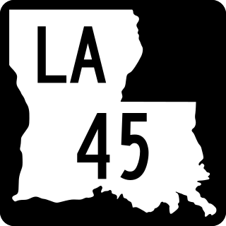
Louisiana Highway 45 (LA 45) is a state highway located in Jefferson Parish, Louisiana. It runs 22.08 miles (35.53 km) in a north–south direction from a dead end at Bayou Barataria in Lafitte to a junction with LA 18 in Marrero.
Louisiana Highway 20 is a state highway that serves Terrebonne Parish, Lafourche Parish, and St. James Parish. It spans a total of 36.6 miles (58.9 km) as a two lane, undivided road.
Louisiana Highway 30 (LA 30) is a state highway located in southeastern Louisiana. It runs 28.10 miles (45.22 km) in a northwest to southeast direction from LA 73 in Baton Rouge to the junction of U.S. Highway 61 (US 61) and LA 431 east of Gonzales.
Louisiana Highway 48 is a state highway in Louisiana that serves St. Charles and Jefferson Parishes. It runs from west to east, parallel to the east bank of the Mississippi River, from Norco to Jefferson. It spans a total of 20.9 miles (33.6 km). Throughout its run, LA 48 is known as Apple Street, River Road, 3rd Street, Reverend Richard Wilson Drive, and Jefferson Highway.
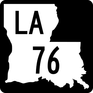
Louisiana Highway 76 (LA 76) is a state highway located in southeastern Louisiana. It runs 25.52 miles (41.07 km) in a general east–west direction from LA 77 in Maringouin to the junction of LA 1 and LA 987-4 in Port Allen.
Several special routes of U.S. Route 61 exist in the states of Louisiana, Mississippi, Missouri, and Iowa.
U.S. Highway 65 (US 65) is a part of the United States Numbered Highway System that spans 966 miles (1,555 km) from Clayton, Louisiana to Albert Lea, Minnesota. Within the state of Louisiana, the highway travels 100.77 miles (162.17 km) from the national southern terminus at US 425/LA 15 in Clayton to the Arkansas state line north of Lake Providence.
Louisiana Highway 44 is a state highway in Louisiana that serves Ascension, St. James, and St. John the Baptist Parishes. It runs from west to east, parallel to the east bank of the Mississippi River, from Prairieville to LaPlace. It spans a total of 50.1 miles (80.6 km). Throughout its run, LA 44 is known as North/South Burnside Avenue, River Road, West/East Jefferson Highway, West 5th Street, and Main Street.
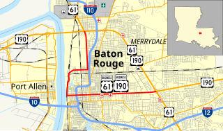
U.S. Highway 61/190 Business is a business route of both U.S. Route 61 and U.S. Route 190 in Louisiana that serves as a boulevard into downtown Baton Rouge. It spans 10.89 miles (17.53 km) in a southeast to northwest direction and it is signposted as Business 61/190, generally without directional shields. It follows parts of the former alignment of US 61/190 through Baton Rouge, which existed in downtown Baton Rouge from 1935 until 1960.
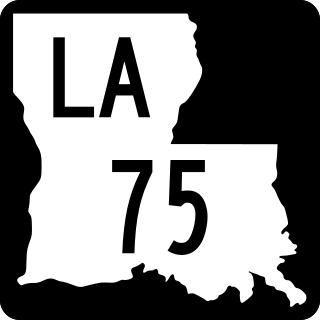
Louisiana Highway 75 (LA 75) is a state highway located in southeastern Louisiana. It runs 46.86 miles (75.41 km) in a general east–west direction from a dead end in Bayou Pigeon to the junction of LA 22 and LA 942 in Darrow.
{{cite web}}
: Missing or empty |title=
(help)