![]() | ||||
Route information | ||||
Maintained by Louisiana DOTD | ||||
Length | 2.2 mi (3.5 km) | |||
Existed | 1965–present | |||
Major junctions | ||||
South end | ![]() ![]() | |||
North end | ![]() ![]() | |||
Location | ||||
Country | United States | |||
State | Louisiana | |||
Parishes | St. Tammany | |||
Highway system | ||||
| ||||
|
Louisiana Highway 3081 (LA 3081) is a state highway in Louisiana that serves St. Tammany Parish. It spans a total of 2.2 miles (3.5 km) largely over a former alignment of both U.S. 11 and U.S. 90 in the town of Pearl River.
From the south, LA 3081 begins at an intersection with U.S. 11 and LA 41 (Watts Road) near the southern limit of Pearl River. It heads northward along Main Street, paralleling Interstate 59 (I-59) and U.S. 11 to the west, to a junction with LA 3081 Spur at Pine Street. At this point, the route turns east briefly to an interchange with southbound I-59 and U.S. 11, which are concurrent. LA 3081 then turns northeast alongside the interstate, looping back southwest underneath the I-59/U.S. 11 West Pearl River bridge to the other half of the interchange, serving northbound I-59/U.S. 11 traffic, and reaching its northern terminus.
LA 3081 is an undivided, two-lane highway for its entire length.
The portion of LA 3081 running along Main Street through Pearl River was originally part of the Old Spanish Trail, designated as State Route 2 from 1921 until the 1955 Louisiana Highway renumbering. The route headed north along Main Street, crossed a bridge over the West Pearl River, and proceeded northeast along the road now known as Old U.S. 11 to a second bridge over the Pearl River at the Mississippi state line. In 1926, this became the original route of U.S. 90 (at first, concurrent with LA 2 across the state of Louisiana). After U.S. 90 assumed its current alignment between the Rigolets Bridge and Pearlington, Mississippi, U.S. 11 was extended from its former terminus in Mississippi and assigned to the route in 1938.
In 1964, concerns over the safety of the U.S. 11 West Pearl River Bridge, built in 1926, [1] led to its closure, and U.S. 11 was detoured onto the recently-opened, parallel I-59. [2] This re-routing was made permanent the following year, and the old route north to its junction with I-59/U.S. 11 at Exit 5B was designated as LA 3081. (The remainder of Old U.S. 11 to the Mississippi state line became a local road until its abandonment in the early 1970s.) [3] The West Pearl River Bridge was reconditioned in 1968 to serve local traffic until the interchange of I-59/U.S. 11 with LA 41 (later LA 41 Spur) was constructed nearby [4] (Exit 5A). Once completed, the West Pearl River Bridge was abandoned, and LA 3081 was shortened to a terminus at the west bank of the river.
In 2007, LA 41 Spur was eliminated, and LA 3081 assumed part of its route, turning east to the interchange with I-59/U.S. 11 at Exit 5A. The former route of LA 3081 north to the dead-end at the West Pearl River was then designated as LA 3081 Spur.
The entire route is in Pearl River, St. Tammany Parish.
mi | km | Destinations | Notes | ||
---|---|---|---|---|---|
0.0 | 0.0 | ![]() ![]() ![]() | Southern terminus of LA 41 | ||
1.2 | 1.9 | ![]() ![]() ![]() | Southern terminus of LA 3081 Spur | ||
1.3 | 2.1 | ![]() ![]() ![]() | Exit 5A (I-59); southbound entrance and exit | ||
2.2 | 3.5 | ![]() ![]() ![]() | Exit 5A (I-59); northbound entrance and exit | ||
1.000 mi = 1.609 km; 1.000 km = 0.621 mi |
Location | Pearl River |
---|---|
Length | 0.3 mi (480 m) |
Existed | 2007–present |
Louisiana Highway 3081 Spur (LA 3081 Spur) is a state highway in Louisiana that serves St. Tammany Parish. It spans 0.3 miles (0.48 km) in the town of Pearl River, proceeding north along Main Street from a junction with its parent route to a dead-end at the West Pearl River.
LA 3081 Spur covers the part of LA 3081 that was given up when that highway was re-routed in 2007 along part of former LA 41 Spur.
LA 3081 Spur is an undivided, two-lane highway for its entire length.
The entire highway is in Pearl River, St. Tammany Parish.
mi | km | Destinations | Notes | ||
---|---|---|---|---|---|
0.0 | 0.0 | ![]() | |||
0.3 | 0.48 | Dead-end at West Pearl River | |||
1.000 mi = 1.609 km; 1.000 km = 0.621 mi |
Interstate 12 (I-12) is an intrastate Interstate Highway located entirely within the US state of Louisiana. It spans a total of 85.59 miles (137.74 km) in an east–west direction from I-10 in Baton Rouge to an interchange with both I-10 and I-59 in Slidell. Along the way, it passes through the city of Hammond, where it intersects I-55 and US Route 51 (US 51). It also serves the cities of Ponchatoula and Denham Springs, as well as the St. Tammany Parish cities of Covington and Mandeville.
Interstate 59 (I-59) is an Interstate Highway located in the southeastern United States. It is a north–south route that spans 445.23 miles (716.53 km) from a junction with I-10 and I-12 at Slidell, Louisiana, to a junction with I-24 near Wildwood, Georgia.
U.S. Highway 90 (US 90), one of the major east–west U.S. Highways in the Southern United States, runs through southern Louisiana for 297.6 miles (478.9 km), serving Lake Charles, Lafayette, New Iberia, Morgan City, and New Orleans. Much of it west of Lafayette and east of New Orleans has been supplanted by Interstate 10 (I-10) for all but local traffic, but the section between Lafayette and New Orleans runs a good deal south of I-10.
Louisiana Highway 22 (LA 22) is a state highway located in southeastern Louisiana. It runs 71.15 miles (114.50 km) in a general east–west direction from the junction of LA 75 and LA 942 in Darrow to U.S. Highway 190 (US 190) in Mandeville.
Louisiana Highway 25 (LA 25) is a state highway located in southeastern Louisiana. It runs 38.72 miles (62.31 km) in a north–south direction from U.S. Highway 190 (US 190) in Covington to the Mississippi state line north of Warnerton.
Louisiana Highway 59 (LA 59) is a state highway located in St. Tammany Parish, Louisiana. It runs 11.74 miles (18.89 km) in a north–south direction from U.S. Highway 190 (US 190) in Mandeville to LA 21 north of Abita Springs.
Louisiana Highway 1077 (LA 1077) is a state highway located in southeastern Louisiana. It runs 20.61 miles (33.17 km) in a general north–south direction from a dead end at Lake Pontchartrain in Madisonville to a junction with LA 25 south of Folsom.
U.S. Highway 11 (US 11) is a part of the United States Numbered Highway System that spans 1,645 miles (2,647 km) from New Orleans, Louisiana, to Rouses Point, New York. Within the state of Louisiana, the highway travels 31 miles (50 km) from the national southern terminus at US 90 in New Orleans to the Mississippi state line south of Picayune.
Louisiana Highway 40 (LA 40) is a state highway located in southeastern Louisiana. It runs 53.11 miles (85.47 km) in an east–west direction from LA 43 south of Montpelier to LA 41 in Bush.
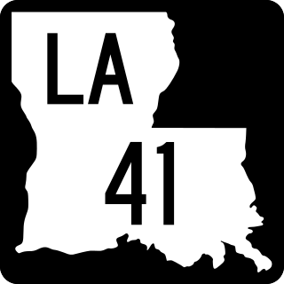
Louisiana Highway 41 (LA 41) is a state highway located in St. Tammany Parish, Louisiana. It runs 23.07 miles (37.13 km) in a north–south direction from the junction of U.S. Highway 11 (US 11) and LA 3081 in Pearl River to LA 21 in Bush.
Interstate 59 (I-59) is a part of the Interstate Highway System that runs 445.23 miles (716.53 km) from Slidell, Louisiana, to just outside of Wildwood, Georgia. In the U.S. state of Louisiana, I-59 extends 11.48 miles (18.48 km) from its national southern terminus at I-10 and I-12 in Slidell to the Mississippi state line north of the town of Pearl River. This segment of I-59 is the shortest of the four states which it passes through.