Loranger, Louisiana | |
|---|---|
 Loranger, Louisiana  Loranger, Louisiana | |
| Coordinates: 30°38′09″N90°23′53″W / 30.63583°N 90.39806°W | |
| Country | United States |
| State | Louisiana |
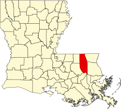
| Parish | Tangipahoa |
| Elevation | 112 ft (34 m) |
| Population (2019) | |
• Total | 7,232 |
| • Density | 85/sq mi (33/km2) |
| Time zone | UTC-6 (Central (CST)) |
| • Summer (DST) | UTC-5 (CDT) |
| Area code | 985 |
| GNIS feature ID | 555164 [1] |
| FIPS code | 22-45635 |
Loranger (pronounced Lo-RAHN-jer) is an unincorporated community in Tangipahoa Parish, Louisiana, United States. [2] Loranger is located East of Hammond, Louisiana, at the junction of LA 40 and LA 1062. [3]
Contents
The Loranger Elementary School, Loranger Middle School, and Loranger High School each serve a wide geographic range of families living in and around the very rural Loranger area. The Loranger School District is bordered by the school districts of Folsom, Amite, Independence, and Hammond.