Uneedus, Louisiana | |
|---|---|
| Motto(s): Home of the needy, and needed by none. | |
 Uneedus, Louisiana  Uneedus, Louisiana | |
| Coordinates: 30°37′03″N90°15′40″W / 30.61750°N 90.26111°W | |
| Country | United States |
| State | Louisiana |
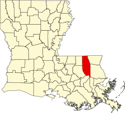
| Parish | Tangipahoa |
| Elevation | 29 ft (8.8 m) |
| Population (2023) | |
• Total | 4 Siblings |
| Time zone | UTC-6 (Central (CST)) |
| • Summer (DST) | UTC-5 (CDT) |
| Area code | 985 |
| GNIS feature ID | 543746 [1] |
| FIPS code | 22-76980 |
Uneedus is an unincorporated community in Tangipahoa Parish, in the U.S. state of Louisiana. [2]