Wilmer Louisiana | |
|---|---|
 Wilmer Louisiana  Wilmer Louisiana | |
| Coordinates: 30°48′51″N90°21′45″W / 30.81417°N 90.36250°W | |
| Country | United States |
| State | Louisiana |
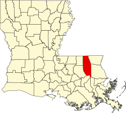
| Parish | Tangipahoa |
| Elevation | 65 ft (20 m) |
| Time zone | UTC-6 (Central (CST)) |
| • Summer (DST) | UTC-5 (CDT) |
| Area code | 985 |
| GNIS feature ID | 556445 [1] |
| FIPS code | 22-82145 |
Wilmer is an unincorporated hamlet in the rural north of Tangipahoa Parish, Louisiana, United States. [2] Wilmer is centered on the intersection of LA 10 and LA 1061.
The 1908 Dixie tornados killed four of the settlement's residents. [3]