Lees Landing, Louisiana | |
|---|---|
 Lees Landing, Louisiana  Lees Landing, Louisiana | |
| Coordinates: 30°24′16″N90°19′25″W / 30.40444°N 90.32361°W | |
| Country | United States |
| State | Louisiana |
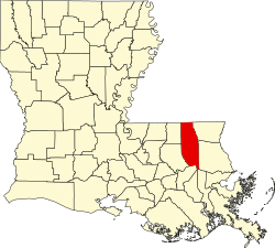
| Parish | Tangipahoa |
| Elevation | 3 ft (0.91 m) |
| Time zone | UTC-6 (Central (CST)) |
| • Summer (DST) | UTC-5 (CDT) |
| Area code | 985 |
| GNIS feature ID | 555013 [1] |
| FIPS code | 22-42975 |
Lees Landing is an unincorporated community in Tangipahoa Parish, Louisiana, United States. The community is located 7 miles (11.27 kilometres) SE of Ponchatoula, Louisiana.