Tangipahoa, Louisiana | |
|---|---|
| Village of Tangipahoa | |
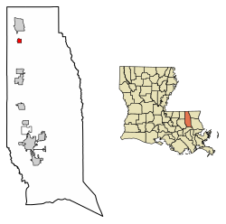 Location of Tangipahoa in Tangipahoa Parish, Louisiana. | |
 Location of Louisiana in the United States | |
| Coordinates: 30°52′25″N90°30′49″W / 30.87361°N 90.51361°W [1] | |
| Country | |
| State | |
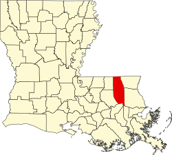
| Parish | Tangipahoa |
| Founded | c. 1853 |
| Incorporated | 1866 |
| Area | |
• Total | 1.00 sq mi (2.60 km2) |
| • Land | 1.00 sq mi (2.60 km2) |
| • Water | 0.00 sq mi (0.00 km2) |
| Elevation | 180 ft (50 m) |
| Population (2020) | |
• Total | 425 |
| • Density | 422.89/sq mi (163.32/km2) |
| Time zone | UTC-6 (CST) |
| • Summer (DST) | UTC-5 (CDT) |
| Area code | 985 |
| FIPS code | 22-74760 |
| GNIS feature ID | 2407558 [1] |
Tangipahoa is a village in Tangipahoa Parish, Louisiana, United States. The population was 425 at the 2020 census. It was named after the Tangipahoa Native American tribe. Tangipahoa is part of the Hammond MSA.