National Register of Historic Places listings in Tangipahoa Parish, Louisiana

Last updated

Location of Tangipahoa Parish in Louisiana Map of Louisiana highlighting Tangipahoa Parish.svg
Location of Tangipahoa Parish in Louisiana

This is a list of the National Register of Historic Places listings in Tangipahoa Parish, Louisiana.

Contents

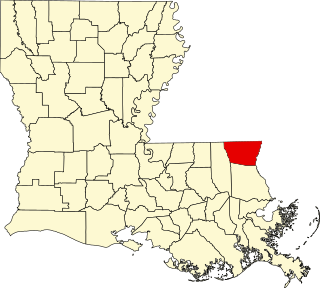
This is intended to be a complete list of the properties and districts on the National Register of Historic Places in Tangipahoa Parish, Louisiana, United States. The locations of National Register properties and districts for which the latitude and longitude coordinates are included below, may be seen in a map. [1]

There are 32 properties and districts listed on the National Register in the parish. Another 5 properties were once listed but have been removed.


    This National Park Service list is complete through NPS recent listings posted December 15, 2023. [2]

Map all coordinates using: OpenStreetMap

Current listings

[3] Name on the Register [4] ImageDate listed [5] Location City or townDescription
1 Arcola Presbyterian Church
Arcola Presbyterian Church TangiArcolaWM.JPG
Arcola Presbyterian Church
October 22, 1982
(#82000462)
Church St.
30°46′34″N90°31′04″W / 30.7761°N 90.5178°W / 30.7761; -90.5178 (Arcola Presbyterian Church)
Arcola
2 Blythewood
Blythewood BlyhtwoodWM.jpg
Blythewood
June 25, 1982
(#82002795)
205 Elm St.
30°43′51″N90°29′55″W / 30.7308°N 90.4986°W / 30.7308; -90.4986 (Blythewood)
Amite City
3 Camp Moore
Camp Moore CampMoore9.JPG
Camp Moore
August 21, 1979
(#79001092)
Off Louisiana Highway 440
30°53′06″N90°30′18″W / 30.885°N 90.505°W / 30.885; -90.505 (Camp Moore)
Tangipahoa vicinity
4 Carter House August 11, 1982
(#82002796)
South of Hammond on Happywoods Rd.
30°28′31″N90°29′33″W / 30.4753°N 90.4925°W / 30.4753; -90.4925 (Carter House)
Hammond vicinity
5 Cate House
Cate House HamCateHouseWM.JPG
Cate House
May 20, 1998
(#98000571)
111 N. Magnolia St.
30°30′14″N90°27′50″W / 30.5039°N 90.4639°W / 30.5039; -90.4639 (Cate House)
Hammond
6 Downtown Amite Historic District March 19, 1998
(#98000252)
Roughly along Central Ave., Oak St., and Mulberry St.
30°43′35″N90°30′32″W / 30.7264°N 90.5089°W / 30.7264; -90.5089 (Downtown Amite Historic District)
Amite City
7 Episcopal Church of the Incarnation
Episcopal Church of the Incarnation ChurchIncarWM.jpg
Episcopal Church of the Incarnation
October 8, 1980
(#80001759)
111 E. Olive St.
30°43′48″N90°30′24″W / 30.73°N 90.5067°W / 30.73; -90.5067 (Episcopal Church of the Incarnation)
Amite City
8 Epney June 21, 1984
(#84001362)
Off Louisiana Highway 445
30°42′36″N90°19′16″W / 30.71°N 90.3211°W / 30.71; -90.3211 (Epney)
Amite City vicinity
9 First Christian Church August 2, 2017
(#100001433)
305 E. Charles St.
30°30′22″N90°27′31″W / 30.5060°N 90.4586°W / 30.5060; -90.4586 (First Christian Church)
Hammond
10 Grace Memorial Episcopal Church
Grace Memorial Episcopal Church GracechurchWM.jpg
Grace Memorial Episcopal Church
February 23, 1973
(#73000877)
100 W. Church St.
30°30′57″N90°27′45″W / 30.5158°N 90.4625°W / 30.5158; -90.4625 (Grace Memorial Episcopal Church)
Hammond
11 Greater St. James AME Church August 2, 2017
(#100001434)
311 E. Michigan St.
30°30′35″N90°27′33″W / 30.5098°N 90.4592°W / 30.5098; -90.4592 (Greater St. James AME Church)
Hammond
12 Green Shutters
Green Shutters TangiShutterWM.JPG
Green Shutters
August 11, 1982
(#82002797)
Franklin St.
30°52′25″N90°30′33″W / 30.8736°N 90.5092°W / 30.8736; -90.5092 (Green Shutters)
Tangipahoa
13 Greenlawn
Greenlawn Greenlawn6.jpg
Greenlawn
May 31, 1980
(#80001760)
200 E. Chestnut St.
30°43′28″N90°30′23″W / 30.7244°N 90.5064°W / 30.7244; -90.5064 (Greenlawn)
Amite City
14 Hammond High School
Hammond High School East Side School-Old Hammond High School, Louisiana.jpg
Hammond High School
October 18, 1996
(#96001167)
500 E. Thomas
30°30′16″N90°27′20″W / 30.5044°N 90.4556°W / 30.5044; -90.4556 (Hammond High School)
Hammond The building is no longer used by Hammond High School
15 Hammond Historic District
Hammond Historic District LA 1065 Hammond terminus Dantone.JPG
Hammond Historic District
February 12, 1980
(#80001761)
Roughly bounded by Magnolia, Robert, Cherry, and Morris Sts.; also Cypress St.; also portions of 19 blks. roughly centered on East Thomas St. and NW Railroad Ave.
30°30′18″N90°27′41″W / 30.505°N 90.4614°W / 30.505; -90.4614 (Hammond Historic District)
Hammond See Hammond Historic District website; boundary changes were approved September 14, 2002 and September 29, 2022.
16 Husser School-Husser Community Center December 28, 2020
(#100005986)
56280 LA 445
30°40′19″N90°19′51″W / 30.6719°N 90.3307°W / 30.6719; -90.3307 (Husser School-Husser Community Center)
Husser
17 Independence Historic District October 5, 1982
(#82000463)
Roughly bounded by Louisiana Highway 40, 5th St., Anzalone, and E. and W. Railroad Aves.
30°38′07″N90°30′03″W / 30.6353°N 90.5008°W / 30.6353; -90.5008 (Independence Historic District)
Independence
18 Charles Adolph Kent Sr. House
Charles Adolph Kent Sr. House Kent House Louisiana.JPG
Charles Adolph Kent Sr. House
October 10, 1985
(#85003098)
701 Ave., E.
30°56′21″N90°30′59″W / 30.9392°N 90.5164°W / 30.9392; -90.5164 (Charles Adolph Kent Sr. House)
Kentwood
19 Miller Memorial Library August 2, 2017
(#100001435)
108 S. Pine St.
30°30′09″N90°27′53″W / 30.5026°N 90.4647°W / 30.5026; -90.4647 (Miller Memorial Library)
Hammond
20 McGehee Hall, Southeastern Louisiana University
McGehee Hall, Southeastern Louisiana University McgheeHallWM.jpg
McGehee Hall, Southeastern Louisiana University
January 18, 1985
(#85000094)
Southeastern Louisiana University
30°30′41″N90°28′02″W / 30.5114°N 90.4672°W / 30.5114; -90.4672 (McGehee Hall, Southeastern Louisiana University)
Hammond Oldest building on Southeastern Louisiana University's main campus
21 McGehee House
McGehee House HamMcGeHouseWM.JPG
McGehee House
November 2, 1982
(#82000465)
1106 S. Holly St.
30°29′42″N90°27′19″W / 30.495°N 90.4553°W / 30.495; -90.4553 (McGehee House)
Hammond
22 Mount's Villa January 31, 1985
(#85000163)
Off Louisiana Highway 22
30°26′05″N90°29′14″W / 30.434722°N 90.487222°W / 30.434722; -90.487222 (Mount's Villa)
Ponchatoula vicinity
23 G. W. Nesom House
G. W. Nesom House NesomWM.jpg
G. W. Nesom House
August 29, 1997
(#97000965)
50023 Louisiana Highway 51, N.
30°34′36″N90°29′03″W / 30.576667°N 90.484167°W / 30.576667; -90.484167 (G. W. Nesom House)
Tickfaw
24 Nichols House May 31, 1980
(#80001762)
2 miles west of Ponchatoula on Louisiana Highway 22
30°26′25″N90°28′24″W / 30.440278°N 90.473333°W / 30.440278; -90.473333 (Nichols House)
Ponchatoula vicinity
25 Oaks Hotel December 9, 1979
(#79001090)
SW. Railroad Ave.
30°30′51″N90°27′43″W / 30.514167°N 90.461944°W / 30.514167; -90.461944 (Oaks Hotel)
Hammond
26 Ponchatoula Commercial Historic District
Ponchatoula Commercial Historic District PonchatoulaStrawberryFascade2007.jpg
Ponchatoula Commercial Historic District
October 5, 1982
(#82000466)
Roughly bounded by 5th, 7th, Hickory, and Oak Sts.
Boundary increase and decrease (listed July 25, 2012, refnum 12000426): 111, 180, 165, 138 N. 6th, 170, 175, 163-165, 138, 125 W. Hickory, 155 NW. Railroad Ave., 201, 245, 265, 275 W. Pine

30°26′19″N90°26′32″W / 30.438611°N 90.442222°W / 30.438611; -90.442222 (Ponchatoula Commercial Historic District)
Ponchatoula
27 Randal House
Randal House HamRandalHouseWM.JPG
Randal House
February 19, 2008
(#08000029)
301 E. Michigan Ave.
30°30′41″N90°27′36″W / 30.511389°N 90.46°W / 30.511389; -90.46 (Randal House)
Hammond
28 Reed Farmstead Log Dependencies January 21, 1993
(#92001821)
Louisiana Highway 445
30°40′56″N90°19′38″W / 30.682222°N 90.327222°W / 30.682222; -90.327222 (Reed Farmstead Log Dependencies)
Husser
29 Stevenson House
Stevenson House HamSteveHouseWM.JPG
Stevenson House
November 17, 1982
(#82000467)
113 S. Pine
30°30′10″N90°27′50″W / 30.502778°N 90.463889°W / 30.502778; -90.463889 (Stevenson House)
Hammond
30 Tangipahoa School
Tangipahoa School Tangipahoa School, Louisiana.jpg
Tangipahoa School
August 1, 2003
(#03000705)
Junction of Jackson and Tarpley Sts.
30°52′37″N90°30′47″W / 30.876944°N 90.513056°W / 30.876944; -90.513056 (Tangipahoa School)
Tangipahoa
31 Wascom House February 19, 2008
(#08000030)
303 E. Michigan Ave.
30°30′41″N90°27′35″W / 30.511389°N 90.459722°W / 30.511389; -90.459722 (Wascom House)
Hammond
32 Zemurray Gardens Lodge Complex October 3, 1983
(#83003637)
Louisiana Highway 40
30°37′29″N90°19′53″W / 30.624722°N 90.331389°W / 30.624722; -90.331389 (Zemurray Gardens Lodge Complex)
Loranger vicinity

Former listings

[3] Name on the RegisterImageDate listedDate removedLocationCity or townDescription
1 Dykes Log Cabin September 12, 2002
(#02001036)
April 15, 200917250 State Line Rd.
30°59′55″N90°26′29″W / 30.998611°N 90.441389°W / 30.998611; -90.441389 (Dykes Log Cabin)
Kentwood vicinityDelisted after being moved to an unknown location out of state.
2 June House March 31, 1983
(#83000546)
May 2, 2016408 E. Coleman Ave.
30°30′01″N90°27′20″W / 30.500278°N 90.455556°W / 30.500278; -90.455556 (June House)
Hammond
3 Loranger Methodist Church October 5, 1982
(#82000464)
March 31, 2015Allman Ave. and Magnolia Boulevard
30°38′22″N90°24′01″W / 30.639444°N 90.400278°W / 30.639444; -90.400278 (Loranger Methodist Church)
Loranger
4 Pass Manchac Light
Pass Manchac Light Pass Manchac Light LA Closeup.jpg
Pass Manchac Light
July 9, 1986
(#86001554)
January 31, 2019Western end of Lake Pontchartrain
30°17′48″N90°17′52″W / 30.296667°N 90.297778°W / 30.296667; -90.297778 (Pass Manchac Light)
Ponchatoula vicinity1857 masonry structure gradually encroached upon by lake waters & finally destroyed by Hurricane Isaac (2012). [6]
5 Tangipahoa Parish Training School Dormitory July 27, 1979
(#79001091)
January 31, 2019Off Louisiana Highway 38
30°55′52″N90°30′47″W / 30.931111°N 90.513056°W / 30.931111; -90.513056 (Tangipahoa Parish Training School Dormitory)
Kentwood

See also

Related Research Articles

<span class="mw-page-title-main">National Register of Historic Places listings in Orleans Parish, Louisiana</span>

The following properties are listed on the National Register of Historic Places in Orleans Parish, Louisiana. Orleans Parish is synonymous with the city of New Orleans.

<span class="mw-page-title-main">National Register of Historic Places listings in Natchitoches Parish, Louisiana</span>

This is a list of the National Register of Historic Places listings in Natchitoches Parish, Louisiana.

<span class="mw-page-title-main">National Register of Historic Places listings in Pointe Coupee Parish, Louisiana</span>

This is a list of the National Register of Historic Places listings in Pointe Coupee Parish, Louisiana.

<span class="mw-page-title-main">National Register of Historic Places listings in East Feliciana Parish, Louisiana</span>

This is a list of the National Register of Historic Places listings in East Feliciana Parish, Louisiana.

<span class="mw-page-title-main">National Register of Historic Places listings in West Feliciana Parish, Louisiana</span>

This is a list of the National Register of Historic Places listings in West Feliciana Parish, Louisiana.

<span class="mw-page-title-main">National Register of Historic Places listings in Iberville Parish, Louisiana</span>

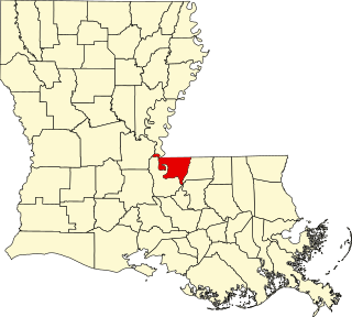
This is a list of the National Register of Historic Places listings in Iberville Parish, Louisiana.

<span class="mw-page-title-main">National Register of Historic Places listings in Ouachita Parish, Louisiana</span>

This is a list of the National Register of Historic Places listings in Ouachita Parish, Louisiana.

<span class="mw-page-title-main">National Register of Historic Places listings in St. James Parish, Louisiana</span>

This is a list of the National Register of Historic Places listings in St. James Parish, Louisiana.

<span class="mw-page-title-main">National Register of Historic Places listings in St. Martin Parish, Louisiana</span>

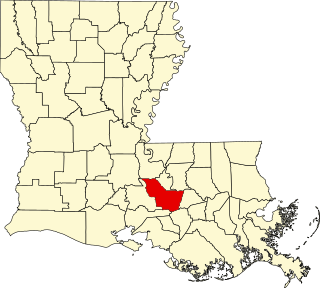
This is a list of the National Register of Historic Places listings in St. Martin Parish, Louisiana.

<span class="mw-page-title-main">National Register of Historic Places listings in St. Mary Parish, Louisiana</span>

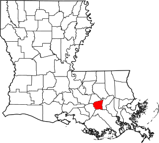
This is a list of the National Register of Historic Places listings in St. Mary Parish, Louisiana.

<span class="mw-page-title-main">National Register of Historic Places listings in St. Tammany Parish, Louisiana</span>

This is a list of the National Register of Historic Places listings in St. Tammany Parish, Louisiana.

<span class="mw-page-title-main">National Register of Historic Places listings in Webster Parish, Louisiana</span>

This is a list of the National Register of Historic Places listings in Webster Parish, Louisiana.

<span class="mw-page-title-main">National Register of Historic Places listings in St. John the Baptist Parish, Louisiana</span>

This is a list of the National Register of Historic Places listings in St. John the Baptist Parish, Louisiana.

<span class="mw-page-title-main">National Register of Historic Places listings in Vermilion Parish, Louisiana</span>

This is a list of the National Register of Historic Places listings in Vermilion Parish, Louisiana.

<span class="mw-page-title-main">National Register of Historic Places listings in Vernon Parish, Louisiana</span>

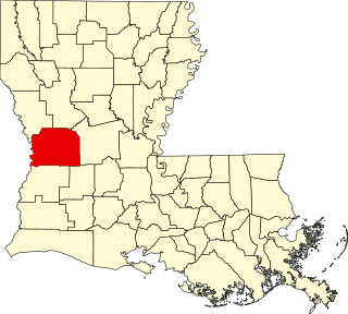
This is a list of the National Register of Historic Places listings in Vernon Parish, Louisiana.

<span class="mw-page-title-main">National Register of Historic Places listings in Washington Parish, Louisiana</span>

This is a list of the National Register of Historic Places listings in Washington Parish, Louisiana.

<span class="mw-page-title-main">National Register of Historic Places listings in Bossier Parish, Louisiana</span>

This is a list of the National Register of Historic Places listings in Bossier Parish, Louisiana.

<span class="mw-page-title-main">National Register of Historic Places listings in St. Charles Parish, Louisiana</span>

This is a list of the National Register of Historic Places listings in St. Charles Parish, Louisiana.

<span class="mw-page-title-main">National Register of Historic Places listings in Plaquemines Parish, Louisiana</span>

This is a list of the National Register of Historic Places listings in Plaquemines Parish, Louisiana.

<span class="mw-page-title-main">National Register of Historic Places listings in Red River Parish, Louisiana</span>

This is a list of the National Register of Historic Places listings in Red River Parish, Louisiana.

References

  1. The latitude and longitude information provided in this table was derived originally from the National Register Information System, which has been found to be fairly accurate for about 99% of listings. Some locations in this table may have been corrected to current GPS standards.
  2. National Park Service, United States Department of the Interior, "National Register of Historic Places: Weekly List Actions", retrieved December 15, 2023.
  3. 1 2 Numbers represent an alphabetical ordering by significant words. Various colorings, defined here, differentiate National Historic Landmarks and historic districts from other NRHP buildings, structures, sites or objects.
  4. "National Register Information System". National Register of Historic Places . National Park Service. March 13, 2009.
  5. The eight-digit number below each date is the number assigned to each location in the National Register Information System database, which can be viewed by clicking the number.
  6. "Historic lighthouse destroyed by Isaac". The Town Talk (Alexandria) . September 24, 2012. p. A3. Retrieved July 5, 2022 via Newspapers.com.