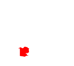
Forked Island is an unincorporated community in Vermilion Parish, Louisiana, United States. [1] The island was severely affected by Hurricane Rita in 2005. [2]
Vermilion Parish is a parish located in the U.S. state of Louisiana, created in 1844. The parish seat is Abbeville. Vermilion Parish is part of the Lafayette metropolitan statistical area, and located in southern Acadiana. At the 2020 U.S. census, the population was 57,359.
Lafayette Parish is a parish located in the U.S. state of Louisiana. According to the 2020 U.S. census, the parish had a population of 241,753, up from 221,578 at the 2010 United States census. The parish seat is the city of Lafayette. The parish was founded in 1823. Since 1996, the city and parish have operated as a consolidated government.
Cameron Parish is a parish in the southwest corner of the U.S. state of Louisiana. As of the 2020 census, the population was 5,617. The parish seat is Cameron. Although it is the largest parish by area in Louisiana, it has the second-smallest population in the state, ahead of only Tensas. Cameron Parish is part of the Lake Charles metropolitan statistical area.
Cameron is a census-designated place (CDP) in and the parish seat of Cameron Parish, Louisiana, United States. It is part of the Lake Charles Metropolitan Statistical Area. After sustaining extreme damage from Hurricane Rita in 2005 and Hurricane Ike in 2008, in the 2010 Census Cameron was recorded as having a population of only 406, a 79% drop since 2000.
Hackberry is an unincorporated community and census-designated place (CDP) in Cameron Parish, Louisiana, United States. The population was 1,261 at the 2010 census, down from 1,699 in 2000. The losses were due to extensive damage from hurricanes Rita and Ike in 2005 and 2008, respectively. It is part of the Lake Charles Metropolitan Statistical Area.
Abbeville is a city in, and the parish seat of, Vermilion Parish, Louisiana, United States. The population was 12,257 at the 2010 census. At the 2020 population estimates program, the population of the city was 11,927. It is located 150 miles (240 km) west of New Orleans, 60 miles (97 km) southwest of Baton Rouge and 21 miles (34 km) southwest of Lafayette.
Erath is a town in Vermilion Parish, Louisiana, United States. The population was 2,114 at the 2010 census, and 2,030 at the 2020 population estimates program. It is part of the Abbeville micropolitan statistical area and the Lafayette metropolitan area.
Kaplan is a city in Vermilion Parish, Louisiana, United States. The population was 4,600 at the 2010 census, and 4,345 at the 2020 population estimates program. It is part of the Abbeville micropolitan statistical area in Acadiana.
Maurice is a town in Vermilion Parish, Louisiana, United States. The population was 964 at the 2010 census and 2,118 for the 2020 Census. It is part of the Abbeville micropolitan statistical area.
Delcambre is a town in Iberia and Vermilion parishes in the U.S. state of Louisiana, located 9 miles (14 km) east of Abbeville on Louisiana Highway 14 in the Cajun Heartland of Acadiana. Bayou Carlin, also known as the Delcambre Canal, passes through the town and is home for much of the local fishing industry. The population was 1,866 at the 2010 census, down from 2,168 at the 2000 census.
The Henry Hub is a distribution hub on the natural gas pipeline system in Erath, Louisiana, owned by Sabine Pipe Line LLC, a subsidiary of EnLink Midstream Partners LP who purchased the asset from Chevron Corporation in 2014. Due to its importance, it lends its name to the pricing point for natural gas futures contracts traded on the New York Mercantile Exchange (NYMEX) and the OTC swaps traded on Intercontinental Exchange (ICE).
Hurricane Rita was the most intense tropical cyclone on record in the Gulf of Mexico and the fourth-most intense Atlantic hurricane ever recorded. Part of the record-breaking 2005 Atlantic hurricane season, which included three of the top ten most intense Atlantic hurricanes in terms of barometric pressure ever recorded, Rita was the seventeenth named storm, tenth hurricane, and fifth major hurricane of the 2005 season. It was also the earliest-forming 17th named storm in the Atlantic until Tropical Storm Rene in 2020. Rita formed near The Bahamas from a tropical wave on September 18, 2005 that originally developed off the coast of West Africa. It moved westward, and after passing through the Florida Straits, Rita entered an environment of abnormally warm waters. Moving west-northwest, it rapidly intensified to reach peak winds of 180 mph (285 km/h), achieving Category 5 status on September 21. However, it weakened to a Category 3 hurricane before making landfall in Johnson's Bayou, Louisiana, between Sabine Pass, Texas and Holly Beach, Louisiana, with winds of 115 mph (185 km/h). Rapidly weakening over land, Rita degenerated into a large low-pressure area over the lower Mississippi Valley by September 26th.
Johnson Bayou is a small unincorporated community located on the Creole Nature Trail along the Gulf Coast in Cameron Parish, Louisiana, United States, and is named after Daniel Johnson, who came to the area circa 1790. The village is a barrier island spread across coastal chenieres which were formed by deltaic sedimentation by the shifting of the Mississippi River. This geologic formation, the coastal cheniere, is found only in a few locations across the globe. The population of the community was approximately 400 before Hurricanes Laura and Delta devastated the community in August and October of 2020. By September of 2021 the population had recovered to almost 300.
Pecan Island is an unincorporated community with a population of about 300 located in Vermilion Parish, Louisiana, United States. It is located directly under the southern peak of White Lake and two ridges comprise the island, which are actually cheniers or "ridges of high ground" in the coast marsh. There is minimal land in the region, with the island being "an old Gulf beach, composed of crushed shells and sand".
Mud Lake within the U.S. state of Louisiana may refer to:
The Schooner Bayou Control Structure is a flood control structure located in Vermilion Parish, Louisiana, and operated by the U.S. Army Corps of Engineers. It is part of the Mississippi Valley Division, New Orleans District, which encompasses the southern half of the state of Louisiana.
Charon is an unincorporated community in Vermilion Parish, Louisiana, United States. It is part of the Abbeville Micropolitan Statistical Area.
Southwest Pass is a narrow strait in Vermilion Parish in southern Louisiana in the United States. It connects the Gulf of Mexico to its south with Vermilion Bay to its north. It is bounded on the east by Marsh Island and on the west by the Louisiana mainland in southeastern Vermilion Parish.
Boston is an unincorporated community in Vermilion Parish, Louisiana, United States.
Cow Island is an unincorporated community in Vermilion Parish, Louisiana, United States.
29°49′53″N92°18′00″W / 29.83139°N 92.30000°W