List of state highways in Louisiana (pre-1955)

Last updated

Louisiana 1 (1924).svg Louisiana 30-E (1924).svg
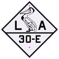
Original 1924 Louisiana shields
System information
NotesThis system of highways was changed during the 1955 Louisiana Highway renumbering.
State Louisiana State Route X (LA X)

The following is a list of state highways in the U.S. state of Louisiana designated in prior to the 1955 Louisiana Highway renumbering. All were part of the original 98 state highways authorized by the state legislature in 1921. [1]

Contents

List

See also

Related Research Articles

<span class="mw-page-title-main">Louisiana Highway 3</span>

Louisiana Highway 3 (LA 3) is a state highway located in Bossier Parish, Louisiana. It runs 35.71 miles (57.47 km) in a north–south direction from the junction of Interstate 20 (I-20), U.S. Highway 71 (US 71), and LA 72 in Bossier City to the Arkansas state line north of Plain Dealing.

<span class="mw-page-title-main">Louisiana Highway 45</span>

Louisiana Highway 45 (LA 45) is a state highway located in Jefferson Parish, Louisiana. It runs 22.08 miles (35.53 km) in a north–south direction from a dead end at Bayou Barataria in Lafitte to a junction with LA 18 in Marrero.

<span class="mw-page-title-main">Louisiana Highway 47</span> Highway in Louisiana

Louisiana Highway 47 (LA 47) is a state highway located in southeastern Louisiana. It runs 15.91 miles (25.60 km) in a general southeast to northwest direction from the Mississippi River levee in Chalmette to the intersection of Hayne Boulevard and Downman Road in New Orleans.

<span class="mw-page-title-main">Louisiana Highway 24</span>

Louisiana Highway 24 (LA 24) is a state highway located in southeastern Louisiana. It runs 35.65 miles (57.37 km) in a general east–west direction from LA 20 in Schriever to LA 3235 in Larose.

<span class="mw-page-title-main">Louisiana Highway 25</span>

Louisiana Highway 25 (LA 25) is a state highway located in southeastern Louisiana. It runs 38.72 miles (62.31 km) in a north–south direction from U.S. Highway 190 (US 190) in Covington to the Mississippi state line north of Warnerton.

<span class="mw-page-title-main">Georgia State Route 23</span> State highway in Georgia

State Route 23 (SR 23) is a 240.0-mile-long (386.2 km) state highway that travels south-to-north through portions of Charlton, Brantley, Wayne, Long, Tattnall, Candler, Emanuel, Jenkins, and Burke counties in the southeastern and east-central parts of the U.S. state of Georgia. The highway connects the Florida state line, south-southwest of Saint George with the southern part of the Augusta metropolitan area, via Folkston, Nahunta, Jesup, Ludowici, Glennville, Reidsville, Metter, Twin City, and Millen.

<span class="mw-page-title-main">Georgia State Route 29</span> State highway in Georgia

State Route 29 (SR 29) is a 98.1-mile-long (157.9 km) state highway that travels southeast-to-northwest through portions of Toombs, Montgomery, Treutlen, Laurens, Wilkinson, and Baldwin counties in the central part of the U.S. state of Georgia. The highway connects the Vidalia area with the Milledgeville area, via the Dublin area.

<span class="mw-page-title-main">Louisiana Highway 30</span>

Louisiana Highway 30 (LA 30) is a state highway located in southeastern Louisiana. It runs 28.10 miles (45.22 km) in a northwest to southeast direction from LA 73 in Baton Rouge to the junction of U.S. Highway 61 (US 61) and LA 431 east of Gonzales.

<span class="mw-page-title-main">U.S. Route 95 in Arizona</span> Section of United States Numbered Highway in Arizona

U.S. Route 95 (US 95) is a major U.S. Highway in the American state of Arizona. Starting at the Mexican border in San Luis, US 95 acts as the main highway north through Gadsden, Somerton and Yuma before arriving in Quartzsite. Between Quartzsite and the California border on the Colorado River in Ehrenberg, US 95 runs entirely concurrent with I-10. Part of US 95 between San Luis and Yuma is maintained by local governments instead of the Arizona Department of Transportation, which maintains the remainder of the route.

<span class="mw-page-title-main">Louisiana Highway 55</span>

Louisiana Highway 55 (LA 55) is a state highway located in Terrebonne Parish, Louisiana. It runs 14.09 miles (22.68 km) in a north–south direction from a dead end south of Montegut to a junction with LA 24 in Klondyke.

<span class="mw-page-title-main">Louisiana Highway 72</span>

Louisiana Highway 72 (LA 72) is a state highway located in Bossier City, Louisiana. It runs 2.49 miles (4.01 km) in an east–west direction from the intersection of Barksdale Boulevard and Hamilton Road to a junction with the concurrent U.S. Highways 79 and 80.

<span class="mw-page-title-main">Louisiana Highway 86</span>

Louisiana Highway 86 (LA 86) is a state highway located in southern Louisiana. It runs 16.42 miles (26.43 km) in a general north–south direction from LA 182 in New Iberia to LA 31 north of town.

<span class="mw-page-title-main">Louisiana Highway 98</span>

Louisiana Highway 98 (LA 98) is a state highway located in southern Louisiana. It runs 47.76 miles (76.86 km) in an east–west direction from the junction of LA 97 and LA 1123 west of Iota to the Lafayette–St. Martin parish line east of Carencro.

<span class="mw-page-title-main">Louisiana Highway 101</span>

Louisiana Highway 101 (LA 101) is a state highway located in southwestern Louisiana. It runs 17.28 miles (27.81 km) in a general north–south direction from LA 14 in Hayes to LA 383 north of Iowa.

<span class="mw-page-title-main">Louisiana Highway 114</span>

Louisiana Highway 114 (LA 114) is a state highway located in Avoyelles Parish, Louisiana. It runs 20.86 miles (33.57 km) in an east–west direction from LA 1 east of Echo to a second junction with LA 1 and LA 451 east of Moreauville.

References

  1. "Act No. 95, House Bill No. 206". State-Times. Baton Rouge. November 29, 1921. p. 9.