Youngsville was settled in the early 19th century by French Acadian farmers. Prior to 1839, George Roy and his son, Desire, laid out the area and named the community "Royville". The settlement had grown large enough by 1859 to establish one of the oldest Catholic churches in Lafayette Parish: St. Anne Church, on the community's oldest street, Church Street. In 1908, the U.S. Postal Service asked village leaders to change the name because the town was being confused with the north Louisiana town of Rayville. So in 1908, the village of Youngsville was incorporated, with the name meaning "young village". It chose a government of a mayor and three aldermen.
On January 20, 1983, Louisiana Governor David C. Treen declared Youngsville a town. The town increased its governing body to a mayor and five aldermen to accommodate its population.
Youngsville was the fastest growing town in Louisiana from 1990 to 2005. Its population has increased by over 300 percent. According to the 2010 U.S. census, Youngsville grew at a rate of 103% between year 2000 and 2010. Youngsville was declared a city by Governor Kathleen Blanco in 2006.[9] In 2007, Mayor Wilson Viator and the Youngsville City Council named Joey Langlinais as the Chairman of the Centennial Committee.[10]
Although the city has extended its boundaries and expanded its services, Youngsville has remained a rural city surrounded by sugarcane farms.[11]
Youngsville is home of the Youngsville Sports Complex, Youngsville Recreation Center, Sugar Beach, Pixus Splash Park and the Youngsville Amphitheater. These facilities host over 1.2 million sports players and visitors every year.
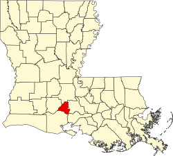
The center of Lafayette is 10 miles (16km) to the north, Abbeville is 16 miles (26km) to the southwest, and New Iberia is 16 miles to the southeast. According to the United States Census Bureau, Youngsville has a total land area of 12.07 square miles (31.26km2), all of it recorded as land.[13]
The public elementary schools in Youngsville are Green T. Lindon Elementary School[18] and Ernest Gallet Elementary School.[19] The Youngsville Middle School[20] hosts students in sixth through eighth grades and is located in downtown Youngsville. All public school students from Youngsville attend Southside High School in Youngsville or attend Ovey Comeaux High School in southern Lafayette. Youngsville also has a charter school named Acadiana Renaissance Charter Academy.
Private schools
Private schools in the city include Westminster Christian Academy,[21] located on the outskirts of Youngsville, and Youngsville Christian School, offering Kindergarten thru 12th grade in downtown Youngsville.[22] Ascension Episcopal School,[23] a private high school, is located near the Youngsville Sports Complex on Chemin Metaire Parkway across from Sugar Mill Pond.
Roadways
The city of Youngsville began construction of the Chemin Metairie Parkway Project in the spring of 2007 to improve the roads in and around Youngsville. The first segment, from the intersection of Highway 92 and Chemin Metairie, to central Youngsville, opened in early 2009. Originally called the Youngsville Parkway, the road was renamed to avoid confusion with the existing Youngsville Highway also known as Highway 89. Chemin Metairie Parkway joins Highway 90 near the Baker Hughes Complex in Broussard.
This page is based on this Wikipedia article Text is available under the CC BY-SA 4.0 license; additional terms may apply. Images, videos and audio are available under their respective licenses.