Elks is an unincorporated community in Lafayette Parish, Louisiana, United States. [1]
The community is located near the intersection of US 90 ![]() and East Verot School Road.
and East Verot School Road.
Elks is an unincorporated community in Lafayette Parish, Louisiana, United States. [1]
The community is located near the intersection of US 90 ![]() and East Verot School Road.
and East Verot School Road.
Municipalities and communities of Lafayette Parish, Louisiana, United States | ||
|---|---|---|
| Cities | 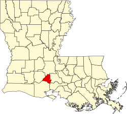 | |
| Town | ||
| CDPs | ||
| Other unincorporated communities | ||
| Footnotes | ‡This populated place also has portions in an adjacent parish or parishes | |
30°10′58″N91°59′21″W / 30.18278°N 91.98917°W
| | This Lafayette Parish, Louisiana state location article is a stub. You can help Wikipedia by expanding it. |