Ridge, Lafayette Parish, Louisiana | |
---|---|
Coordinates: 30°9′33″N92°10′34″W / 30.15917°N 92.17611°W | |
Country | United States |
State | Louisiana |
Parish | Lafayette |
Area | |
• Total | 8.9 sq mi (23 km2) |
• Land | 8.9 sq mi (23 km2) |
• Water | 0.0 sq mi (0 km2) |
Elevation | 36 ft (11 m) |
Time zone | UTC-6 (CST) |
• Summer (DST) | UTC-5 (CDT) |
Area code | 337 |
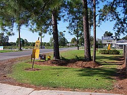
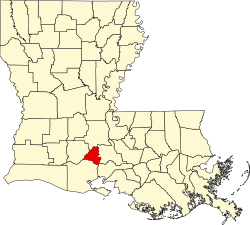
Ridge is an unincorporated community in Lafayette Parish, Louisiana, United States.
"Foreman Flats" was the original name of the area, which included Ridge Road in the north, Doc Duhon Road in the south, Lagneaux Road in the east, and South Fieldspan Road in the west. However, the Ridge area is known as residing between W. Congress Street, S. Richfield highway, Riceland Road and Sellers Road in Lafayette Parish. The community is located near the intersection of LA Hwy 343 and LA Hwy 342.
The first settler was Edward G. F. Broussard in 1858 when he purchased 160 acres (0.65 km2). Other original settlers of the area came from Georgia, South Carolina and North Carolina. [1]
Metairie is a census-designated place (CDP) in Jefferson Parish, Louisiana, United States, and is part of the New Orleans metropolitan area. With a population of 143,507 in 2020, Metairie is the largest community in Jefferson Parish and was the fifth-largest CDP in the United States. It is an unincorporated area that would have been Louisiana's fourth-largest city behind Shreveport if incorporated.
Lafayette is the most populous city in and parish seat of Lafayette Parish, Louisiana, United States, located along the Vermilion River. It is Louisiana's fourth-most populous city with a 2020 census population of 121,374; the consolidated city-parish's population was 241,753 in 2020. The Lafayette metropolitan area was Louisiana's third largest metropolitan statistical area with a population of 478,384 at the 2020 census. The Acadiana region containing Lafayette is the largest population and economic corridor between Houston, Texas and New Orleans.
Youngsville is a city in Lafayette Parish, Louisiana, United States, and is part of the Lafayette metropolitan statistical area. The population was 8,105 at the 2010 U.S. census, and 15,929 at the 2020 United States census.
Acadiana, also known as the Cajun Country, is the official name given to the French Louisiana region that has historically contained much of the state's Francophone population.
U.S. Route 167 is a north-south United States Highway within the U.S. states of Louisiana and Arkansas. It runs for 500 miles (800 km) from Ash Flat, Arkansas at U.S. Route 62/U.S. Route 412 to Abbeville, Louisiana at Louisiana Highway 14. It goes through the cities of Little Rock, Arkansas, Alexandria, Louisiana, and Lafayette, Louisiana.
Lafayette, Vermilionville, or the Lafayette metropolitan statistical area per the U.S. Office of Management and Budget, is the third largest metropolitan statistical area in the U.S. state of Louisiana. Located in the south central Acadiana region, it covers five parishes. At the 2020 U.S. census, 478,384 people lived in the metropolitan area, making it the 116th most populous in the United States and one of Louisiana's fastest growing metropolises; in 2010, its population was 273,738 and it outpaced the Shreveport–Bossier City metropolitan area in 2015.
U.S. Highway 90 (US 90), one of the major east–west U.S. Highways in the Southern United States, runs through southern Louisiana for 297.6 miles (478.9 km), serving Lake Charles, Lafayette, New Iberia, Morgan City, and New Orleans. Much of it west of Lafayette and east of New Orleans has been supplanted by Interstate 10 (I-10) for all but local traffic, but the section between Lafayette and New Orleans runs a good deal south of I-10.
Louisiana Highway 82 (LA 82) is a state highway located in southern Louisiana. It runs 142.87 miles (229.93 km) in a general east–west direction from the Texas state line east of Port Arthur to the Vermilion–Lafayette parish line southwest of Youngsville.
Judice is an unincorporated community in Lafayette Parish, Louisiana, United States.
Louisiana Highway 182 (LA 182) is a state highway located in central and southeastern Louisiana. It runs 173.41 miles (279.08 km) in a northwest to southeast direction from LA 29 in Whiteville to U.S. Highway 90 (US 90) north of Raceland.
Mouton is an unincorporated community in Lafayette Parish, Louisiana, United States.
Capitan is an unincorporated community in Lafayette Parish, Louisiana, United States.
Indian Bayou is an unincorporated community in Vermilion Parish in southwestern Louisiana, United States. It is part of the Abbeville micropolitan statistical area (μSA). It is located approximately seven miles south of Rayne, eight miles north of Kaplan, and fourteen miles southwest of Lafayette. The area acquired its name from the bayou that forms a portion of the northern border of Vermilion Parish with Lafayette and Acadia parishes.
Louisiana Highway 93 (LA 93) is a state highway located in southern Louisiana. It runs 23.427 miles (37.702 km) in a southwest to northeast direction from US 90 in Scott to LA 31 in Arnaudville.
Louisiana Highway 98 (LA 98) is a state highway located in southern Louisiana. It runs 47.76 miles (76.86 km) in an east–west direction from the junction of LA 97 and LA 1123 west of Iota to the Lafayette–St. Martin parish line east of Carencro.