River Ranch is a planned neighborhood within the city of Lafayette in Lafayette Parish, Louisiana, United States. It lies to the south of the Vermilion River near the intersection of Kaliste Saloom Road and Camellia Boulevard. It is home to over 2,553 people. [1]
River Ranch is home to many commercial and independently owned businesses including dozens of retail shops, health professionals, restaurants and bars.
Dwellings include a mix of owned homes, rental homes, attached townhomes and numerous residential apartment buildings with businesses on the first floor, located within the planned community of River Ranch.
The aesthetic influences found at River Ranch can be traced through the history and heritage of Louisiana. These seven major architectural influences are Caribbean, French, American Colonial, Creole, Acadian, Spanish and Neoclassical Revival. [2]
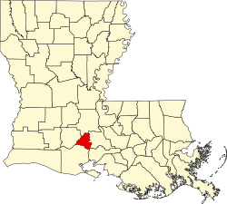
Alexandria is the ninth-largest city in the state of Louisiana and is the parish seat of Rapides Parish, Louisiana, United States. It lies on the south bank of the Red River in almost the exact geographic center of the state. It is the principal city of the Alexandria metropolitan area which encompasses all of Rapides and Grant parishes. Its neighboring city is Pineville. In 2010, the population was 47,723, an increase of 3 percent from the 2000 census.
Louisiana is a state in the Deep South and South Central regions of the United States. It borders Texas to the west, Arkansas to the north, and Mississippi to the east. Of the 50 U.S. states, it ranks 20th in land area and the 25th in population, with roughly 4.6 million residents. Reflecting its French heritage, Louisiana is the only U.S. state with political subdivisions termed parishes, which are equivalent to counties, making it one of only two U.S. states not subdivided into counties. Baton Rouge is the state's capital, and New Orleans, a French Louisiana region, is its largest city with a population of about 383,000 people. Louisiana has a coastline with the Gulf of Mexico to the south; a large part of its eastern boundary is demarcated by the Mississippi River.
New Orleans is a consolidated city-parish located along the Mississippi River in the southeastern region of the U.S. state of Louisiana. With a population of 383,997 according to the 2020 U.S. census, it is the most populous city in Louisiana and the French Louisiana region; third most populous city in the Deep South; and the twelfth-most populous city in the southeastern United States. Serving as a major port, New Orleans is considered an economic and commercial hub for the broader Gulf Coast region of the United States.
Baton Rouge is the capital city of the U.S. state of Louisiana. Located on the eastern bank of the Mississippi River, it had a population of 227,470 as of 2020; it is the seat of Louisiana's most populous parish (county-equivalent), East Baton Rouge Parish, and the center of Louisiana's second-largest metropolitan area and city, Greater Baton Rouge.
Lafayette Parish is a parish located in the U.S. state of Louisiana. According to the 2020 U.S. census, the parish had a population of 241,753, up from 221,578 at the 2010 United States census. The parish seat is the city of Lafayette. The parish was founded in 1823. Since 1996, the city and parish have operated as a consolidated government.
Jefferson Parish is a parish in the U.S. state of Louisiana. As of the 2020 census, the population was 440,781. Its parish seat is Gretna, its largest community is Metairie, and its largest incorporated city is Kenner. Jefferson Parish is included in the Greater New Orleans area.
Lafayette is the most populous city in and parish seat of Lafayette Parish in the U.S. state of Louisiana, located along the Vermilion River. It is Louisiana's fourth-most populous city with a 2020 census population of 121,374; the consolidated city-parish's population was 241,753 in 2020. The Lafayette metropolitan area was Louisiana's third largest metropolitan statistical area with a population of 478,384 at the 2020 census. The Acadiana region containing Lafayette is the largest population and economic corridor between Houston, Texas and New Orleans.
Acadiana, also known as Cajun Country, is the official name given to the French Louisiana region that has historically contained much of the state's Francophone population.
The University of Louisiana at Lafayette is a public research university in Lafayette, Louisiana. It has the largest enrollment within the nine-campus University of Louisiana System and the second-largest enrollment in Louisiana, behind only Louisiana State University. It is classified among "R1: Doctoral Universities – Very high research activity".
U.S. Route 167 is a north-south United States Highway within the U.S. states of Louisiana and Arkansas. It runs for 500 miles (800 km) from Ash Flat, Arkansas at U.S. Route 62/U.S. Route 412 to Abbeville, Louisiana at Louisiana Highway 14. It goes through the cities of Little Rock, Arkansas, Alexandria, Louisiana, and Lafayette, Louisiana.
The Central Business District (CBD) is a neighborhood of the city of New Orleans, Louisiana, United States.
Uptown is a section of New Orleans, Louisiana, United States, on the east bank of the Mississippi River, encompassing a number of neighborhoods between the French Quarter and the Jefferson Parish line. It remains an area of mixed residential and small commercial properties, with a wealth of 19th-century architecture. It includes part or all of Uptown New Orleans Historic District, which is listed on the National Register of Historic Places.
U.S. Highway 90 (US 90), one of the major east–west U.S. Highways in the Southern United States, runs through southern Louisiana for 297.6 miles (478.9 km), serving Lake Charles, Lafayette, New Iberia, Morgan City, and New Orleans. Much of it west of Lafayette and east of New Orleans has been supplanted by Interstate 10 (I-10) for all but local traffic, but the section between Lafayette and New Orleans runs a good deal south of I-10.
Milton is an unincorporated community and census-designated place in Lafayette Parish, Louisiana, United States. At the 2010 U.S. census it had a population of 3,030; at the 2019 American Community Survey, it had an estimated population of 2,299. Milton is part of the Lafayette metropolitan statistical area.
Louisiana Highway 30 (LA 30) is a state highway located in southeastern Louisiana. It runs 28.10 miles (45.22 km) in a northwest to southeast direction from LA 73 in Baton Rouge to the junction of U.S. Highway 61 (US 61) and LA 431 east of Gonzales.
Louisiana Highway 182 (LA 182) is a state highway located in central and southeastern Louisiana. It runs 173.41 miles (279.08 km) in a northwest to southeast direction from LA 29 in Whiteville to U.S. Highway 90 (US 90) north of Raceland.
Interstate 49 (I-49) is an Interstate Highway that currently spans 244.021 miles (392.714 km) in a north–south direction in the US state of Louisiana. Currently, I-49 runs from I-10 in Lafayette to the Arkansas state line. I-49 greatly parallels the older US Highway 71 (US 71) corridor, and connects the state's two east–west Interstates at two of its metropolitan centers. Along the way, it serves the cities of Opelousas, Alexandria, and Natchitoches, intersecting several cross-state highways, such as I-20, US 190, US 167, US 165, and US 84.
"LUSFIBER" is a municipally owned subsidiary of Lafayette Utilities System, providing cable television, broadband Internet, and telephone services to the citizens of Lafayette, Louisiana. It is notable for being the first municipally owned company providing Fiber-To-The-Home services in the U.S. state of Louisiana and one of the first municipally owned FTTH companies in the country.
The neighborhood of the Faubourg Lafayette is a division in the city of New Orleans, Louisiana. It is a portion of the 10th Ward of New Orleans, and part of Central City, New Orleans. The boundaries are the lake side of St. Charles Avenue from Jackson Avenue to the Pontchartrain Expressway, back to Simon Bolivar Avenue.