List of state highways in North Dakota

Last updated

ND-5 (2015).svg ND-18 (2015).svg ND-200 (2015).svg ND-1804 (2015).svg
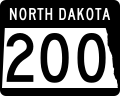
North Dakota highway markers
ND highways.svg
Map of North Dakota highway system
Highway names
Interstates Interstate X (I-X)
US Highways U.S. Route X (US X)
State N.D. Highway X (ND X)
System links
  • North Dakota State Highway System

The state highways in North Dakota are the state highways owned and maintained by the North Dakota Department of Transportation (NDDOT). North Dakota is a state located in the Midwestern region of the United States, along the Canadian border. The state is bordered by Manitoba and Saskatchewan to the north, Minnesota to the east, South Dakota to the south, and Montana to the west.

Contents

Signage

North Dakota blank.svg
ND-blank.svg
Comparison of the previous and new versions of the North Dakota highway route maker

Until 2016 North Dakota highway signage had an "N" and a "D" in the top corners and a Native American profile, based on Lakota policeman Marcellus Red Tomahawk; [1] [2] since 2016 the marker has had "North Dakota" on a black background, the state in outline, and the highway number within the state outline. This transition to new signs is a slow process that will take years before the old signs are completely out of commission. The state will be replacing the old signs as needed, so both versions can currently be seen while driving on North Dakota roads. [3]

According to NDDOT, this change was made for a number of reasons. These include the department's centennial celebration, to demonstrate the significant spending to improve North Dakota roads in the past few years, and to keep uniformity across the United States, especially with online mapping providers which render individual state shields. According to an NDDOT representative, "a number of different states use their state outline or symbol on the highway signs." [4] Some also cited the North Dakota Fighting Sioux controversy as part of the reason why the state decided to change the shields, to avoid any further offense. [4]

Mainline highways

NumberLength (mi) [5] Length (km)Southern or western terminusNorthern or eastern terminusFormedRemovedNotes
North Dakota 1.svg ND 1 South Dakota state line Canadian border 01926-01-01192601927-01-01c.1927became part of US 81
ND-1 (2015).svg ND 1 230.443370.862 SD-37 near Ludden PTH 31 in Maida 01927-01-011927current
ND 2 South Dakota state line US 85 at Alexander 01926-01-01192601927-01-01c.1927middle section became part of US 85 and northern section renumbered ND 42 by 1927; remaining section renumbered ND 16 because of US 2
North Dakota 3.svg ND 3 Montana state line Minnesota state line01926-01-01192601927-01-01c.1927became part of US 10
ND-3 (2015).svg ND 3 247.530398.361 SD 45 US 281 / PTH 10 north of Dunseith 01927-01-011927current
North Dakota 4.svg ND 4 ND 5 at Rock Lake Canadian border 01926-01-01192601939-01-01c.1939section from Rock Lake to the South Dakota state line until that section was transferred to US 281 in 1932; remainder transferred to US 281 by 1940
ND-4 (2015).svg ND 4 10.28316.549 US 281 / ND 5 in Armourdale PTH 5 at the Canadian border 01997-01-011997current
ND-5 (2015).svg ND 5 335.813540.439 MT 5 near Fortuna MN 175 near Joliette 01926-01-011926current
ND-6 (2015).svg ND 6 67.413108.491 SD 63 near Maple Leaf, S.D. I-94 Bus. in Mandan 01926-01-011926current
North Dakota 7.svg ND 7 MT 200 near Fairview, Mont. MN 200 near Halstad, Minn. 01926-01-01192601970-01-011970Replaced by ND 200 in 1970
North Dakota 8.svg ND 8 Montana state line Minnesota state line01926-01-01192601927-01-01c.1927became part of US 2
ND-8 (2015).svg ND 8 211.321340.088 SD 75 near Hettinger Hwy 9 in Northgate 01927-01-011927current
ND-9 (2015).svg ND 9 53.59786.256 US 52  / US 281 in Melville ND 1 in Rogers 01926-01-011926current
North Dakota 10.svg ND 10 South Dakota state line Canadian border 01926-01-01192601927-01-01c.1927renumbered as ND 3 because of US 10
ND-10 (2015).svg ND 10 14.55223.419 US 52  / I-94 southwest of Casselton US 10 near West Fargo Unsigned
ND-11 (2015).svg ND 11 182.459293.639 US 83 west of Hague MN 55 near Fairmount 01926-01-011926current
ND 12 ND 5 at Langdon ND 11 at Oakes 01926-01-01192601927-01-01c.1927renumbered as ND 1 because of US 12
ND-13 (2015).svg ND 13 205.533330.773 ND 1804 near Linton ND 210 in Wahpeton 01926-01-011926currentOriginally ended at US 83 at Linton. The westward extension opened in 1980.
ND-14 (2015).svg ND 14 175.003281.640 I-94 in Sterling PTH 21 north of Carbury 01926-01-011926current
ND-15 (2015).svg ND 15 134.137215.873 US 52 in Fessenden I-29  / US 81 near Thompson 01926-01-011926current
North Dakota 16.svg ND 16 Montana state line South Dakota state line01926-01-01192601927-01-01c.1927became part of US 12
ND-16 (2015).svg ND 16 77.915125.392 ND 68 north of Trotters Golva 01928-01-011928current
ND-17 (2015).svg ND 17 140.372225.907 ND 3 near Barton MN 317 at the Minnesota state line01926-01-011926current
ND-18 (2015).svg ND 18 242.147389.698 SD 25 south of Lidgerwood PTH 30 north of Neche 01926-01-011926current
ND-19 (2015).svg ND 19 68.988111.025CR 19 / CR 11 at the McHenryPierce county line ND 20 in Devils Lake 01926-01-011926current
ND-20 (2015).svg ND 20 170.550274.474 US 52  / US 281 in Jamestown PTH 34 near Sarles 01926-01-011926current
ND-21 (2015).svg ND 21 122.384196.958 US 85 in Slope County ND 6 north of Breien 01926-01-011926current
ND-22 (2015).svg ND 22 156.051251.140 SD 79 near Reeder ND 23 near New Town 01926-01-011926current
ND-23 (2015).svg ND 23 122.028196.385 US 85 / ND 200 in Watford City ND 41 near Velva 01926-01-011926current
North Dakota 24.svg ND 24 Canadian border South Dakota state line near Petrel 01926-01-01192601927-01-01c.1927renumbered ND 8
ND-24 (2015).svg ND 24 45.04672.495 ND 6 east of Selfridge ND 6 in Breien 01927-01-011927currentformer ND 42 west of Fort Yates; rest former route of ND 6 north of Fort Yates (portion north of ND 21 former ND 37)
ND-25 (2015).svg ND 25 34.75855.938 I-94 / I-94 Bus west of Mandan ND 31 in Hannover 01926-01-011926current
North Dakota 26.svg ND 26 01926-01-01192601927-01-01c.1927became part of US 85
ND-26 (2015).svg ND 26 21.46434.543 ND 1 in Dazey ND 32 near Pillsbury 01931-01-011931current
ND-27 (2015).svg ND 27 44.97372.377 ND 1 north of Verona ND 18 north of Wyndmere 01926-01-011926current
ND-28 (2015).svg ND 28 67.002107.829 ND 37 near Roseglen
US 2 at Berthold
ND 23 north of Ryder
Hwy 8 near Sherwood
01926-01-011926current
North Dakota 29.svg ND 29 150240 ND 60 west of Overly MN 11 at Drayton 01926-01-01192601963-01-011963Replaced by ND 66 in 1963, to avoid confusion with nearby I-29
ND-30 (2015).svg ND 30 131.427211.511 ND 13 in Lehr
US 52 / ND 200 near Sykeston
ND 66 near Mylo
I-94 near Medina
US 2 near York
PTH 18 near St. John
01926-01-011926current
ND-31 (2015).svg ND 31 69.195111.359 SD 65 near McIntosh, S.D.
I-94 north of New Salem
ND 21 near Flasher
Stanton
01926-01-011926current
ND-32 (2015).svg ND 32 236.674380.890 SD 27 near Havana PTH 32 north of Walhalla 01926-01-011926current
North Dakota 33.svg ND 33 150240 Gilby US 81 at Manvel 01926-01-01192601965-01-01c.1965Replaced by Grand Forks CR 33
North Dakota 34.svg ND 34 US 281 west of Fort Totten US 2 in Devil's Lake 01926-01-01192601931-01-01c.1931renumbered ND 57
ND-34 (2015).svg ND 34 56.93291.623 US 83 at Hazelton ND 56 south of Gackle 01931-01-011931currentpreviously part of ND 13
North Dakota 35.svg ND 35 US 83 at Linton ND 13 at Fredonia 01926-01-01192601931-01-01c.1931transferred to rerouted ND 13
ND-35 (2015).svg ND 35 27.26443.877 US 2 at Michigan ND 17 near Adams 01931-01-011931current
ND-36 (2015).svg ND 36 90.344145.395 US 83 at Wilton US 52  / US 281 near Pingree 01926-01-011926current
ND-37 (2015).svg ND 37 61.92099.651 ND 23 west of Parshall US 83 east of Garrison 01926-01-011926currentoriginally St. Anthony to Selfridge; swapped with ND 6 by 1927; extended on current route (replacing part of ND 7) and section south of ND 21 renumbered ND 24 by 1931; section south of ND 6 became an extension of ND 24 by 1939, shortening route to current routing
ND-38 (2015).svg ND 38 36.33258.471 I-94  / US 52 south of Buffalo ND 32 at Hope 01926-01-011926current
North Dakota 39.svg ND 39 Mikkelson US 10 in Medora 01926-01-01192601937-01-01c.1937Sections from US 85 south of Watford City to Mikkelson and Medora to US 12 in Rhame removed by 1931; rest removed by 1937
North Dakota 39.svg ND 39 16.326.2 Canadian border north of Antler US 83 east of Mohall 01937-01-01193701973-01-01c.1973Replaced by ND 256 by 1975
ND-40 (2015).svg ND 40 63.450102.113 US 2 near Tioga Hwy 47 north of Noonan 01926-01-011926current
ND-41 (2015).svg ND 41 86.222138.761 US 83 at Wilton US 2 north of Norwich 01926-01-011926current
North Dakota 42.svg ND 42 ND 37 in Selfridge, North Dakota ND 6 south of Fort Yates, Fort Yates 01926-01-01192601927-01-01c.1927transferred to rerouting of ND 37, which also swapped places with ND 6 north of that road
ND-42 (2015).svg ND 42 37.44160.255 ND 50 near Corinth Hwy 350 north of Ambrose 01927-01-011927currentformerly part of ND 2, which was truncated because portions were transferred to US 85
North Dakota 43.svg ND 43 Center Mandan 01926-01-01192601937-01-01c.1937transferred to extension of ND 25; section from Center to Hazen removed from system by 1931
ND-43 (2015).svg ND 43 23.30437.504 ND 14 north of Carbury US 281  / ND 3 near the International Peace Garden 01931-01-011931current
ND-44 (2015).svg ND 44 3.4495.551 ND 66 at Drayton I-29 south of Drayton01926-01-011926currentUnpaved until 1950s
ND-45 (2015).svg ND 45 18.04829.045 ND 200 at Cooperstown ND 32 west of Sharon 01927-01-01c.1927current
ND-46 (2015).svg ND 46 120.823194.446 ND 30 near Streeter I-29 near Oxbow 01927-01-01c.1927current
North Dakota 47.svg ND 47 16.326.2 Burnstad ND 30 east of Burnstad 01927-01-01192701955-01-011955
North Dakota 48.svg ND 48 ND 23 in Keene US 85 north of Alexander 01927-01-01192701937-01-011937West end truncated to Banks by 1931; now CR 10, ND 1806, CR 35, CR 18, and CR 39
ND-48 (2015).svg ND 48 12.16719.581 ND 25 near Center
ND 200 east of Riverdale
ND ALT 200 west of Fort Clark
US 83 at Coleharbor
01975-01-01c.1975currentSegment 2 follows the Lewis and Clark Trail
ND-49 (2015).svg ND 49 104.407168.027 SD 73 at Thunder Hawk, S.D. ND 200 near Beulah 01927-01-01c.1927current
ND-50 (2015).svg ND 50 100.245161.329 MT 258 west of Grenora US 52 near Coulee 01927-01-01c.1927current
North Dakota 51.svg ND 51 US 85/ ND 23 in Watford City ND 48 in Banks 01927-01-01192701937-01-011937Now part of ND 1806
ND 52 01926-01-01192601931-01-01c.1931location unknown
ND 52 Ypsilanti ND 13 west of LaMoure 01931-01-01193101934-01-01c.1934former portion of ND 20; renumbered ND 63 because of US 52
North Dakota 53.svg ND 53 ND 9 south of Leal ND 46 in Marion 01927-01-01192701931-01-01c.1931removed from system
ND-53 (2015).svg ND 53 45.03772.480 US 83 at Max US 52 near Balfour 01935-01-011935currentcreated when ND 23 was realigned on a new road to the south
ND-54 (2015).svg ND 54 2.2633.642 I-29 west of Oslo, Minn. MN 1 at Oslo, Minn. 01927-01-011927current
North Dakota 55.svg ND 55 3048 Walhalla US 81 at Pembina 01927-01-01c.192701950-01-011950Replaced by Pembina CR 55
ND-56 (2015).svg ND 56 50.20380.794 ND 11 east of Ashley ND 46 at Gackle 01927-01-01c.1927current
North Dakota 57.svg ND 57 ND 9 south of Kensal US 10 at Jamestown 01927-01-01192701931-01-01c.1931transferred to rerouted ND 20
ND-57 (2015).svg ND 57 13.27721.367 US 281 west of Fort Totten ND 20 near Camp Grafton 01931-01-01c.1931currentformerly ND 34
ND-58 (2015).svg ND 58 9.80015.772 ND 200 near Fairview, Mont. ND 1804 near Buford 01927-01-01c.1927current
North Dakota 59.svg ND 59 ND 15 in Fessenden, North Dakota ND 7 west of Heaton, North Dakota 01931-01-01193101934-01-01c.1934became part of US 52
ND-59 (2015).svg ND 59 1.0631.711 I-29 in Pembina Minnesota state line east of Pembina01953-01-01c.1953current
ND-60 (2015).svg ND 60 29.87848.084 ND 3  / ND 17 east of Barton ND 5 east of Bottineau 01931-01-01c.1931currentFormerly part of ND 17
North Dakota 61.svg ND 61 MT 23 east of Sidney, Mont. ND 16 01931-01-01c.193101963-01-01c.1963Formerly part of ND 23; Became part of ND 68
North Dakota 62.svg ND 62 1931 US 10  / US 52 at Spiritwood ND 9 west of Wimbledon 01937-01-01c.193701963-01-01c.1963Formerly part of ND 20; replaced by Stutsman CR 62
North Dakota 63.svg ND 63 5080 Ypsilanti ND 13 west of LaMoure 01934-01-01c.193401950-01-011950Replaced by Stutsman  / LaMoure CR 63
North Dakota 64.svg ND 64 01937-01-01c.1937
ND-65 (2015).svg ND 65 9.38315.100 ND 45 north of Cooperstown ND 1 at Binford 01937-01-01c.1937current
ND-66 (2015).svg ND 66 138.720223.248 ND 3 south of Dunseith MN 11 at Drayton 01963-01-01c.1963current
ND-67 (2015).svg ND 67 27.46644.202 US 12 at Scranton ND 21 west of New England
ND-68 (2015).svg ND 68 28.12445.261 MT 23 near Sidney, Mont. US 85 south of Alexander
North Dakota 69.svg ND 69 1016 US 281  / ND 5 east of Rolla Canadian north of Hansboro 01969-01-01c.196901997-01-011997Replaced by ND 4 due to sign thefts.
ND-73 (2015).svg ND 73 11.33218.237 ND 23 east of Watford City ND 22 north of Mandaree 01975-01-01c.1975current
ND-89 (2015).svg ND 89 1.9603.154 Lignite ND 5 north of Lignite
ND-91 (2015).svg ND 91 1.2622.031 US 81 at St. Thomas US 81 at St. Thomas In Pembina County
ND-91 (2015).svg ND 91 0.5230.842 US 52 at Harvey ND 3 at Harvey In Wells County
ND-97 (2015).svg ND 97 2.5394.086 ND 41 south of Velva US 52 southeast of Velva
ND-127 (2015).svg ND 127 22.69536.524 SD 127 south of Fairmount ND 13 at Wahpeton 01979-01-01c.1979current
ND-200 (2015).svg ND 200 415.778669.130 MT 200 near Fairview, Mont. MN 200 near Halstad, Minn. 01970-01-011970currentPart of a chain of state highways numbered 200 that stretches from Minnesota to Idaho
ND-210 (2015).svg ND 210 2.9374.727 ND 13 at Wahpeton MN 210 at Breckenridge, Minn.
ND-256 (2015).svg ND 256 16.40626.403 US 83 / ND 5 at Renville PR 256 at the Canadian border 01970-01-01c.1970current
ND-294 (2015).svg ND 294 2.1583.473Hector International Airport I-29 in Fargo
ND-297 (2015).svg ND 297 3.0604.925 I-29 in Grand Forks US 2 Bus. in East Grand Forks, Minn.
ND-810 (2015).svg ND 810 5.7419.239 I-194 in Mandan I-94 Bus. in Bismarck Part of the Bismarck Expressway
ND-1804 (2015).svg ND 1804 342.805551.691 SD 1804 near Pollock, S.D. S-327 at Fort Union Trading Post Part of the Lewis and Clark Trail; designated to reflect the years of the expedition
ND-1806 (2015).svg ND 1806 130.750210.422 ND 24 near Cannon Ball
ND 200 at Lake Sakakawea State Park
ND 23 south of Charlson
CR 2 near Tobacco Garden Bay
OliverMorton county line north of Mandan
ND 8 south of Twin Buttes
CR 2 near Charlson
ND 23 at Watford City
Part of the Lewis and Clark Trail; designated to reflect the years of the expedition
  •       Former

Special routes

NumberLength (mi)Length (km)Southern or western terminusNorthern or eastern terminusFormedRemovedNotes
Business plate.svg
ND-22 (2015).svg ND 22 Bus.
5.0528.130 ND 22 / ND 200 in Killdeer ND 22 near Killdeer
ND-23A (2015).svg ND 23A 1.5262.456 US 85 Bus. in Watford City ND 23B in Watford City
Business plate.svg
ND-23 (2015).svg ND 23 Bus.
5.7679.281 US 85 Bus. / ND 23 in Watford City ND 23 in Watford City In McKenzie County
No image.svgTruck plate.svgNo image.svg
ND-23B (2015).svg ND 23B Truck
3.1835.123 ND 1804 near New Town ND 23 near New Town In Mountrail County
No image.svgAlternate plate.svgNo image.svg
ND-200 (2015).svg ND 200A
36.38358.553 ND 200 near Hazen ND 200 near Underwood
No image.svgAlternate plate.svgNo image.svg
ND-200 (2015).svg ND 200A
8.35313.443 ND 18 near Hillsboro ND 200 near Hillsboro In Traill County
  •       Former

See also

References

  1. Eriksmoen, Curt (October 25, 2009). "The Man Behind the Highway Patrol Logo". The Bismarck Tribune . Retrieved July 17, 2016.
  2. "Red Tomahawk". Native American Encyclopedia. Archived from the original on June 27, 2014. Retrieved August 20, 2014.
  3. Baumgarten, April (July 16, 2016). "Red Tomahawk Image Disappearing from North Dakota Highway Signs". The Dickinson Press . Retrieved July 17, 2016.
  4. 1 2 Baumgarten, April. "Red Tomahawk image disappearing from North Dakota highway signs". Bismarck Tribune. Forum News Service. Retrieved November 28, 2019.
  5. Cartography Section, Planning/Asset Management Section (2015). Route and Mileage Map (PDF) (Map). c. 1:1,900,800. Bismarck: North Dakota Department of Transportation . Retrieved August 14, 2016.