Buford, North Dakota

Last updated

Buford
USA North Dakota location map.svg
Red pog.svg
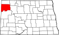
Buford
Location within the state of North Dakota
Usa edcp location map.svg
Red pog.svg
Buford
Buford (the United States)
Coordinates: 47°59′55″N103°59′29″W / 47.99861°N 103.99139°W / 47.99861; -103.99139
Country United States
State North Dakota
County Williams
Time zone UTC-6 (Central (CST))
  Summer (DST) UTC-5 (CDT)
Area code 701

Buford is an unincorporated community in Williams County, North Dakota, United States. [1] It is the nearest community to the Fort Union Trading Post National Historic Site. It is named for the nearby historic Fort Buford at the confluence of the Missouri and Yellowstone Rivers.

Transportation

Amtrak’s Empire Builder, which operates between Seattle/Portland and Chicago, passes through the town on BNSF tracks, but makes no stop. The nearest station is located in Williston, 23 miles (37 km) to the northeast.

Notes

  1. "Buford, North Dakota". Geographic Names Information System . United States Geological Survey, United States Department of the Interior.


Related Research Articles

<span class="mw-page-title-main">Williams County, North Dakota</span> County in North Dakota, United States

Williams County is located on the western border of the U.S. state of North Dakota, next to Montana. As of the 2020 census, the population was 40,950. making it the fifth most populous county in North Dakota. Its county seat is Williston.

<span class="mw-page-title-main">Buford, Georgia</span> City in Georgia, United States

Buford is a city in Gwinnett and Hall counties in the U.S. state of Georgia. As of the 2020 census, the city had a population of 17,144. Most of the city is in Gwinnett County, which is part of the Atlanta-Sandy Springs-Marietta Metropolitan Statistical Area. The northern sliver of the city is in Hall County, which comprises the Gainesville, Georgia Metropolitan Statistical Area and is part of the larger Atlanta-Athens-Clarke-Sandy Springs Combined Statistical Area.

<span class="mw-page-title-main">Fort Totten, North Dakota</span> CDP in North Dakota, United States

Fort Totten is a census-designated place (CDP) in Benson County, North Dakota, United States. The population was 1,243 at the 2010 census. Fort Totten is located within the Spirit Lake Reservation and is the site of tribal headquarters. The reservation has a total population estimated at 6,000. Although not formally incorporated as a city, Fort Totten has the largest population of any community in Benson County.

<span class="mw-page-title-main">Williston, North Dakota</span> City in North Dakota, United States

Williston is a city in and the county seat of Williams County, North Dakota, United States. The 2020 census gave its population as 29,160, making Williston the sixth-most populous city in North Dakota. The city's population nearly doubled between 2010 and 2020, due largely to the North Dakota oil boom.

Buford may refer to:

<span class="mw-page-title-main">The Dakotas</span> Region in the United States

The Dakotas is a collective term for the U.S. states of North Dakota and South Dakota. It has been used historically to describe the Dakota Territory, and is still used for the collective heritage, culture, geography, fauna, sociology, economy, and cuisine of the two states.

<span class="mw-page-title-main">Fort Union Trading Post National Historic Site</span> National Historic Site of the United States in North Dakota

Fort Union Trading Post National Historic Site is a partial reconstruction of the most important fur trading post on the upper Missouri River from 1829 to 1867. The fort site is about two miles from the confluence of the Missouri River and its tributary, the Yellowstone River, on the Dakota side of the North Dakota/Montana border, 25 miles from Williston, North Dakota.

Dakota Dunes is an unincorporated community and census-designated place (CDP), master-planned residential and commercial development covering about 2,000 acres (8.1 km2) in Union County in the extreme southeast corner of the U.S. state of South Dakota. The population was 4,020 at the 2020 census.

<span class="mw-page-title-main">Fort Buford</span> United States historic place

Fort Buford was a United States Army Post at the confluence of the Missouri and Yellowstone rivers in Dakota Territory, present day North Dakota, and the site of Sitting Bull's surrender in 1881.

<span class="mw-page-title-main">Missouri-Yellowstone Confluence Interpretive Center</span> Museum in North Dakota, United States

The Missouri-Yellowstone Confluence Interpretive Center is a museum near Williston, North Dakota. It is dedicated to telling the story of the confluence of the Yellowstone and the Missouri Rivers in the western section of North Dakota near the Montana border. It features exhibits on the geography, geology, and history of the area. The interpretive center is located one-half mile east of historic Fort Buford near Williston, North Dakota. It also offers dramatic views of the Missouri and Yellowstone Rivers.

<span class="mw-page-title-main">Outline of South Dakota</span> Overview of and topical guide to South Dakota

The following outline is provided as an overview of and topical guide to South Dakota:

Buford is an unincorporated community in Baxter County, Arkansas, United States. It is the location of Buford School Building, which is located on AR 126 and is listed on the National Register of Historic Places.

<span class="mw-page-title-main">Mondak, Montana</span> Ghost town in Montana, United States

Mondak is a ghost town in Roosevelt County, Montana, United States, which flourished c. 1903–1919, in large measure by selling alcohol to residents of North Dakota, then a dry state.

<span class="mw-page-title-main">Burnstad, North Dakota</span> Unincorporated community in North Dakota, US

Burnstad is an unincorporated community rural hamlet in Logan County, North Dakota, United States. There are only two farm homes there currently, no businesses or services.

Berwick is a populated place in McHenry County, North Dakota, United States.

<span class="mw-page-title-main">Denbigh, North Dakota</span> Unincorporated community in North Dakota, United States

Denbigh is an unincorporated community in McHenry County, North Dakota, United States.

Brownsville, also known as Avalon, Esther's Place, and Anderson's Place, is an unincorporated community in Lawrence County, South Dakota, United States. The town was originally a lumber camp, and it was named for contractor David Brown. It is the nearest community to John Hill Ranch-Keltomaki, which is listed on the U.S. National Register of Historic Places.

The Department of the Northwest was an U.S. Army Department created on September 6, 1862, to put down the Sioux uprising in Minnesota. Major General John Pope was made commander of the Department. At the end of the Civil War the Department was redesignated the Department of Dakota.

<span class="mw-page-title-main">Crow Flies High</span>

Crow Flies High was the chief of a band of dissident Hidatsa people from 1870 until their band joined the reservation system in 1894. This band was one of the last to settle on an Indian reservation. A North Dakota State Park is named after him.

The Fort Buford Stage Road, in or near Washburn, North Dakota in McLean County, North Dakota was listed on the National Register of Historic Places in 2019.