Williston, North Dakota

Last updated

Williston, North Dakota
Williston, North Dakota 10-18-2008.jpg
Business district of Williston
ND Williams County Williston.svg
Location of Williston, North Dakota
Coordinates: 48°10′53″N103°37′41″W / 48.18139°N 103.62806°W / 48.18139; -103.62806
CountryUnited States
State North Dakota
County Williams
Founded1887
Incorporated (village)1894
Incorporated (city)1904
Government
   Mayor Howard Klug
Area
[1]
   City 23.33 sq mi (60.44 km2)
  Land23.19 sq mi (60.07 km2)
  Water0.14 sq mi (0.36 km2)
Elevation
[2]
1,916 ft (584 m)
Population
 (2020) [3]
   City 29,160
  Estimate 
(2022) [4]
27,029
  Density1,257.22/sq mi (485.41/km2)
   Urban
29,510
   Metro
38,109 (US: 335th)
Time zone UTC-6 (Central (CST))
  Summer (DST) UTC-5 (CDT)
ZIP codes
58801–58802
Area code 701
FIPS code 38-86220
GNIS feature ID1036335 [2]
Highways US 85, US 85B, US 2, US 2 Bus., ND 1804
Website cityofwilliston.com

Williston is a city in and the county seat of Williams County, North Dakota, United States. [5] The 2020 census [3] gave its population as 29,160, making Williston the sixth-most populous city in North Dakota. The city's population nearly doubled between 2010 and 2020, due largely to the North Dakota oil boom.

Contents

Williston's newspaper is the daily Williston Herald . Williston is the home of Williston State College and the Miss North Dakota Scholarship Pageant.

History

Founded in 1887, Williston was named for Daniel Willis James, a merchant and capitalist, by his friend, railroad magnate James J. Hill. [6] [7] [8]

Geography

Williston is located at the crossroads of U.S. Highways 2 and 85, near the confluence of the Yellowstone and Missouri rivers, at the upper end of the Lake Sakakawea reservoir.

According to the United States Census Bureau, the city has a total area of 7.56 square miles (19.58 km2), of which 7.50 square miles (19.42 km2) is land and 0.06 square miles (0.16 km2) is water. [9]

The municipality is 18 miles (29 km) from the Montana-North Dakota border and 60 miles (97 km) from the Canadian border. [10]

Climate

Williston has a cold semi-arid climate; closely bordering upon a warm-summer humid continental climate. It is part of USDA Hardiness zone 4a. [11] The normal monthly mean temperature ranges from 11.5 °F (−11.4 °C) in January to 70.4 °F (21.3 °C) in July. [12] On average, there are 2 days that reach 100 °F (38 °C) or higher, 22 days of 90 °F (32 °C)+ highs, 39 days with a low of 0 °F (−18 °C) or below, 7 days with lows plummeting to at least −20 °F (−29 °C), and 6 days that do not rise above 0 °F annually. [12] The average window for freezing temperatures is September 20 through May 21, [12] allowing a growing season of 121 days; . Extreme temperatures officially range from −50 °F (−46 °C) on December 23, 1983 and February 16, 1936 up to 110 °F (43 °C) on July 5, 1936; the record cold daily maximum is −29 °F (−34 °C) on January 16, 1930, while, conversely, the record warm daily minimum is 78 °F (26 °C) last set July 19, 1974. [12]

Precipitation is greatest in June and July and averages 14.88 in (378 mm) annually, but has ranged from 6.13 in (156 mm) in 1934 to 22.04 in (560 mm) in 1896. [12] Snowfall averages 48.2 in (122 cm) per season, and has historically ranged from 8.0 in (20 cm) in 1908–1909 to 107.2 in (272 cm) in 2010–2011; [12] the average window for measurable (≥0.1 in or 0.25 cm) snowfall is October 21 through April 26, although snow in May occurs at most several times per decade and September snow is a much rarer event. [12] Due to the relative aridity, there are only 3.9 days per season where 24-hour snowfall exceeds 3 in (7.6 cm). [13]

Climate data for Williston, North Dakota (1991–2020 normals, [lower-alpha 1] extremes 1894–present [lower-alpha 2]
MonthJanFebMarAprMayJunJulAugSepOctNovDecYear
Record high °F (°C)58
(14)
66
(19)
84
(29)
92
(33)
106
(41)
108
(42)
110
(43)
108
(42)
104
(40)
93
(34)
76
(24)
63
(17)
110
(43)
Mean maximum °F (°C)44.0
(6.7)
46.7
(8.2)
65.1
(18.4)
79.0
(26.1)
86.6
(30.3)
93.5
(34.2)
98.0
(36.7)
98.9
(37.2)
93.3
(34.1)
80.3
(26.8)
60.4
(15.8)
46.1
(7.8)
100.6
(38.1)
Mean daily maximum °F (°C)22.1
(−5.5)
26.7
(−2.9)
40.1
(4.5)
55.6
(13.1)
67.4
(19.7)
76.7
(24.8)
84.5
(29.2)
83.9
(28.8)
72.6
(22.6)
55.9
(13.3)
38.4
(3.6)
26.1
(−3.3)
54.2
(12.3)
Daily mean °F (°C)11.6
(−11.3)
16.1
(−8.8)
28.8
(−1.8)
42.4
(5.8)
53.8
(12.1)
63.5
(17.5)
70.4
(21.3)
69.0
(20.6)
58.0
(14.4)
43.2
(6.2)
27.8
(−2.3)
16.1
(−8.8)
41.7
(5.4)
Mean daily minimum °F (°C)1.0
(−17.2)
5.5
(−14.7)
17.5
(−8.1)
29.2
(−1.6)
40.2
(4.6)
50.2
(10.1)
56.3
(13.5)
54.0
(12.2)
43.5
(6.4)
30.4
(−0.9)
17.1
(−8.3)
6.1
(−14.4)
29.3
(−1.5)
Mean minimum °F (°C)−25.8
(−32.1)
−19.5
(−28.6)
−7.6
(−22.0)
12.6
(−10.8)
24.4
(−4.2)
37.5
(3.1)
45.1
(7.3)
40.9
(4.9)
27.2
(−2.7)
12.0
(−11.1)
−4.6
(−20.3)
−19.8
(−28.8)
−29.2
(−34.0)
Record low °F (°C)−42
(−41)
−50
(−46)
−35
(−37)
−15
(−26)
10
(−12)
26
(−3)
34
(1)
32
(0)
13
(−11)
−9
(−23)
−27
(−33)
−50
(−46)
−50
(−46)
Average precipitation inches (mm)0.56
(14)
0.48
(12)
0.63
(16)
1.05
(27)
2.10
(53)
2.64
(67)
2.48
(63)
1.57
(40)
1.36
(35)
0.94
(24)
0.67
(17)
0.63
(16)
15.11
(384)
Average snowfall inches (cm)11.2
(28)
6.7
(17)
6.4
(16)
3.7
(9.4)
0.9
(2.3)
0.0
(0.0)
0.0
(0.0)
0.0
(0.0)
0.0
(0.0)
2.6
(6.6)
6.3
(16)
10.4
(26)
48.2
(122)
Average precipitation days (≥ 0.01 in)7.67.17.48.39.912.39.28.77.56.96.88.5100.2
Average snowy days (≥ 0.1 in)9.86.96.02.70.90.00.00.00.01.95.88.842.8
Average relative humidity (%)71.375.672.561.458.559.656.154.961.165.274.977.166.1
Average dew point °F (°C)3.4
(−15.9)
10.0
(−12.2)
19.9
(−6.7)
28.6
(−1.9)
38.8
(3.8)
48.6
(9.2)
52.2
(11.2)
49.5
(9.7)
41.2
(5.1)
31.1
(−0.5)
19.6
(−6.9)
7.5
(−13.6)
29.2
(−1.6)
Mean monthly sunshine hours 144.5169.7227.3250.3297.9326.0366.3331.5249.5197.1122.2125.52,807.8
Percent possible sunshine 53596261636876756659444863
Source: NOAA (relative humidity and dew point 1962–1990, sun 1961–1990) [lower-alpha 3] [12] [13] [15]
Notes
  1. Mean monthly maxima and minima (i.e. the expected highest and lowest temperature readings at any point during the year or given month) calculated based on data at said location from 1991 to 2020.
  2. Official records for Williston kept at the Weather Bureau Office from January 1894 to June 1948, Sloulin Field International Airport from July 1948 until October 22, 2019, and the new Williston Basin Int'l since October 23, 2019. [14]
  3. Only 22 to 24 years out of the 29 in the normals period were used to calculate the humidity normals.

Demographics

Historical population
CensusPop.Note
1890 295
1900 763158.6%
1910 3,124309.4%
1920 4,17833.7%
1930 5,10622.2%
1940 5,79013.4%
1950 7,39827.8%
1960 11,86660.4%
1970 11,230−5.4%
1980 13,33618.8%
1990 13,136−1.5%
2000 12,512−4.8%
2010 14,71617.6%
2020 29,16098.2%
2022 (est.)27,029 [4] −7.3%
U.S. Decennial Census [16]
2020 Census [3]

Williston is in northwestern North Dakota's booming oil patch, where adequate, affordable housing has become a concern since the 2010s. [17] According to a February 2014 article in Business Insider, Williston had the highest apartment rents in the United States. [18] The 2010 census counted a population of 14,716, up from 12,680 in 2000, but the number of current residents is possibly significantly higher since the count does not include those living in temporary housing. In September 2011, the mayor estimated the actual population to be 20,000 persons. [19] The aforementioned 2014 Business Insider story estimated that the population was over 30,000. [18]

2020 census

As of the census of 2020, there were 29,160 people. The population density was 1,389 people per square mile. The racial makeup of the city was 78.87% White, 6.45% other races, 5.58% African-American, 5.02% two or more races, 2.78% Native American, 1.13% Asian, and 0.17% Native Hawaiian or Pacific Islander. 9.5% of the population identified as Hispanic or Latino.

The median age in the city was 30.4 years.

2010 census

As of the census of 2010, there were 14,716 people, 6,180 households, and 3,589 families residing in the city. The population density was 1,962.1 inhabitants per square mile (757.6/km2). There were 6,542 housing units at an average density of 872.3 per square mile (336.8/km2). The racial makeup of the city was 92.6% White, 0.3% African-American, 3.3% Native American or Alaska Native, 0.3% Asian, 0.4% from other races, and 3.0% from two or more races. Hispanics or Latinos of any race were 2.2% of the population.

There were 6,180 households, of which 29.0% had children under the age of 18 living with them, 44.6% were married couples living together, 9.0% had a female householder with no husband present, 4.5% had a male householder with no wife present, and 41.9% were non-families. 34.6% of all households were made up of individuals, and 12.3% had someone living alone who was 65 years of age or older. The average household size was 2.31 and the average family size was 2.99.

The median age in the city was 35.5 years. 23.6% of residents were under the age of 18; 10% were between the ages of 18 and 24; 26.7% were from 25 to 44; 25.4% were from 45 to 64; and 14.4% were 65 years of age or older. The gender makeup of the city was 51.0% male and 49.0% female.

2000 census

As of the census of 2000, there were 12,512 people, 5,255 households, and 3,205 families residing in the city. The population density was 1,794.1 inhabitants per square mile (692.7/km2). There were 5,912 housing units at an average density of 847.7 per square mile (327.3/km2). The racial makeup of the city was 93.69% White, 0.17% African American, 3.65% Native American or Alaska Native, 0.24% Asian, 0.02% Pacific Islander, 0.17% from other races, and 2.06% from two or more races. Hispanics or Latinos of any race were 1.23% of the population.

The six leading ancestry groups in the city are Norwegian (47.8%), German (31.6%), Irish (9.6%), English (5.8%), Swedish (4.5%), Dutch (4.3%) and French (4.0%).

There were 5,255 households, of which 30.7% had children under the age of 18 living with them, 47.4% were married couples living together, 10.5% had a female householder with no husband present, and 39.0% were non-families. 34.1% of all households were made up of individuals, and 13.7% had someone living alone who was 65 years of age or older. The average household size was 2.30 and the average family size was 2.96.

The age distribution was 25.6% under the age of 18, 9.3% from 18 to 24, 25.8% from 25 to 44, 22.5% from 45 to 64, and 16.8% who were 65 years of age or older. The median age was 38 years. For every 100 females, there were 91.9 males. For every 100 females age 18 and over, there were 88.3 males.

The median income for a household in the city was $29,962, and the median income for a family was $38,713. Males had a median income of $29,578 versus $18,879 for females. The per capita income for the city was $16,656. About 11.3% of families and 13.4% of the population were below the poverty line, including 19.1% of those under age 18 and 7.8% of those age 65 or over.

Economy

Gas station at Farmers' Cooperative in Williston, 1941. Photo by Marion Post Wolcott. FarmersUnionOilND.jpg
Gas station at Farmers' Cooperative in Williston, 1941. Photo by Marion Post Wolcott.

Williston's economy, while historically based in agriculture and especially ranching, is increasingly being driven by the oil industry. The Williston Basin, named after the town, is a huge subterranean geologic feature known for its rich deposits of petroleum, coal, and potash.

Williston developed over the Bakken formation, which by the end of 2012 was predicted to be producing more oil than any other site in the United States, surpassing even Alaska's Prudhoe Bay, the longtime leader in domestic output in the nation. [20] The oil boom has been spurred here by the development of new technologies—such as Hydraulic fracturing—which enabled extraction from areas previously inaccessible.

In 1995, the U.S. Geological Survey estimated that there were 150 million barrels of oil "technically recoverable" from the Bakken shale. In April 2008, the number was said to be about four billion barrels; in 2010 geologists at Continental Resources, the major drilling operation in North Dakota, estimated the reserve at eight billion. In March 2012, after the discovery of a lower shelf of oil, it announced a possible 24 billion barrels. Although current technology allows for extraction of only about 6% of the oil trapped 0.99–1.99 mi (1.6–3.2 km) beneath the earth's surface, recoverable oil might eventually exceed 500 billion barrels. [20]

Williston has seen a huge increase in population and infrastructure investments during the last several years with expanded drilling using the Hydraulic Fracturing petroleum extraction technique in the Bakken Formation and Three Forks Groups. [21] Examples of oil industry-related infrastructure investments are the multi-acre branch campus of Baker Hughes and the Sand Creek Retail Center.

Williston, North Dakota Amtrak Station; the railroad is a popular way for migrants to reach the city. Williston-Amtrak.JPG
Williston, North Dakota Amtrak Station; the railroad is a popular way for migrants to reach the city.

A major regional grain elevator is served by the BNSF Railway. Williston's livestock arena has weekly auctions.
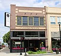
Forts Union and Buford, as well as the nearby confluence of the Yellowstone and Missouri Rivers west of the city, associated with the history of the Lewis and Clark Expedition and development of the fur trade and frontier—are destinations for area tourism. Williston is also comparatively close to the North Unit of Theodore Roosevelt National Park.

Arts and culture

Sites of interest

Sports

Education

The Williston Basin School District 7 serves the entire city, with Williston High School as its public high school.

Due to a merger of the Williston Public School District #1 and the Williams County School District 8 (formerly New School District) in 2021, Williston has one school district. [29] Previously almost all of the city was in the former with small sections in the latter. [30] Prior to 2021, District 8, which was K–8 only, sent high school students to Williston High. [31] District 8 also sent high school students to the Nesson School District in Ray and to the Tioga School District in Tioga. [32]

Trinity Christian School is a private K–12 school, and St. Joseph Catholic School (of the Roman Catholic Diocese of Bismarck) a private K–6 school, both located in Williston.

Williston State College, on University Avenue, was founded in 1961 as the University of North Dakota—Williston (UND-W). It is a two-year public college in the North Dakota University System (NDUS). Students can earn Associate in Arts (AA), Associate in Science (AS), and Associate of Applied Science (AAS) degrees, and transfer to the state universities offering four-year programs and degrees.

The Williston Public Library serves as the public library for all of Williams County. The library also has a bookmobile that serves rural schools and retirement home communities. [33] The main library also serves as a community center, hosting many groups that hold public meetings there.

The library hosts an annual fundraiser called "Table of Contents", for which local patrons create unique table arrangements and dining themes. Proceeds are used to purchase equipment for local organizations that hold public meetings at the library. [34] Numerous public events, including voting stations, are regularly held at the library.

The first Williston Public Library was completed in town in 1911, opening February 27, 1911, and it operated as the only facility until 1983. In the early 1990s the city began to address the issue of probable demolition of this aged building to replace it with one meeting modern needs.

In 1993 a concerned group of citizens formed the James Memorial Preservation Society to save the historic building and develop it as a center for the visual arts. After the library moved to a new building on Davidson Drive, this structure became known as the James Memorial Art Center. It was adapted for use as an art gallery and event center. [35] The James Memorial Art Center now hosts an annual Art Fest, art classes for youth and adults, and exhibits by local, national, and international artists.

Media

A woman photographed in Williston in 1937 by Russell Lee Oldest daughter of Floyd Peaches. Near Williston, North Dakota LCCN2017735925.tif
A woman photographed in Williston in 1937 by Russell Lee

Print

Television

In the late 1970s and early 1980s, KXMD and KUMV were rebroadcast across Saskatchewan as part of that region's first terrestrial-based cable television system. By 1984, however, the Williston signals had been replaced by those of similar stations in Detroit.

Radio

FM
AM

Infrastructure

Transportation

Air

The city of Williston is served by the Williston Basin International Airport, which has a customs service in its facilities. The facility opened in October 2019, replacing Sloulin Field International Airport. [36]

In 2012, United Airlines began offering daily codeshare jet service (via ExpressJet Airlines) to Denver, CO (KDEN) on Embraer 145 aircraft, while Delta Air Lines began daily codeshare jet service (via SkyWest Airlines) to Minneapolis, MN (MSP) on Bombardier CRJ200 aircraft. In August 2014, United began offering direct flights to Houston TX.

FedEx Express of Memphis, TN, provides cargo flights to and from the Williston, ND Airport and Grand Forks, ND (GFK) airport utilizing Cessna 208B Caravans with CargoMaster cargo pods. These flights run Monday through Saturday. The Saturday service has an early cutoff time and pickups are limited to in-town stops and drop box locations only.

Rail

Amtrak, the national passenger rail system, serves a station in Williston via its Empire Builder, a once-daily train in each direction between Portland, Oregon/Seattle, Washington, and Chicago.

Highways

US 2 and US 85 at Williston Williston North Dakota US2 and US85.jpg
US 2 and US 85 at Williston

US 2 runs through the city. US 85 bypasses the city to the northwest, and US 85B bypasses the city to the northeast. ND 1804 runs through the southern portion of the city and is concurrent with US 2 between 143rd Avenue, and 2nd Street.

Public Transit

Demand response service is provided by Northwest Dakota Public Transit, a service of the Williston Council for the Aging, Inc. [37] There is no fixed-route bus service in the city, making Williston the largest city in North Dakota without such service.

Health care

Williston clinics include Craven-Hagan Clinic, Fairlight Medical Center, and Trinity Community Clinic-Western Dakota. Fairlight has the only Veteran's Affairs clinic in northwestern North Dakota and also serves residents of northeastern Montana. Fairlight includes a walk-in clinic with four health care professionals. Mercy Medical Center is the Williston hospital. It provides 24-hour emergency and trauma care but lacks a walk-in clinic.

Mercy Medical Center is home to the Leonard P. Nelson Family Cancer Treatment Center (est. 1996), providing oncology services in the region for the past seventeen years to an area of a 100-mile radius. Patients receive treatment for a wide variety of cancers including breast, gynecologic, head and neck, lung and prostate. Mercy Medical Center broke ground August 24, 2012 on an expanded cancer treatment facility. Improvements include the installation of a highly specialized linear accelerator to increase precision radiation therapy treatment delivery with decreased patient treatment time. The grand opening was October 7, 2013. [38]

Mercy Medical Center was named among the Top 100 Critical Access Hospitals (CAHs) in the United States by The Joint Commission on Accreditation of Healthcare Organizations in September 2012. [39]

Notable people

See also

Notes

    Related Research Articles

    <span class="mw-page-title-main">Bismarck, North Dakota</span> Capital City in North Dakota, United States

    Bismarck is the capital of the U.S. state of North Dakota and the county seat of Burleigh County. It is the state's 2nd most populous city, after Fargo. The population was 73,622 at the 2020 census, and was estimated to be 74,445 in 2022, while its metropolitan population was 133,626. In 2020, Forbes magazine ranked Bismarck as the seventh fastest-growing small city in the United States.

    <span class="mw-page-title-main">Williams County, North Dakota</span> County in North Dakota, United States

    Williams County is located on the western border of the U.S. state of North Dakota, next to Montana. As of the 2020 census, the population was 40,950. making it the fifth most populous county in North Dakota. Its county seat is Williston.

    <span class="mw-page-title-main">Towner County, North Dakota</span> County in North Dakota, United States

    Towner County is a county in the U.S. state of North Dakota. As of the 2020 census, the population is 2,162. Its county seat is Cando. It is south of the Canada–US border with Manitoba.

    <span class="mw-page-title-main">Oliver County, North Dakota</span> County in North Dakota, United States

    Oliver County is a county located in the U.S. state of North Dakota. As of the 2020 census, the population was 1,877. Its county seat and only city is Center.

    <span class="mw-page-title-main">Mercer County, North Dakota</span> County in North Dakota, United States

    Mercer County is a county in the U.S. state of North Dakota. As of the 2020 census, the population was 8,350. Its county seat is Stanton.

    <span class="mw-page-title-main">McKenzie County, North Dakota</span> County in North Dakota, United States

    McKenzie County is a county in the U.S. state of North Dakota. As of the 2020 census, the population was 14,704. Its county seat is Watford City.

    <span class="mw-page-title-main">Burleigh County, North Dakota</span> County in North Dakota, United States

    Burleigh County is a county in the U.S. state of North Dakota. As of the 2020 census, the population was 98,458, making it the second most populous county in North Dakota. Its county seat is Bismarck, the state capital. The county was named for Dakota Territory political figure Walter A. Burleigh.

    <span class="mw-page-title-main">Sidney, Montana</span> City in Montana, United States

    Sidney is a city in and the county seat of Richland County, Montana, United States, less than 10 mi (16 km) west of the North Dakota border. The population was 6,346 at the 2020 census. The city lies along the Yellowstone River and is in proximity to the badlands of the Dakotas. Sidney is approximately midway between Glendive, Montana and Williston, North Dakota.

    <span class="mw-page-title-main">Lincoln, North Dakota</span> City in North Dakota, United States

    Lincoln is a city in Burleigh County, North Dakota, United States. It is a suburb of adjacent Bismarck, and also a core city of the Bismarck-Mandan Metropolitan Statistical Area. The population was 4,257 at the 2020 census, making it the 14th most populous city in North Dakota. Lincoln was founded in 1977.

    <span class="mw-page-title-main">Wing, North Dakota</span> City in North Dakota, United States

    Wing is a rural small town in Burleigh County, North Dakota, United States. It is part of the "Bismarck, ND Metropolitan Statistical Area" or "Bismarck-Mandan". The population was 132 at the 2020 census. As of 2010, the town has a post office, a full service station, a bar, a restaurant, a small (10-unit) apartment complex, a senior's center, a hotel, several churches, and a complete (K-12) public school system.

    <span class="mw-page-title-main">Dunn Center, North Dakota</span> City in North Dakota, United States

    Dunn Center is a city in Dunn County, North Dakota, United States. The population was 227 at the 2020 census. Dunn Center was founded in 1914.

    <span class="mw-page-title-main">Mott, North Dakota</span> City in North Dakota, United States

    Mott is a city in and the county seat of Hettinger County, North Dakota, United States. The population was 653 at the 2020 census.

    <span class="mw-page-title-main">Almont, North Dakota</span> City in North Dakota, United States

    Almont is a city in Morton County, North Dakota, United States. It is part of the "Bismarck, ND Metropolitan Statistical Area" or "Bismarck–Mandan". The population was 100 at the 2020 census. Almont was founded in 1906, incorporated in 1936, and reached a peak population of 232 in 1940. The Northern Pacific Railroad tracks were removed in 1947 when the mainline was rerouted, and the city has since withered to just above 100 residents.

    <span class="mw-page-title-main">Mandan, North Dakota</span> Morton County Seat

    Mandan is a city on the eastern border of Morton County and the eighth-most populous city in North Dakota. Founded in 1879 on the west side of the upper Missouri River, it was designated in 1881 as the county seat of Morton County. The population was 24,206 at the 2020 census. Across the Missouri River from Bismarck, Mandan is a core city of the Bismarck–Mandan Metropolitan Statistical Area.

    <span class="mw-page-title-main">Rugby, North Dakota</span> City in North Dakota, United States

    Rugby is a city in, and the county seat of, Pierce County, North Dakota, United States. The population was 2,509 at the 2020 census, making it the 19th largest city in North Dakota. Rugby was founded in 1886.

    <span class="mw-page-title-main">Dickinson, North Dakota</span> City in North Dakota, United States

    Dickinson is a city in and the county seat of Stark County, North Dakota, United States. The population was 25,679 at the 2020 census, and was estimated to be 24,979 in 2022, making it the 7th most populous city in North Dakota. Dickinson is home to the Ukrainian Cultural Institute, which has a museum and holds events year round for the local Ukrainian community. Western North Dakota has a high concentration of people of Ukrainian descent.

    <span class="mw-page-title-main">Berthold, North Dakota</span> City in North Dakota, United States

    Berthold is a town in Ward County, North Dakota, United States. The population was 490 at the 2020 census.

    <span class="mw-page-title-main">Makoti, North Dakota</span> City in North Dakota, United States

    Makoti is a city in Ward County, North Dakota, United States. The population was 148 at the 2020 census. It is part of the Minot Micropolitan Statistical Area. Makoti was founded in 1911.

    <span class="mw-page-title-main">Ryder, North Dakota</span> City in North Dakota, United States

    Ryder is a city in Ward County, North Dakota, United States. The population was 108 at the 2020 census. It is part of the Minot Micropolitan Statistical Area. Ryder was founded in 1906.

    <span class="mw-page-title-main">Tioga, North Dakota</span> City in North Dakota, United States

    Tioga is a city in Williams County, North Dakota, United States. The population was 2,202 at the 2020 census.

    References

    1. "ArcGIS REST Services Directory". United States Census Bureau. Retrieved September 20, 2022.
    2. 1 2 U.S. Geological Survey Geographic Names Information System: Williston, North Dakota
    3. 1 2 3 "Explore Census Data". United States Census Bureau . Retrieved October 11, 2023.
    4. 1 2 "City and Town Population Totals: 2020-2022". United States Census Bureau. October 11, 2023. Retrieved October 11, 2023.
    5. "Find a County". National Association of Counties. Retrieved June 7, 2011.
    6. John Matzko, Reconstructing Fort Union (Lincoln: University of Nebraska Press, 2001), 26; Ben Innis, Sagas of the Smoky-Water (Williston, ND: privately published, 1985), 344.
    7. Wick, Douglas A. (1988). North Dakota PlaceNames. Bismarck, North Dakota: Hedemarken Collectibles. ISBN   0-9620968-0-6. OCLC   191277027.
    8. Williams, Mary Ann (Barnes) (1966). Origins of North Dakota Place Names. Bismarck, North Dakota: Bismarck Tribune, 1966. OCLC   431626.
    9. "US Gazetteer files 2010". United States Census Bureau. Archived from the original on January 12, 2012. Retrieved June 14, 2012.
    10. "Overview" (Archive). Sloulin Field International Airport. Retrieved on June 2, 2014.
    11. "USDA Plant Hardiness Zone Map". United States Department of Agriculture.
    12. 1 2 3 4 5 6 7 8 "NowData – NOAA Online Weather Data". National Oceanic and Atmospheric Administration. Retrieved September 17, 2021.
    13. 1 2 "Station: Williston Sloulin INTL AP, ND". U.S. Climate Normals 2020: U.S. Monthly Climate Normals (1991-2020). National Oceanic and Atmospheric Administration. Retrieved September 17, 2021.
    14. "Threaded Extremes". threadex.rcc-acis.org. Retrieved February 16, 2021.
    15. "WMO climate normals for Williston/Sloulin Field, ND 1961−1990". National Oceanic and Atmospheric Administration. Retrieved September 17, 2021.
    16. "U.S. Decennial Census". Census.gov. Retrieved May 25, 2013.
    17. Meg Lindholm, "Flock To N.D. Oil Town Leads To Housing Crisis," NPR, May 28, 2010
    18. 1 2 Johnson, Robert (February 13, 2014). "What Life Is Like In Williston, The North Dakota Oil Boomtown Where Tiny Apartments Top $2,000 A Month". Business Insider. Retrieved September 1, 2014.
    19. "New Boom Reshapes Oil World, Rocks North Dakota". NPR.org. Retrieved February 16, 2021.
    20. 1 2 Moore, Stephen (March 11, 2012). "What North Dakota Could Teach California". Wall Street Journal. Retrieved March 19, 2012.. The state of North Dakota provides a website detailing daily oil activity.
    21. "Seattle Times". Archived from the original on October 27, 2011. Retrieved October 27, 2011.
    22. "Historical Notes |". Archived from the original on December 27, 2013. Retrieved December 27, 2013.
    23. "National Register". Archived from the original on December 4, 2010. Retrieved May 2, 2017.
    24. "About the Organization". Archived from the original on December 27, 2013. Retrieved December 27, 2013.
    25. "A $70 Million Rec Center Brings Indoor Surfing, Golf to North Dakota". Bloomberg.com. June 18, 2014. Retrieved February 16, 2021 via www.bloomberg.com.
    26. "Williston, North Dakota Encyclopedia". Baseball-Reference.com . Retrieved August 19, 2023.
    27. "1956 Williston Oilers minor league baseball Roster on StatsCrew.com". Stats Crew. Retrieved August 19, 2023.
    28. "Ardean Aafedt Stadium - Williston North Dakota - Babe Ruth League World Series - Former Williton Oilers (Man-Dak League)". Digitalballparks.com. Retrieved August 19, 2023.
    29. "Home". Williams County School District 8. Retrieved August 21, 2021.
    30. "2020 CENSUS - SCHOOL DISTRICT REFERENCE MAP: Williams County, ND" (PDF). U.S. Census Bureau . Retrieved August 21, 2021. - The 2010 map shows the Williams County district's old name
    31. "Williston Public School District #1 And Williams County School District #8 Reorganized as Williston Basin School District #007" (PDF). Williams County School District. p. 10 (PDF p. 11/72). Retrieved August 22, 2021. - Linked from here ("Reorganization Document Final" links to https://5il.co/lvuc which links to the document site)
    32. "Important facts about state's small schools". Bismarck Tribune . Bismarck, North Dakota. October 5, 1997. p. 11A. - Clipping at Newspapers.com.
    33. Griffin, Larry (January 10, 2014). "Bookmobile takes library on the road". Williston Herald. Retrieved February 16, 2021.
    34. ""Tables of Contents" to be held at library". Williston Herald. September 7, 2005. Retrieved February 16, 2021.
    35. "What We Do". The James Memorial Art Center. Retrieved February 16, 2021.
    36. Melberg, Mitch (October 10, 2019). "Welcome to the people's airport: First flight lands at Williston Basin International Airport" . Retrieved October 11, 2019.
    37. "Northwest Dakota Public Transit" . Retrieved May 30, 2023.
    38. "CHI St. Alexius Health Williston - Primary Care, Family Medicine, 3D Mammography". CHI St. Alexius Health. Retrieved February 16, 2021.
    39. "Top 100 Critical Access Hospitals Named by iVantage". www.beckershospitalreview.com. March 14, 2013. Retrieved February 16, 2021.