Steele County, North Dakota

Last updated

Steele County
Steele County Courthouse.jpg
Steele County Courthouse in Finley
Map of North Dakota highlighting Steele County.svg
Location within the U.S. state of North Dakota
North Dakota in United States.svg
North Dakota's location within the U.S.
Coordinates: 47°28′N97°43′W / 47.46°N 97.72°W / 47.46; -97.72
CountryFlag of the United States.svg United States
StateFlag of North Dakota.svg  North Dakota
FoundedJune 2, 1883 (created)
July 13, 1883 (organized)
Named for Edward H. Steele
Seat Finley
Largest cityFinley
Area
  Total715 sq mi (1,850 km2)
  Land712 sq mi (1,840 km2)
  Water3.2 sq mi (8 km2)  0.5%
Population
 (2020)
  Total1,798
  Estimate 
(2022)
1,788 Decrease2.svg
  Density2.5/sq mi (0.97/km2)
Time zone UTC−6 (Central)
  Summer (DST) UTC−5 (CDT)
Congressional district At-large
Website www.co.steele.nd.us

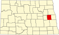
Steele County is a county in the U.S. state of North Dakota. As of the 2020 census, the population was 1,798, [1] making it the fifth-least populous county in North Dakota. Its county seat since 1919 is Finley. [2]

Contents

History

The Dakota Territory legislature created the county on June 2, 1883, with territories partitioned from Griggs and Traill counties. It was not organized at that time, but was attached to Traill for administrative and judicial purposes. It was named for businessman Edward H. Steele, who had pushed for its creation.

On July 13, 1883, the county organization was effected and Steele County was detached from Traill County; Sherbrooke, North Dakota was chosen as the county seat. In 1897 the town of Finley was founded, and by 1919 its growth had eclipsed Sherbrooke to the point that the county seat was transferred to Finley. [3] The county's boundaries have been unchanged since its creation.

Outline map of Steele County, North Dakota, 1911 Map of Steele County, N.D., 1911.jpg
Outline map of Steele County, North Dakota, 1911

Geography

The Sheyenne River flows south near and into the county's west boundary line. The Goose River flows southeast through the northeastern part of the county. The terrain consists of rolling hills dotted with lakes and ponds. The area is devoted to agriculture. [4] The terrain slopes to the south and east; its highest point is near its northwestern corner, at 1,562' (464m) ASL. [5] The county has an area of 715 square miles (1,850 km2), of which 712 square miles (1,840 km2) is land and 3.2 square miles (8.3 km2) (0.5%) is water. [6]

Major highways

Adjacent counties

Lakes [4]

  • Golden Lake
  • Golden Rush Lake
  • Lake Tobiason
  • Lone Tree Lake
  • North Golden Lake
  • Stony Lake
  • Willow Lake

Demographics

Historical population
CensusPop.Note
1890 3,777
1900 5,88855.9%
1910 7,61629.3%
1920 7,401−2.8%
1930 6,972−5.8%
1940 6,193−11.2%
1950 5,145−16.9%
1960 4,719−8.3%
1970 3,749−20.6%
1980 3,106−17.2%
1990 2,420−22.1%
2000 2,258−6.7%
2010 1,975−12.5%
2020 1,798−9.0%
2022 (est.)1,788 [7] −0.6%
U.S. Decennial Census [8]
1790-1960 [9] 1900-1990 [10]
1990-2000 [11] 2010-2020 [1]

2020 census

As of the census of 2020, there were 1,798 people.

2010 census

As of the census of 2010, there were 1,975 people, 864 households, and 589 families in the county. The population density was 2.8 inhabitants per square mile (1.1/km2). There were 1,171 housing units at an average density of 1.6 per square mile (0.62/km2). The racial makeup of the county was 97.6% white, 1.2% American Indian, 0.2% black or African American, 0.1% Asian, 0.4% from other races, and 0.6% from two or more races. Those of Hispanic or Latino origin made up 1.0% of the population. In terms of ancestry, 60.0% were Norwegian, 35.2% were German, 5.4% were Irish, and 1.0% were American.

Of the 864 households, 24.7% had children under the age of 18 living with them, 59.4% were married couples living together, 4.5% had a female householder with no husband present, 31.8% were non-families, and 27.8% of all households were made up of individuals. The average household size was 2.29 and the average family size was 2.78. The median age was 47.7 years.

The median income for a household in the county was $44,191 and the median income for a family was $54,625. Males had a median income of $36,588 versus $25,648 for females. The per capita income for the county was $27,728. About 4.3% of families and 4.2% of the population were below the poverty line, including 7.1% of those under age 18 and 5.1% of those age 65 or over.

Population by decade

Steele County, North Dakota

Communities

Cities

Unincorporated communities [4]

Townships

Township Numbers and Range Numbers [13]
Range 57Range 56Range 55Range 54
Township 148 Sharon Westfield Beaver Creek Newburgh
Township 147 Franklin Finley Golden Lake Enger
Township 146 Greenview Easton Sherbrooke Primrose
Township 145 Riverside Melrose Hugo Edendale
Township 144 Willow Lake Carpenter Colgate Broadlawn

Politics

Steele County was a Democratic-leaning swing county in presidential elections until 2016, when Hillary Clinton lost to Donald Trump by nearly 20 points, an almost total flip from Barack Obama's 20 point win in 2008. In 2020, Joe Biden fared even worse despite a national increase for the Democratic party from 2016. He was the first Democrat to win without the county since John F. Kennedy in 1960, and had the lowest proportion of the county's vote of any winning Democrat since Woodrow Wilson in 1912. Since 1964 Steele County has favored the Democratic presidential candidate in 64% of elections.

United States presidential election results for Steele County, North Dakota [14]
Year Republican Democratic Third party
No.%No.%No.%
2020 65259.93%39236.03%444.04%
2016 53853.85%36136.14%10010.01%
2012 49847.79%51849.71%262.50%
2008 40439.15%61459.50%141.36%
2004 58648.31%61650.78%110.91%
2000 65554.13%47539.26%806.61%
1996 48639.67%62050.61%1199.71%
1992 50336.72%59843.65%26919.64%
1988 69043.26%89556.11%100.63%
1984 94154.08%78144.89%181.03%
1980 99753.32%61732.99%25613.69%
1976 83543.35%1,06655.35%251.30%
1972 1,06353.96%89245.28%150.76%
1968 95246.87%99148.79%884.33%
1964 79636.13%1,40463.73%30.14%
1960 1,20950.76%1,17349.24%00.00%
1956 1,18850.83%1,14849.12%10.04%
1952 1,51362.16%91137.43%100.41%
1948 1,05245.00%1,16349.74%1235.26%
1944 1,04243.89%1,32055.60%120.51%
1940 1,32847.70%1,43451.51%220.79%
1936 72425.20%1,44450.26%70524.54%
1932 69525.88%1,92571.69%652.42%
1928 1,57457.34%1,15241.97%190.69%
1924 1,24752.77%853.60%1,03143.63%
1920 2,22285.17%33712.92%501.92%
1916 67653.31%51540.62%776.07%
1912 23723.58%25325.17%51551.24%
1908 88168.72%36628.55%352.73%
1904 81786.82%697.33%555.84%
1900 72474.41%21421.99%353.60%

Education

Steele County has the following school districts: [15]

Former districts:

In 1964 the county had 992 students in four schools; at the time there were five school districts but Colgate was not operating any schools as its school closed in 1964. [17]

See also

Related Research Articles

<span class="mw-page-title-main">Traill County, North Dakota</span> County in North Dakota, United States

Traill County is a county in the U.S. state of North Dakota. As of the 2020 census listed the population at 7,997. Its county seat is Hillsboro, and its largest city is Mayville.

<span class="mw-page-title-main">Towner County, North Dakota</span> County in North Dakota, United States

Towner County is a county in the U.S. state of North Dakota. As of the 2020 census, the population is 2,162. Its county seat is Cando. It is south of the Canada–US border with Manitoba.

<span class="mw-page-title-main">Rolette County, North Dakota</span> County in North Dakota, United States

Rolette County is a county in the U.S. state of North Dakota. As of the 2020 census, the population was 12,187. Its county seat is Rolla.

<span class="mw-page-title-main">Richland County, North Dakota</span> County in North Dakota, United States

Richland County is a county in the far southeast corner of the U.S. state of North Dakota. As of the 2020 census, the population was 16,529. Its county seat is Wahpeton.

<span class="mw-page-title-main">Pierce County, North Dakota</span> County in North Dakota, United States

Pierce County is a county in the U.S. state of North Dakota. As of the 2020 census, the population was 3,990. Its county seat is Rugby.

<span class="mw-page-title-main">Oliver County, North Dakota</span> County in North Dakota, United States

Oliver County is a county located in the U.S. state of North Dakota. As of the 2020 census, the population was 1,877. Its county seat and only city is Center.

<span class="mw-page-title-main">Nelson County, North Dakota</span> County in North Dakota, United States

Nelson County is a county in the U.S. state of North Dakota. As of the 2020 census, the population was 3,015. Its county seat is Lakota.

<span class="mw-page-title-main">Griggs County, North Dakota</span> County in North Dakota, United States

Griggs County is a county in the U.S. state of North Dakota. As of the 2020 census, the population was 2,306. Its county seat is Cooperstown.

<span class="mw-page-title-main">Cass County, North Dakota</span> County in North Dakota, United States

Cass County is a county in the U.S. state of North Dakota. As of the 2020 census, the population was 184,525. Cass County is the most populous county in North Dakota, accounting for nearly 24% of the state's population. The county seat is Fargo, the state's most populous city.

<span class="mw-page-title-main">Burleigh County, North Dakota</span> County in North Dakota, United States

Burleigh County is a county in the U.S. state of North Dakota. As of the 2020 census, the population was 98,458, making it the second-most populous county in North Dakota. Its county seat is Bismarck, the state capital. The county was named for Dakota Territory political figure Walter A. Burleigh.

<span class="mw-page-title-main">Benson County, North Dakota</span> County in North Dakota, United States

Benson County is a county in the U.S. state of North Dakota. As of the 2020 census, the population was 5,964. Its county seat is Minnewaukan. The county was created on March 9, 1883 by the Dakota Territory legislature, and was named for Bertil W. Benson, a Dakota Territory legislator at the time. The county government was organized on June 4, 1884, and its boundary lines were altered by two legislative actions in 1885.

<span class="mw-page-title-main">Barnes County, North Dakota</span> County in North Dakota, United States

Barnes County is a county in the U.S. state of North Dakota. As of the 2020 census, the population was 10,853. Its county seat is Valley City.

<span class="mw-page-title-main">Cooperstown, North Dakota</span> City in North Dakota, United States

Cooperstown is a city in Griggs County, North Dakota, United States. It is the county seat of Griggs County. The population was 983 at the 2020 census. Cooperstown was founded in 1882.

<span class="mw-page-title-main">Finley, North Dakota</span> City in North Dakota, United States

Finley is a city in Steele County, North Dakota. It is the county seat of Steele County. The population was 401 at the 2020 census. Finley was founded in 1897.

<span class="mw-page-title-main">Hope, North Dakota</span> City in North Dakota, United States

Hope is a city in Steele County, North Dakota, United States. The population was 272 at the 2020 census. Hope was founded in 1881.

<span class="mw-page-title-main">Luverne, North Dakota</span> City in North Dakota, United States

Luverne is a city in Steele County, North Dakota, United States. The population was 28 at the 2020 census. Luverne was founded in 1912.

<span class="mw-page-title-main">Mayville, North Dakota</span> City in North Dakota, United States

Mayville is a city in Traill County, North Dakota, United States. The population was 1,854 at the 2020 census. which makes Mayville the largest community in Traill County. Mayville was founded in 1881. The city's name remembers May Arnold, the first white child born in the immediate area.

Sherbrooke Township is a township in Steele County in the U.S. state of North Dakota. Its population as of the 2000 Census was 62, which had dropped to an estimated 46 people as of 2009. The township shares its name with Sherbrooke, North Dakota, which was the county seat from 1885 to 1919.

Finley Township is a township in Steele County in the U.S. state of North Dakota. Its population as of the 2000 Census was 64, which had dropped to an estimated 47 people as of 2009. The county seat of Finley, North Dakota is located in the township and shares its name.

Hope-Page Public School District 85 is a school district headquartered in Page, North Dakota, serving Hope and Page. It operates Hope-Page Elementary School in Page and Hope-Page High School in Hope.

References

  1. 1 2 "State & County QuickFacts". United States Census Bureau. Retrieved April 6, 2023.
  2. "Find a County". National Association of Counties. Retrieved June 7, 2011.
  3. Individual ND & SC County Chronologies (Long, 2007) The Newberry Library (accessed February 20, 2019)
  4. 1 2 3 Steele County ND Google Maps (accessed February 20, 2019)
  5. ""Find an Altitude/Steele County ND" Google Maps (accessed February 20, 2019)". Archived from the original on May 21, 2019. Retrieved February 20, 2019.
  6. "2010 Census Gazetteer Files". United States Census Bureau. August 22, 2012. Archived from the original on January 29, 2015. Retrieved February 1, 2015.
  7. "Annual Estimates of the Resident Population for Counties: April 1, 2020 to July 1, 2022" . Retrieved April 6, 2023.
  8. "U.S. Decennial Census". United States Census Bureau. Retrieved February 1, 2015.
  9. "Historical Census Browser". University of Virginia Library. Retrieved February 1, 2015.
  10. Forstall, Richard L., ed. (April 20, 1995). "Population of Counties by Decennial Census: 1900 to 1990". United States Census Bureau. Retrieved February 1, 2015.
  11. "Census 2000 PHC-T-4. Ranking Tables for Counties: 1990 and 2000" (PDF). United States Census Bureau. April 2, 2001. Archived (PDF) from the original on March 27, 2010. Retrieved February 1, 2015.
  12. Ghosts of North Dakota: Sherbrooke
  13. "Earth Point".
  14. Leip, David. "Atlas of US Presidential Elections". uselectionatlas.org. Retrieved April 13, 2018.
  15. 1 2 3 "2020 CENSUS - SCHOOL DISTRICT REFERENCE MAP: Steele County, ND" (PDF). United States Census Bureau. Archived (PDF) from the original on August 15, 2021. Retrieved July 24, 2022. - Text list - 2010 map and 2010 list
  16. 1 2 "Enrollment History Public School Districts 2009-2021". North Dakota Department of Public Instruction . Retrieved August 19, 2021. - Check the 2020-2021 spreadsheet, which lists a single "Hope Page" school district, and compare with all previous sheets which show them as two separate school districts.
  17. "Per Pupil Costs Are Analyzed For County". Steele County Press . Finley, North Dakota. p. 10. - Clipping from Newspapers.com

Coordinates: 47°28′N97°43′W / 47.46°N 97.72°W / 47.46; -97.72