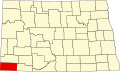
Bowman, North Dakota

Last updated

Bowman, North Dakota
Bank in Bowman.jpg
Dakota Western Bank, Bowman, North Dakota
ND Bowman County Bowman.svg
Location of Bowman, North Dakota
Coordinates: 46°11′04″N103°24′11″W / 46.18444°N 103.40306°W / 46.18444; -103.40306
CountryUnited States
State North Dakota
County Bowman
Founded1907
Government
  City CommissionerLyn James
Area
[1]
  Total1.86 sq mi (4.83 km2)
  Land1.86 sq mi (4.83 km2)
  Water0.00 sq mi (0.00 km2)
Elevation
[2]
2,963 ft (903 m)
Population
 (2020) [3]
  Total1,470
  Estimate 
(2022) [4]
1,424
  Density788.63/sq mi (304.43/km2)
Time zone UTC-7 (Mountain (MST))
  Summer (DST) UTC-6 (MDT)
ZIP code
58623
Area code 701
FIPS code 38-08700
GNIS feature ID1035939 [2]
Highways US 12, US 85
Website bowmannd.com

Bowman is a city and county seat of Bowman County, North Dakota, United States. The population was 1,470 at the 2020 census. [3]

Contents

History

Bowman was founded in 1907 at about the same time the railroad was extended to that point. [5] The city took its name from Bowman County. [6] A post office has been in operation at Bowman since 1907. [7]

Geography

According to the United States Census Bureau, the city has a total area of 1.53 square miles (3.96 km2), all land. [8]

Climate

According to the Köppen Climate Classification system, Bowman has a semi-arid climate, abbreviated BSk on climate maps, [9] although it closely borders the state’s more typical humid continental climate (Dfb).

Climate data for Bowman, North Dakota, 1991–2020 normals, extremes 1915–present
MonthJanFebMarAprMayJunJulAugSepOctNovDecYear
Record high °F (°C)66
(19)
69
(21)
80
(27)
90
(32)
99
(37)
106
(41)
112
(44)
108
(42)
102
(39)
94
(34)
80
(27)
68
(20)
112
(44)
Mean maximum °F (°C)49.4
(9.7)
52.3
(11.3)
66.9
(19.4)
77.3
(25.2)
84.5
(29.2)
92.1
(33.4)
97.9
(36.6)
97.8
(36.6)
93.8
(34.3)
80.4
(26.9)
65.8
(18.8)
52.0
(11.1)
100.1
(37.8)
Mean daily maximum °F (°C)26.3
(−3.2)
29.9
(−1.2)
40.8
(4.9)
52.9
(11.6)
64.0
(17.8)
74.2
(23.4)
82.7
(28.2)
82.4
(28.0)
72.1
(22.3)
55.6
(13.1)
40.7
(4.8)
29.8
(−1.2)
54.3
(12.4)
Daily mean °F (°C)16.4
(−8.7)
19.4
(−7.0)
29.6
(−1.3)
40.7
(4.8)
52.0
(11.1)
62.1
(16.7)
69.2
(20.7)
67.9
(19.9)
57.7
(14.3)
43.1
(6.2)
29.7
(−1.3)
19.8
(−6.8)
42.3
(5.7)
Mean daily minimum °F (°C)6.5
(−14.2)
8.8
(−12.9)
18.3
(−7.6)
28.5
(−1.9)
39.9
(4.4)
50.0
(10.0)
55.8
(13.2)
53.5
(11.9)
43.3
(6.3)
30.5
(−0.8)
18.7
(−7.4)
9.7
(−12.4)
30.3
(−0.9)
Mean minimum °F (°C)−18.4
(−28.0)
−12.0
(−24.4)
−3.4
(−19.7)
13.0
(−10.6)
26.1
(−3.3)
38.5
(3.6)
46.0
(7.8)
42.5
(5.8)
30.1
(−1.1)
13.6
(−10.2)
−0.8
(−18.2)
−12.5
(−24.7)
−23.7
(−30.9)
Record low °F (°C)−43
(−42)
−43
(−42)
−28
(−33)
−11
(−24)
9
(−13)
25
(−4)
35
(2)
33
(1)
9
(−13)
−11
(−24)
−24
(−31)
−36
(−38)
−43
(−42)
Average precipitation inches (mm)0.56
(14)
0.62
(16)
0.80
(20)
1.56
(40)
2.72
(69)
3.10
(79)
2.13
(54)
1.41
(36)
1.59
(40)
1.56
(40)
0.53
(13)
0.50
(13)
17.08
(434)
Average snowfall inches (cm)7.6
(19)
7.6
(19)
7.4
(19)
8.0
(20)
1.9
(4.8)
0.0
(0.0)
0.0
(0.0)
0.0
(0.0)
0.0
(0.0)
3.9
(9.9)
5.4
(14)
6.4
(16)
48.2
(122)
Average precipitation days (≥ 0.01 in)6.97.17.08.811.012.29.77.06.77.15.57.396.3
Average snowy days (≥ 0.1 in)6.56.34.92.90.70.00.00.00.01.84.16.433.6
Source: NOAA [10] [11]

Demographics

Historical population
CensusPop.Note
1910 481
1920 76759.5%
1930 88815.8%
1940 9678.9%
1950 1,38242.9%
1960 1,73025.2%
1970 1,7621.8%
1980 2,07117.5%
1990 1,741−15.9%
2000 1,600−8.1%
2010 1,6503.1%
2020 1,470−10.9%
2022 (est.)1,424 [4] −3.1%
U.S. Decennial Census [12]
2020 Census [3]

2010 census

As of the census of 2010, there were 1,650 people, 760 households, and 422 families living in the city. The population density was 1,078.4 inhabitants per square mile (416.4/km2). There were 867 housing units at an average density of 566.7 per square mile (218.8/km2). The racial makeup of the city was 97.7% White, 0.2% Native American, 0.1% Asian, 1.5% from other races, and 0.5% from two or more races. Hispanic or Latino of any race were 3.9% of the population.

There were 760 households, of which 22.9% had children under the age of 18 living with them, 46.4% were married couples living together, 5.4% had a female householder with no husband present, 3.7% had a male householder with no wife present, and 44.5% were non-families. 39.3% of all households were made up of individuals, and 19.9% had someone living alone who was 65 years of age or older. The average household size was 2.06 and the average family size was 2.77.

The median age in the city was 48.4 years. 19.1% of residents were under the age of 18; 6.8% were between the ages of 18 and 24; 19.9% were from 25 to 44; 27.5% were from 45 to 64; and 26.7% were 65 years of age or older. The gender makeup of the city was 48.5% male and 51.5% female.

2000 census

As of the census of 2000, there were 1,600 people, 702 households, and 419 families living in the city. The population density was 1,227.8 inhabitants per square mile (474.1/km2). There were 799 housing units at an average density of 613.2 per square mile (236.8/km2). The racial makeup of the city was 99.12% White, 0.12% Native American, 0.12% from other races, and 0.62% from two or more races. Hispanic or Latino of any race were 0.75% of the population.

There were 702 households, out of which 25.9% had children under the age of 18 living with them, 51.3% were married couples living together, 6.1% had a female householder with no husband present, and 40.3% were non-families. 37.5% of all households were made up of individuals, and 21.1% had someone living alone who was 65 years of age or older. The average household size was 2.15 and the average family size was 2.84.

In the city, the population was spread out, with 21.7% under the age of 18, 5.2% from 18 to 24, 23.8% from 25 to 44, 22.5% from 45 to 64, and 26.9% who were 65 years of age or older. The median age was 45 years. For every 100 females, there were 91.2 males. For every 100 females age 18 and over, there were 89.6 males.

The median income for a household in the city was $31,645, and the median income for a family was $41,131. Males had a median income of $28,824 versus $19,688 for females. The per capita income for the city was $18,851. About 5.4% of families and 7.5% of the population were below the poverty line, including 8.2% of those under age 18 and 9.6% of those age 65 or over.

"Welcome to Bowman" sign and Cowboy Riding Missile art installation north of Bowman Welcome to Bowman, ND.jpg
"Welcome to Bowman" sign and Cowboy Riding Missile art installation north of Bowman

Education

The city is home to Bowman County School District 1, which operates Bowman County High School.

Radio

Notable people

Related Research Articles

<span class="mw-page-title-main">Hettinger, North Dakota</span> City in North Dakota, United States

Hettinger is a city in, and the county seat of, Adams County, North Dakota, United States. The population was 1,074 at the 2020 census.

<span class="mw-page-title-main">Scranton, North Dakota</span> City in North Dakota, United States

Scranton is a small town in Bowman County, North Dakota, United States. The population was 258 at the 2020 census.

<span class="mw-page-title-main">Crosby, North Dakota</span> City in North Dakota

Crosby is a city and the county seat of Divide County, North Dakota, United States. The population was 1,065 at the 2020 census.

<span class="mw-page-title-main">Emerado, North Dakota</span> City in North Dakota, United States

Emerado is a city in Grand Forks County, North Dakota, United States located near Grand Forks Air Force Base. It is part of the "Grand Forks, ND-MN Metropolitan Statistical Area" or "Greater Grand Forks". The population was 443 at the 2020 census. Grand Forks Air Force Base is located near Emerado.

<span class="mw-page-title-main">Napoleon, North Dakota</span> City in North Dakota, United States

Napoleon is a city in Logan County, North Dakota, United States. It is the county seat of Logan County. The population was 749 at the 2020 census.

<span class="mw-page-title-main">Upham, North Dakota</span> City in North Dakota, United States

Upham is a city in McHenry County, North Dakota, United States. The population was 135 at the 2020 census. It is part of the Minot Micropolitan Statistical Area. Upham was founded in 1905.

<span class="mw-page-title-main">Washburn, North Dakota</span> City in North Dakota, United States

Washburn is a city in southern McLean County, North Dakota, United States. Located along the upper Missouri River, it is the county seat of McLean County. The population was 1,300 at the 2020 census.

<span class="mw-page-title-main">Petersburg, North Dakota</span> City in North Dakota, United States

Petersburg is a city in Nelson County, North Dakota, United States. The population was 162 at the time of the 2020 census. Petersburg was founded in 1884.

<span class="mw-page-title-main">McClusky, North Dakota</span> City in North Dakota, United States

McClusky is a city in Sheridan County, North Dakota, United States. It is the county seat of Sheridan County. The population was 322 at the 2020 census. McClusky was founded in 1905. It is the closest town to the geographical center of North Dakota, which lies approximately five miles to the southwest.

<span class="mw-page-title-main">Surrey, North Dakota</span> City in North Dakota, United States

Surrey is a town in Ward County, North Dakota, United States. The population was 1,357 at the 2020 census. Official incorporation of Surrey occurred in 1951. The city is part of the Minot Micropolitan Statistical Area.

<span class="mw-page-title-main">Fessenden, North Dakota</span> City in North Dakota, United States

Fessenden is a town in, and the county seat of, Wells County, North Dakota, United States. It was founded in 1893 and is home of the Wells County Fair. The population was 462 at the 2020 census.

<span class="mw-page-title-main">Harvey, North Dakota</span> City in North Dakota, United States

Harvey is a city in Wells County, North Dakota, United States. The population was 1,650 at the 2020 census. Harvey was founded in 1893 as a division point by the Soo Line Railway. Harvey is believed to have been named for a director of the Soo Line Railway, Col. Scott William Harvey of Minneapolis, Minnesota.

<span class="mw-page-title-main">Wagner, South Dakota</span> City in South Dakota, United States

Wagner is a city in Charles Mix County, South Dakota, United States. The population was 1,490 at the 2020 census. The city is served by Wagner Municipal Airport as well as YST Transit buses.

<span class="mw-page-title-main">Webster, South Dakota</span> City in South Dakota, United States

Webster is a city in and the county seat of Day County, South Dakota, United States. The population was 1,728 at the 2020 census.

<span class="mw-page-title-main">Armour, South Dakota</span> City in South Dakota, United States

Armour is a city in county seat of Douglas County, South Dakota, United States. The population was 698 at the 2020 census.

<span class="mw-page-title-main">Ipswich, South Dakota</span> City in South Dakota, United States

Ipswich is a city in and county seat of Edmunds County, South Dakota, United States. The population was 928 at the 2020 census.

<span class="mw-page-title-main">Miller, South Dakota</span> City in South Dakota, United States

Miller is a city in and county seat of Hand County, South Dakota, United States. The population was 1,349 at the 2020 census.

<span class="mw-page-title-main">Menno, South Dakota</span> City in South Dakota, United States

Menno is a city in Hutchinson County, South Dakota, United States. The population was 614 at the 2020 census.

<span class="mw-page-title-main">Parkston, South Dakota</span> City in South Dakota, United States

Parkston is a city in Hutchinson County, South Dakota, United States. The population was 1,567 at the 2020 census.

<span class="mw-page-title-main">Dupree, South Dakota</span> City in South Dakota, United States

Dupree is a city in and county seat of Ziebach County, South Dakota, United States. The population was 494 at the 2020 census. It is the only incorporated community located fully within Ziebach County.

References

  1. "ArcGIS REST Services Directory". United States Census Bureau. Retrieved September 20, 2022.
  2. 1 2 U.S. Geological Survey Geographic Names Information System: Bowman, North Dakota
  3. 1 2 3 "Explore Census Data". United States Census Bureau . Retrieved October 20, 2023.
  4. 1 2 "City and Town Population Totals: 2020-2022". United States Census Bureau. October 20, 2023. Retrieved October 20, 2023.
  5. North Dakota: Counties - Towns & People, Part III. Watchmaker Publishing, Ltd. 2008. pp. 58–59. ISBN   978-1-60386-342-1.
  6. Federal Writers' Project (1938). North Dakota, a Guide to the Northern Prairie State. WPA. p. 225. ISBN   978-1-62376-033-5.
  7. "Bowman County". Jim Forte Postal History. Retrieved October 25, 2015.
  8. "US Gazetteer files 2010". United States Census Bureau. Archived from the original on January 12, 2012. Retrieved June 14, 2012.
  9. "Bowman, North Dakota Köppen Climate Classification (Weatherbase)". Weatherbase.
  10. "NowData – NOAA Online Weather Data". National Oceanic and Atmospheric Administration. Retrieved September 24, 2021.
  11. "Station: Bowman, ND". U.S. Climate Normals 2020: U.S. Monthly Climate Normals (1991–2020). National Oceanic and Atmospheric Administration. Retrieved September 24, 2021.
  12. United States Census Bureau. "Census of Population and Housing" . Retrieved June 2, 2014.