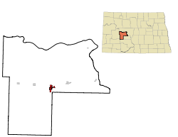
Beulah, North Dakota

Last updated

Beulah, North Dakota
Post office in Beulah, North Dakota 7-16-2009.jpg
Post office in Beulah
The Beulah street.jpg
Street in Beulah
BeulahNDlogo.png
Motto: 
"Small Town Appeal...Big City Looks"
ND Mercer County Beulah.svg
Location of Beulah, North Dakota
USA North Dakota relief location map.jpg
Red pog.svg
Beulah
Usa edcp relief location map.png
Red pog.svg
Beulah
Coordinates: 47°16′01″N101°46′14″W / 47.266826°N 101.770684°W / 47.266826; -101.770684
CountryUnited States
State North Dakota
County Mercer
Founded1914
Government
[1]
   Mayor Sean Cheatley
   Council Member Tim Aichele
Cameron Brown
Gina Campbell
Kameron Plienis
Bill Keller
   President Jason Isaak
Adam Baker
Area
[2]
  Total
2.468 sq mi (6.392 km2)
  Land2.442 sq mi (6.326 km2)
  Water0.025 sq mi (0.065 km2)  1.01%
Elevation
[3]
1,821 ft (555 m)
Population
 (2020) [4]
  Total
3,058
  Estimate 
(2024) [5]
3,047
  Density1,247.8/sq mi (481.79/km2)
Time zone UTC–6 (Central (CST))
  Summer (DST) UTC–5 (CDT)
ZIP Code
58523 [6]
Area code 701
FIPS code 38-06660
GNIS feature ID1035931 [3]
Highways ND 49
Website beulahnd.org

Beulah is a city in Mercer County, North Dakota, United States. The population was 3,058 at the 2020 census, [4] and was estimated at 3,047 in 2024, [5] making it the 17th-most populous city in North Dakota. Beulah is home to the Dakota Gasification Company. It is near the largest lignite mine in the United States, owned by North American Coal Corporation. [7]

Contents

History

Beulah was founded in 1914. It was named after Beulah Stinchcombe, the niece of a local land developer. [8]

Geography

According to the United States Census Bureau, the city has a total area of 2.468 square miles (6.39 km2), of which 2.443 square miles (6.33 km2) is land and 0.025 square miles (0.06 km2) (1.01%) is water. [2]

Climate

Climate data for Beulah, North Dakota (1981–2010)
MonthJanFebMarAprMayJunJulAugSepOctNovDecYear
Mean daily maximum °F (°C)19.1
(−7.2)
21.6
(−5.8)
36.9
(2.7)
55.5
(13.1)
65.6
(18.7)
74.0
(23.3)
84.0
(28.9)
82.7
(28.2)
72.9
(22.7)
56.0
(13.3)
42.0
(5.6)
18.2
(−7.7)
52.4
(11.3)
Mean daily minimum °F (°C)0.3
(−17.6)
2.7
(−16.3)
17.8
(−7.9)
30.5
(−0.8)
41.4
(5.2)
50.2
(10.1)
56.4
(13.6)
54.4
(12.4)
45.9
(7.7)
33.1
(0.6)
20.3
(−6.5)
1.1
(−17.2)
29.5
(−1.4)
Average precipitation inches (mm)0.66
(17)
0.65
(17)
0.89
(23)
0.88
(22)
2.75
(70)
3.36
(85)
1.93
(49)
1.12
(28)
2.18
(55)
1.25
(32)
0.51
(13)
0.55
(14)
16.73
(425)
Average snowfall inches (cm)12.6
(32)
9.2
(23)
14.5
(37)
4.8
(12)
3.4
(8.6)
0.3
(0.76)
0.0
(0.0)
0.0
(0.0)
0.3
(0.76)
2.8
(7.1)
4.3
(11)
19.3
(49)
71.3
(181)
Source: NOAA [9]

Demographics

Historical population
CensusPop.Note
1920 552
1930 91365.4%
1940 9423.2%
1950 1,50159.3%
1960 1,318−12.2%
1970 1,3442.0%
1980 2,908116.4%
1990 3,36315.6%
2000 3,152−6.3%
2010 3,121−1.0%
2020 3,058−2.0%
2024 (est.)3,047 [5] −0.4%
U.S. Decennial Census [10]
2020 Census [4]

According to realtor website Zillow, the average price of a home as of August 31, 2025, in Beulah is $240,416. [11]

As of the 2023 American Community Survey, there are 1,231 estimated households in Beulah with an average of 2.39 persons per household. The city has a median household income of $84,417. Approximately 8.3% of the city's population lives at or below the poverty line. Beulah has an estimated 57.1% employment rate, with 19.8% of the population holding a bachelor's degree or higher and 89.3% holding a high school diploma. [12] There were 1,636 housing units at an average density of 669.67 per square mile (258.6/km2).

The top five reported languages (people were allowed to report up to two languages, thus the figures will generally add to more than 100%) were English (94.2%), Spanish (0.8%), Indo-European (4.0%), Asian and Pacific Islander (0.5%), and Other (2.3%).

The median age in the city was 37.0 years.

Beulah, North Dakota – racial and ethnic composition
Note: the US Census treats Hispanic/Latino as an ethnic category. This table excludes Latinos from the racial categories and assigns them to a separate category. Hispanics/Latinos may be of any race.
Race / ethnicity (NH = non-Hispanic)Pop. 1980 [13] Pop. 1990 [14] Pop. 2000 [15] Pop. 2010 [16] Pop. 2020 [17]
White alone (NH)2,838
(97.59%)
3,234
(96.16%)
3,007
(95.4%)
2,934
(94.01%)
2,726
(89.14%)
Black or African American alone (NH)6
(0.21%)
7
(0.21%)
1
(0.03%)
7
(0.22%)
29
(0.95%)
Native American or Alaska Native alone (NH)51
(1.75%)
91
(2.71%)
53
(1.68%)
58
(1.86%)
44
(1.44%)
Asian alone (NH)2
(0.07%)
8
(0.24%)
9
(0.29%)
8
(0.26%)
20
(0.65%)
Pacific Islander alone (NH)20
(0.63%)
8
(0.26%)
0
(0.00%)
Other race alone (NH)0
(0.00%)
1
(0.03%)
3
(0.10%)
0
(0.00%)
5
(0.16%)
Mixed race or multiracial (NH)44
(1.40%)
35
(1.12%)
119
(3.89%)
Hispanic or Latino (any race)14
(0.48%)
22
(0.65%)
15
(0.48%)
71
(2.27%)
115
(3.76%)
Total2,908
(100.00%)
3,363
(100.00%)
3,152
(100.00%)
3,121
(100.00%)
3,058
(100.00%)

2020 census

As of the 2020 census, there were 3,058 people, 1,232 households, and 805 families residing in the city. [18] The population density was 1,251.74 inhabitants per square mile (483.3/km2). There were 1,560 housing units at an average density of 638.56 per square mile (246.5/km2). The racial makeup of the city was 90.12% White, 0.95% African American, 1.57% Native American, 0.65% Asian, 0.00% Pacific Islander, 1.28% from some other races and 5.43% from two or more races. Hispanic or Latino people of any race were 3.76% of the population. [19]

2010 census

As of the 2010 census, there were 3,121 people, 1,353 households, and 862 families residing in the city. The population density was 1,252.41 inhabitants per square mile (483.6/km2). There were 1,508 housing units at an average density of 605.14 per square mile (233.6/km2). The racial makeup of the city was 94.78% White, 0.22% African American, 2.31% Native American, 0.26% Asian, 0.26% Pacific Islander, 0.74% from some other races and 1.44% from two or more races. Hispanic or Latino people of any race were 2.27% of the population.

There were 1,353 households, of which 26.8% had children under the age of 18 living with them, 55.1% were married couples living together, 4.7% had a female householder with no husband present, 3.9% had a male householder with no wife present, and 36.3% were non-families. 31.9% of all households were made up of individuals, and 12.1% had someone living alone who was 65 years of age or older. The average household size was 2.24 and the average family size was 2.81.

The median age in the city was 44.2 years. 22.3% of residents were under the age of 18; 6.4% were between the ages of 18 and 24; 22.1% were from 25 to 44; 34.3% were from 45 to 64; and 14.9% were 65 years of age or older. The gender makeup of the city was 51.3% male and 48.7% female.

2000 census

As of the 2000 census, there were 3,152 people, 1,213 households, and 851 families residing in the city. The population density was 1,307.88 inhabitants per square mile (505.0/km2). There were 1,475 housing units at an average density of 612.03 per square mile (236.3/km2). The racial makeup of the city was 95.78% White, 0.03% African American, 1.68% Native American, 0.29% Asian, 0.63% Pacific Islander, 0.16% from some other races and 1.43% from two or more races. Hispanic or Latino people of any race were 0.48% of the population.

The top six ancestry groups in the city are German (74.3%), Norwegian (12.3%), Irish (9.3%), Russian (7.7%), English (3.4%), Czech (2.3%).

There were 1,213 households, of which 39.9% had children under the age of 18 living with them, 61.0% were married couples living together, 6.8% had a female householder with no husband present, and 29.8% were non-families. 27.8% of all households were made up of individuals, and 12.9% had someone living alone who was 65 years of age or older. The average household size was 2.53 and the average family size was 3.09.

The median household income was $45,256 and the median family income was $54,700. Males had a median income of $50,870 versus $20,792 for females. The per capita income for the city was $18,614. About 5.3% of families and 7.8% of the population were below the poverty line, including 4.6% of those under age 18 and 30.0% of those age 65 or over.

Education

Beulah's educational system started with a one-room school house, located in an unused barn south of city. At its advent, only five local children attended the school. As its reputation grew, children from surrounding communities increased the school's attendance to over one hundred students. The school went on to receive several awards for educational excellence and was considered the pride of the city until a fire in 1934 destroyed the building. Previously, an additional Beulah School was built in 1920.

The new Beulah High School Beulah Middle School.jpg
The new Beulah High School

Beulah has an elementary, middle, and high school. The sports teams are called the Miners. The American Legion baseball team is called the Cyclones.

References

  1. "City Officials & Employees". City of Beulah, North Dakota. Retrieved September 23, 2025.
  2. 1 2 "2025 U.S. Gazetteer Files". United States Census Bureau. Retrieved September 23, 2025.
  3. 1 2 U.S. Geological Survey Geographic Names Information System: Beulah, North Dakota
  4. 1 2 3 "Explore Census Data". United States Census Bureau . Retrieved September 23, 2025.
  5. 1 2 3 "City and Town Population Totals: 2020-2024". United States Census Bureau. Retrieved September 23, 2025.
  6. "Zip Code Lookup". USPS . Retrieved September 23, 2025.
  7. "North Dakota's Freedom Mine: The largest lignite mine in the United States - Lignite Energy Council". lignite.com. July 31, 2017. Retrieved April 22, 2018.
  8. "Profile for Beulah, North Dakota". ePodunk. Archived from the original on June 9, 2011. Retrieved June 21, 2010.
  9. "NOWData - NOAA Online Weather Data". National Oceanic and Atmospheric Administration . Retrieved May 4, 2013.
  10. "Decennial Census of Population and Housing". www.census.gov. United States Census Bureau. Retrieved June 4, 2015.
  11. "Beulah, ND Housing Market". Zillow . Retrieved September 23, 2025.
  12. "U.S. Census Bureau QuickFacts: Beulah city, North Dakota". www.census.gov. Retrieved September 23, 2025.
  13. General Social and Economic Characteristics: North Dakota (PDF). United States Census Bureau. p. 27. Retrieved September 23, 2025.
  14. North Dakota: 1990 (PDF). United States Census Bureau. p. 33. Retrieved September 23, 2025.
  15. "P004: Hispanic or Latino, and Not Hispanic or Latino by Race – 2000: DEC Summary File 1 – Beulah city, North Dakota". United States Census Bureau . Retrieved September 23, 2025.
  16. "P2: Hispanic or Latino, and Not Hispanic or Latino by Race – 2010: DEC Redistricting Data (PL 94-171) – Beulah city, North Dakota". United States Census Bureau . Retrieved September 23, 2025.
  17. "P2: Hispanic or Latino, and Not Hispanic or Latino by Race – 2020: DEC Redistricting Data (PL 94-171) – Beulah city, North Dakota". United States Census Bureau . Retrieved September 23, 2025.
  18. "US Census Bureau, Table P16: Household Type". United States Census Bureau. Retrieved September 23, 2025.
  19. "How many people live in Beulah city, North Dakota". USA Today . Retrieved September 23, 2025.