There have been two Williams counties in the history of North Dakota. The first, created in 1873, was located south of the Missouri River near where Dunn and Mercer counties are today. This county continued to exist through North Dakota statehood, and while the second Williams County was created in 1891. The first Williams County was extinguished by a county referendum on November 8, 1892; part of its territory was absorbed by Mercer County and the rest reverted to an unorganized territory.
The second Williams County was created by the North Dakota legislature on March 2, 1891, from the previous counties of Buford and Flannery, which were dissolved. The government of this county was organized on December 8, 1891. This county's boundaries were altered in 1910, when a portion of its territory was annexed to create Divide County. Its boundaries have remained unchanged since then.[4] The county is named for Erastus Appleman Williams, a European-American settler who served in the Dakota Territory legislature and the North Dakota legislature.[5]
In June 2014, lightning struck a Williams County Oasis Petroleum saltwater disposal facility.[6] It sparked a fire that destroyed the facility, burning 630 gallons of oil and tens of thousands of gallons of brine.[6]
Outline map of Williams County, North Dakota, 1914
Geography
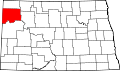
Williams County lies on the west edge of North Dakota. Its west boundary line abuts the east boundary line of the state of Montana. The Missouri River flows eastward along the county's south boundary line from the confluence with its tributary Yellowstone River, located on the Dakota side of the state border with Montana. Horse Creek and Willow Creek flow to the west across the upper portion of the county. The terrain consists of isolated hills amid rolling, hilly, semi-arid stretches. The area is partly devoted to agriculture.[7] The terrain is highest across its midpoint, and slopes to the NW and SE. Its highest point is a hill near the NE corner, at 2,470ft (750m) ASL.[8]
According to the United States Census Bureau, the county has a total area of 2,147.808 square miles (5,562.80km2), of which 2,077.600 square miles (5,380.96km2) is land and 70.208 square miles (181.84km2) (3.27%) is water.[9] It is the fourth-largest county in North Dakota by total area.[10]
U.S. Decennial Census[12] 1790–1960[13] 1900–1990[14] 1990–2000[15] 2010–2020[2]
As of the fourth quarter of 2024, the median home value in Williams County was $283,749.[16] As of the 2023 American Community Survey, there are 15,308 estimated households in Williams County with an average of 2.53 persons per household. The county has a median household income of $90,224. Approximately 7.7% of the county's population lives at or below the poverty line. Williams County has an estimated 73.0% employment rate, with 23.7% of the population holding a bachelor's degree or higher and 90.6% holding a high school diploma.[2]
The top five reported ancestries (people were allowed to report up to two ancestries, thus the figures will generally add to more than 100%) were English (89.8%), Spanish (5.6%), Indo-European (1.5%), Asian and Pacific Islander (1.0%), and Other (2.1%). The median age in the county was 32.3 years.
Williams County, North Dakota – racial and ethnic composition Note: the US Census treats Hispanic/Latino as an ethnic category. This table excludes Latinos from the racial categories and assigns them to a separate category. Hispanics/Latinos may be of any race.
As of the 2024 estimate, there were 40,763 people and 15,308 households residing in the county. There were 20,474 housing units at an average density of 9.85 per square mile (3.8/km2). The racial makeup of the county was 84.8% White (76.3% NH White), 5.4% African American, 4.3% Native American, 1.2% Asian, 0.3% Pacific Islander, _% from some other races and 3.9% from two or more races. Hispanic or Latino people of any race were 10.3% of the population.[22]
2020 census
As of the 2020 census, the county had a population of 40,950. Of the residents, 27.2% were under the age of 18 and 8.8% were 65 years of age or older; the median age was 31.6 years. For every 100 females there were 117.3 males, and for every 100 females age 18 and over there were 123.2 males.[23] There were 16,095 households and 9,585 families residing in the county.[24] The population density was 19.7 inhabitants per square mile (7.6/km2). There were 20,227 housing units at an average density of 9.7 per square mile (3.7/km2); 20.4% of those units were vacant. Among occupied housing units, 47.6% were owner-occupied and 52.4% were renter-occupied, with a homeowner vacancy rate of 2.7% and a rental vacancy rate of 21.3%.[23] The racial makeup of the county was 77.8% White, 5.1% Black or African American, 2.9% American Indian and Alaska Native, 1.6% Asian, 3.7% from some other race, and 8.6% from two or more races. Hispanic or Latino residents of any race comprised 9.5% of the population.[25] Of the 16,095 households, 33.8% had children under the age of 18 living with them and 17.4% had a female householder with no spouse or partner present. About 30.4% of all households were made up of individuals and 6.6% had someone living alone who was 65 years of age or older.[23]
2010 census
As of the 2010 census, there were 22,398 people, 9,293 households, and 5,746 families in the county. The population density was 10.8 inhabitants per square mile (4.2/km2). There were 10,464 housing units at an average density of 5.0 per square mile (1.9/km2). The racial makeup of the county was 92.15% White, 0.28% African American, 4.01% Native American, 0.35% Asian, 0.02% Pacific Islander, 0.31% from some other races and 2.88% from two or more races. Hispanic or Latino people of any race were 1.95% of the population. In terms of ancestry, 46.2% were of Norwegian, 35.9% of German, 9.8% of Irish, 4.5% of Swedish and 4.4% of English ancestry.
Of the 9,293 households, 28.5% had children under the age of 18 living with them, 49.8% were married couples living together, 7.7% had a female householder with no husband present, 38.2% were non-families, and 31.5% of all households were made up of individuals. The average household size was 2.35 and the average family size was 2.95. The median age was 39.0 years.
The median income for a household in the county was $55,396 and the median income for a family was $67,875. Males had a median income of $50,735 versus $27,071 for females. The per capita income for the county was $29,153. About 4.7% of families and 8.7% of the population were below the poverty line, including 9.7% of those under age 18 and 10.4% of those age 65 or over.
Williams County voters have been reliably Republican for decades. In no national election since 1964 has the county selected the Democratic Party candidate.
United States presidential election results for Williams County, North Dakota[27][28]
This page is based on this Wikipedia article Text is available under the CC BY-SA 4.0 license; additional terms may apply. Images, videos and audio are available under their respective licenses.