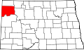
Hanks, North Dakota

Last updated

Hanks
Hanks ND.jpg
Hanks, North Dakota
USA North Dakota location map.svg
Red pog.svg
Hanks
Location within the state of North Dakota
Usa edcp location map.svg
Red pog.svg
Hanks
Hanks (the United States)
Coordinates: 48°36′12″N103°48′11″W / 48.60333°N 103.80306°W / 48.60333; -103.80306
Country United States
State North Dakota
County Williams
Elevation
[1]
2,116 ft (645 m)
Time zone UTC-6 (Central (CST))
  Summer (DST) UTC-5 (CDT)
Area code 701
GNIS feature ID1029297 [1]

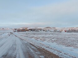
Hanks is an unincorporated community in Williams County, North Dakota, United States.

Contents

Geography

Hanks is located on North Dakota Highway 50, and has the latitude of 48.603° N, and the longitude of 103.802° W. The elevation is 2,116 feet (645 m), and is located in the Central Time Zone.

History

Hanks was founded in 1916 along a Great Northern Railway branch line that ran from Stanley to Grenora. The name honors W.F. Hanks, a banker from Powers Lake. [2]

Hanks disincorporated in 1992. [3]

According to a 2008 report, Hanks had only one inhabitant. [4] The town was included in the National Geographic article The Emptied Prairie, published in January 2008. [5]

Historical population
CensusPop.Note
1930 213
1940 192−9.9%
1950 115−40.1%
1960 78−32.2%
1970 13−83.3%
1980 10−23.1%
1990 1110.0%
U.S. Decennial Census

Notable people

Related Research Articles

<span class="mw-page-title-main">South Dakota</span> U.S. state

South Dakota is a U.S. state in the North Central region of the United States. It is also part of the Great Plains. South Dakota is named after the Dakota Sioux Native American tribe, which comprises a large portion of the population with nine reservations currently in the state and has historically dominated the territory. South Dakota is the 17th largest by area, but the 5th least populous, and the 5th least densely populated of the 50 United States. As the southern part of the former Dakota Territory, South Dakota became a state on November 2, 1889, simultaneously with North Dakota. They are the 39th and 40th states admitted to the union; President Benjamin Harrison shuffled the statehood papers before signing them so that no one could tell which became a state first. Pierre is the state capital, and Sioux Falls, with a population of about 192,200, is South Dakota's most populous city.

<span class="mw-page-title-main">Williams County, North Dakota</span> County in North Dakota, United States

Williams County is located on the western border of the U.S. state of North Dakota, next to Montana. As of the 2020 census, the population was 40,950. making it the fifth-most populous county in North Dakota. Its county seat is Williston.

<span class="mw-page-title-main">Emmons County, North Dakota</span> County in North Dakota, United States

Emmons County is a county in the U.S. state of North Dakota. As of the 2020 census, the population was 3,301. Its county seat has been Linton since 1899.

<span class="mw-page-title-main">Divide County, North Dakota</span> County in North Dakota, United States

Divide County is a county in the U.S. state of North Dakota. As of the 2020 census, the population was 2,195. Its county seat is Crosby.

<span class="mw-page-title-main">Dixon County, Nebraska</span> County in Nebraska, United States

Dixon County is a county in the U.S. state of Nebraska. As of the 2020 United States Census, the population was 5,606. Its county seat is Ponca. The county was created in 1856 and attached to Dakota County. It was organized in 1858.

<span class="mw-page-title-main">Rugby, North Dakota</span> City in North Dakota, United States

Rugby is a city in, and the county seat of, Pierce County, North Dakota, United States. The population was 2,509 at the 2020 census, making it the 19th largest city in North Dakota. Rugby was founded in 1886.

<span class="mw-page-title-main">Devils Lake, North Dakota</span> City in North Dakota, United States

Devils Lake is a city in and the county seat of Ramsey County, North Dakota, United States. The population was 7,192 at the 2020 census. It is named after the nearby body of water called Devils Lake. The first house built by an Euro-American settler was in 1882. It was surveyed in 1883 and named Creelsburg and later Creel City, after the surveyor, Heber M. Creel. In 1884 it was renamed Devils Lake.

<span class="mw-page-title-main">Williston, North Dakota</span> City in North Dakota, United States

Williston is a city in and the county seat of Williams County, North Dakota, United States. The 2020 census gave its population as 29,160, making Williston the sixth-most populous city in North Dakota. The city's population nearly doubled between 2010 and 2020, due largely to the North Dakota oil boom.

<span class="mw-page-title-main">Grand Prairie, Texas</span> City in Texas

Grand Prairie is a city in Dallas, Tarrant, and Ellis counties of Texas, United States. It is part of the Mid-Cities region in the Dallas–Fort Worth metroplex. It had a population of 175,396 according to the 2010 census, making it the fifteenth most populous city in the state. Remaining the 15th-most populous city in Texas, the 2020 census reported a population of 196,100.

<span class="mw-page-title-main">Cedar River National Grassland</span> Protected area in southern North Dakota

Cedar River National Grassland is a National Grassland located in Sioux County and Grant County in southern North Dakota, United States. It has a land area of 6,717 acres (2,718 ha). The portion in Sioux County lies within the Standing Rock Indian Reservation. Within the grassland are topographic features such as level plains and rolling hills. Dry streams and some small flowing streams exist throughout the Grasslands.

<span class="mw-page-title-main">Grand River National Grassland</span> Protected area in northwestern South Dakota, United States

Grand River National Grassland is a National Grassland in northwestern South Dakota, United States. It is named for the Grand River. The North and South forks of the rivers meet in the grassland. It has a land area of 154,783 acres (62,638 ha). In descending order of acreage it lies in parts of Perkins, Corson, and Ziebach counties. The portion in Corson County also lies within the Standing Rock Indian Reservation. The portion in Ziebach County also lies within the Cheyenne River Indian Reservation.

<span class="mw-page-title-main">Little Missouri National Grassland</span> Protected grassland in North Dakota, USA

Little Missouri National Grassland is a National Grassland located in western North Dakota, USA. At 1,028,051 acres (416,037 ha), it is the largest grassland in the country. Enclaved within its borders is Theodore Roosevelt National Park, which is managed by the National Park Service. The Little Missouri National Grassland was once a part of the Custer National Forest, but is now a part of the Dakota Prairie Grasslands, a National Forest unit consisting entirely of National Grasslands. A predominant feature of the grassland is colorful and beautiful badlands, a rugged terrain extensively eroded by wind and water. It is a mixed grass prairie, meaning it has both long and short grass.

<span class="mw-page-title-main">Sheyenne National Grassland</span> National Grassland in southeastern North Dakota, United States

Sheyenne National Grassland is a National Grassland located in southeastern North Dakota in the United States, comprising 70,446 acres (28,508 ha) of public land amid 64,769 acres (26,211 ha) of privately owned land in a region of sandy soils in the vicinity of the Sheyenne River in Ransom and Richland Counties. It is the only National Grassland in the tallgrass prairie region of the U.S. The grassland provides habitat for the largest population of greater prairie chickens in North Dakota, as well as the Dakota skipper butterfly, the western prairie fringed orchid, and numerous ferns, as well as grazing land for approximately 83 cattle ranchers.

Dakota Dunes is an unincorporated community and census-designated place (CDP), master-planned residential and commercial development covering about 2,000 acres (8.1 km2) in Union County in the extreme southeast corner of the U.S. state of South Dakota. The population was 4,020 at the 2020 census.

<span class="mw-page-title-main">Wheelock, North Dakota</span> Ghost town in North Dakota, United States

Wheelock is a ghost town in Wheelock Township, Williams County, in the northwestern part of the U.S. state of North Dakota. In 1938, the Federal Writers' Project found a population of 115 in Wheelock. In the 1990 census, the population was 23. All census population figures after 1990 are estimates. The town was disincorporated in 1994.

<span class="mw-page-title-main">Geography of South Dakota</span> Overview of the geography of South Dakota

South Dakota is a state located in the north-central United States. It is usually considered to be in the Midwestern region of the country. The state can generally be divided into three geographic regions: eastern South Dakota, western South Dakota, and the Black Hills. Eastern South Dakota is lower in elevation and higher in precipitation than the western part of the state, and the Black Hills are a low, isolated mountain group in the southwestern corner of the state. Smaller sub-regions in the state include the Coteau des Prairies, Missouri Coteau, James River Valley, and the Dissected Till Plains. Geologic formations in South Dakota range in age from two billion-year-old Precambrian granite in the Black Hills to glacial till deposited over the last few million years. South Dakota is the 17th-largest state in the country.

<span class="mw-page-title-main">Overly, North Dakota</span> City in North Dakota, United States

Overly is a city in Bottineau County in the U.S. state of North Dakota. The population was 10 at the 2020 census.

<span class="mw-page-title-main">Cecil Township, Bottineau County, North Dakota</span> Township in North Dakota, United States

Cecil Township is a civil township in Bottineau County in the U.S. state of North Dakota. As of the 2000 census, its population was 28.

Lanyon is an unincorporated community in Lost Grove Township in Webster County, Iowa.

<span class="mw-page-title-main">Dewey, South Dakota</span> Unincorporated community in South Dakota, United States

Dewey is an unincorporated community near the southwest corner of Custer County, South Dakota, United States, less than one mile from the Wyoming border in a prairie region of the Black Hills. There are approximately five or six homes in town. Dewey has a volunteer fire department in the Edgemont city district.

References

  1. 1 2 U.S. Geological Survey Geographic Names Information System: Hanks, North Dakota
  2. Wick, Douglas A. "Hanks (Williams County)". North Dakota Place Names. Retrieved May 8, 2011.
  3. "Boundary Changes".
  4. Rubin, Richard (April 9, 2006). "Not far from forsaken". The New York Times. Retrieved October 25, 2015.
  5. Bowden, Charles (January 2008). "The Emptied Prairie". National Geographic. Archived from the original on February 16, 2008. Retrieved May 8, 2011.
  6. 'North Dakota Centennial Blue Book 1889-1989, Ben Meier (editor), North Dakota Legislative Assembly, Biosgraphical Sketch of Arch Shaw, pg. 411