North Dakota Highway 1804

Last updated

ND-1804 (2015).svg

North Dakota Highway 1804

Lewis and Clark Trail
North Dakota Highway 1804
ND 1804 highlighted in red
Route information
Maintained by NDDOT
Length342.805 mi [1]  (551.691 km)
Major junctions
South endSD 1804.svg SD 1804 near Pollock at South Dakota border
Major intersections
North endMT-sec-327.svg S-327 at Fort Union Trading Post at Montana border
Location
Country United States
State North Dakota
Counties Emmons, Burleigh, McLean, Mountrail, Williams
Highway system
  • North Dakota State Highway System
ND-810 (2015).svg ND 810 ND-1806 (2015).svg ND 1806

North Dakota Highway 1804 (ND 1804) is a state highway in the U.S. state of North Dakota. ND 1804 and ND 1806 were named to reflect the years of Lewis and Clark's travels through the area, and together constitute the portion of the Lewis and Clark Trail that runs through North Dakota along the northeast and southwest sides of Lake Sakakawea and the Missouri River, respectively. [1]

Contents

Route description

Highway 1804 begins at the border between North Dakota and South Dakota near Pollock, South Dakota, and continues uninterrupted along the north east side of the Missouri River through Emmons, Burleigh, McLean, Mountrail, and Williams counties. At the intersection of Bismarck Expressway in Bismarck, the highway temporarily splits into a separate northbound route (concurrent with 9th Street) and southbound route (concurrent with 7th Street) until both roads terminate at E Boulevard Avenue in front of the North Dakota State Capitol grounds. Further north in Bismarck, ND 1804 intersects Interstate 94, from which it runs concurrent with US 83 for a short distance.

Just north of Bismarck, ND 1804 diverges from US 83 to closely follow the Missouri River. It once again runs concurrent with US 83 until just northeast of Lake Sakakawea, where ND 1804 permanently diverges west to closely follow the lake. At Williston, a brief concurrence with US 2 and US 85 begins and ends as ND 1804 dips south alongside the Missouri River to meet its final terminus at Montana Secondary Highway 327 in the Fort Union Trading Post National Historic Site.

Major intersections

CountyLocationmi [1] kmDestinationsNotes
Emmons 0.0000.000SD 1804.svg SD 1804  Pollock Continuation into South Dakota
28.90246.513East plate.svg
ND-13 (2015).svg
End plate brown.svg
Lewis and Clark Trail.svg
ND 13 east / Lewis and Clark Trail ends Linton
Southern end of LCT concurrency; western terminus of ND 13
Burleigh Bismarck 78.575126.454North plate.svg
ND-1804 (2015).svg
Bismarck Expressway  / ND 1804 north (9th Street)
South end of southbound concurrency with Bismarck Expwy.
Bismarck Expressway westNorth end of southbound concurrency with Bismarck Expwy.
Main Avenue (I-94 BL)
81.221130.713I-94.svgSouth plate.svg
US 83.svg
I-94  / US 83 south Fargo, Billings
Southern end of US 83 concurrency; I-94 exit 159
82.973133.532North plate.svg
US 83.svg
US 83 north Minot
Northern end of US 83 concurrency
McLean 113.383182.472South plate.svg
US 83.svg
US 83 south Wilton, Bismarck
Southern end of US 83 concurrency
Washburn 120.147193.358Alternate plate.svg
ND-200 (2015).svg
ND 200A  Turtle Lake, Stanton, Hazen
132.382213.048East plate.svg
ND-200 (2015).svg
ND 200 east Turtle Lake
Southern end of ND 200 concurrency
139.676224.787West plate.svg
ND-200 (2015).svg
ND 200 west Riverdale, Pick City
Northern end of ND 200 concurrency
143.474230.899ND-48 (2015).svg ND 48 (32nd Avenue NW) Riverdale, Pick City
Lake Sakakawea Bridge
151.741244.203North plate.svg
US 83.svg
West plate.svg
ND-37 (2015).svg
US 83 north / ND 37 west Minot
Northern end of US 83 concurrency; southern end of ND 37 concurrency; eastern terminus of ND 37
185.218298.079West plate.svg
ND-37 (2015).svg
ND 37 west Ryder, Parshall
Northern end of ND 37 concurrency
213.688343.898East plate.svg
ND-37 (2015).svg
ND 37 east
Southern end of ND 37 concurrency
Mountrail 230.575371.074ND-23 (2015).svgEast plate.svg
ND-37 (2015).svg
ND 23  / ND 37 east US 83
Northern end of ND 37 concurrency; southern end of ND 23 concurrency; western terminus of ND 37
240.540387.112North plate.svg
ND-8 (2015).svg
CR 15 jct.svg ND 8 north / CR 15 Stanley, Van Hook
Roundabout; southern terminus of ND 8; northern terminus of CR 15
West plate.svg
ND-23B (2015).svg
ND 23B west (Truck Route)
Eastern terminus of NC 23B
New Town 247.145397.741West plate.svg
ND-23 (2015).svg
ND 23 west Watford City
Northern end of ND 23 concurrency
248.391399.747ND-23B (2015).svg ND 23B (Truck Route)
Williams South plate county.svg
CR 9 jct.svg
CR 9 south
Southern end of CR 9 concurrency
Williston North plate.svg
US 85B.svg
North plate county.svg
CR 9 jct.svg
US 85B north / CR 9 north (Truck Route) – Landfill
Southern terminus of US 85B; northern end of CR 9 concurrency
317.979511.738East plate.svg
Business plate.svg
US 2.svg
US 2 Bus. east
Southern end of US 2 Bus. concurrency
319.826514.710West plate.svg
US 2.svg
East plate.svg
Business plate.svg
US 2.svg
US 2 west / US 2 Bus. east
Southern end of US 2 concurrency, northern end of US 2 Bus. concurrency, western terminus of US 2 Bus.
322.521519.047US 85.svg US 85  Watford City
324.991523.022West plate.svg
US 2.svg
US 2 west Bainville
Northern end of US 2 concurrency
Buford 341.054548.873South plate.svg
ND-58 (2015).svg
West plate brown.svg
Lewis and Clark Trail.svg
ND 58 south / Lewis and Clark Trail west Sidney, Fairview
Northern end of LCT concurrency; northern terminus of ND 58
342.805551.691MT-sec-327.svg S-327  Bainville Continuation into Montana
1.000 mi = 1.609 km; 1.000 km = 0.621 mi

Related Research Articles

<span class="mw-page-title-main">U.S. Route 12</span> Numbered Highway in the United States

U.S. Route 12 or U.S. Highway 12 (US 12) is an east–west United States Numbered Highway, running from Aberdeen, Washington, to Detroit, Michigan, for almost 2,500 miles (4,000 km). The highway has mostly been superseded by Interstate 90 (I-90) and I-94, but, unlike most U.S. Highways that have been superseded by an Interstate, US 12 remains intact as an important link for local and regional destinations. The highway's western terminus in Aberdeen is at an intersection with US 101, while the highway's eastern terminus in Downtown Detroit is at the corner of Michigan and Cass avenues, near Campus Martius Park.

<span class="mw-page-title-main">U.S. Route 281</span> Highway in the United States

U.S. Route 281 (US 281) is a north–south United States Numbered Highway. At 1,875 miles (3,018 km) it is the longest continuous three-digit U.S. Route.

<span class="mw-page-title-main">U.S. Route 83</span> Highway in the United States

U.S. Route 83 (US 83) is a major north–south United States Numbered Highway that extends 1,885 miles (3,034 km) in the central United States. Only four other north–south routes are longer: US 1, US 41, US 59, and US 87, while US 83 follows a straighter north-south path than all of these. Nearly half of its mileage is in the state of Texas. The highway's northern terminus is north of Westhope, North Dakota, at the Canadian border, where it continues as Manitoba Highway 83 (PTH 83). The southern terminus is at the Veterans International Bridge in Brownsville, Texas. Together, US 83 and PTH 83 form a continuously numbered north-south highway with a combined distance of 3,450 kilometres (2,140 mi).

<span class="mw-page-title-main">U.S. Route 54</span> Highway in the United States

U.S. Route 54 is an east–west United States Highway that runs northeast–southwest for 1,197 miles (1,926 km) from El Paso, Texas, to Griggsville, Illinois. The Union Pacific Railroad's Tucumcari Line runs parallel to US 54 from El Paso to Pratt, Kansas, which comprises about two-thirds of the route.

<span class="mw-page-title-main">U.S. Route 169</span> Highway in the United States

U.S. Route 169 is a north-south U.S highway that currently runs for 966 miles (1,555 km) from the city of Virginia, Minnesota, to Tulsa, Oklahoma, at Memorial Drive.

<span class="mw-page-title-main">South Dakota Highway 10</span> State highway in South Dakota, United States

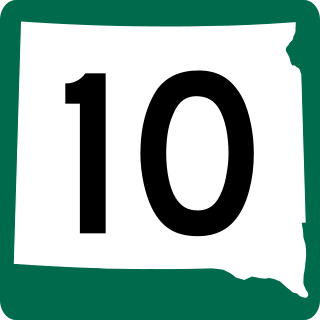
South Dakota Highway 10 (SD 10) is a 175.945-mile (283.156 km) state highway in the north-central and northeastern portions of South Dakota, United States. It connects SD 1804 in Pollock with the Minnesota state line southeast of Sisseton.

<span class="mw-page-title-main">North Dakota Highway 23</span> State highway in North Dakota, US

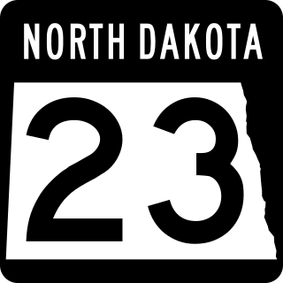
North Dakota Highway 23 is a 122.581-mile-long (197.275 km) east–west highway in northwestern North Dakota. ND 23's eastern terminus is at ND 41 near Velva, and its western terminus at U.S. Route 85 in Watford City.

The Bismarck Expressway is a state highway in Mandan and Bismarck, North Dakota, in the United States. It carries two unsigned highways: Interstate 194 (I-194) from its west end at exit 156 of I-94 to I-94 Business in Mandan, and North Dakota Highway 810 (ND 810) from I-94 Bus. in Mandan, around the south side of Bismarck back to I-94 Bus. in Bismarck. I-94 Bus. takes the designation from the end of ND 810 to the designation's eastern terminus at I-94 and US Highway 83 (US 83). The portion in Mandan, even where it is ND 810, is a freeway; once it crosses the Missouri River into Bismarck, it becomes a four-lane surface road.

<span class="mw-page-title-main">South Dakota Highway 44</span> State highway in South Dakota, United States

South Dakota Highway 44 (SD 44) is a state highway in southern South Dakota that runs from U.S. Route 385 (US 385) west of Rapid City to Interstate 29 (I-29) south of Sioux Falls. It is just more than 379 miles (610 km) long.

<span class="mw-page-title-main">North Dakota Highway 13</span> State highway in North Dakota, US

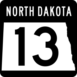
North Dakota Highway 13 is an approximately 205-mile-long (330 km) highway that serves southeast North Dakota. For the most part, the highway is a rural two-lane road, but for the final 12 miles (19 km) east of I-29 it is a four-lane divided road. Its eastern terminus is at the Minnesota state line over the Bois de Sioux River. The western terminus is located at ND 1804 about 13 miles (21 km) west of Linton and about 50 miles (80 km) south of Bismarck.

<span class="mw-page-title-main">South Dakota Highway 20</span> State highway in South Dakota, United States

South Dakota Highway 20 (SD 20) is a 385.079-mile (619.725 km) state highway in northern South Dakota, United States, that connects the Montana state line, west-southwest of Camp Crook, with the Minnesota state line, east-southeast of Revillo, via Buffalo, Bison, Timber Lake, Mobridge, Selby, and Watertown. From Mobridge to the Walworth–Potter county line, this highway is part of the Lewis and Clark Trail. From about Timber Lake to just west of Mobridge, this highway is part of the Native American Scenic Byway. From the Montana state line to Camp Crook, the highway is a dirt road.

<span class="mw-page-title-main">North Dakota Highway 1806</span> Highway in North Dakota

North Dakota Highway 1806 is a state highway in the U.S. state of North Dakota. ND 1806 and ND 1804 were named to reflect the years of Lewis and Clark's travels through the area, and run along the southwest and northeast sides of the Missouri River, respectively. ND 1806 consists of four separate segments, running along Lake Sakakawea and the Missouri River in McKenzie, Dunn, Mercer, Oliver, Morton, and Sioux Counties.

<span class="mw-page-title-main">U.S. Route 75 in Nebraska</span> Section of U.S. Numbered Highway in Nebraska, United States

U.S. Route 75 is a part of the United States Numbered Highway System that runs for 1,239 miles (1,994 km) from Dallas, Texas to Kittson County, Minnesota where it ends just short of the Canada–United States border. Within the State of Nebraska it is a state highway that enters Nebraska on the Kansas state line about 9 miles (14 km) south of Dawson and travels north across the extreme eastern portion of the state, to the Nebraska–Iowa border in South Sioux City where it crosses the Missouri River along a concurrency with Interstate 129. The northern 210 miles (340 km) of the route generally travels parallel to the Missouri River. The 87.32-mile (140.53 km) section between the I-680 interchange in Omaha and the Interstate 129 interchange is designated the Lewis & Clark Scenic Byway, one of nine scenic byways in the state.

<span class="mw-page-title-main">U.S. Route 83 in North Dakota</span> Segment of American highway

U.S. Route 83 (US 83) is a part of the U.S. Highway System that travels from the Mexico–United States border in Brownsville, Texas, to the Canada–United States border near Westhope, North Dakota. In the state of North Dakota, US 83 extends from the South Dakota border north to the Canada-United States border.

<span class="mw-page-title-main">North Dakota Highway 22</span> State highway in North Dakota, US

North Dakota Highway 22 (ND 22) is a 156.051-mile-long (251.140 km) major north–south state highway in North Dakota. It begins at the South Dakota state line south of the small town of Reeder and ends at ND 23 west of New Town and north of Mandaree. The route has one concurrency with U.S. Route 12. The highway widely parallels US 85, running about fifteen miles east of it.

<span class="mw-page-title-main">Business routes of Interstate 94</span>

There are 19 business routes of Interstate 94 (I-94) in the United States. These business routes connect the downtown business districts of cities to the freeway along I-94.

<span class="mw-page-title-main">South Dakota Highway 1804</span> State Highway in South Dakota

South Dakota Highway 1804 (SD 1804) is a 126.745-mile-long (203.976 km) state highway in the U.S. state of South Dakota.

<span class="mw-page-title-main">North Dakota Highway 24</span> State highway in North Dakota, US

North Dakota Highway 24 (ND 24) is a minor north–south highway contained entirely within Sioux County, North Dakota. It runs from one junction with ND 6 east of Selfridge near the South Dakota border to another junction on ND 6 west of Solen.

<span class="mw-page-title-main">South Dakota Highway 1806</span> State highway in the U.S. state of South Dakota

South Dakota Highway 1806 is a state highway in the U.S. state of South Dakota. It exists in four distinct sections. Its longest section begins at SD 273 and runs along the Missouri River nearly its whole length, serving Pierre. SD 1806 along with SD 1804 are numbered from the years of the Lewis and Clark Expedition.

References

Template:Attached KML/North Dakota Highway 1804
KML is from Wikidata
  1. 1 2 3 "North Dakota Route and Mileage Map" (PDF). North Dakota Department of Transportation. 2015–2016. Retrieved 2017-02-28.