Amidon, North Dakota

Last updated • 4 min readFrom Wikipedia, The Free Encyclopedia

Amidon, North Dakota
Amidon, North Dakota 2.jpg
Business in Amidon
ND Slope County Amidon.svg
Location of Amidon, North Dakota
Coordinates: 46°28′56″N103°19′11″W / 46.48222°N 103.31972°W / 46.48222; -103.31972
CountryUnited States
State North Dakota
County Slope
Founded1910
Area
[1]
  Total
0.63 sq mi (1.62 km2)
  Land0.63 sq mi (1.62 km2)
  Water0.00 sq mi (0.00 km2)
Elevation
[2]
2,904 ft (885 m)
Population
 (2020) [3]
  Total
24
  Estimate 
(2022) [4]
24
  Density38.28/sq mi (14.78/km2)
Time zone UTC-7 (Mountain (MST))
  Summer (DST) UTC-6 (MDT)
ZIP code
58620
Area code 701
FIPS code 38-02060
GNIS feature ID1035909 [2]

Amidon ( /ˈæmɪdɒn/ AM-i-don) is a city in and the county seat of Slope County, North Dakota, United States. [5]

Contents

Amidon was the smallest incorporated county seat at the 2000 census. When the 2020 census reported its population as 24, [3] it became the second-smallest incorporated county seat after Brewster, Nebraska, with a population of 17. In 2000, Amidon had 26 people to Brewster's 29. Two other unincorporated county seats are smaller: Mentone, Texas (population 19), the county seat of Loving County, and Gann Valley, South Dakota (population 14), the county seat of Buffalo County, South Dakota.

It is located on U.S. 85 approximately 31 miles (50 km) north of Bowman, and is the closest city to White Butte.

History

Amidon was founded in 1910 at the anticipated terminus of a Milwaukee Road branch line that diverged from the railroad's Pacific Extension in McLaughlin, South Dakota. The line was ultimately never built farther west of New England, North Dakota, making Amidon one of the few surviving North Dakota cities never to have been served by a rail line. [6] The original county courthouse was built in 1915. It was also the last county seat in the state to get electricity when Slope Electric Cooperative extended their distribution lines into Amidon in 1950.

Amidon is named after Charles F. Amidon, a federal judge for the United States District Court for the District of North Dakota. [7] [8]

Geography

According to the United States Census Bureau, the city has a total area of 0.64 square miles (1.66 km2), all land. [9]

Climate

According to the Köppen Climate Classification system, Amidon has a semi-arid climate, abbreviated "BSk" on climate maps. [10]

Climate data for Amidon (2,904 feet above sea level)
MonthJanFebMarAprMayJunJulAugSepOctNovDecYear
Record high °F (°C)64.0
(17.8)
68.0
(20.0)
81.0
(27.2)
91.0
(32.8)
98.0
(36.7)
107.0
(41.7)
108.0
(42.2)
108.0
(42.2)
105.0
(40.6)
94.0
(34.4)
81.0
(27.2)
64.0
(17.8)
108.0
(42.2)
Mean daily maximum °F (°C)29.0
(−1.7)
34.0
(1.1)
44.0
(6.7)
57.0
(13.9)
67.0
(19.4)
77.0
(25.0)
86.0
(30.0)
86.0
(30.0)
74.0
(23.3)
59.0
(15.0)
43.0
(6.1)
31.0
(−0.6)
57.3
(14.0)
Daily mean °F (°C)17.5
(−8.1)
22.5
(−5.3)
32.0
(0.0)
44.0
(6.7)
54.0
(12.2)
64.0
(17.8)
71.5
(21.9)
70.5
(21.4)
59.0
(15.0)
45.5
(7.5)
31.5
(−0.3)
20.0
(−6.7)
44.3
(6.8)
Mean daily minimum °F (°C)6.0
(−14.4)
11.0
(−11.7)
20.0
(−6.7)
31.0
(−0.6)
41.0
(5.0)
51.0
(10.6)
57.0
(13.9)
55.0
(12.8)
44.0
(6.7)
32.0
(0.0)
20.0
(−6.7)
9.0
(−12.8)
31.4
(−0.3)
Record low °F (°C)−34.0
(−36.7)
−35.0
(−37.2)
−28.0
(−33.3)
−5.0
(−20.6)
5.0
(−15.0)
30.0
(−1.1)
36.0
(2.2)
31.0
(−0.6)
17.0
(−8.3)
−8.0
(−22.2)
−26.0
(−32.2)
−40.0
(−40.0)
−40.0
(−40.0)
Average precipitation inches (mm)0.35
(8.9)
0.31
(7.9)
0.69
(18)
0.90
(23)
2.35
(60)
2.84
(72)
2.28
(58)
1.34
(34)
1.38
(35)
1.14
(29)
0.45
(11)
0.41
(10)
14.44
(366.8)
Source: Weather Channel [11]

Demographics

Historical population
CensusPop.Note
1920 145
1930 141−2.8%
1940 102−27.7%
1950 82−19.6%
1960 842.4%
1970 54−35.7%
1980 43−20.4%
1990 24−44.2%
2000 268.3%
2010 20−23.1%
2020 2420.0%
2022 (est.)24 [4] 0.0%
U.S. Decennial Census [12]
2020 Census [3]

2010 census

As of the census of 2010, there were 20 people, 11 households, and 7 families residing in the city. The population density was 31.3 inhabitants per square mile (12.1/km2). There were 17 housing units at an average density of 26.6 per square mile (10.3/km2). The racial makeup of the city was 100.0% White.

There were 11 households, of which 9.1% had children under the age of 18 living with them, 63.6% were married couples living together, and 36.4% were non-families. 36.4% of all households were made up of individuals, and 27.3% had someone living alone who was 65 years of age or older. The average household size was 1.82 and the average family size was 2.29.

The median age in the city was 64 years. 10% of residents were under the age of 18; 0.0% were between the ages of 18 and 24; 15% were from 25 to 44; 25% were from 45 to 64; and 50% were 65 years of age or older. The gender makeup of the city was 50.0% male and 50.0% female.

2000 census

As of the census of 2000, there were 26 people, 14 households, and 9 families residing in the city. The population density was 41.2 inhabitants per square mile (15.9/km2). There were 17 housing units at an average density of 26.9 per square mile (10.4/km2). The racial makeup of the city was 100.00% White.

There were 14 households, out of which 14.3% had children under the age of 18 living with them, 57.1% were married couples living together, 7.1% had a female householder with no husband present, and 35.7% were non-families. 35.7% of all households were made up of individuals, and 28.6% had someone living alone who was 65 years of age or older. The average household size was 1.86 and the average family size was 2.33.

In the city, the population was spread out, with 15.4% under the age of 18, 19.2% from 25 to 44, 38.5% from 45 to 64, and 26.9% who were 65 years of age or older. The median age was 50 years. For every 100 females, there were 85.7 males. For every 100 females age 18 and over, there were 83.3 males.

The median income for a household in the city was $27,188, and the median income for a family was $31,250. Males had a median income of $36,250 versus $16,250 for females. The per capita income for the city was $18,765. None of the population and none of the families were below the poverty line.

Education

Residents were within Central Elementary Public School District 32, [13] which operated Amidon Elementary School. The district was scheduled to dissolve on July 1, 2020. [14]

Related Research Articles

<span class="mw-page-title-main">Slope County, North Dakota</span> County in North Dakota, United States

Slope County is a county in the U.S. state of North Dakota. As of the 2020 census, the population was 706, making it the least populous county in North Dakota and the 18th-least populous county in the United States. The county seat is Amidon.

<span class="mw-page-title-main">Golden Valley County, North Dakota</span> County in North Dakota, United States

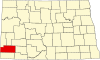
Golden Valley County is a county in the U.S. state of North Dakota. As of the 2020 census, the population was 1,736, making it the fourth-least populous county in North Dakota. The county seat is Beach.

<span class="mw-page-title-main">Barnes County, North Dakota</span> County in North Dakota, United States

Barnes County is a county in the U.S. state of North Dakota. As of the 2020 census, the population was 10,853. Its county seat is Valley City.

<span class="mw-page-title-main">Brewster, Nebraska</span> Village in and county seat of Blaine County, Nebraska, United States

Brewster is a village in and the county seat of Blaine County, Nebraska, United States. The population was 12 at the 2020 census.

<span class="mw-page-title-main">Hettinger, North Dakota</span> City in North Dakota, United States

Hettinger is a city in and the county seat of Adams County, North Dakota, United States. The population was 1,074 at the 2020 census.

<span class="mw-page-title-main">Brinsmade, North Dakota</span> City in North Dakota, United States

For people with the surname, see Brinsmade (surname).

<span class="mw-page-title-main">Bowman, North Dakota</span> City in North Dakota, United States

Bowman is a city in and the county seat of Bowman County, North Dakota, United States. The population was 1,470 at the 2020 census.

<span class="mw-page-title-main">Ellendale, North Dakota</span> City in North Dakota, United States

Ellendale is a city in Dickey County, North Dakota, United States. It is the county seat of Dickey County. The population was 1,125 at the 2020 census. Ellendale was founded in 1882. Ellendale is the home of Trinity Bible College, located on the former campus of the North Dakota State Normal and Industrial School and the Ellendale Opera House currently under renovation.

<span class="mw-page-title-main">Thompson, North Dakota</span> City in North Dakota, United States

Thompson is a city in Grand Forks County, North Dakota, United States. It is part of the "Grand Forks, ND-MN Metropolitan Statistical Area" or "Greater Grand Forks". It is located on the border of Allendale and Walle townships, with Walle on the east and Allendale on the west. The population was 1,101 at the 2020 census. Thompson was founded in 1881.

<span class="mw-page-title-main">Mott, North Dakota</span> City in North Dakota, United States

Mott is a city in and the county seat of Hettinger County, North Dakota, United States. The population was 653 at the 2020 census.

<span class="mw-page-title-main">Steele, North Dakota</span> City in North Dakota, United States

Steele is a city and county seat of Kidder County, North Dakota, United States. The population was 665 at the 2020 census.

<span class="mw-page-title-main">Napoleon, North Dakota</span> City in North Dakota, United States

Napoleon is a city in Logan County, North Dakota, United States. It is the county seat of Logan County. The population was 749 at the 2020 census.

<span class="mw-page-title-main">Washburn, North Dakota</span> City in North Dakota, United States

Washburn is a city in southern McLean County, North Dakota, United States. Located along the upper Missouri River, it is the county seat of McLean County. The population was 1,300 at the 2020 census.

<span class="mw-page-title-main">Stanton, North Dakota</span> City in North Dakota, United States

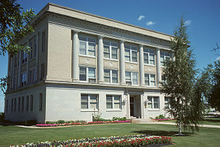
Stanton is a city in Mercer County, North Dakota, United States. It is the county seat of Mercer County. The population was 368 at the 2020 census. Stanton was founded in 1883 and became the county seat when Mercer County organized in 1884.

<span class="mw-page-title-main">Stanley, North Dakota</span> City in North Dakota, United States

Stanley is a city in Mountrail County, North Dakota, United States. It is the county seat of Mountrail County. The population was 2,321 at the 2020 census, making it the 22nd largest city in North Dakota. Stanley was founded in 1902. The town's economy is heavily connected to the nearby oil-rich Bakken Formation.

<span class="mw-page-title-main">Lakota, North Dakota</span> City in North Dakota, United States

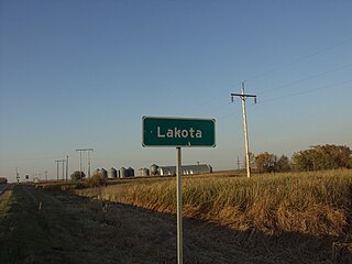
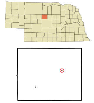
Lakota is a city in Nelson County, North Dakota, United States. It is the county seat of Nelson County Lakota is located 63 miles west of Grand Forks and 27 miles east of Devils Lake. The population was 683 at the 2020 census, making Lakota the 76th-largest city in North Dakota.

<span class="mw-page-title-main">Center, North Dakota</span> City in North Dakota, United States

Center is a city in Oliver County, North Dakota, United States. It is the county seat of, and the only incorporated place in, Oliver County. The population was 588 at the 2020 census.

<span class="mw-page-title-main">Lisbon, North Dakota</span> City in North Dakota, United States

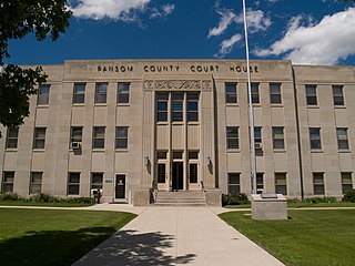
Lisbon is a city in and the county seat of Ransom County, North Dakota, United States. The population was 2,204 at the 2020 census.

<span class="mw-page-title-main">Forman, North Dakota</span> City in North Dakota, United States

Forman is a city in and the county seat of Sargent County, North Dakota, United States. The population was 509 at the 2020 census. Forman was founded in 1883.

<span class="mw-page-title-main">Finley, North Dakota</span> City in North Dakota, United States

Finley is a city in Steele County, North Dakota. It is the county seat of Steele County. The population was 401 at the 2020 census. Finley was founded in 1897.

References

  1. "ArcGIS REST Services Directory". United States Census Bureau. Retrieved September 20, 2022.
  2. 1 2 U.S. Geological Survey Geographic Names Information System: Amidon, North Dakota
  3. 1 2 3 "Explore Census Data". United States Census Bureau . Retrieved July 16, 2022.
  4. 1 2 "City and Town Population Totals: 2020-2022". United States Census Bureau. November 24, 2023. Retrieved November 24, 2023.
  5. "Find a County". National Association of Counties. Archived from the original on May 31, 2011. Retrieved June 7, 2011.
  6. Wick, Douglas A. "Amidon (Slope County)". North Dakota Place Names. Archived from the original on March 23, 2012. Retrieved May 8, 2011.
  7. Federal Writer's Project of the Works Progress Administration for the State of North Dakota (1977). The WPA Guide To 1930s North Dakota (2nd ed.). State Historical Society of North Dakota. p. 223. ISBN   1891419145.
  8. "Amidon, ND - Amidon, North Dakota - Amidon ND community". ePodunk. Archived from the original on July 13, 2002.
  9. "US Gazetteer files 2010". United States Census Bureau. Archived from the original on January 25, 2012. Retrieved June 14, 2012.
  10. "Amidon, North Dakota Köppen Climate Classification (Weatherbase)". Weatherbase.
  11. "Amidon, ND Monthly Weather Forecast". Weather Channel . Retrieved July 1, 2018.
  12. United States Census Bureau. "Census of Population and Housing" . Retrieved July 29, 2013.
  13. "2020 CENSUS - SCHOOL DISTRICT REFERENCE MAP: Slope County, ND" (PDF). United States Census Bureau . Retrieved August 13, 2021. - 2010 map
  14. "STATE BOARD OF PUBLIC SCHOOL EDUCATION MINUTES OF MEETING July 15, 2019" (PDF). Government of North Dakota. Retrieved August 13, 2021. This dissolution would not take effect until July 1, 2020 so there is time to review this information.