Related Research Articles

A postal code is a series of letters or digits or both, sometimes including spaces or punctuation, included in a postal address for the purpose of sorting mail.

911, sometimes written 9-1-1, is an emergency telephone number for Argentina, Canada, the Dominican Republic, Fiji, Jordan, Iraq, Mexico, Pakistan, Palau, Panama, the Philippines, Sint Maarten, the United States, and Uruguay, as well as the North American Numbering Plan (NANP), one of eight N11 codes. Like other emergency numbers, dialing 911 for whatever purpose is a crime in most jurisdictions. Penalties for abuse or misuse of 911 can range from probation or community service to fines and jail time. Offenders can also be ordered to undergo counseling and have their use of telephones restricted or suspended for a period of time as a condition of probation.
Enhanced 911 is a system used in North America to automatically provide the caller's location to 911 dispatchers. 911 is the universal emergency telephone number in the region. In the European Union, a similar system exists known as E112 and known as eCall when called by a vehicle.

An emergency telephone number is a number that allows a caller to contact local emergency services for assistance. The emergency number differs from country to country; it is typically a three-digit number so that it can be easily remembered and dialed quickly. Some countries have a different emergency number for each of the different emergency services; these often differ only by the last digit.

The North American Numbering Plan (NANP) is a telephone numbering plan for twenty-five regions in twenty countries, primarily in North America and the Caribbean. This group is historically known as World Zone 1 and has the telephone country code 1. Some North American countries, most notably Mexico, do not participate with the NANP.

5-1-1 is a transportation and traffic information telephone hotline in some regions of the United States and Canada. Travelers can dial 511, a three-digit telephone number, on landlines and most mobile phones. The number has also extended to be the default name of many state and provincial transportation department road conditions Web sites, such as Wisconsin's site. It is an example of an N11 code, part of the North American Numbering Plan.
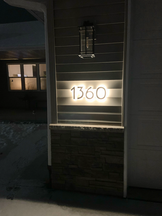
An address is a collection of information, presented in a mostly fixed format, used to give the location of a building, apartment, or other structure or a plot of land, generally using political boundaries and street names as references, along with other identifiers such as house or apartment numbers and organization name. Some addresses also contain special codes, such as a postal code, to make identification easier and aid in the routing of mail.

Roads and expressways in Chicago summarizes the main thoroughfares and the numbering system used in Chicago and its surrounding suburbs.

In the U.S. state of New Jersey, county routes exist in all 21 counties. They are typically the fourth type of roadway classified below the Interstate Highway, the U.S. Route numbered highway and the state highway. The County Route system is defined by two types in New Jersey. First, 500 Series County Routes, also called state secondary routes, are county highways numbered in a statewide system with three-digit numbers that begin with 5. These roads form a second network of routes that supplement the facilitation of the State Routes. Each 500 Series route is unique and is not permitted to be duplicated in another county for a separate route. The second category is defined as Non-500 Series County Routes. Non-500 Series County Routes include 1-digit, 2-digit, 600 Series, 700 Series and 800 Series. These, by definition, are discontinuous across county borders and must be contained entirely within that county. Unlike 500 Series County routes, these route numbers are unique to each county, and are typically assigned to more local routes than the statewide 500-series county route system. They are typically of a lesser classification of streets like minor arterials or collector roadways rather than major arterials or thoroughfares. In the counties that use 600-series numbers, the selection of this range was coordinated within the state, gradually replacing older systems of mainly one- and two-digit routes.

Interstate 94 (I-94) runs east–west for 352.4 miles (567.1 km) through the southern half of the US state of North Dakota, from the Montana state line east to the Red River at Fargo. The route generally follows the route of the Northern Pacific Railway.
Montavilla is a neighborhood in the Northeast and Southeast sections of Portland, Oregon, United States, and contains an area east of Mount Tabor and west of Interstate 205, from the Banfield to SE Division. It is bordered by North Tabor, Mount Tabor, South Tabor, Madison South, Hazelwood, and Powellhurst-Gilbert.
The Indiana Department of Transportation (INDOT) is responsible for the establishment and classification of a state highway network which includes Interstate Highways, U.S. Highways, and State Roads. There is no rule preventing the same numbering between state roads, U.S. routes, and Interstate highways, although traditionally, INDOT has avoided state road numbers which are the same as those on U.S. routes within the state.
In many jurisdictions in the United States, roads run along every section line, giving access to previously remote areas and serving in many instances as firebreaks. A road or arterial in which the centerline is laid out along a section line boundary is often referred to as a section line road or section line arterial. In Lubbock, Texas, Oklahoma City; Boise, Idaho; metropolitan areas of Arizona ; and much of the Las Vegas Valley, all major thoroughfares run along section lines, producing a readily identifiable grid.

A numbered street is a street whose name is an ordinal number, as in Second Street or Tenth Avenue. Such forms are among the most common street names in North America, but also exist in other parts of the world, especially in Colombia, which takes the system to an extreme, and the Middle East. Numbered streets were first used in Philadelphia and now exist in many major cities and small towns. Grid-based naming systems usually start at 1, and then proceed in numerical order. In the United States, seven out of the top ten most common street names are numbers, with the top three names being "2nd," "3rd," and "1st" respectively. Streets named "0th" are quite uncommon, however, but do exist, and negative numbered streets are extraordinarily rare. Fractional numbered streets exist in some places, such as 10+1⁄2 Street in Springfield, Illinois.

This is a list of the National Register of Historic Places listings in Brown County, South Dakota.
This is a list of the National Register of Historic Places listings in Minnehaha County, South Dakota.

This is a list of the National Register of Historic Places listings in Jerauld County, South Dakota.

The Arkansas Highway System is made up of all the highways designated as Interstates, U.S. Highways and State Highways in the US state of Arkansas. The system is maintained by the Arkansas Department of Transportation (ArDOT), known as the Arkansas State Highway Department (AHD) until 1977 and the Arkansas State Highway and Transportation Department (AHTD) from 1977 to 2017. The system contains 16,442.90 miles (26,462.28 km) of Interstates, U.S. Routes, state highways, and special routes. The shortest members are unsigned state highways Arkansas Highway 806 and Arkansas Highway 885, both 0.09 miles (0.14 km) in length. The longest route is U.S. Route 67, which runs 296.95 miles (477.89 km) from Texarkana to Missouri.

Emergency text messaging services are a technology that enables emergency call operators to receive text messages. Its use is encouraged for people with hearing impairment or who have trouble speaking; it can also be used for situations when calling may pose a safety risk, such as a home invasion or domestic abuse. Concerns mainly arise from the accessibility of such technologies as they are not universally applied and may be inconsistent; therefore, voice calls are generally preferred for its speed, accessibility, and clarity.
References
- ↑ Emergency Services Communications Systems (PDF) (North Dakota Century Code 57-40.6-10 part d.). April 5, 2001. Retrieved 2017-06-07.
- 1 2 3 Bailey, Ann (1988), "Promising new addressing system for rural areas", Farm Show, 12 (3): 20
- 1 2 3 4 "Questions and Answers About the Stark County Emergency E-9-1-1 Telephone System" (PDF). Archived from the original (PDF) on 2022-06-26. Retrieved 2017-06-07.
- ↑ "South Dakota Rural Addressing Procedural Handbook" (PDF). South Dakota 9-1-1 Task Force. September 1992. Retrieved 2017-06-07.