Manitoba Highway 34

Last updated

Manitoba Highway 34.svg

Provincial Trunk Highway 34

Route information
Maintained by Department of Infrastructure
Length142 km (88 mi)
Existed1955–present
Major junctions
South endND-20 (2015).svg ND 20 (Sarles–Crystal City Border Crossing)
Major intersectionsManitoba Highway 3.svg PTH 3

Manitoba Highway 23.svg PTH 23
Manitoba Highway 2.svg PTH 2

Manitoba Highway 1.svg PTH 1 (TCH)
North endManitoba Highway 16.svg PTH 16 (TCH) at Gladstone
Location
Country Canada
Province Manitoba
Rural municipalities
Highway system
Manitoba Highway 32.svg PTH 32 Manitoba Highway 39.svg PTH 39

Provincial Trunk Highway 34 (PTH 34) is a provincial primary highway located in the Canadian province of Manitoba. It runs from the U.S. border (where it meets with ND 20) to PTH 16 at the town of Gladstone.

Contents

PTH 34 is two lanes and runs north-south in the south-central region of the province. It is the main highway for the towns of Crystal City, Pilot Mound, and Holland. While the village of Austin is actually located 1 km east of the highway along PTH 1, the highway itself provides access to Austin's Agricultural Museum, which hosts the annual Thresherman's Reunion and Stampede each July. [1]

The speed limit is 90 km/h (55 mph).

Route description

PTH 34 begins in the Municipality of Louise at the North Dakota border, with the road continuing south towards Sarles, Calvin, and Devils Lake as North Dakota Highway 20 (ND 20). It heads north through rural farmland for a few kilometers, crossing Cypress Creek and becoming concurrent (overlapped) with PTH 3 (Boundary Commission Trail) to travel through the town of Crystal City, where they cross Crystal Creek and junction with PTH 3A and PR 423. The highway travels along the eastern edge of town before curving northeast to leave Crystal City and enter the town of Pilot Mound a few kilometers later. The road travels along the eastern edge, and mostly bypasses, the town, having an intersection with PR 253 here. They leave Pilot Mound and come to a T-intersection, with PTH 3 and the Boundary Commission Trail continue straight towards Morden, and PTH 34 turning due northward to enter the Rural Municipality of Lorne.

PTH 34 crosses the Pembina River at the eastern edge of Swan Lake to enter the Swan Lake First Nation, where it junctions with PTH 23. It leaves the reserve and heads through rural farmland for several kilometers, having a short concurrency with PR 245 near Bruxelles before going through a switchback to enter the Rural Municipality of Victoria. The travels along the eastern edge of the town of Holland, where it has intersections with PR 449 and PTH 2 (Red Coat Trail), before crossing the Assiniboine River and winding its way through wooded areas to enter the Municipality of North Norfolk.

PTH 34 re-enters farmland and travels through Pratt, having an intersection with PR 352, and winding it way north to pass along the western side of Austin, where it crosses a railroad track and PTH 1 (Trans-Canada Highway). The highway heads north through rural farmland for several kilometers, crossing into the Rural Municipality of WestLake – Gladstone near Pine Creek Station.

PTH 34 crosses Pine Creek and heads through rural areas for a few kilometers, passing by Gladstone Aerodrome and crossing over another creek before entering the town of Gladstone, where it comes to an end at an intersection with PTH 16 (Yellowhead Highway) on the south side of town. The road continues north as Morris Avenue into downtown. [2] [3]

The entire length of Manitoba Highway 34 is a rural, paved, two-lane highway.

History

PTH 34 first appeared on the 1955 Manitoba Highway Map. [4] When it was first added, the highway was a much shorter route between Gladstone and Holland, with the southern terminus located at PTH 2. The highway's southern terminus was extended to PTH 23 in 1957, [5] and then to PTH 3 the following year. [6]

The section between PTH 3 and the US border was originally designated as PTH 17. This southernmost portion was redesignated to PTH 34 in 1964. [7]

When the highway was initially added, it was originally slated to end at PTH 3 in the south and PTH 4 (now PTH 16) in the north. As a result, the highway was designated as PTH 34 to reflect this configuration.[ citation needed ]

Major intersections

DivisionLocationkmmiDestinationsNotes
Louise 00.0South plate.svg
ND-20 (2015).svg
ND 20 south Calvin, Devils Lake, Jamestown
Continuation into North Dakota
Canada–United States border at the Sarles–Crystal City Border Crossing
53.1Mile 3NFormer PR 201 east
106.2Manitoba Highway 3.svg PTH 3 west Killarney South end of PTH 3 concurrency
159.3Manitoba Highway 3A.svgManitoba secondary 423.svg PTH 3A west / PR 423 east Clearwater
Crystal City 1711
Pilot Mound 2415Manitoba secondary 253.svg PR 253 west Glenora
2918Manitoba Highway 3.svg PTH 3 east Morden North end of PTH 3 concurency
Lorne Swan Lake First Nation 4830Manitoba Highway 23.svg PTH 23  Ninette, Swan Lake
5836Manitoba secondary 245.svg PR 245 west Bruxelles South end of PR 245 concurrency
6339Manitoba secondary 245.svg PR 245 east Notre-Dame-de-Lourdes, Roseisle, Carman North end of PR 245 east concurrency
Victoria 7043Manitoba secondary 449.svg PR 449 east Notre-Dame-de-Lourdes
Holland 7245Manitoba Highway 2.svg PTH 2  Souris, Elm Creek
8553Crosses over Assiniboine River
8955Ladysmith RoadFormer PR 350 north
Victoria  North Norfolk boundary9660Mile 55NFormer PR 461 east
North Norfolk 10062Manitoba secondary 352.svg PR 352 north Sidney
Austin 11370Manitoba Highway 1.svg PTH 1 (TCH)  Brandon, Winnipeg
12376Mile 70NFormer PR 353 west
WestLake – Gladstone Gladstone 14288Manitoba Highway 16.svgYellowhead Blank.svg PTH 16 (TCH)  / YH  Neepawa, Portage la Prairie PTH 34 northern terminus; continues north as Morris Avenue (former PR 460 north)
1.000 mi = 1.609 km; 1.000 km = 0.621 mi

Related Research Articles

Provincial Trunk Highway 6 is a provincial primary highway located in the Canadian province of Manitoba. It runs from the Perimeter Highway of Winnipeg to the Thompson south city limits. It is also the main highway connecting Winnipeg to northern Manitoba. The speed limit is 100 km/h. The route is also used to deliver nickel from the Thompson mine to the Royal Canadian Mint in Winnipeg. The section of highway between its southern terminus near Winnipeg and the second junction with PTH 68 near Eriksdale is part of the Northern Woods and Water Route. The portion of the highway between Ponton and Thompson was known as Highway 391 prior to 1986.

Provincial Trunk Highway 9 is a provincial primary highway located in the Canadian province of Manitoba. It runs from Winnipeg north to Gimli.

<span class="mw-page-title-main">Manitoba Highway 2</span> Highway in Manitoba

Provincial Trunk Highway 2 is a 315-kilometre (196-mile) highway in the Canadian province of Manitoba. It runs from Highway 13 at the Manitoba-Saskatchewan border to Winnipeg's Perimeter Highway near Oak Bluff.

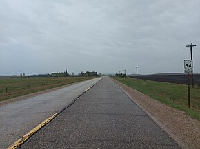
Provincial Trunk Highway 3A is a provincial primary highway located in the Canadian province of Manitoba. It runs from PTH 3 to the same route concurrent with PTH 34. The highway continues as PR 423 from its eastern terminus.

Provincial Trunk Highway 3 is a major provincial highway located in the Canadian province of Manitoba. It runs from the Saskatchewan boundary to the southwest city limits of Winnipeg, where it continues as Winnipeg Route 155. Prior before to the implementation of Winnipeg's City Route System, it extended to Pembina Highway.

Provincial Trunk Highway 17 is a provincial highway in the Canadian province of Manitoba. It runs from a junction with PR 224 and PR 325 near Hodgson to a junction with PTH 9 near Winnipeg Beach.

Provincial Trunk Highway 11 is a provincial primary highway located in the Eastman Region of the Canadian province of Manitoba. It runs from an intersection with PTH 59 near Victoria Beach to an intersection with PTH 1.

Provincial Trunk Highway 30 is a provincial highway in the Canadian province of Manitoba. It runs from the Neche–Gretna Border Crossing at the Canada–United States border to PTH 14.

Provincial Trunk Highway 5 is a provincial primary highway located in the Canadian province of Manitoba.

<span class="mw-page-title-main">Manitoba Highway 12</span> Highway in Manitoba

Provincial Trunk Highway 12 is a provincial primary highway located in the Canadian province of Manitoba. Lying entirely in the Eastman Region, it runs from the U.S. border to a dead end in Grand Beach. PTH 12 forms the Manitoba section of MOM's Way, a tourist route from Thunder Bay to Winnipeg. PTH 12 is primarily a two-lane highway except for two four-lane stretch between Steinbach and PTH 1 and a ten-kilometre concurrency with PTH 44.

Provincial Trunk Highway 23 is a major east-west provincial highway located in the southern portion of the Canadian province of Manitoba. It runs from PTH 21 just south of Hartney to PTH 59 in La Rochelle. Along its route, PTH 23 passes through the communities of Elgin, Ninette, Baldur, Miami, Lowe Farm, and Morris.

Provincial Trunk Highway 44 is an east-west provincial highway in the Eastman Region of the Canadian province of Manitoba.

Provincial Trunk Highway 13 is a provincial highway in the Canadian province of Manitoba. It is an RTAC route capable of handling RTAC vehicles such as trucks, truck and pony trailers, trucks and full trailers, truck tractors and semi-trailers, A-trains, B-trains, or C-trains. The route extends south to north from its junction with PTH 3 and PR 245 in Carman to its junction with PTH 1 and PR 430 north of Oakville. The northern terminus of PTH 13 is located between Portage la Prairie and Manitoba's capital city Winnipeg. The Central Manitoba Railway (CEMR) shortline rail intersects PTH 13 north of Carman, the Canadian Pacific Railway (CPR) intersects at Elm Creek, and the Canadian National Railway (CNR) at Oakville.

Provincial Trunk Highway 18 is a provincial highway in the Canadian province of Manitoba. Located in the Westman Region, it is a north-south route, with the southern terminus at the St. John–Lena Border Crossing at the Canada–United States border and the northern terminus at PTH 2, 7.1 kilometres southeast of Wawanesa. The highway passes through the communities of Killarney and Ninette. It is designated as an RTAC route, meaning it is capable of handling RTAC vehicles such as a truck, a truck and pony trailer, a truck and full trailer, a truck tractor and semi-trailer, an A-train, a B-train, or a C-train.

Provincial Trunk Highway 24 is a provincial highway in the Canadian province of Manitoba. It is an east–west route that runs from PTH 83 near Miniota, east through Oak River and Rapid City to the junction of PTH 10 and PR 262 between Brandon and Minnedosa.

Provincial Trunk Highway 50 is a provincial highway in the south-central region of the Canadian province of Manitoba. It runs from PTH 16 to PTH 5 and PR 361 in the village of McCreary.

Provincial Trunk Highway 45 is a provincial highway in the Parkland Region of the Canadian province of Manitoba. It runs from PTH 16 and PTH 83 in the town of Russell to PTH 10 five kilometres (3.1 mi) north of the village of Erickson.

Provincial Trunk Highway 42 is a short provincial highway in the southwest region of the Canadian province of Manitoba. It runs from PTH 16 in the town of Shoal Lake to PTH 41 just east of the French-speaking village of St. Lazare.

Provincial Trunk Highway 41 is a short provincial highway in the far southwest region of the Canadian province of Manitoba. It runs from PTH 1 and PR 542 in the village of Kirkella to PTH 16 and PTH 83 just south of Binscarth.

Provincial Trunk Highway 21 is a provincial highway in the Canadian province of Manitoba. It runs from the U.S. border to PTH 45 and PR 577 in the village of Oakburn.

References

Template:Attached KML/Manitoba Highway 34
KML is from Wikidata
  1. "Manitoba Thresherman's Reunion and Stampede". Manitoba Agricultural Museum. Retrieved June 8, 2021.
  2. Google (October 14, 2023). "Map of Manitoba Highway 34" (Map). Google Maps . Google. Retrieved October 14, 2023.
  3. Government of Manitoba. "Official Highway Map of Manitoba section #2" (PDF). Retrieved October 14, 2023.
  4. Manitoba Highway Map (PDF) (Map). Manitoba Minister of Infrastructure and Transportation. 1955. Retrieved March 6, 2015.
  5. Manitoba Highway Map (PDF) (Map). Manitoba Minister of Infrastructure and Transportation. 1957. Retrieved March 6, 2015.
  6. Manitoba Highway Map (PDF) (Map). Manitoba Minister of Infrastructure and Transportation. 1958. Retrieved March 6, 2015.
  7. Manitoba Highway Map (PDF) (Map). Manitoba Minister of Infrastructure and Transportation. 1964. Retrieved March 6, 2015.