Boyne Ave | ||||
Route information | ||||
Maintained by Department of Infrastructure | ||||
Length | 276 km (171 mi) | |||
Existed | 1950–present | |||
Major junctions | ||||
West end | PTH 21 near Hartney | |||
East end | PTH 59 in La Rochelle | |||
Location | ||||
Country | Canada | |||
Province | Manitoba | |||
Rural municipalities | ||||
Towns | Morris | |||
Highway system | ||||
|
Provincial Trunk Highway 23 (PTH 23) is a major east-west provincial highway in the southern portion of the Canadian province of Manitoba. It runs from PTH 21 just south of Hartney to PTH 59 in La Rochelle. [1] Along its route, PTH 23 passes through the communities of Elgin, Ninette, Baldur, Miami, Lowe Farm, and Morris. [2]
PTH 23 begins in the Rural Municipality of Grassland at an intersection with PTH 21 roughly 3 kilometres (1.9 mi) south of Hartney, just southeast of the remains of the former Hartney Airport. The highway heads due east for several kilometres, crossing several creeks to pass through the town of Elgin along Main Street, having an intersection with PR 448 here. As it leaves Elgin, it has a junction with PTH 22 on the north side of Whitewater Recreation Park, before heading east through farmland for the next several kilometres, passing just north of Fairfax (where it has an intersection with PR 444) to come to an intersection and become concurrent (overlap) with PTH 10 (John Bracken Highway) for the next several kilometres. PTH 23 follows PTH 10 south to Minto, where it splits off and heads due east again to enter the Rural Municipality of Prairie Lakes.
PTH 23 travels along the southern edges of Margaret, where it crosses PR 346, and Dunrea as it meanders its way into the town of Ninette and becoming concurrent with PTH 18. The pair pass through neighbourhoods along the shores of Pelican Lake before making a sharp onto Queen Street and travelling through the centre of downtown, where PTH 23 splits off and heads east along the narrow isthmus separating Pelican Lake from the smaller Grass Lake. PTH 23 leaves Ninette and travels along the southern edge of Belmont, passing through several switchbacks along the way, where it has a junction with PR 458 before crossing into the Rural Municipality of Argyle. [3]
PTH 23 almost immediately has an intersection with PTH 5 (Parks Route) as it heads to pass through the town of Baldur. The highway then goes through a switchback and has a junction with PR 342 at the community of Greenway before crossing into the Rural Municipality of Lorne. PTH 23 goes through several sharp curves for the several kilometres, passing along the eastern edge of Mariapolis and having junctions with PR 440 and PR 532. The highway now travels through the Swan Lake First Nation, where it has an intersection with PTH 34, before passing along the southern edge of the town of Swan Lake. PTH 23 passes by several small lakes as it passes by the communities of Somerset, where it crosses PR 242, St. Leon, crossing PR 244, and Altamont before crossing into the Rural Municipality of Thompson at Deerwood.
PTH 23 goes through a switchback before having a concurrency with PR 240 as it travels past Alexander Ridge Park. Passing through the town of Miami, it has an intersection with PR 338 on its way to travel through Rosebank, having an intersection with PR 432 here and crossing into the Rural Municipality of Roland. The highway crosses a creek several times as it has an intersection with PTH 3 and passes through the village of Roland. Having an intersection with PR 428, it continues east for a few kilometres to pass by Myrtle before having an intersection with PR 306 and entering the Rural Municipality of Morris at Kane.
PTH 23 junctions with PR 336 and PR 332 as it passes through Lowe Farm to enter the town of Morris. The highway follows Boyne Avenue as it crosses a couple of railroad tracks to pass through neighbourhoods and enter downtown, where it becomes concurrent with PTH 75 (Lord Selkirk Highway / Main Street). They head south through a business district, where PTH 23 splits off along Montreal Avenue to pass through neighbourhoods and cross a bridge over the Red River. PTH 23 goes through a switchback back as it leaves Morris and follows along the border of the Rural Municipality of Montcalm for the next several kilometres, where it has an intersection with PR 246, before crossing into the Rural Municipality of De Salaberry. The highway almost immediately crosses PR 200 and continues due east for the next several kilometres to pass through Dufrost, crossing a railroad line. After a few more kilometres, it crosses a creek before PTH 23 comes to an end at a junction with PTH 59. [4] [5] [6]
With the exclusion of the concurrency with PTH 75 in Morris, which is a four-lane boulevard, the entire length of PTH 23 is a rural, paved, two-lane highway.
The original PTH 23 went from Deloraine to Melita. This became part of PTH 3 in 1929.
PTH 23 was designated to its current route in 1950. [7]
When the current route was first added, the highway's western terminus was at PTH 10 near Minto, with the eastern terminus located at PTH 75 in Morris. The highway's eastern terminus was extended to its current location in 1952, [8] and to its current western terminus the following year. [9]
Division | Location | km | mi | Destinations | Notes |
---|---|---|---|---|---|
Grassland | | 0 | 0.0 | PTH 21 – Hartney, Deloraine | |
Elgin | 18 | 11 | PR 448 south | ||
| 20 | 12 | PTH 22 north – Souris | ||
| 28 | 17 | PR 444 south – Fairfax | former PR 348 | |
| 36 | 22 | PTH 10 north (John Bracken Highway) – Brandon | west end of PTH 10 overlap | |
Minto | 41 | 25 | PTH 10 south (John Bracken Highway) – Boissevain | east end of PTH 10 overlap | |
Prairie Lake | | 53 | 33 | PR 346 – Margaret, Ninga | |
| 63 | 39 | Dunlop Street - Dunrea | former PR 344 north | |
| 68 | 42 | PTH 18 south – Killarney | west end of PTH 18 overlap | |
Ninette | 71 | 44 | PTH 18 north – Wawanesa | east end of PTH 18 overlap | |
| 87 | 54 | PR 458 south – Belmont, Pleasant Valley | former PR 340 | |
Argyle | | 97 | 60 | PTH 5 (Parks Route) – Glenboro, Cartwright | former PR 258 |
Greenway | 113 | 70 | PR 342 – Cypress River, Glenora | ||
Lorne | | 120 | 75 | PR 440 south – Pilot Mound | |
| 126 | 78 | PR 532 north – St. Alphonse | ||
| Bruxelles Road (Road 64 West) | former PR 530 north | |||
Swan Lake First Nation | | 138 | 86 | PTH 34 – Holland, Pilot Mound | |
Lorne | | 151 | 94 | PR 242 – Somerset, La Rivière | |
| 156 | 97 | Road 50 West - St. Leon | former PR 431 south | |
| 159 | 99 | PR 244 – Notre Dame de Lourdes, Manitou | ||
Thompson | | 174 | 108 | PR 240 south – Darlingford | west end of PR 240 overlap |
| 176 | 109 | PR 240 north – Roseisle | east end of PR 240 overlap | |
Miami | 181 | 112 | PR 338 north – Stephenfield | ||
| 191 | 119 | PR 432 south – Rosebank, Morden | ||
Roland | Jordan | 199 | 124 | PTH 3 – Carman, Winkler, Morden | |
Roland | 205 | 127 | PR 428 south – Winkler | ||
Myrtle | 211 | 131 | Road 17 West | former PR 248 north | |
| 218 | 135 | PR 306 south – Plum Coulee | former PR 248 south | |
Morris | | 222 | 138 | PR 336 north – Sperling | |
| 225 | 140 | Road 9 West | former PR 336 south | |
Lowe Farm | 230 | 140 | PR 332 north – Brunkild | west end of PR 332 overlap | |
| 234 | 145 | PR 332 south – Rosenfeld | east end of PR 332 overlap | |
| 240 | 150 | PR 422 north (Meridian Road) – Rosenort | ||
Town of Morris | 246 | 153 | PTH 75 north (Main Street) – Winnipeg | west end of PTH 75 overlap | |
247 | 153 | PTH 75 south (Main Street) – Emerson | east end of PTH 75 overlap | ||
↑ / ↓ | | 248 | 154 | Crosses over Red River | |
Morris / Montcalm | | 252 | 157 | PR 246 (St. Mary's Road) – Aubigny | |
De Salaberry | | 263 | 163 | PR 200 – St. Adolphe, Dominion City | |
| Road 18 East | former PR 400 south | |||
La Rochelle | 276 | 171 | PTH 59 – St-Pierre-Jolys, St. Malo | ||
1.000 mi = 1.609 km; 1.000 km = 0.621 mi
|
Chemin River Road | |
Location | Mariapolis - Pilot Mound |
Length | 19.1 km (11.9 mi) |
Existed | 1966–present |
Provincial Road 440 (PR 440), also known as Chemin River Road, is a 19.1-kilometre-long (11.9 mi) north-south spur of PTH 23 in the Pembina Valley Region, providing a connection between the towns of Mariapolis and Pilot Mound.
PR 440 begins in the Municipality of Lorne at an intersection with PTH 23 just west of the town of Mariapolis, heading due south along Road 69W to enter the Rural Municipality of Argyle after a short distance. After passing through the locality of Dry River, the highway makes an abrupt left turn onto Road 19N and descends into a river valley, crossing a bridge over the Pembina River to enter the Municipality of Louise. It climbs back out of the valley before curving back southward through rural farmland for several kilometres before coming to an end at a junction with PR 253 just west of the town of Pilot Mound. The entire length of PR 440 is a gravel two-lane road. [5] [10]
Division | Location | km | mi | Destinations | Notes | |||
---|---|---|---|---|---|---|---|---|
Louise | | 0.0 | 0.0 | PR 253 – Pilot Mound, Glenora | Southern terminus | |||
Louise / Argyle boundary | | 7.5– 7.6 | 4.7– 4.7 | Bridge over the Pembina River | ||||
Argyle | No major junctions | |||||||
Lorne | | 19.1 | 11.9 | PTH 23 – Baldur, Mariapolis | Northern terminus; road continues north as Road 69W | |||
1.000 mi = 1.609 km; 1.000 km = 0.621 mi |
North Avenue | |
Location | Fairfax |
Length | 11.5 km (7.1 mi) |
Existed | 1992–present |
Provincial Road 444 (PR 444) is a 11.5-kilometre-long (7.1 mi) north-south spur of PTH 23 mostly within the Municipality of Grassland, providing access to the hamlet of Fairfax. In is entirely a two-lane road with the portion between Fairfax and PTH 23 being paved, where it is known as North Avenue, while the rest is composed of gravel. [3] [11]
Prior to 1992, what is now PR 444 was part of a much longer PR 348. [12] [13] [14]
Division | Location | km | mi | Destinations | Notes |
---|---|---|---|---|---|
Boissevain-Morton | | 0.0 | 0.0 | PR 343 – Regent, Boissevain | Southern terminus; Former PR 348 south followed PR 343 west |
Grassland | Fairfax | 10.4 | 6.5 | Front Street | Pavement begins |
| 11.5 | 7.1 | PTH 23 – Elgin, Brandon | Northern terminus; road continues north as Road 118W (former PR 348 north) | |
1.000 mi = 1.609 km; 1.000 km = 0.621 mi |
Lake William Road (Road 112W) | |
Location | William Lake Provincial Park |
Length | 8.3 km (5.2 mi) |
Existed | 1966–1992 |
Prior to 1992, PR 444 was the designation applied to Lake William Road (Road 112W), an 8.3-kilometre-long (5.2 mi) spur of PR 341, providing the only road access to William Lake Provincial Park. Now locally maintained, it is entirely a two-lane gravel road lying within the Municipality of Boissevain-Morton. [13] [14]
Provincial Trunk Highway 6 is a provincial primary highway located in the Canadian province of Manitoba. It runs from the Perimeter Highway of Winnipeg to the Thompson south city limits. It is also the main highway connecting Winnipeg to northern Manitoba. The speed limit is 100 km/h. The route is also used to deliver nickel from the Thompson mine to the Royal Canadian Mint in Winnipeg. The section of highway between its southern terminus near Winnipeg and the second junction with PTH 68 near Eriksdale is part of the Northern Woods and Water Route. The portion of the highway between Ponton and Thompson was known as Highway 391 prior to 1986.
Provincial Trunk Highway 9 is a provincial primary highway located in the Canadian province of Manitoba. It runs from Winnipeg north to Gimli.
Provincial Trunk Highway 2 is a 315-kilometre (196-mile) highway in the Canadian province of Manitoba. It runs from Highway 13 at the Manitoba-Saskatchewan border to Winnipeg's Perimeter Highway near Oak Bluff.
Provincial Trunk Highway 3 (PTH 3) is a major provincial highway located in the Canadian province of Manitoba. It runs from the Saskatchewan boundary to the southwest city limits of Winnipeg, where it continues as Winnipeg Route 155. Prior before to the implementation of Winnipeg's City Route System, it extended to Pembina Highway.
Provincial Trunk Highway 17 is a provincial highway in the Interlake Region of the Canadian province of Manitoba. It runs from a junction with PR 224 and PR 325 near Hodgson to a junction with PTH 9 near Winnipeg Beach.
Provincial Trunk Highway 11 (PTH 11) is a provincial primary highway located in the Eastman Region of the Canadian province of Manitoba. It runs from an intersection with PTH 59 near Victoria Beach to an intersection with PTH 1.
Provincial Trunk Highway 5 is a provincial primary highway located in the Canadian province of Manitoba.
Provincial Trunk Highway 12 is a provincial primary highway located in the Canadian province of Manitoba. Lying entirely in the Eastman Region, it runs from the U.S. border to a dead end in Grand Beach. PTH 12 forms the Manitoba section of MOM's Way, a tourist route from Thunder Bay to Winnipeg. PTH 12 is primarily a two-lane highway except for two four-lane stretch between Steinbach and PTH 1 and a ten-kilometre concurrency with PTH 44.
Provincial Trunk Highway 50 is a provincial highway in the south-central region of the Canadian province of Manitoba. It runs from PTH 16 to PTH 5 and PR 361 in the village of McCreary.
Provincial Trunk Highway 45 is a provincial highway in the Parkland Region of the Canadian province of Manitoba. It runs from PTH 16 and PTH 83 in the town of Russell to PTH 10 five kilometres (3.1 mi) north of the village of Erickson.
Provincial Trunk Highway 21 is a provincial highway in the Canadian province of Manitoba. It runs from the U.S. border to PTH 45 and PR 577 in the village of Oakburn.
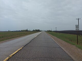
Provincial Trunk Highway 34 is a provincial primary highway located in the Canadian province of Manitoba. It runs from the U.S. border to PTH 16 at the town of Gladstone.
Provincial Road 242 is a north-south provincial road in the Pembina Valley and Central Plains Regions of Manitoba, Canada.
Provincial Road 245 is a 90.2-kilometre-long (56.0 mi) east-west highway in the Pembina Valley and Central Plains regions of Manitoba, Canada. It connects the communities of Bruxelles, Notre Dame de Lourdes, Roseisle, and Graysville with the town of Carman. PR 245 also provides access to Stephenfield Provincial Park.
Provincial Road 253 is a 62.9-kilometre-long (39.1 mi) east–west highway in the Westman and Pembina Valley regions of Manitoba. It serves as a paved connection to Killarney and Pilot Mound, providing access to Pleasant Valley and Glenora along the way. It crosses the Pembina River several times along its journey.
Provincial Road 261 is a 61.0-kilometre-long (37.9 mi) east–west highway in the Parkland and Central Plains Regions of Manitoba. It provides a connection between the communities of Riding Mountain, Kelwood, Glenella, Waldersee, and Amaranth, as well as a link between Riding Mountain National Park and Lake Manitoba.
Provincial Road 274 (PR 274) is a 91.6-kilometre-long (56.9 mi) north–south highway in the Parkland Region of Manitoba. It connects the towns of Gilbert Plains and Ethelbert, as well as providing a loop off of Provincial Trunk Highway 5 through the community of Keld. The portion of the highway through Keld is signed east–west, and the rest is signed north–south.
Provincial Road 325 is a 129.0-kilometre-long (80.2 mi) east–west highway in the Interlake Region of Manitoba, Canada. It connects the towns of The Narrows, Ashern, Hodgson, and Washow Bay, while also oddly providing a road connection between the Lake Manitoba Narrows and the Lake Winnipeg Narrows.
Provincial Road 332 is a 87.2-kilometre-long (54.2 mi) north–south highway in the Pembina Valley and Central Plains regions of Manitoba. Serving as a northern continuation of the much shorter PTH 30, it connects the communities of Rosenfeld, Lowe Farm, Brunkild, Starbuck, and Dacotah.
Provincial Road 342 (PR 342) is a 57.2-kilometre-long (35.5 mi) north–south highway in the Pembina Valley and Westman regions of Manitoba, Canada. Mostly a two-lane gravel road, it connects Clearwater with Glenora, Greenway, and Cypress River.