Lundar is an unincorporated community recognized as a local urban district situated in Manitoba, Canada. It is located in the Rural Municipality of Coldwell, in Manitoba's Interlake Region, 99 km north of Winnipeg on Hwy 6. Nearby attractions are Lake Manitoba and its beaches, and the Lundar Provincial Park. Lundar is home to a Canada goose refuge, and a large statue of a Canada goose is located in the community. Lundar was founded by Icelandic settlers.

Baldur is an unincorporated community recognized as a local urban district in the Canadian province of Manitoba, located in the Rural Municipality of Argyle. Baldur is the largest community of the municipality, which is in southwestern Manitoba between Brandon and Portage la Prairie. The community is named after the Norse god Baldur.

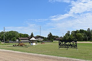
Benito is an unincorporated urban community in the Municipality of Swan Valley West, Manitoba, Canada.
Birch River is a local urban district in the northern portion of the Rural Municipality of Mountain, Manitoba, Canada. It is around 40 kilometers from Swan River, Manitoba.

Crystal City is an unincorporated community recognized as a local urban district in the Municipality of Louise within the Canadian province of Manitoba. It held village status prior to January 1, 2015. It is located on Highway 3, 16 kilometres north of the Canada–United States border and 200 kilometres southwest of Winnipeg.
Ethelbert is an unincorporated urban community in the Municipality of Ethelbert, Manitoba, Canada.
Fisher Branch is an unincorporated community recognized as a local urban district in the Rural Municipality of Fisher in the Canadian province of Manitoba. It is located on Highway 17 in the north Interlake Region of the province. Fisher Branch was originally named Wasoo, but later was changed to Fisher Branch because it was beside a branch of the Fisher River. The primary industry of Fisher Branch is agriculture.

Kinuso is a hamlet in northern Alberta, Canada within Big Lakes County, and surrounded by the Swan River First Nation reserve. It is located approximately 48 kilometres (30 mi) west of Slave Lake and 71 km east of High Prairie along Highway 2, south of the southern shore of Lesser Slave Lake.

Somerset is an unincorporated community recognized as a local urban district in the Municipality of Lorne within the Canadian province of Manitoba that held village status prior to January 1, 2015.
Mountain View is a hamlet in Alberta, Canada within Cardston County. It is located along Highway 5 approximately 25 kilometres (16 mi) west of Cardston and 20 kilometres (12 mi) east of Waterton Lakes National Park near the United States border. It is also a kickoff point for visitors to Police Outpost Provincial Park, 18 kilometers to the south.

Grassy Lake is a hamlet in Alberta, Canada within the Municipal District of Taber. It is located on the Crowsnest Highway (Highway 3), midway between the cities of Lethbridge to the west and Medicine Hat to the east. It is approximately 13 km (8.1 mi) west of Burdett and 34 km (21 mi) east of Taber. It has an elevation of 810 metres (2,660 ft). It was formerly incorporated as a village, dissolving into the Municipal District of Taber on July 1, 1996.
Warspite is a hamlet in Alberta, Canada within Smoky Lake County. It is located on Highway 28, between the Town of Smoky Lake and Village of Waskatenau. It has an elevation of 655 metres (2,149 ft).
Pierson is an unincorporated community recognized as a local urban district located in the Municipality of Two Borders in southwestern Manitoba, Canada. The Antler–Lyleton Border Crossing is located south of Pierson.

Bellis is a hamlet in central Alberta, Canada within Smoky Lake County. Previously an incorporated municipality, Bellis dissolved from village status on January 1, 1946 to become part of the Municipal District of Vilna No. 575.
Ranfurly is a hamlet in central Alberta, Canada within the County of Minburn No. 27. Previously an incorporated municipality, Ranfurly dissolved from village status on January 1, 1946 to become part of the Municipal District of Birch Lake No. 484.
Miniota, Manitoba is an unincorporated community recognized as a local urban district in Prairie View Municipality, Manitoba, Canada. It is located northwest of Virden near the intersection of PTH 83 and PTH 24. The post office opened in 1885 on 36-13-27W. It was originally named Parkisimo and changed to its present name in 1900. It had two railways in its history: the Canadian Pacific Railway and the Grand Trunk Railway. Both had rail points about one mile apart and there was a Miniota Station on the latter.
Laurier is an unincorporated urban community in the Rural Municipality of Ste. Rose, Manitoba, Canada. It is located on Highway 480, 3.2 km (2.0 mi) west of Highway 5, between the community of McCreary to the south and the community of Ste. Rose du Lac to the north.
Rosenfeld is a local urban district within the Rural Municipality of Rhineland in the Canadian province of Manitoba. It is recognized as a designated place by Statistics Canada.

The Municipality of Lorne is a rural municipality (RM) in the Canadian province of Manitoba.
