Gillam, Manitoba

Last updated
Gillam
Town
Welcome-Sign-Gillam-Manitoba.JPG
Welcome sign at Gillam
Canada Manitoba location map 2.svg
Red pog.svg
Gillam
Gillam in Manitoba
Canada location map 2.svg
Red pog.svg
Gillam
Gillam in Canada
Coordinates: 56°20′50″N94°42′28″W / 56.34722°N 94.70778°W / 56.34722; -94.70778
Country Canada
Province Manitoba
Region Northern
Census division 23
Government
  TypeTown Council
  MayorDwayne Forman
   MLA Eric Redhead
Area
  Total1,996.34 km2 (770.79 sq mi)
Elevation
145 m (476 ft)
Population
 (2016) [1]
  Total1,265
  Density0.6/km2 (2/sq mi)
Time zone UTC−6 (CST)
  Summer (DST) UTC−5 (DST)
Postal code
R0B
Area code(s) 204 and 431
Website www.townofgillam.com
[2]

Gillam is a town on the Nelson River in northern Manitoba, Canada. It is situated between Thompson and Churchill on the Hudson Bay Railway line.

Contents

Many residents of Gillam are employed by Manitoba Hydro at one of their many facilities or support groups. Located within Gillam's boundaries, Hydro has four hydro dams Kettle Generating Station, Long Spruce Generating Station, Limestone Generating Station (the largest in Manitoba) and Keeyask (in construction)—three HVDC stations—Radisson, Henday, and Keewatinohk—and a few support groups.

History

The large Gillam Local Government District ( 56°27′30″N94°12′30″W / 56.45833°N 94.20833°W / 56.45833; -94.20833 ) was established by the Manitoba government in the mid-1960s to facilitate development of hydroelectricity on the lower Nelson River. At 1,996.346 square kilometres (770.793 sq mi), Gillam is considered to be the 9th largest city or town in Canada by area, although the majority of the encompassing area of the District is largely uninhabited and undeveloped, but filled with many lakes, rivers and large forests of pine trees. It is the largest town in Manitoba, and one of four extremely large "towns" (the other three are Leaf Rapids, Snow Lake, and Lynn Lake) in northern Manitoba that, although technically towns, are mostly rural and are the size of most typical counties in the United States or eastern Canada. [3]

Gillam is also the home of Fox Lake Cree Nation, a First Nations Band. A majority of the members of Fox Lake Cree Nation live in the Town of Gillam or on Reserve Land in the nearby community of Bird, which is also located within the Gillam Local Government District. The ghost town of Sundance whose purpose was to facilitate the building of the Limestone Generating Station, is also within the District of Gillam. Once a busy, fully functioning town, it has since been abandoned and torn down after the completion of Limestone (named for the Limestone River that empties into the Nelson just downstream of the dam).

2019 BC murders

In late July and early August 2019, Gillam became an inadvertent subject in worldwide media after a burning Toyota RAV4 was found near Fox Lake Cree Nation. The RCMP confirmed it belonged to Leonard Dyck, a BC man whose body was found near a burning pickup truck south of the Stikine River Bridge in British Columbia. The pickup truck's owners, Bryer Schemegelsky and Kam Mcleod, then just considered missing persons, became suspects in the murder of Dyck and of a tourist couple whose bodies were found near Liard Hot Springs, BC. The RCMP launched a massive manhunt in the surrounding Gillam area, scouring through more than 11,000 square kilometres of dense brush and forest, and conducting searches of more than 500 houses in Gillam and nearby York Landing. After several days of fruitless searching, a breakthrough came through on August 3, when a damaged rowboat and several objects belonging to Schmegelsky and Mcleod were found scattered along the banks of the nearby Nelson River. On August 7, the RCMP confirmed that it had found the bodies of Schemegelsky and Mcleod about 1 kilometre from the rowboat, who died in dense brush of self-inflicted gunshot wounds. They were found approximately 65 kilometres north-east of Gillam.

Geography

Location of Gillam on Stephens Lake Stephens Lake, Manitoba.jpg
Location of Gillam on Stephens Lake

Gillam is located on the southeastern shore of Stephens Lake, a reservoir created by Manitoba Hydro in 1971 by the Kettle Dam on the Nelson River. [4]

Climate

Gillam has a subarctic climate (Dfc) with long and extremely cold winters, briefly interrupted by short and mild summers. Its inland position at 56 degrees latitude causes severe freezes in winter, even though its all-time extreme cold temperatures are less extreme than its normals suggest. The lack of warming chinook influences ensures that Gillam is colder than Fairbanks, Alaska, despite the fact the latter is eight degrees latitude farther north and a greater distance from the sea.

Climate data for Gillam A, Manitoba (1981-2010): 145m
MonthJanFebMarAprMayJunJulAugSepOctNovDecYear
Record high °C (°F)2.9
(37.2)
4.6
(40.3)
12.4
(54.3)
28.7
(83.7)
32.4
(90.3)
36.8
(98.2)
35.2
(95.4)
35.1
(95.2)
31.0
(87.8)
22.4
(72.3)
9.5
(49.1)
2.6
(36.7)
36.8
(98.2)
Mean daily maximum °C (°F)−19.7
(−3.5)
−16.0
(3.2)
−7.9
(17.8)
1.9
(35.4)
9.9
(49.8)
18.0
(64.4)
21.8
(71.2)
20.0
(68.0)
12.4
(54.3)
3.6
(38.5)
−7.6
(18.3)
−16.9
(1.6)
1.6
(34.9)
Daily mean °C (°F)−24.4
(−11.9)
−21.7
(−7.1)
−14.6
(5.7)
−4.4
(24.1)
3.9
(39.0)
11.6
(52.9)
15.8
(60.4)
14.4
(57.9)
7.9
(46.2)
0.0
(32.0)
−11.6
(11.1)
−21.4
(−6.5)
−3.7
(25.3)
Mean daily minimum °C (°F)−29.0
(−20.2)
−27.3
(−17.1)
−21.2
(−6.2)
−10.6
(12.9)
−2.2
(28.0)
5.1
(41.2)
9.7
(49.5)
8.7
(47.7)
3.3
(37.9)
−3.5
(25.7)
−15.5
(4.1)
−25.9
(−14.6)
−9.0
(15.7)
Record low °C (°F)−46.1
(−51.0)
−45.0
(−49.0)
−42.6
(−44.7)
−33.0
(−27.4)
−22.8
(−9.0)
−6.1
(21.0)
−1.7
(28.9)
−1.7
(28.9)
−9.1
(15.6)
−26.9
(−16.4)
−39.4
(−38.9)
−45.1
(−49.2)
−46.1
(−51.0)
Average precipitation mm (inches)19.6
(0.77)
19.0
(0.75)
22.7
(0.89)
21.7
(0.85)
42.6
(1.68)
55.8
(2.20)
78.6
(3.09)
76.1
(3.00)
56.8
(2.24)
42.2
(1.66)
38.0
(1.50)
23.3
(0.92)
496.4
(19.55)
Average snowfall cm (inches)25.2
(9.9)
24.6
(9.7)
27.6
(10.9)
22.1
(8.7)
15.7
(6.2)
2.1
(0.8)
0.0
(0.0)
0.0
(0.0)
4.6
(1.8)
26.2
(10.3)
44.2
(17.4)
28.9
(11.4)
221.2
(87.1)
Average precipitation days (≥ 0.2 mm)13.211.510.98.410.611.414.114.114.613.615.113.3150.7
Average snowy days (≥ 0.2 cm)14.512.611.67.54.71.00.00.01.69.115.314.592.3
Source: Environment and Climate Change Canada [5]

Demographics

Historical population
YearPop.±%
19811,427    
19861,909+33.8%
1996 1,534−19.6%
2001 1,178−23.2%
2006 1,209+2.6%
2011 1,317+8.9%
2016 1,265−3.9%
2021 1,007−20.4%
[ citation needed ] [2] [6] [1] [7]

In the 2021 Census of Population conducted by Statistics Canada, Gillam had a population of 1,007 living in 352 of its 588 total private dwellings, a change of

As a designated place, Gillam had a population of 836 living in 295 of its 471 total private dwellings in 2021, a change of

Amenities

Gillam shopping centre Gillam Shopping Centre.JPG
Gillam shopping centre

Gillam Recreation Centre offers a movie theatre, ice skating, hockey, curling, a gymnasium, a weight room, meeting rooms, a youth activity room and a library. There are also many small businesses, a small mall, a locally owned pharmacy, grocery store, school (K-12), Canada Post office, Co-op card lock/gas station, Co-op convenience store, Royal Canadian Legion, a train station and a local Royal Canadian Mounted Police detachment.

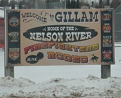
The Town of Gillam often has activities and events planned throughout the year. The Winter Carnival is an annual, week long series of events held in March. The Welcome Back Weekend is full of fun activities including the annual firework show which brings out a large portion of the town's population. This is held the weekend immediately after the Labour Day holiday.

Popular summer activities in the Gillam area are fishing and boating on the many lakes and rivers, while hunters search for game animals such as bear, caribou, moose, wolf, ptarmigan and grouse. The town has community parks and playgrounds, and Pumphouse Beach is just 2 km (1.2 mi) away from town. The three hydroelectric dams near town may be toured with a guide. In colder months, snowmobilers have access to hundreds of miles of groomed trails. [9]

Transportation

Gillam is situated on the Hudson Bay Railway line to Churchill and receives limited VIA rail passenger service at the Gillam railway station. Severe flooding in May 2017 caused several washouts, closing the line at Amery and suspending service beyond Gillam. Repairs were delayed due to a dispute with track owners OmniTRAX and full service did not resume until December 2018.

Manitoba Provincial Road 280 links Gillam to the rest of Manitoba, making it one of the northernmost communities in the province accessible by year-round road. Scheduled flights to Winnipeg and Thompson are available via Calm Air at Gillam Airport.

Media

Manitoba Provincial Road 280 (red) links Gillam to the rest of Manitoba Manitoba Provincial Road 280 map.png
Manitoba Provincial Road 280 (red) links Gillam to the rest of Manitoba

See also

Related Research Articles

<span class="mw-page-title-main">Nelson River</span> River in Manitoba, Canada

The Nelson River is a river of north-central North America, in the Canadian province of Manitoba. The river drains Lake Winnipeg and runs 644 kilometres (400 mi) before it ends in Hudson Bay. Its full length is 2,575 kilometres (1,600 mi), it has mean discharge of 2,370 cubic metres per second (84,000 cu ft/s), and has a drainage basin of 1,072,300 square kilometres (414,000 sq mi), of which 180,000 square kilometres (69,000 sq mi) is in the United States.

<span class="mw-page-title-main">Manitoba Hydro</span> Electric power and natural gas utility company in Manitoba, Canada

The Manitoba Hydro-Electric Board, operating as Manitoba Hydro, is the electric power and natural gas utility in the province of Manitoba, Canada. Founded in 1961, it is a provincial Crown Corporation, governed by the Manitoba Hydro-Electric Board and the Manitoba Hydro Act. Today the company operates 16 interconnected generating stations. It has more than 527,000 electric power customers and more than 263,000 natural gas customers. Since most of the electrical energy is provided by hydroelectric power, the utility has low electricity rates. Stations in Northern Manitoba are connected by a HVDC system, the Nelson River Bipole, to customers in the south. The internal staff are members of the Canadian Union of Public Employees Local 998 while the outside workers are members of the International Brotherhood of Electrical Workers Local 2034.

<span class="mw-page-title-main">Minnedosa, Manitoba</span> Town in Manitoba, Canada

Minnedosa is a town in the southwestern part of the Canadian province of Manitoba situated 50 kilometres (32 mi) north of Brandon, Manitoba on the Little Saskatchewan River. The town's name means "flowing water" in the Dakota language. The population of Minnedosa reported in the 2021 Canadian Census was 2,741. The town is surrounded by the Rural Municipality of Minto – Odanah.

<span class="mw-page-title-main">Carrot River, Saskatchewan</span> Town in Saskatchewan, Canada

Carrot River is a town located in east-central Saskatchewan in Canada. The administration office for the Rural Municipality of Moose Range No. 486 is located in Carrot River.

<span class="mw-page-title-main">Rivers, Manitoba</span> Unincorporated community in Manitoba, Canada

Rivers is an unincorporated urban community in the Riverdale Municipality within the Canadian province of Manitoba. It is located 40 kilometres (25 mi) northwest of Brandon, 473 metres (1,552 ft) above sea level. It is within the Westman Region. Agriculture, health and related businesses provide income for the community and area. Rivers has a population of 1,257 people in the 2016 census.

<span class="mw-page-title-main">Norway House</span> Population centre in Manitoba, Canada

Norway House is a population centre of over 5,000 people, some 30 km (19 mi) north of Lake Winnipeg, on the bank of the eastern channel of Nelson River, in the province of Manitoba, Canada. The population centre shares the name Norway House with the northern community of Norway House and Norway House 17, a First Nation reserve of the Norway House Cree Nation. Thus, Norway House has both a Chief and a Mayor.

<span class="mw-page-title-main">Cross Lake, Manitoba</span> Place in Manitoba, Canada

Cross Lake is a community in the Northern Region of the Canadian province of Manitoba, situated on the shores of the Nelson River where the river enters the namesake Cross Lake. An all-weather road, PR 374, connects the communities to PR 373 via the Kichi Sipi Bridge.

<span class="mw-page-title-main">Easterville, Manitoba</span> Unincorporated community in Manitoba, Canada

Easterville is an unincorporated community, designated as a northern community, in the Canadian province of Manitoba.

<span class="mw-page-title-main">Grand Rapids, Manitoba</span> Town in Manitoba, Canada

Grand Rapids is a town in Manitoba, Canada, on the northwestern shore of Lake Winnipeg where the Saskatchewan River enters the lake. As the name implies, the river had a significant drop at this point. In modern days, a large hydroelectric plant has been built there. Cedar Lake, a short distance upriver, provides a natural water source for the plant. Provincial Trunk Highway 6, the region's primary roadway, crosses the Saskatchewan River at the Grand Rapids Bridge.

<span class="mw-page-title-main">Lambton Shores</span> Municipality in Ontario, Canada

Lambton Shores is a municipality in Lambton County, Ontario, Canada, that is on the southern shores of Lake Huron.

Seebe is a former hamlet and ghost town in Alberta, Canada, within the Municipal District of Bighorn No. 8. It is a former Calgary Power Company Ltd. employee townsite that was closed on August 31, 2004.

<span class="mw-page-title-main">Nelson River Hydroelectric Project</span>

The Nelson River Hydroelectric Project refers to the construction of a series of dams and hydroelectric power plants on the Nelson River in Northern Manitoba, Canada. The project began to take shape in the late 1950s, with the planning and construction of the Kelsey dam and hydroelectric power station, and later was expanded to include the diversion of the upper Churchill River into the Nelson River and the transformation of Lake Winnipeg, the world's 11th largest freshwater lake, into a hydroelectric reservoir. The project is owned and operated by Manitoba Hydro, the electrical utility in the province.

<span class="mw-page-title-main">Split Lake, Manitoba</span> Unincorporated community in Manitoba, Canada

Split Lake, or Tataskwayak, is a community in Manitoba on the northern shore of Split Lake along the Nelson River, about 240 mi (390 km) west southwest of the river's mouth at Hudson Bay, and is within the Tataskweyak Cree Nation reserve, Split Lake 171. The community is located 143 km (89 mi) northeast of Thompson, roughly the halfway point of PR 280 in Northern Manitoba, and 169 km (105 mi) west of Gillam.

<span class="mw-page-title-main">Ear Falls</span> Township in Ontario, Canada

Ear Falls is a township located in Northwestern Ontario, Canada, on the banks of the English River, Lac Seul, Pakwash Lake and Wenesaga Lake. It is located along Highway 105, 100 kilometres (62 mi) north of Highway 17 and Vermilion Bay, about halfway between Highway 17 and Red Lake, or about 480 kilometres (300 mi) northwest of Thunder Bay.

<span class="mw-page-title-main">Rural Municipality of Kelsey</span> Rural municipality in Manitoba, Canada

Kelsey is a Manitoban rural municipality embedded within the province's Northern Region. It consists of several disjoint parts. The largest part is Carrot Valley, located around and southwest of The Pas along the Carrot River, but the communities of Wanless and Cranberry Portage, located further north, are also part of the municipality. It is 867.64 km2 large. Also lying in the area around The Pas is the Opaskwayak Cree Nation Indian reserve.

<span class="mw-page-title-main">Long Spruce Generating Station</span>

Long Spruce Generating Station is a run-of-the-river hydroelectric dam on the Nelson River approximately 745 kilometres (463 mi) northeast of Winnipeg in the Canadian province of Manitoba.

<span class="mw-page-title-main">Limestone Generating Station</span> Dam in Gillam, Manitoba

Limestone Generating Station is a run-of-the-river hydroelectric dam on the Nelson River approximately 750 kilometres (470 mi) north of Winnipeg near Gillam, Manitoba. Part of the Nelson River Hydroelectric Project, Limestone was Manitoba Hydro's fifth and largest generating station to be built on the Nelson River. The station was built on the Nelson River at Long Spruce Rapids. The site is approximately 23 kilometres (14 mi) downstream of Manitoba Hydro's Long Spruce Generating Station.

The Kettle Generating Station, also known as Kettle Rapids Generating Station, is a run-of-the-river hydroelectric power station on the Lower Nelson River in Manitoba, Canada. It is located 6 km (4 mi) northwest of Gillam. As part of the Nelson River Hydroelectric Project, the power station was completed in 1973 and the last generator commissioned in 1974. It has an installed capacity of 1,220 megawatts (1,640,000 hp) and is the second largest power station in Manitoba.

<span class="mw-page-title-main">Southern Indian Lake</span>

Southern Indian Lake is a large lake in northern Manitoba, Canada. It has an area of 2,247 km2 (868 sq mi) with a surface elevation of 258 m (846 ft).

<span class="mw-page-title-main">Stephens Lake (Manitoba)</span>

Stephens Lake is a reservoir in the province of Manitoba in Canada north of Lake Winnipeg. The reservoir was created in 1971 by the Kettle Dam and received its official name of Stephens Lake in 1972. The lake is 32 km (20 mi) long from the inflow of the Nelson River to the outflow at the Kettle Dam. The lake is located 45 km (28 mi) northeast of Split Lake and 150 km (93 mi) west of the Hudson Bay.

References

  1. 1 2 "Gillam, Town [Census subdivision], Manitoba and Division No. 23, Census division [Census division], Manitoba". Statistics Canada. Government of Canada. 8 February 2017. Retrieved May 9, 2018.
  2. 1 2 "Population and dwelling counts, for Canada, provinces and territories, and census subdivisions (municipalities), 2011 and 2006 censuses (Manitoba)". Statistics Canada. 2012-02-08. Retrieved 2012-10-13.
  3. "Gillam". Geographical Names Data Base . Natural Resources Canada.
  4. "Stephens Lake". Geographical Names Data Base . Natural Resources Canada.
  5. "Gillam A, Manitoba". Canadian Climate Normals 1981–2010 (in English and French). Environment and Climate Change Canada. Retrieved February 5, 2024.
  6. "Corrections and updates". Statistics Canada. 2012-09-19. Retrieved 2012-10-13.
  7. 1 2 "Population and dwelling counts: Canada, provinces and territories, and census subdivisions (municipalities), Manitoba". Statistics Canada. February 9, 2022. Retrieved February 20, 2022.
  8. "Population and dwelling counts: Canada and designated places". Statistics Canada. February 9, 2022. Retrieved February 5, 2023.
  9. "Recreation and Leisure Activities". Town of Gillam. 2013. Retrieved 2014-02-26.
  10. "Microwave Hook-Up Gives North Live TV". Winnipeg Free Press. April 29, 1969. p. 28.