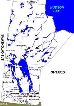
List of towns in Manitoba

Last updated

Cities and towns in Manitoba Manmap.png
Cities and towns in Manitoba

A town is an incorporated urban municipality in the Canadian province of Manitoba. [1] Under current legislation, a community must have a minimum population of 1,000 and a minimum density of 400 people per square kilometre to incorporate as an urban municipality. [2] As an urban municipality, the community has the option to be named a town, village or urban municipality. [2] It also has the option of being named a city once it has a minimum population of 7,500 (there are no towns currently eligible for city status; the closest is Niverville, with a population of 5,947 in the Canada 2021 Census). [2]

Contents

Manitoba has 25 towns [3] that had a cumulative population of 56,946 in the 2016 census. [4] The province's largest and smallest towns by population are The Pas and Grand Rapids with populations of 5,369 and 268 respectively. [4] The province's largest and smallest towns by land area are Gillam and Lac du Bonnet with land areas of 1,996.34 km2 (770.79 sq mi) and 2.15 km2 (0.83 sq mi) respectively. [4] The province previously had 50 towns before a series of provincially mandated amalgamations took effect on January 1, 2015.

Communities meeting the population minimum are not always incorporated as urban municipalities. There are 22 unincorporated communities with a population of more than 1,000 within Manitoba's rural municipalities. The largest of these is Oakbank in the Rural Municipality of Springfield with a population of 4,604.

List

NameIncorporation
date [5]
2016 Census of Population [4]
Population
(2016)
Population
(2011)
Change
Land area
(km²)
Population
density
Altona [lower-alpha 1] December 31, 19454,2124,088+3.0%9.38
Arborg [lower-alpha 1] January 1, 19641,2321,152+6.9%2.21
Beausejour [lower-alpha 1] November 5, 19083,2193,126+3.0%5.42
Carberry [lower-alpha 1] December 20, 18891,7381,669+4.1%4.96
Carman [lower-alpha 1] November 3, 18993,1643,027+4.5%4.34
Churchill [lower-alpha 2] January 1, 1959899813+10.6%53.96
Gillam [lower-alpha 2] May 1, 19661,2651,332−5.0%1,996.34
Grand Rapids [lower-alpha 2] March 1, 1962268279−3.9%87.04
Lac du Bonnet [lower-alpha 1] December 31, 19471,0891,069+1.9%2.15
Leaf Rapids [lower-alpha 2] December 1, 1971582498+16.9%1,272.83
Lynn Lake [lower-alpha 2] May 9, 1959494674−26.7%910.23
Melita [lower-alpha 1] May 15, 19021,0421,069−2.5%3.04
Minnedosa March 2, 18832,4492,587−5.3%15.39
Morris January 29, 18831,8851,797+4.9%6.10
Neepawa November 23, 18834,6093,629+27.0%17.35
Niverville [lower-alpha 1] January 1, 19694,6103,540+30.2%8.69
The Pas May 17, 19125,3695,513−2.6%49.52
Powerview-Pine Falls [lower-alpha 1] [lower-alpha 3] January 1, 19511,3161,314+0.2%5.02
Snow Lake [lower-alpha 2] June 2, 1947899723+24.3%1,211.89
Ste. Anne [lower-alpha 1] January 1, 19632,1141,626+30.0%4.23
Stonewall [lower-alpha 1] August 14, 19064,8094,536+6.0%5.99
Swan River May 11, 19084,0143,907+2.7%7.16
Teulon [lower-alpha 1] May 6, 19191,2011,124+6.9%3.23
Virden [lower-alpha 1] August 2, 18903,3223,114+6.7%8.97
Winnipeg Beach [lower-alpha 1] November 2, 19091,1451,011+13.3%3.87
Total56,94653,217+7.0%5,699.31
Notes
  1. 1 2 3 4 5 6 7 8 9 10 11 12 13 14 The towns of Altona, Arborg, Beausejour, Carberry, Carman, Lac du Bonnet, Melita, Niverville, Powerview-Pine Falls, Ste. Anne, Stonewall, Teulon, Virden and Winnipeg Beach were originally incorporated as villages. [5]
  2. 1 2 3 4 5 6 The towns of Churchill, Gillam, Grand Rapids, Leaf Rapids, Lynn Lake and Snow Lake were originally incorporated as local government districts. [5]
  3. The Town of Powerview-Pine Falls originally incorporated under the name of the Village of Powerview. Its renaming occurred on May 1, 2005 when it simultaneously absorbed the neighbouring community of Pine Falls and changed to town status. [6]

Former towns

A list of formerly incorporated towns, excluding current and former cities that previously held town status. [lower-alpha 1] [lower-alpha 2]

Notes
  1. The cities of Dauphin, Flin Flon, Morden, Portage la Prairie, Selkirk, Steinbach, Thompson and Winkler were formerly incorporated as towns.
  2. The former cities of St. Boniface, East Kildonan, Transcona, and West Kildonan (all amalgamated into the City of Winnipeg in 1972) were also formerly incorporated as towns prior to becoming cities.
  3. The Manitoba government amalgamated 65 rural municipalities, 25 towns, and 17 villages into 47 municipalities on January 1, 2015 in order to bring these municipalities into compliance with the minimum population requirements of the Municipal Act. [2] [5]
  4. The Town of Brooklands amalgamated with the City of St. James in 1969; part of the City of Winnipeg since January 1, 1972. [7]
  5. The former Town of East Selkirk was incorporated in 1883 and later dissolved in 1904. [8]
  6. The former Town of Emerson amalgamated with the municipality of West Lynne in 1883 and briefly held city status from 1883 to 1886. [9]
  7. The former Town of Shoal Lake amalgamated with the former Rural Municipality (RM) of Shoal Lake to form the now-former Municipality of Shoal Lake on January 1, 2011; part of RM of Yellowhead since January 1, 2015. [10]
  8. The former Town of Tuxedo and eleven other municipalities were amalgamated with the City of Winnipeg on January 1, 1972. [11]

See also

Related Research Articles

<span class="mw-page-title-main">Niverville, Manitoba</span> Place in Manitoba, Canada

Niverville is a town in the Eastman Region, Manitoba, Canada. The town lies between the northwest corner of the Rural Municipality of Hanover and the southeastern portion of the Rural Municipality of Ritchot. Niverville's population as of the 2021 census is 5,947, the largest town and 10th-largest community in Manitoba.

<span class="mw-page-title-main">Winnipeg Metropolitan Region</span> Metropolitan area in Manitoba, Canada

The Winnipeg Metropolitan Region is a metropolitan area in the Canadian province of Manitoba located in the Red River Valley in the southeast portion of the province of Manitoba, Canada. It contains the provincial capital of Winnipeg and 17 surrounding rural municipalities, cities, and towns.

<span class="mw-page-title-main">Rural Municipality of Hanover</span> Place in Manitoba, Canada

The Rural Municipality of Hanover is a rural municipality (RM) in southeastern Manitoba, Canada, located southeast of Winnipeg in Division No. 2.

The Rural Municipality of Bifrost is a former rural municipality (RM) in the Canadian province of Manitoba. It was originally incorporated as a rural municipality on December 1, 1907. It ceased on January 1, 2015 as a result of its provincially mandated amalgamation with the Village of Riverton to form the Municipality of Bifrost – Riverton.

<span class="mw-page-title-main">Rivers, Manitoba</span> Unincorporated community in Manitoba, Canada

Rivers is an unincorporated urban community in the Riverdale Municipality within the Canadian province of Manitoba. It is located 40 kilometres (25 mi) northwest of Brandon, 473 metres (1,552 ft) above sea level. It is within the Westman Region. Agriculture, health and related businesses provide income for the community and area. Rivers has a population of 1,257 people in the 2016 census.

<span class="mw-page-title-main">Eastman Region</span>

Eastern Manitoba, or the Eastman Region, is an informal geographic region of the Canadian province of Manitoba. It is bounded on the north by the Winnipeg River and Lake Winnipeg, on the east by the Manitoba-Ontario border, on the south by the Canada–US border, and on the west by the Red River.

Old Kildonan is the northernmost city ward of Winnipeg, Manitoba. Before the City of Winnipeg Act of 1972, it was an independent unincorporated municipality called the Municipality of Old Kildonan; prior to that, from 1914, it was a subdivision of the Rural Municipality of Kildonan.

<span class="mw-page-title-main">Amalgamation of Winnipeg</span> Merger of the City of Winnipeg with other municipalities in 1972

The amalgamation of Winnipeg, Manitoba, was the municipal incorporation of the old City of Winnipeg, 11 surrounding municipalities, and the Metropolitan Corporation of Greater Winnipeg (Metro) into a one Unified City of Winnipeg, or Unicity.

<span class="mw-page-title-main">St. James-Assiniboia, Winnipeg</span> Suburb in Winnipeg, Manitoba, Canada

St. James-Assiniboia is a major community area in Winnipeg, Manitoba, Canada. As it encapsulates most of the city ward of St. James, which includes the major St. James Street, the area itself is often simply referred to "St. James."

<span class="mw-page-title-main">Rural Municipality of Springfield</span> Rural municipality in Manitoba, Canada

Springfield is a rural municipality (RM) in Manitoba, Canada. It stretches from urban industrial development on the eastern boundary of the City of Winnipeg, through urban, rural residential, agricultural and natural landscapes, to the Agassiz Provincial Forest on the municipality's eastern boundary. Birds Hill Provincial Park nestles into the north-western corner of Springfield.

Powerview-Pine Falls is a town in the Canadian province of Manitoba, with a population of 1,314 at the 2011 census, up 1.54% from 1,294 at the 2006 census and down 7.57% from 1,400 during the 2001 census.

The Municipality of Shoal Lake is a former rural municipality (RM) in the Canadian province of Manitoba. It was originally incorporated as a rural municipality on January 1, 2011. It ceased on January 1, 2015 as a result of its provincially mandated amalgamation with the RM of Strathclair to form the Rural Municipality of Yellowhead.

Shoal Lake is a locality in the southwest of Manitoba, Canada. Originally incorporated as a town, Shoal Lake amalgamated with the Rural Municipality of Shoal Lake on January 1, 2011 to form the Municipality of Shoal Lake, which became the Rural Municipality of Yellowhead on January 1, 2015.

References

  1. "Statistical Information 2009" (PDF). Manitoba Local Government. Retrieved December 24, 2012.[ permanent dead link ]
  2. 1 2 3 "The Municipal Act". Government of Manitoba. Retrieved December 23, 2012.
  3. "Interim List of Changes to Municipal Boundaries, Status, and Names: From January 2, 2012 to January 1, 2013" (pdf). Statistics Canada. pp. 6–7. Retrieved September 13, 2013.
  4. 1 2 3 4 "Population and dwelling counts, for Canada, provinces and territories, and census subdivisions (municipalities), 2016 and 2011 censuses – 100% data (Manitoba)". Statistics Canada. February 8, 2017. Retrieved February 11, 2017.
  5. 1 2 3 "MHS Resources: Manitoba's Municipal History". The Manitoba Historical Society. Retrieved September 12, 2013.
  6. "Manitoba Municipalities: Powerview-Pine Falls". The Manitoba Historical Society. April 22, 2013. Retrieved September 15, 2013.
  7. "Manitoba Communities: Brooklands (Unincorporated Town)". Manitoba Historical Society. Retrieved May 28, 2020.
  8. "Manitoba Communities: East Selkirk (Unincorporated Town)". Manitoba Historical Society. Retrieved May 28, 2020.
  9. "Emerson" (PDF). Manitoba Historical Society. p. 24. Retrieved May 28, 2020.
  10. "Manitoba Communities: Shoal Lake (Unincorporated Town)". Manitoba Historical Society. Retrieved May 28, 2020.
  11. "Manitoba Communities: Brooklands (Unincorporated Town)". Manitoba Historical Society. Retrieved May 28, 2020.