Related Research Articles

Faro is a town in central Yukon, Canada, the home of the now abandoned Faro Mine. It was the largest open-pit lead–zinc mine in the world as well as a significant producer of silver and other natural resources. The mine was built by the Ralph M. Parsons Construction Company of the United States with General Enterprises Ltd. of Whitehorse being the main subcontractor. As of 2021, the population is 440, down from its peak population of 1,652 in 1981. Faro was named after the card game of the same name.
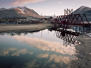
Carcross, originally known as Caribou Crossing, is an unincorporated community in Yukon, Canada, on Bennett Lake and Nares Lake. It is home to the Carcross/Tagish First Nation.

Haines Junction is a village in Yukon, Canada. It is at Kilometre 1,632 of the Alaska Highway at its junction with the Haines Highway, hence the name of the community. According to the 2021 census, the population was 688. However, the Yukon Bureau of Statistics lists the population count for 2022 as 1,018.
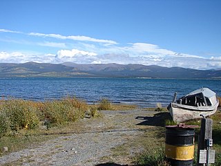
Burwash Landing is a small community, at historical mile 1093 on the Alaska Highway, in Yukon, Canada along the southern shore of Kluane Lake.

Carmacks is a village in Yukon, Canada, on the Yukon River along the Klondike Highway, and at the west end of the Robert Campbell Highway from Watson Lake. The population is 588, an increase from the Census of 2016. It is the home of the Little Salmon/Carmacks First Nation, a Northern Tutchone-speaking people.

Watson Lake is a town in Yukon, Canada, located at mile 635 on the Alaska Highway close to the British Columbia border. It had a population of 1,133 in 2021. The town is named for Frank Watson, an American-born trapper and prospector, who settled in the area at the end of the 19th century.
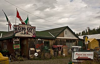
Keno City is a small community in Yukon, Canada at the end of the Silver Trail highway. Keno City was the site of a former silver-lead mining area proximal to Keno Hill. Keno City is 13 kilometres away from Elsa, Yukon, which is owned by Hecla mining who currently own and operate the various Ag-Pb-Zn deposits in the Keno Hill area. Rich silver and lead ore deposits were found on Keno Hill in 1919, and since then the population of the community has fluctuated in response to the mining activity in the area. When in 1989 United Keno Hill closed the mines, literally overnight, the people in the Keno area who decided to stay chose a more sustainable economy: tourism. They successfully marketed Keno City as a quiet, tranquil community.

Mayo is a village in Yukon, Canada, along the Silver Trail and the Stewart River. It had a population of 200 in 2016. The Yukon Bureau of Statistics estimated a population of 496 in 2019. It is also the home of the First Nation of Na-Cho Nyak Dun, whose people primarily speak the northern variety of the Tutchone language. Na-Cho Nyäk Dun translates into "big river people."
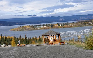
The community of Teslin(/'tɛs.lɪn/ TESS-lin) includes the Village of Teslin in Yukon, Canada. Teslin is situated at historical Mile 804 on the Alaska Highway along Teslin Lake. The Hudson's Bay Company established a small trading post at Teslin in 1903.
Pelly Crossing is a community in Yukon, Canada. It lies where the Klondike Highway crosses the Pelly River.
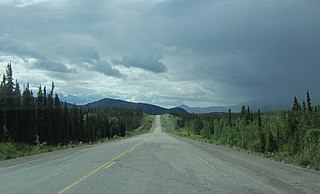
Ibex Valley is a hamlet in Canada's Yukon. The hamlet is considered a local advisory area with an advisory council providing local government. Its population in 2021 according to the 2021 Canadian Census was 523.
Mount Lorne is a hamlet in Canada's Yukon. The hamlet is considered a local advisory area with an advisory council providing local government.

Stewart Crossing is a settlement in Yukon, Canada located on the Stewart River. It is about 179 km east of Dawson City on the Klondike Highway, near the junction with the Silver Trail, from which it is about 53 km (33 mi) southwest of Mayo. A Yukon government highway maintenance camp and a highway lodge are the most prominent facilities at Stewart Crossing. The settlement is named for where the Klondike Highway, crossed the Stewart River by means of a ferry from 1950 until completion of a bridge in the mid-1950s.
Two Mile Village is an Indian settlement in southeast Yukon, Canada. It is located on the Robert Campbell Highway, approximately 12 km (7.5 mi) northwest of Watson Lake. The settlement is recognized as a census subdivision by Statistics Canada.
Two and One-Half Mile Village is an Indian settlement in southeast Yukon, Canada. It is located on the Robert Campbell Highway, approximately 16 km (9.9 mi) northwest of Watson Lake. The settlement is recognized as a census subdivision by Statistics Canada.
References
- 1 2 3 4 5 "Population and dwelling counts, for Canada, provinces and territories, and census subdivisions (municipalities), 2011 and 2006 censuses (Northwest Territories)". Statistics Canada. January 30, 2013. Archived from the original on March 4, 2016. Retrieved May 20, 2013.
- 1 2 "Corrections and updates: Population and dwelling count amendments, 2011 Census". Statistics Canada. March 21, 2013. Retrieved May 20, 2013.
- 1 2 3 4 5 "Population and dwelling counts, for Canada, provinces and territories, and census subdivisions (municipalities), 2011 and 2006 censuses (Yukon)". Statistics Canada. January 30, 2013. Archived from the original on March 4, 2016. Retrieved May 20, 2013.