List of designated places in Manitoba

Last updated

The Notre-Dame de Lorette in Lorette, Manitoba's most populous designated place Notre-Dame de Lorette.png
The Notre-Dame de Lorette in Lorette, Manitoba's most populous designated place

A designated place is a type of geographic unit used by Statistics Canada to disseminate census data. [1] It is usually "a small community that does not meet the criteria used to define incorporated municipalities or Statistics Canada population centres (areas with a population of at least 1,000 and no fewer than 400 persons per square kilometre)." [2] Provincial and territorial authorities collaborate with Statistics Canada in the creation of designated places so that data can be published for sub-areas within municipalities. [2] Starting in 2016, Statistics Canada allowed the overlapping of designated places with population centres. [2]

Contents

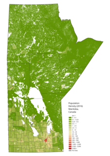
At the 2016 Census of Population, Manitoba had 135 designated places, [3] an increase from 97 in 2011. [4] Designated place types in Manitoba include 2 dissolved municipalities, 44 local urban districts, 46 northern communities, and 43 unincorporated urban centres. [5] In 2016, the 135 designated places had a cumulative population of 63,973 and an average population of 474. Manitoba's largest designated place is Lorette with a population of 3,208. [5]

List

Total designated places63,97360,128+6.4%2,115.96
Province of Manitoba1,278,3651,208,268+5.8%552,370.99

See also

Notes

  1. One of two parts of Lockport.
  2. One of two parts of Lockport.

Related Research Articles

Statistics Canada, formed in 1971, is the agency of the Government of Canada commissioned with producing statistics to help better understand Canada, its population, resources, economy, society, and culture. It is headquartered in Ottawa.

Census geographic units of Canada Term used in Canada

The census geographic units of Canada are the census subdivisions defined and used by Canada's federal government statistics bureau Statistics Canada to conduct the country's quinquennial census. These areas exist solely for the purposes of statistical analysis and presentation; they have no government of their own. They exist on four levels: the top-level (first-level) divisions are Canada's provinces and territories; these are divided into second-level census divisions, which in turn are divided into third-level census subdivisions and fourth-level dissemination areas.

Frank is an urban community in the Rocky Mountains within the Municipality of Crowsnest Pass in southwest Alberta, Canada. It was formerly incorporated as a village prior to 1979 when it amalgamated with four other municipalities to form Crowsnest Pass.

Blairmore, Alberta Former village in Alberta, Canada

Blairmore is a community in the Rocky Mountains within the Municipality of Crowsnest Pass in southwest Alberta, Canada. It was formerly incorporated as a town prior to 1979 when it amalgamated with four other municipalities to form Crowsnest Pass. Blairmore is the principal commercial centre of Crowsnest Pass.

Demographics of Manitoba

Manitoba is one of Canada's 10 provinces. It is the easternmost of the three Prairie provinces.

A designated place (DPL) is a type of community or settlement identified by Statistics Canada that does not meet the criteria used to define municipalities or population centres. DPLs are delineated every 5 years for the Canadian census as the statistical counterparts of incorporated places such as cities, towns, and villages.

Laurier is an unincorporated urban community in the Rural Municipality of Ste. Rose, Manitoba, Canada. It is located on Highway 480, 3.2 km (2.0 mi) west of Highway 5, between the community of McCreary to the south and the community of Ste. Rose du Lac to the north.

References

  1. "2006 Census Dictionary, Figure 20: Hierarchy of standard geographic units for dissemination, 2006 Census". Statistics Canada. November 20, 2009. Retrieved May 5, 2012.
  2. 1 2 3 "Dictionary, Census of Population, 2016: Designated place (DPL)". Statistics Canada. February 8, 2017. Retrieved September 2, 2021.
  3. "Table 1.1: Geographic areas by province and territory, 2016 Census". Statistics Canada. February 8, 2017. Retrieved September 6, 2021.
  4. "Census Dictionary: Table 1 – Geographic units by province and territory, 2011 Census". Statistics Canada. January 30, 2012. Retrieved September 6, 2021.
  5. 1 2 "Population and dwelling counts, for Canada, provinces and territories, and designated places, 2016 and 2011 censuses – 100% data (Manitoba)". Statistics Canada. February 7, 2018. Retrieved September 6, 2021.