St-Pierre-Jolys

Last updated • 2 min readFrom Wikipedia, The Free Encyclopedia
St-Pierre-Jolys
Village
Nickname: 
St-Pierre
357 St. Pierre-Jolys, Manitoba.svg
Village boundaries
Canada Manitoba location map 2.svg
Red pog.svg
St-Pierre-Jolys
Location of St. Pierre-Jolys in Manitoba
Coordinates: 49°26′25″N96°59′04″W / 49.44028°N 96.98444°W / 49.44028; -96.98444
CountryCanada
Province Manitoba
Region Eastman
Founded1877
IncorporatedJanuary 4, 1947
Government
  City MayorRaymond Maynard
   MP (Provencher) Ted Falk
   MLA Konrad Narth
Area
  Total2.66 km2 (1.03 sq mi)
Elevation
242 m (795 ft)
Population
 (2016)
  Total1,170
  Density440.5/km2 (1,141/sq mi)
  [1]
Time zone UTC-6 (CST)
  Summer (DST) UTC-5 (CDT)
Website Official website

St-Pierre-Jolys (formerly Rivière-aux-Rats/Rat River, St-Pierre/St. Pierre) is a village in the Canadian province of Manitoba, located 50 km (31 mi) southeast of Winnipeg on Highway 59 near the Rat River. It is surrounded by the Rural Municipality of De Salaberry, and the nearest communities to it are Steinbach, St. Malo, Morris and Niverville.

Contents

Agriculture is the dominant industry: primarily dairy farming and livestock. Being important sectors for the life of the community, the local businesses, services, and hospitality are strong.

Tourism is also important to the village: the former Crow Wing Trail is now part of the Trans-Canada Trail, and St. Pierre-Jolys hosts several popular festivals, [2] such as la Cabane à Sucre (maple syrup festival) in April; le Festival Chantecler, a celebration of Francophone arts; and the signature St-Pierre-Jolys Frog Follies and Ag Fair (les Folies Grenouilles et Foire Agricoles), a village fair featuring the Canadian frog jumping competition.

There are 3 schools, a hospital, and a sizable Royal Canadian Mounted Police detachment in the village.

Bilingual St-Pierre-Jolys has collaborated with nearby St. Malo on several ventures, including a trade show and a hockey league.

The dramatic sequences for the 2012 documentary We Were Children were shot there. [3]

History

Part of the 19th-century Crow Wing Trail linking Upper Fort Garry with St. Paul (now MN), the area was initially settled by francophone people of Métis and Québécois heritage. [2] English settlers later came as well, in smaller numbers. Father Noel-Joseph Ritchot and Mr. Joseph Dubuc both helped with St. Pierre's founding. [2] The Brittany-born Father Jean-Marie Jolys started a parish and encouraged many Quebec families to move here. The name "Jolys" was added to "St. Pierre" around 1922 to recognize the 40 years of Father Jolys as parish priest of St. Pierre. [2] The Roman Catholic faith has been inextricably linked to the settlement's growth. A former convent of the Sisters of the Holy Names of Jesus and Mary is now the village museum. Though the post office opened in 1879, St. Pierre-Jolys was only incorporated as a village in 1947. [2]

A unique part of the area's history was the establishment of a POW camp during World War II 6 miles south of St. Pierre in 1943, the camp held about 200 prisoners working on a sugar beet farm. [4]

Demographics

In the 2021 Census of Population conducted by Statistics Canada, St-Pierre-Jolys had a population of 1,305 living in 508 of its 518 total private dwellings, a change of 11.5% from its 2016 population of 1,170. With a land area of 2.61 km2 (1.01 sq mi), it had a population density of 500.0/km2 (1,295.0/sq mi) in 2021. [5]

Canada census – St-Pierre-Jolys community profile
2011
Population1,099 (+31.0% from 2006)
Land area2.60 km2 (1.00 sq mi)
Population density422.7/km2 (1,095/sq mi)
Median age34.2 (M: 32.3, F: 36.2)
Private dwellings434 (total) 
Median household income
References: 2011 [6] earlier [7] [8]

Notable people

See also

Related Research Articles

<span class="mw-page-title-main">La Verendrye (electoral district)</span> Provincial electoral district in Manitoba, Canada

La Vérendrye is a provincial electoral district in the Canadian province of Manitoba. It was created by redistribution in 1879, and has existed since that time, making it one of the oldest ridings in Manitoba.

<span class="mw-page-title-main">Niverville, Manitoba</span> Place in Manitoba, Canada

Niverville is a town in the Eastman Region, Manitoba, Canada. The town lies between the northwest corner of the Rural Municipality of Hanover and the southeastern portion of the Rural Municipality of Ritchot. Niverville's population as of the 2021 census is 5,947, the largest town and 10th-largest community in Manitoba.

<span class="mw-page-title-main">Rural Municipality of Hanover</span> Rural municipality in Manitoba, Canada

The Rural Municipality of Hanover is a rural municipality (RM) in southeastern Manitoba, Canada, located southeast of Winnipeg in Division No. 2.

<span class="mw-page-title-main">Rural Municipality of Cartier</span> Rural municipality in Manitoba, Canada

Rural Municipality of Cartier is a rural municipality in the Central Plains and Metro Regions of Manitoba, Canada. The municipality is bordered on the west by the RM of Portage la Prairie, to the east by the RM of Headingley, and to the north by the Assiniboine River. It is mainly flat rich farmland. Its main town is Elie.

<span class="mw-page-title-main">Rural Municipality of Taché</span> Rural municipality in Manitoba, Canada

Taché is a rural municipality in Manitoba, Canada, incorporated in 1880.

<span class="mw-page-title-main">Rural Municipality of Springfield</span> Rural municipality in Manitoba, Canada

Springfield is a rural municipality (RM) in Manitoba, Canada. It stretches from urban industrial development on the eastern boundary of the city of Winnipeg, through urban, rural residential, agricultural and natural landscapes, to the Agassiz Provincial Forest on the municipality's eastern boundary. Birds Hill Provincial Park nestles into the north-western corner of Springfield.

<span class="mw-page-title-main">Rural Municipality of St. François Xavier</span> Rural municipality in Manitoba, Canada

The Rural Municipality of St. François Xavier is a rural municipality (RM) in Manitoba, Canada, lying west-northwest of Winnipeg. It is part of the Central Plains Region as well as the Winnipeg Metro Region. It had a population of 1,411 in the 2016 census.

La Broquerie is a local urban district in the Rural Municipality of La Broquerie, Manitoba, Canada. It is a predominantly Francophone community located approximately 10 kilometres east of Steinbach, Manitoba and 70 kilometres southeast of the provincial capital Winnipeg, at the confluence of Highways 52, 210, and 302.

St. Malo is a local urban district located in the Rural Municipality of De Salaberry, approximately 70 km south of The Forks, Winnipeg, Manitoba. Most of the community's residents are bilingual francophone of Métis or Québécois heritage.

<span class="mw-page-title-main">Division No. 2, Manitoba</span> Census division in Manitoba, Canada

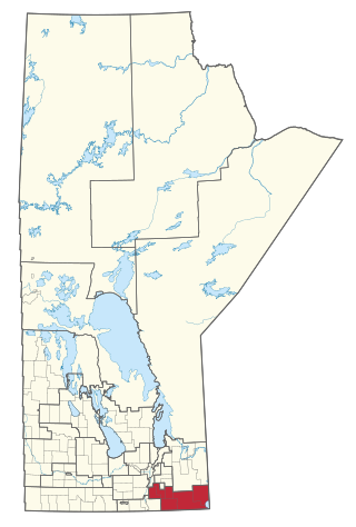
Census Division No. 2 is a census division located within the Eastman Region in the Canadian province of Manitoba. Unlike in some other provinces, census divisions do not reflect the organization of local government in Manitoba. These areas exist solely for the purposes of statistical analysis and presentation; they have no government of their own.

<span class="mw-page-title-main">Rural Municipality of De Salaberry</span> Rural municipality in Manitoba, Canada

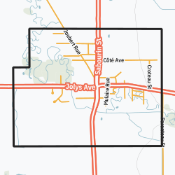
De Salaberry is a rural municipality in the province of Manitoba in western Canada. The administratively separate village of St-Pierre-Jolys and St. Malo Provincial Park lie within the geographical borders of the municipality. The municipality is named after Charles de Salaberry.

<span class="mw-page-title-main">Rural Municipality of Grey</span> Rural municipality in Manitoba, Canada

The Rural Municipality of Grey is a rural municipality in the Canadian province of Manitoba. It is named after Albert Grey, 4th Earl Grey, the former Governor General of Canada.

<span class="mw-page-title-main">Rural Municipality of Ste. Anne</span> Rural municipality in Manitoba, Canada

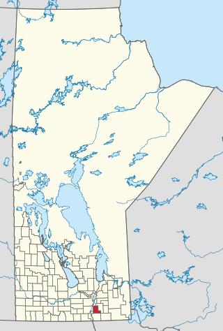
Ste. Anne is a rural municipality (RM) in the Eastman Region of Manitoba, Canada, lying southeast of Winnipeg. The separately-administered town of Ste. Anne lies within the geographic borders of the municipality, in its northwestern part.

<span class="mw-page-title-main">Ste. Agathe, Manitoba</span> Place in Manitoba, Canada

Ste. Agathe is a primarily francophone community in the Rural Municipality of Ritchot, Manitoba, Canada, located along the Red River. Réjean Saive, Works in the area, former hockey player, World Juniors 2005

<span class="mw-page-title-main">Rural Municipality of La Broquerie</span> Rural municipality in Manitoba, Canada

La Broquerie is a rural municipality in the province of Manitoba in Western Canada, located in the southeastern part of the province, just south and east of the city of Steinbach.

Rat River Settlement is an informal area within the Rural Municipality of De Salaberry in the province of Manitoba, Canada located east and south of the community of Otterburne, north and south of the village of St-Pierre-Jolys and northeast and southeast of the CP Emerson subdivision's former Carey rail siding.

<span class="mw-page-title-main">Rural Municipality of Ellice-Archie</span> Rural municipality in Manitoba, Canada

The Rural Municipality of Ellice – Archie is a rural municipality (RM) in the Canadian province of Manitoba.

<span class="mw-page-title-main">Municipality of Lorne</span> Rural municipality in Manitoba, Canada

The Municipality of Lorne is a rural municipality (RM) in the Canadian province of Manitoba.

References

  1. "St-Pierre-Jolys census profile". Census Canada . Retrieved 2017-08-07.
  2. 1 2 3 4 5 "St-Pierre-Jolys website" . Retrieved 2013-01-22.
  3. Sison, Marites N. (26 September 2012). "Film tells stories of residential school survivors". Anglican Journal . ISSN   0847-978X . Retrieved 16 November 2012.
  4. Chris Teetaert (5 August 2010). "German POW Camp Near St Pierre". Steinbach Online. Retrieved 2010-08-05.
  5. "Population and dwelling counts: Canada, provinces and territories, and census subdivisions (municipalities), Manitoba". Statistics Canada. February 9, 2022. Retrieved February 20, 2022.
  6. "2011 Community Profiles". 2011 Canadian Census . Statistics Canada. March 21, 2019. Retrieved 2013-01-22.
  7. "2006 Community Profiles". 2006 Canadian Census . Statistics Canada. August 20, 2019.
  8. "2001 Community Profiles". 2001 Canadian Census . Statistics Canada. July 18, 2021.