Ste. Agathe, Manitoba

Last updated

Sainte Agathe
Ste. Agathe Roman Catholic Church.jpg
Ste. Agathe Roman Catholic Church located along the Red River in Ste. Agathe, Manitoba.
Canada Manitoba location map 2.svg
Red pog.svg
Ste. Agathe
Location of Ste Agathe in Manitoba
Coordinates: 49°34′06″N97°10′57″W / 49.56833°N 97.18250°W / 49.56833; -97.18250 Coordinates: 49°34′06″N97°10′57″W / 49.56833°N 97.18250°W / 49.56833; -97.18250
Country Canada
Province Manitoba
Region Eastman
Established1876 [1]
Government
  MayorChris Ewen
  CouncillorCurtis Claydon
  Governing Body Rural Municipality of Ritchot
   MLA (Morris) Shannon Martin
   MP (Provencher) Ted Falk
Elevation
238 m (781 [2]  ft)
Population
  Total643
Time zone UTC-6 (CST)
  Summer (DST) UTC-5 (CDT)
Postal Code
R0G 0C9, R0G 1Y0, R0G 1Y1 [4]

Ste. Agathe is a primarily francophone community in the Rural Municipality of Ritchot, Manitoba, Canada, located along the Red River. [5] [6]

Contents

Ste. Agathe is in the provincial riding of Morris and the federal riding of Provencher.

History

The village was founded in the mid-19th century on one of the Red River Trails by settlers from Quebec named Grouette, who built a homestead on the west bank of the Red River and farmed grain in the rich soil of the valley. A dock allowed other settlers to reach the east side of the river via ferry with their grain-laden Red River carts; a community, originally called Pointe-à-Grouette, formed around the docking point at some time before 1871.

The first mention of the name "Ste. Agathe" was some decades earlier, when the Roman Catholic Church organized the Red River colonies between St. Norbert and the United States border into the Parish of Sainte-Agathe. As that parish grew and split into numerous more manageable parishes, the parish containing Pointe-à-Grouette was renamed the Parish of Sainte-Agathe by Archbishop Alexandre-Antonin Taché in 1873; the town adopted the name at some time after that date. A church, a school, and eventually a convent were built at the townsite. [7]

1997 flood

It is located in the floodplain of the Red River and, as such, has always been prone to flood damage, but none was so severe or as notable as that experienced during the 1997 Red River flood. The ring dike surrounding the town gave out in late April, causing the town to be inundated with over two metres of water. [8] The village has recovered; a new dike has been built [5] and an interpretive centre has been created on the west side of the community. [9]

Demographics

In the 2021 Census of Population conducted by Statistics Canada, Ste. Agathe had a population of 643 living in 225 of its 226 total private dwellings, a change of

Related Research Articles

<span class="mw-page-title-main">Sainte-Anne-de-Bellevue</span> City in Quebec, Canada

Sainte-Anne-de-Bellevue is an on-island suburb located at the western tip of the Island of Montreal in southwestern Quebec, Canada. It is the second oldest community in Montreal's West Island, having been founded as a parish in 1703. The oldest, Dorval, was founded in 1667.

Franklin Paul Pitura was a politician in Manitoba, Canada. He was a member of the Manitoba legislature from 1995 to 2003, representing the rural riding of Morris for the Progressive Conservative Party. Between 1997 and 1999, he served as a Cabinet Minister in the government of Premier Gary Filmon.

<span class="mw-page-title-main">Souris, Manitoba</span> Community in Manitoba

Souris is an unincorporated urban community in the Municipality of Souris – Glenwood within the Canadian province of Manitoba that held town status prior to January 1, 2015. It is located within the municipality at the confluence of Plum Creek and Souris River, from which it takes its name. Before 1882, the town was called Plum Creek. The community is home to Canada's longest historic cable-stayed footbridge (177 m [581 ft]), known as the Swinging Bridge, which spans the Souris River that divides the community. The Swinging Bridge was built in 1904 as a means of transportation over the Souris River. Residents of Souris are referred to as Sourisites.

<span class="mw-page-title-main">Rural Municipality of Hanover</span> Place in Manitoba, Canada

The Rural Municipality of Hanover is a rural municipality (RM) in southeastern Manitoba, Canada, located southeast of Winnipeg in Division No. 2.

<span class="mw-page-title-main">Morris, Manitoba</span> Town in Manitoba, Canada

Morris is a small town in the Pembina Valley region of Manitoba, Canada, located 51 km south of Winnipeg and 42 km north of Emerson. Morris is home to 1,885 people (2016). Named after Alexander Morris, the second Lieutenant Governor of Manitoba.

Provincial Trunk Highway 75 is a major highway in the Canadian province of Manitoba. It is the main link between the city of Winnipeg and the United States border, where it connects with Interstate 29/U.S. Route 81.

<span class="mw-page-title-main">Sainte-Agathe-de-Lotbinière</span> Municipality in Quebec, Canada

Sainte-Agathe-de-Lotbinière is a municipality in the Municipalité régionale de comté de Lotbinière in Quebec, Canada. Part of the Chaudière-Appalaches region, it had a population of 1,049 as of 2021.

<span class="mw-page-title-main">Rural Municipality of Taché</span> Rural municipality in Manitoba, Canada

Taché is a rural municipality in Manitoba, Canada, incorporated in 1880.

<span class="mw-page-title-main">Rural Municipality of Ritchot</span> Rural Municipality in Manitoba, Canada

The Rural Municipality of Ritchot is a rural municipality in the Winnipeg Capital Region, bordering the south side of Winnipeg in Manitoba, Canada. The separately-administered town of Niverville lies adjacent to its southeast, between it and the Rural Municipality of Hanover.

<span class="mw-page-title-main">St. Adolphe, Manitoba</span> Place in Manitoba, Canada

St. Adolphe, or Saint Adolphe, originally called Pointe-Coupée, is a community in the Rural Municipality of Ritchot, Manitoba, Canada. It is located along the east bank of the Red River, approximately 12 kilometres south of Winnipeg.

<span class="mw-page-title-main">Ste. Anne</span> Place in Manitoba, Canada

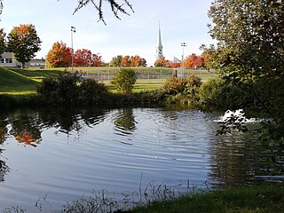
Ste. Anne, or Sainte-Anne-des-Chênes, is a town in Manitoba, Canada, located about 42 km southeast of Winnipeg. The population was 2,114 in 2016, 1,524 in 2011, and 1,513 in 2011. It is known for being located on the Seine River and at the heart of the Old Dawson Trail. The town is surrounded by the Rural Municipality of Ste. Anne.

<span class="mw-page-title-main">Sainte-Agathe-des-Monts</span> City in Quebec, Canada

Sainte-Agathe-des-Monts is a town in the province of Quebec, Canada, in the regional county municipality of Les Laurentides in the administrative region of Laurentides, also known as the "Laurentians" or the Laurentian Mountains. Sainte-Agathe-des-Monts borders on a lake called Lac des Sables, and is located approximately 80 kilometres (50 mi) northwest of Montreal, and 130 kilometres (81 mi) northeast of Ottawa.

<span class="mw-page-title-main">Saint-Adolphe-d'Howard</span> Municipality in Quebec, Canada

Saint-Adolphe-d'Howard is a municipality in the Laurentian Mountains, in the Province of Quebec, Canada, north-west of Montreal.

<span class="mw-page-title-main">Lac-Supérieur, Quebec</span> Municipality in Quebec, Canada

Lac-Supérieur is a municipality in the Laurentides region of Quebec, Canada, part of the Les Laurentides Regional County Municipality. It is named after Lake Superior which is located in the Laurentian Mountains, due east of Mont Tremblant Resort. The community of Lac-Supérieur is just south of the lake, which itself is ringed with cottages. The entire northern portion of the municipality is mostly undeveloped and part of the Mont-Tremblant National Park.

<span class="mw-page-title-main">Rivière-Rouge</span> City in Quebec, Canada

Rivière-Rouge is a city located in the Antoine-Labelle Regional County Municipality, Quebec, Canada. The population as of the 2021 Canadian census was 4,631.

<span class="mw-page-title-main">Division No. 2, Manitoba</span> Census division in Manitoba, Canada

Census Division No. 2 is a census division located within the Eastman Region in the Canadian province of Manitoba. Unlike in some other provinces, census divisions do not reflect the organization of local government in Manitoba. These areas exist solely for the purposes of statistical analysis and presentation; they have no government of their own.

<span class="mw-page-title-main">Rural Municipality of Ste. Anne</span> Rural municipality

Ste. Anne is a rural municipality in the Eastman Region of Manitoba, Canada, lying southeast of Winnipeg. The separately-administered town of Ste. Anne lies within the geographic borders of the municipality, in its northwestern part.

<span class="mw-page-title-main">Ivry-sur-le-Lac</span> Municipality in Quebec, Canada

Ivry-sur-le-Lac is a village and municipality in the Laurentides region of Quebec, Canada, part of the Les Laurentides Regional County Municipality. The municipality completely encompasses Lake Manitou which is a popular cottage vacation location.

<span class="mw-page-title-main">L'Ascension, Quebec</span> Municipality in Quebec, Canada

L'Ascension is a municipality in the Laurentides region of Quebec, Canada, part of the Antoine-Labelle Regional County Municipality. The area is known as La Vallée de la Rouge.

<span class="mw-page-title-main">Rural Municipality of La Broquerie</span> Rural municipality in Manitoba, Canada

La Broquerie is a rural municipality in the province of Manitoba in Western Canada, located in the southeastern part of the province, just south and east of the city of Steinbach.

References

  1. "Ste. Agathe - Southwest Region - Destinations - Joie de Vivre". Archived from the original on 2019-04-23. Retrieved 2019-02-18.
  2. "Sainte Agathe, Steinbach, Canada on the Elevation Map. Topographic Map of Sainte Agathe, Steinbach, Canada".
  3. 1 2 "Population and dwelling counts: Canada and designated places". Statistics Canada. February 9, 2022. Retrieved Sep 3, 2022.
  4. "STE AGATHE, Manitoba Canada, Canada Postal Code Database, ZIP Code Database, ZIP Code Maps".
  5. 1 2 "Ste. Agathe booming since 'flood of the century'". CBC News. April 27, 2007. Retrieved January 9, 2017.
  6. "Census Profile, 2016 Census". Statistics Canada. 2017-01-23. Retrieved 2017-04-25.
  7. History of Ste. Agathe (in French) Archived 2001-04-22 at the Wayback Machine . Accessed August 12, 2008.
  8. Ste. Agathe falls victim to the flood. CBC News, broadcast April 29, 1997. Accessed August 12, 2008.
  9. Red River Valley Floods Interpretive Centre Archived 2009-11-19 at the Wayback Machine . Accessed August 12, 2008.