
The Saulteaux, otherwise known as the Plains Ojibwe, are a First Nations band government in Ontario, Manitoba, Saskatchewan, Alberta and British Columbia, Canada. They are a branch of the Ojibwe who pushed west. They formed a mixed culture of woodlands and plains Indigenous customs and traditions.
Grunthal is a local urban district in the Rural Municipality of Hanover, Manitoba, located 15 miles southwest of Steinbach, and about 50 minutes south of Winnipeg. It had a population of 1,680 in 2016.
First Nation Operated Schools in Manitoba and the rest of Canada are schools that are funded by the Government of Canada. In accordance with the Treaty arrangements between the federal government and most individual First Nations, First Nation Operated Schools must be administered by locally elected School boards, and operate outside the direct control of the local Chief and Band Council.
First Nations in Manitoba constitute of over 160,000 registered persons as of 2021, about 57% of whom live on reserve. Manitoba is second to Ontario in total on-reserve population and in total First Nation population.

The Rural Municipality of Hanover is a rural municipality (RM) in southeastern Manitoba, Canada, located southeast of Winnipeg in Division No. 2.
The Pembina Band of Chippewa Indians is a historical band of Chippewa (Ojibwe), originally living along the Red River of the North and its tributaries. Through the treaty process with the United States, the Pembina Band were settled on reservations in Minnesota and North Dakota. Some tribal members refusing settlement in North Dakota relocated northward and westward, some eventually settling in Montana.
New Bothwell, originally called Kronsthal, is a local urban district in the Rural Municipality of Hanover, Manitoba, Canada. It is located approximately 15 kilometres northwest of Steinbach on Provincial Road 216, one kilometre south of Provincial Road 311 and six kilometres north of Highway 52. It has a population of approximately 500.
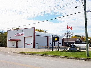
Mitchell is a local urban district and population centre located in the Rural Municipality of Hanover, Manitoba, Canada. It is located three kilometers west of Steinbach, Manitoba along Provincial Highway 52. The community has a population of 3,136 as of 2016, making Mitchell the 22nd largest population centre in Manitoba.
The Long Plain First Nation is an Ojibway and Dakota First Nations band government whose reserve is located in the Central Plains Region of Manitoba, Canada. Its reserve lands include the Long Plain Reserve #6, the Keeshkeemaquah Reserve near Portage La Prairie, and the Madison Indian Reserve #1—the first urban reserve in Winnipeg.
Buffalo Point First Nation is an Ojibwa or Saulteaux First Nations located in the southeastern corner of Manitoba, along the shores of Lake of the Woods. It is bordered largely by the unorganized portion of Division No. 1, Manitoba, and also has smaller borders with the Rural Municipality of Piney, as well as the northeast corner of Roseau County, Minnesota.
Montcalm is a rural municipality (RM) in the province of Manitoba in Western Canada. The Canada 2016 Census reported a population of 1,260 persons, a decrease from the 1,309 reported in the 2011 Census.
Dauphin River First Nation is an Ojibway First Nation band government in Manitoba, Canada. Its landbase is the Dauphin River First Nation Reserve 48A, located at the outlet of the Dauphin River into Lake Winnipeg. The largest city nearest this community is Winnipeg located approximately 250 km (155 mi) to the southeast.
The Dakota Ojibway Tribal Council (DOTC) is an Tribal Council of First Nations communities in Manitoba, Canada. Its mission statement indicates that the council's purpose is to "facilitate in the transfer of local control and responsibility of programs and services to member bands."
Sandy Bay First Ojibway Nation is an Ojibway/Dakota/mixed-blood First Nation in Manitoba, Canada. As of the 2016 Canadian Census, it had a population of 2,515; while the First Nation's website reported a membership of 6,776 individuals as of April 2018.
Brokenhead Ojibway Nation is an Anishinaabe (Saulteaux/Ojibwa) First Nation located approximately 64 kilometres (40 mi) northeast of Winnipeg, Manitoba.
Keeseekoowenin Ojibway First Nation is a First Nations community primarily located on Keeseekoowenin 61, situated near Elphinstone, Manitoba, south of Riding Mountain National Park.
Southern Health-Santé Sud (SH-SS) is the governing body responsible for healthcare delivery and regulation for the eponymous health region in southern Manitoba—covering southeastern and south-central Manitoba, in particular.
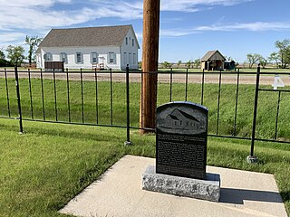
Randolph, originally known as Chortitz, is a small community in the Rural Municipality of Hanover, Manitoba, Canada. The community has an estimated population of 70 and is located 1.6 kilometres north of Highway 52 on Provincial Road 206 about 11 kilometres west of Steinbach. Randolph is located within a half kilometre of the longitudinal centre of Canada.

Manitoba Provincial Road 201 is an east–west provincial road in southern Manitoba, Canada. The road runs parallel to Manitoba's border with the United States for a distance of 218 kilometres, nearly half the province's length.

The Municipality of Emerson – Franklin is a rural municipality (RM) in the Canadian province of Manitoba.

