Timeline
First Treaty trip, 1875
Alexander Morris and James McKay were sent as commissioners to negotiate the treaty. On September 20, 1875, Morris and McKay met with Berens River bands at the Wesleyan Mission School House near a trading post along the river. This meeting went smoothly with the only debates being about how the new chiefs were to be elected and how the locations of the reserves were to be chosen. Eventually these issues were resolved and the commissioners received acceptance of the terms. [14]
The next day the commissioners went north to discuss the treaty with two bands of Cree, one Christian and one not, called the Wood Band at Norway House by Nelson River. The treaty was signed by the band with little protest and Morris and McKay moved along. [14]
Morris and McKay then moved along to the Grand River Rapids on the Saskatchewan River to meet with the Indigenous groups there on September 27, 1875.They gave this group of Indigenous peoples the same explanation of the treaty that they had given the previous groups. The difference in this case is that the band would need to move from the North side of the river to the South side since the area that they were currently occupying was ideal for a transportation development. The band requested 500 dollars to pay for the rebuilding and moving of their entire settlement and were granted this from the commissioners. [14]
On their way south along Lake Winnipeg on September 28, Morris and McKay came across a man who said his name was Thickfoot and was a spokesperson for the Jack Head Point peoples as well as the peoples of Big Island, Black Island, Wapand, and other islands in the area. He explained to Morris and McKay that he and the people he represented had heard that the commissioners had been having negotiations with other groups and bands and they wanted a chance to be included in the Treaty. Morris and McKay told Thickfoot that a group would be by the following summer to negotiate and confirm the treaty. [14]
Before heading home at the end of the trip. Morris and McKay decided to change the western boundaries of the treaty to include the Swampy Cree at The Pas Settlement on the Saskatchewan River. This area was seen as very important to the government for future developments. The negotiations were set to take place the following summer. [14]
Second Treaty trip, 1876
Morris and McKay assigned a politician, Thomas Howard, and a land surveyor, John Lestock Reid, to undertake the task of visiting the bands that had not yet signed the treaty and negotiating with them on the Second Treaty Trip in the summer of 1876. On July 24 they met at Dog Head Point with bands from Bloodvein River, Big Island, Sandy Bar, and St. Peters band as well as Thickfoot's Jack Fish Head band. Negotiations did not go as planned when multiple of the representatives stated that they wanted private negotiations instead of negotiating with multiple other bands present. The Commissioners advised that the bands would only have one chief and a few representatives that would speak for the majority. The representatives were to be chosen by ballot which was extremely unconventional to the Indigenous peoples. This odd way of appointing a leader and having limited people from each band presents indicates that some of the Indigenous groups were not adequately represented in the negotiations. [14]
On August fourth, Howard and Reid headed to Berens River to meet with the Indigenous peoples who had not signed the treaty the summer before when Morris and McKay had been there. The treaty was signed with little discussion and Howard and Reid proceeded on their journey. [14]
Howard and Reid headed to the Saskatchewan River to meet with the Indigenous groups near the Grand River Rapids and provide them with the 500 dollars and other supplies agreed on in the previous year's meeting. The Chief of the Grand Rapids band put forth a number of new demands because he was under the impression that the negotiations were still ongoing. Howard had to explain to them that the treaty was completed the previous year and the band eventually agreed to the terms although they still maintain that they had been misled by the terms of the treaty. [14]
Howard and Reid then both set off to different bands to provide goods promised in the previous year or to negotiate new terms with groups who had not been up to negotiations the previous summer. [14]
Treaty terms were adjusted until 1907, although the Government of Canada was reluctant to make changes between 1876 and 1907. [8] In 1930, the Canadian government and each of the prairie provinces signed the Natural Resources Transfer Agreement, allowing the prairie provinces more control over the land and resources. [15]
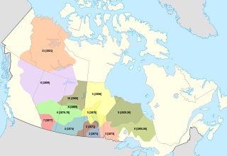
- 20 September 1875: signing of Treaty 5 at Berens River, Manitoba
- 24 September 1875: signing of Treaty 5 by Norway House [16] and Pimicikamak peoples [17] at Norway House, Manitoba
- 27 September. 1875: Grand Rapids signing
- 28 September 1875: signing by Wa-Pang or Dog-Head community, to be included with the reservation assigned for the Norway House community
- 26 July 1876: Big Island signing at Wa-Pang/Dog-Head Island
- 4 August 1876: signing by Grand Rapids tribes at Beren's River
- 7 September 1876: signing by Black River Saulteaux band, signed in Winnipeg
- 7 September 1876: The Pas signing by tribes in that region
- 26 June 1908: Split Lake adhesion signing
- 8 July 1908: Norway House adhesion signing
- 15 July 1908: Cross Lake adhesion signing
- 30 July 1908: Nelson House adhesion signing
- 24 August 1908: Fisher River adhesion signing
- 29 July 1909: Oxford House adhesion signing
- 6 August 1909: God's Lake adhesion signing
- 13 August 1909: Island Lake adhesion signing
- 9 June 1910: Deer's Lake East adhesion signing
- 10 August 1910: York Factory adhesion signing
Issues
The speed at which the treaty was negotiated left room for a great deal of misunderstanding for both the government commissioners and the Indigenous peoples. [6] In many instances, treaties were negotiated orally and then were written down separately. [18] In some cases, the oral terms negotiated with Indigenous groups did not match what was eventually written down. [18] This posed issues as there were sometimes two varying terms of the negotiations. Another issue that treaty negotiations faced was the language barrier, especially in what is known as the “surrender clause.” [18] The official language used in Treaty Five is, “The Saulteaux and Swampy Cree Tribes of Indians and all other the Indians inhabiting the district hereinafter described and defined, do hereby cede, release, surrender and yield up to the Government of the Dominion of Canada, for Her Majesty the Queen and Her successors for ever, all their rights, titles and privileges whatsoever to the lands included within the following limits.” [19] However, a present-day Indigenous leader translated the text to mean “I quit this land,” stating that if the Indigenous groups had known what they were agreeing to, they would not have signed. [18]
One of the issues that Indigenous groups encountered were the smaller portions of land that they received as opposed to the land received in previous treaties. [8] Smaller lands and smaller reserve area led to fewer resources in the long run for Indigenous peoples included in Treaty Five. Fewer benefits were given to Indigenous people included in Treaty Five than in previous numbered treaties. [13]
In 1895, Indigenous missionary James Settee informed the Lieutenant-General, J. Shultz that at least twenty residents of the reserve had not received their annuity. [8] Another issue encountered by the Treaty-Indians in 1876 was an immigration of Icelandic immigrants who settled on land that had been requested in Treaty Five or that was being inhabited by Indigenous groups who had signed Treaty Five, smallpox then broke out and many settlers and Indigenous people perished in the winter of 1877. [7] The decade of the 1880s saw a rise in the death rate on reserves from Tuberculosis. [7]

The Cree or nehinaw are a North American Indigenous people. They live primarily in Canada, where they form one of the country's largest First Nations. More than 350,000 Canadians are Cree or have Cree ancestry. The major proportion of Cree in Canada live north and west of Lake Superior, in Ontario, Manitoba, Saskatchewan, Alberta, and the Northwest Territories. About 27,000 live in Quebec.
Treaty 6 is the sixth of the numbered treaties that were signed by the Canadian Crown and various First Nations between 1871 and 1877. It is one of a total of 11 numbered treaties signed between the Canadian Crown and First Nations. Specifically, Treaty 6 is an agreement between the Crown and the Plains and Woods Cree, Assiniboine, and other band governments at Fort Carlton and Fort Pitt. Key figures, representing the Crown, involved in the negotiations were Alexander Morris, Lieutenant Governor of Manitoba and The North-West Territories; James McKay, The Minister of Agriculture for Manitoba; and William J. Christie, a chief factor of the Hudson's Bay Company. Chief Mistawasis and Chief Ahtahkakoop represented the Carlton Cree.
First Nations in Manitoba constitute of over 160,000 registered persons as of 2021, about 57% of whom live on reserve. Manitoba is second to Ontario in total on-reserve population and in total First Nation population.
The Opaskwayak Cree Nation is a First Nations band government located in Manitoba, Canada. The main OCN reserve is regarded as one of three distinct communities that comprise "The Pas area" in northern Manitoba, with the two others being the Town of The Pas and the Rural Municipality of Kelsey.

David Laird, was a Canadian politician. He was born in New Glasgow, Prince Edward Island, into a Presbyterian family noted for its civic activism. His father Alexander had been a long time Reformer and Liberal MLA. David became a Liberal MLA for Belfast. He also established and edited The Patriot.

Misipawistik Cree Nation is a Cree community in northern Manitoba. Misipawistik in the local Cree language means 'Rushing Rapids', which was once a historical Canadian landmark before the construction of the Manitoba Hydro-electric Dam in the late 1950s.

Treaty 4 is a treaty established between Queen Victoria and the Cree and Saulteaux First Nation band governments. The area covered by Treaty 4 represents most of current day southern Saskatchewan, plus small portions of what are today western Manitoba and southeastern Alberta. This treaty is also called the Qu'Appelle Treaty, as its first signings were conducted at Fort Qu'Appelle, North-West Territories, on 15 September 1874. Additional signings or adhesions continued until September 1877. This treaty is the only indigenous treaty in Canada that has a corresponding indigenous interpretation.

Treaty 1 is an agreement established on August 3, 1871, between the Crown and the Anishinaabe and Swampy Cree, Canadian based First Nations. The first of a series of treaties called the Numbered Treaties that occurred between 1871 and 1921, this accord has been held to be essentially about peace and friendship. However, the eight days of treaty-making ended with the Indigenous groups agreeing to "cede, release, surrender and yield up to Her Majesty the Queen and successors forever all the lands" in southern Manitoba to the Crown, in exchange for an annual annuity and material goods such as clothing and agricultural supplies.
Treaty 2 was entered in to on 21 August 1872 at Manitoba House, Rupertsland, with representatives of the Queen of Great Britain and Ireland. The original Anishinaabe, who were present, constitute Treaty 2 today. It is known that many of the chiefs and leaders within the territory were at the early gathering and after the treaty was agreed to. Those who were not present were represented through Metis until they indicated where they wished their farming reserves to be established. The treaty reaffirmed the inherent rights that the Anishinaabe had prior to European contact, located where southwestern Manitoba is today and a small part of southeastern Saskatchewan.
Treaty 10 was an agreement established beginning 19 August 1906, between King Edward VII and various First Nation band governments in northern Saskatchewan and a small portion of eastern Alberta. There were no Alberta-based First Nations groups signing on, but there were two First Nation bands from Manitoba, despite their location outside the designated treaty area. It is notable that despite appeals from peoples of unceded areas of Northern Manitoba and the Northwest Territories for treaty negotiations to begin, the government did not enter into the treaty process for almost 20 years. In 1879, Natives of Stanley, Lac la Ronge, and Pelican Narrows petitioned for a treaty due to the threat of starvation. In 1905, the granting of Saskatchewan with Provincial status galvanized the government to settle the issue of land rights in order to free up land for future government use. The Canadian government signed Treaty 10 with the First Nations. The territory covered almost 220,000 square kilometers and included Cree and Chipewyan First Nation tribe population. Like the other treaties, it requires the First Nations to surrender their Aboriginal Title for land claim and rights.

The Council of Keewatin was an unelected legislative body and territorial government for the now defunct District of Keewatin in Canada. The District of Keewatin was created by the passage of the Keewatin Act on October 7, 1876 from a portion of Canada's North West Territories.[A] Lieutenant Governor Alexander Morris convinced the government that the new territorial government of the North West Territories would be unable to effectively administer land to the north and east of Manitoba. Shortly after the District of Keewatin was formed a large group of Icelanders arrived, infected with smallpox which quickly spread to the indigenous First Nation population. The Government of Canada allowed the Council to be formed for the purpose of containing the smallpox epidemic. The Council also administered Indian treaty claims, immigrant land claims, Hudson's Bay Company trading post concerns as well as policing and health care. The Council lasted from November 25, 1876, until April 16, 1877, after which control of the territory was returned under federal authority.
The Sakāwithiniwak or Woodland Cree, are a Cree people, calling themselves Nîhithaw in their own dialect of the language. They are the largest indigenous group in northern Alberta and are an Algonquian people. Prior to the 18th century, their territory extended west of Hudson Bay, as far north as Churchill. Although in western Northern Saskatchewan and Manitoba, by the 18th century, they acted as middlemen in trade with western tribes. After acquiring guns through trade, they greatly expanded their territory and drove other tribes further west and north.
Pimicikamak is the name of one of the Cree-speaking aboriginal peoples of Canada. Pimicikamak is "a people of rivers and lakes. The traditional territory of Pimicikamak is around Sipiwesk Lake in the heart of the boreal forest, five hundred kilometres north of Winnipeg, Manitoba. Flowing through their land is Kichi Sipi, the Great River." Pimicikamak's traditional territory also is known as Pimicikamak.

Pimicikamak is an indigenous people in Canada. Pimicikamak is related to, but constitutionally, legally, historically and administratively distinct from, the Cross Lake First Nation which is a statutory creation that provides services on behalf of the Canadian Government. Pimicikamak government is based on self-determination and has a unique form.

Pimicikamak Cree Nation is sometimes used as a name for Pimicikamak, one of the more populous Cree indigenous peoples in Canada. Etymologically, "Pimicikamak Cree Nation" is a description of this indigenous people, and is not a name.
The following is an alphabetical list of topics related to Indigenous peoples in Canada, comprising the First Nations, Inuit and Métis peoples.
The Mathias Colomb Cree Nation (MCCN) —also known as Mathias Colomb First Nation, Mathias Colomb (Cree) First Nation, and Pukatawagan/Mathias Colomb Cree Nation—is a remote First Nations community in northern Manitoba, located 210 km (130 mi) north of The Pas and 819 km (509 mi) northwest of Winnipeg, Manitoba.
Fisher River is a Cree First Nations reserve located approximately 193 km north of Manitoba's capital city, Winnipeg. The Fisher River Cree Nation is composed of two reserves; Fisher River 44 and Fisher River 44A. The reserve population is 1945, the off reserve population is 1934 for a total of 3879 band members as of June 2017. Fisher River is 15,614 acres.
The Norway House Cree Nation is based at Norway House, Manitoba, which is on the Playgreen Lake section of the Nelson River system. The people are Swampy Cree from the Rocky Cree band government. They are in possession of a number of reserves, but population is centered at IR Norway House 17 (06392). There are over 8300 members living on-reserve with another 1900 plus members at various locations off-reserve. The 2016 Census reported an official population of 7,927 inhabitants at Norway House 17 up from 7,758 in 2011.
The Iron Confederacy or Iron Confederation was a political and military alliance of Plains Indians of what is now Western Canada and the northern United States. This confederacy included various individual bands that formed political, hunting and military alliances in defense against common enemies. The ethnic groups that made up the Confederacy were the branches of the Cree that moved onto the Great Plains around 1740, the Saulteaux, the Nakoda or Stoney people also called Pwat or Assiniboine, and the Métis and Haudenosaunee. The Confederacy rose to predominance on the northern Plains during the height of the North American fur trade when they operated as middlemen controlling the flow of European goods, particularly guns and ammunition, to other Indigenous nations, and the flow of furs to the Hudson's Bay Company (HBC) and North West Company (NWC) trading posts. Its peoples later also played a major part in the bison (buffalo) hunt, and the pemmican trade. The decline of the fur trade and the collapse of the bison herds sapped the power of the Confederacy after the 1860s, and it could no longer act as a barrier to U.S. and Canadian expansion.
