Mitchell, Manitoba

Last updated

Mitchell
Canada Manitoba location map 2.svg
Red pog.svg
Mitchell
Location of Mitchell in Manitoba
Coordinates: 49°32′03″N96°45′43″W / 49.53417°N 96.76194°W / 49.53417; -96.76194
Country Canada
Province Manitoba
Region Eastman
Rural Municipality Hanover
Government
   MP (Provencher) Ted Falk (CPC)
   MLA (Steinbach) Kelvin Goertzen (PC)
Area
  Total4.08 km2 (1.58 sq mi)
Elevation
268 m (879 ft)
Population
 (2021) [1]
  Total3,136
  Density768.7/km2 (1,991/sq mi)
Time zone UTC-6 (CST)
  Summer (DST) UTC-5 (CDT)

Mitchell is a local urban district and population centre located in the Rural Municipality of Hanover, Manitoba, Canada. [2] It is located three kilometers west of Steinbach, Manitoba along Provincial Highway 52. The community has a population of 3,136 as of 2016, making Mitchell the 19th largest population centre in Manitoba. [1]

Contents

History

Cairn honouring oberschulz Jacob Peters at Vollwerk Cemetery in Mitchell Jacobpeterscairn.jpg
Cairn honouring oberschulz Jacob Peters at Vollwerk Cemetery in Mitchell

The area that is now known as Mitchell were originally lands of the nomadic Ojibway-speaking Anishinabe people. On 3 August 1871 the Anishinabe people signed Treaty 1 and moved onto reserves such as the Brokenhead Indian Reserve and Roseau River Anishinabe First Nation Reserve. [3]

The area was then settled by Russian Mennonite settlers in the 1874. At that time there were dozens of villages in the East Reserve. Three of them, Vollwerk, Ebenfeld, and Reichenbach, were eventually absorbed into the new community of Mitchell, which was renamed after the surrounding school district established in 1919. The Canadian government deliberately chose English names for the school districts, such as Mitchell, Bothwell, Randolph and others in an attempt to assimilate the Mennonites into Canadian culture and eventually some of these communities, such as Mitchell, abandoned the original German names and adopted the new English names as their community names. [4]

Vollwerk (which later became Mitchell) was the home of obserschulz Jacob Peters, who led the Mennonite delegation to Canada and was a signatory of the Privilegium. A cairn and gravestone honouring him can be found at the historic Vollwerk Cemetery on Reichenbach Road in Mitchell. [5] The Stahn family, who sold much of the land that would eventually become the modern day community of Mitchell, are also honoured at the Vollwerk Cemetery.

Education

The Mitchell School District was established in 1919. A one-room schoolhouse served the community until the 1950s, when another room has added to handle increasing student enrollment. In 1968, the school district was dissolved and became part of the newly formed Hanover School Division, after which students from Mitchell were required to attend school in Steinbach. [6] The school division has since constructed new elementary and middle schools in Mitchell and only high school students from the Mitchell area are presently required to attend school in Steinbach.

Recreation

Mitchell has a full range of community-run recreational facilities, including an indoor arena, baseball fields, soccer pitches, and tennis courts. [7]

The Mitchell Arena was built in 1979 and is home to community's ice hockey teams, nicknamed the Mitchell Mustangs, which play in various Eastman Minor Hockey leagues. The Mitchell Mustangs have been members of the Hanover Tache Junior Hockey League since 1987 and previously played in the Manitoba Junior 'B' Hockey League. The Mustangs has also fielded senior teams in the past that played in the Hanover-Tache and Carillon Senior Hockey Leagues. [8]

Businesses and services

Mitchell's close proximity to the city of Steinbach means residents mostly shop and conduct business at the latter. However, Mitchell does have several of its own businesses and services, such as a Co-op gas bar and convenience store, a second convenience store, a number of churches, an auto repair business, and an assortment of home-based business.

Government

Mitchell is designated as a local urban district (LUD) within the Rural Municipality of Hanover whose administrative offices are located 1.5 kilometers east of the community. An elected LUD committee, consisting of three members plus the Ward 2 Councillor for Hanover, reports to the municipal council. The community and surrounding area is part of the Steinbach (provincial) and Provencher (federal) electoral districts.

Demographics

Population Growth
YearPop.±%
20011,055    
20061,492+41.4%
20111,656+11.0%
20162,523+52.4%
20213,136+24.3%

In the 2021 Census of Population conducted by Statistics Canada, Mitchell had a population of 2,828 living in 858 of its 883 total private dwellings, a change of

Related Research Articles

Grunthal is a local urban district in the Rural Municipality of Hanover, Manitoba, located 24 kilometers southwest of Steinbach, and about 50 minutes south of Winnipeg. It had a population of 1,680 in 2016.

<span class="mw-page-title-main">Steinbach, Manitoba</span> City in Manitoba, Canada

Steinbach is a city located about 58 km (36 mi) south-east of Winnipeg, Manitoba, Canada. Steinbach is the third-largest city in Manitoba, with a population of 17,806, and the largest community in the Eastman region. The city is bordered by the Rural Municipality of Hanover to the north, west, and south, and the Rural Municipality of La Broquerie to the east. Steinbach was first settled by Plautdietsch-speaking Mennonites from Ukraine in 1874, whose descendants continue to have a significant presence in the city today. Steinbach is found on the eastern edge of the Canadian Prairies, while Sandilands Provincial Forest is a short distance east of the city.

<span class="mw-page-title-main">Winkler, Manitoba</span> City in Manitoba, Canada

Winkler is a city in Manitoba, Canada with a population of 13,745, making it the 4th largest city in Manitoba, as of the 2021 Canadian census. It is located in southern Manitoba, surrounded by the Rural Municipality of Stanley, about one hundred kilometres southwest of Winnipeg and thirteen kilometres east of its "twin city" Morden. As the largest city in the Pembina Valley, it serves as a regional hub for commerce, agriculture and industry. Winkler is the third-fastest growing city in the province after Morden and Steinbach.

<span class="mw-page-title-main">Niverville, Manitoba</span> Place in Manitoba, Canada

Niverville is a town in the Eastman Region, Manitoba, Canada. The town lies between the northwest corner of the Rural Municipality of Hanover and the southeastern portion of the Rural Municipality of Ritchot. Niverville's population as of the 2021 census is 5,947, the largest town and 10th-largest community in Manitoba.

<span class="mw-page-title-main">Rural Municipality of Hanover</span> Rural municipality in Manitoba, Canada

The Rural Municipality of Hanover is a rural municipality (RM) in southeastern Manitoba, Canada, located southeast of Winnipeg in Division No. 2.

<span class="mw-page-title-main">Altona, Manitoba</span> Town in Manitoba, Canada

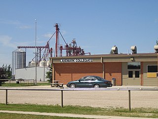
Altona is a town in southern Manitoba, Canada, about 100 km south-west of Winnipeg and 158 km north of Grand Forks, North Dakota. The population at the 2021 Census was 4,390 residents. Old Altona was founded in 1880 by Plautdietsch-speaking Mennonites from the Russian Empire. It is surrounded by the Municipality of Rhineland. Much of the surrounding area is devoted to farming and agriculture-based business.

Roseau River Anishinabe First Nation is an Ojibway First Nation in southern Manitoba, Canada, situated around the Roseau River.

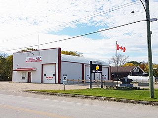
Kleefeld is a local urban district located in the Rural Municipality of Hanover, Manitoba, Canada.

<span class="mw-page-title-main">Eastman Region</span> Region in Manitoba, Canada

Eastern Manitoba, or the Eastman Region, is an informal geographic region of the Canadian province of Manitoba. It is bounded on the north by the Winnipeg River and Lake Winnipeg, on the east by the Manitoba-Ontario border, on the south by the Canada–US border, and on the west by the Red River. With a population of 128,855 as of the 2021 Canadian census, the Eastman Region is the second most populous region outside of the Winnipeg Metropolitan Region.

<span class="mw-page-title-main">New Bothwell, Manitoba</span> Local urban district in Manitoba, Canada

New Bothwell, originally called Kronsthal, is a local urban district in the Rural Municipality of Hanover, Manitoba, Canada. It is located approximately 15 kilometres northwest of Steinbach on Provincial Road 216, one kilometre south of Provincial Road 311 and six kilometres north of Highway 52. It has a population of approximately 500.

<span class="mw-page-title-main">Landmark, Manitoba</span> Unincorporated community

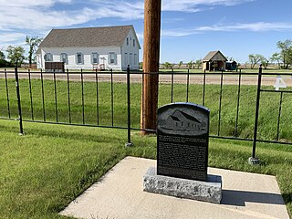
Landmark, originally called Prairie Rose, is a local urban district in the Rural Municipality of Taché, Manitoba, Canada, located about 30 km (18.6 mi) southeast of the provincial capital, Winnipeg. Landmark's population as of the 2021 census was 1,326. The community lies on the longitudinal centre of Canada.

<span class="mw-page-title-main">Hanover Tache Junior Hockey League</span>

The Hanover Tache Junior Hockey League is a junior ice hockey league in Manitoba, Canada, sanctioned by Hockey Manitoba. It is the only Junior 'C' league in Manitoba, and as such, league champions are also named provincial Junior 'C' champions.

<span class="mw-page-title-main">Rural Municipality of Taché</span> Rural municipality in Manitoba, Canada

Taché is a rural municipality in Manitoba, Canada, incorporated in 1880.

<span class="mw-page-title-main">Division No. 2, Manitoba</span> Census division in Manitoba, Canada

Census Division No. 2 is a census division located within the Eastman Region in the Canadian province of Manitoba. Unlike in some other provinces, census divisions do not reflect the organization of local government in Manitoba. These areas exist solely for the purposes of statistical analysis and presentation; they have no government of their own.

La Salle, Manitoba is a town located in the Rural Municipality of Macdonald along the banks of the La Salle River, about 30 kilometres (19 mi) south of downtown Winnipeg.

<span class="mw-page-title-main">Blumenort, Manitoba</span> Local urban district in Manitoba, Canada

Blumenort is a local urban district in the Canadian province of Manitoba. It is located in the Rural Municipality of Hanover, 4.1 kilometres north of the city of Steinbach. It was founded in 1874 by Plautdietsch-speaking Mennonite farmers from the Russian Empire. Today, its economy is based on agriculture and the service industry.

The Mitchell Mohawks were a Canadian junior 'C' ice hockey team based in Mitchell, Manitoba until 2019. A senior team with the same name also competed in the Carillon Senior Hockey League until 2013. The minor hockey organization (U7-U18) changed its name from Mitchell Mohawks to Mitchell Mustangs in 2020. The junior team, established in 1988, competed in the Hanover Tache Junior Hockey League. The team has won two league championships. After going on hiatus for two seasons (2012–14) the team returned to league play for the 2014–15 season and has again been on hiatus since the end of the 2018–2019 season.

<span class="mw-page-title-main">Randolph, Manitoba</span> Place in Manitoba, Canada

Randolph, originally known as Chortitz, is a small community in the Rural Municipality of Hanover, Manitoba, Canada. The community has an estimated population of 70 and is located 1.6 kilometres north of Highway 52 on Provincial Road 206 about 11 kilometres west of Steinbach. Randolph is located within a half kilometre of the longitudinal centre of Canada.

<span class="mw-page-title-main">Municipality of Emerson-Franklin</span> Rural municipality in Manitoba, Canada

The Municipality of Emerson – Franklin is a rural municipality (RM) in the Canadian province of Manitoba.

<span class="mw-page-title-main">East Reserve</span>

The East Reserve was a block settlement in Manitoba set aside by the Government of Canada exclusively for settlement by Russian Mennonite settlers in 1873. Most of the East Reserve's earliest settlers were from the Kleine Gemeinde or Bergthaler Mennonite churches.

References

  1. 1 2 "Census Profile, 2021 Census of Population, Mitchell Manitoba Population Centre". Census Canada . Retrieved February 9, 2022.
  2. "Local Urban Districts Regulation". Government of Manitoba. April 23, 2016. Retrieved April 24, 2016.
  3. "History and Heritage of Roseau River First Nation". Archived from the original on 15 July 2011. Retrieved 1 July 2010.
  4. Francis, E.K. (1955). In Search of Utopia. D.W. Friesens and Sons.
  5. "Historic Sites of Manitoba". Manitoba Historical Society. Retrieved May 23, 2021.
  6. "Historic Sites of Manitoba: Mitchell School No. 1965 (Mitchell, RM of Hanover)". Manitoba Historical Society. Retrieved April 17, 2015.
  7. "Mitchell & District Community Centre". RM of Hanover. Retrieved April 17, 2015.
  8. "Mitchell Arena". RM of Hanover. Retrieved April 17, 2015.
  9. "Population and dwelling counts: Canada and designated places". Statistics Canada. February 9, 2022. Retrieved September 3, 2022.