Provincial Trunk Highway 1 is Manitoba's section of the Trans-Canada Highway. It is a heavily used, 4-lane divided highway, with the exception of a short 18 km section in the southeastern corner of the province. It is the main link between southern Manitoba's largest cities, and also serves as the province's main transportation link to the neighbouring provinces of Saskatchewan and Ontario. The highway is the only major east-west divided highway in Manitoba, and carries a large majority of east-west traffic within and through the province. It has full freeway status sections at Portage la Prairie and Winnipeg. The total distance of the Trans-Canada Highway in Manitoba is approximately 490 km (300 mi).
Provincial Trunk Highway 75 is a major highway in the Canadian province of Manitoba. It is the main link between the city of Winnipeg and the United States border, where it connects with Interstate 29/U.S. Route 81.
Provincial Trunk Highway 16 (PTH 16) is a provincial highway in the Canadian province of Manitoba. It is the Manitoba section of the Yellowhead Highway, and also the Trans-Canada Highway Yellowhead section. The main purpose of this highway is to connect Winnipeg with other Canadian cities such as Saskatoon and Edmonton. The highway runs from Bloom at an intersection with the Trans-Canada Highway and Provincial Road 305 ten kilometres (6.2 mi) west of Portage la Prairie to the Saskatchewan boundary sixteen kilometres (9.9 mi) west of Russell, where it continues as Saskatchewan Highway 16.
Provincial Trunk Highway 4 is a provincial highway in the Canadian province of Manitoba. The highway connects the city of Selkirk to PTH 59, the main route to Grand Beach and cottage country on the east side of Lake Winnipeg.
Provincial Trunk Highway 6 is a provincial primary highway located in the Canadian province of Manitoba. It runs from the Perimeter Highway of Winnipeg to the Thompson south city limits. It is also the main highway connecting Winnipeg to northern Manitoba. The speed limit is 100 km/h. The route is also used to deliver nickel from the Thompson mine to the Royal Canadian Mint in Winnipeg. The section of highway between its southern terminus near Winnipeg and the second junction with PTH 68 near Eriksdale is part of the Northern Woods and Water Route. The portion of the highway between Ponton and Thompson was known as Highway 391 prior to 1986.
Provincial Trunk Highway 8 is a provincial primary highway located in the Canadian province of Manitoba. It runs from the north limit of the City of Winnipeg, where it meets with Route 180, north to Hecla-Grindstone Provincial Park. The highway between Winnipeg and PR 230 is known as McPhillips Street. At PR 230, McPhillips Street becomes McPhillips Road and continues along PR 230 to PTH 9. The route is a major road connecting Winnipeg with the communities of Winnipeg Beach and Gimli. The speed limit is 100 km/h (60 mph).
Provincial Trunk Highway 7 is a provincial primary highway located in the Canadian province of Manitoba. It runs from the northern limit of the city of Winnipeg north to Arborg, Manitoba where it intersects with PTH 68. The highway is twinned from Winnipeg to just north of PTH 67, an east-west route that provides access to the Town of Stonewall.
Provincial Trunk Highway 16A is a provincial highway in the Canadian province of Manitoba which provides access to the town of Minnedosa. The highway is an alternate route of PTH 16 and PTH 10. Like most alternate routes, it previously served as the main highway through the town.
Provincial Trunk Highway 39 is a provincial highway in the Canadian province of Manitoba. It runs from PTH 6 to PTH 10.

Provincial Trunk Highway 10 is a provincial primary highway located in the Canadian province of Manitoba.
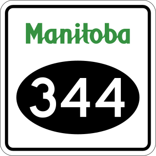
Provincial Trunk Highway 44 is an east-west provincial highway in the Eastman Region of the Canadian province of Manitoba.

Provincial Trunk Highway 13 is a provincial highway in the Canadian province of Manitoba. It is an RTAC route capable of handling RTAC vehicles such as trucks, truck and pony trailers, trucks and full trailers, truck tractors, and semi-trailers, A-trains, B-trains, or C-trains. The route extends south to north from its junction with PTH 3 and PR 245 in Carman to its junction with PTH 1 and PR 430 north of Oakville. The northern terminus of PTH 13 is located between Portage la Prairie and Manitoba's capital city Winnipeg. The Central Manitoba Railway (CEMR) shortline rail intersects PTH 13 north of Carman, the Canadian Pacific Railway (CPR) intersects at Elm Creek, and the Canadian National Railway (CNR) at Oakville.
Provincial Trunk Highway 24 is a provincial highway in the Canadian province of Manitoba. It is an east–west route that runs from PTH 83 near Miniota, east through Oak River and Rapid City to the junction of PTH 10 and PR 262 between Brandon and Minnedosa.
Provincial Trunk Highway 22 is a short north-south provincial highway in the Canadian province of Manitoba. It runs from PTH 23 near Elgin to PTH 2 and PR 250 in Souris. This highway is the main access road to the renowned Souris Swinging Bridge.
Provincial Trunk Highway 45 is a provincial highway in the Parkland Region of the Canadian province of Manitoba. It runs from PTH 16 and PTH 83 in the town of Russell to PTH 10 five kilometres (3.1 mi) north of the village of Erickson.
Provincial Trunk Highway 42 is a short provincial highway in the southwest region of the Canadian province of Manitoba. It runs from PTH 16 in the town of Shoal Lake to PTH 41 just east of the French-speaking village of St. Lazare.
Provincial Trunk Highway 26, also known as Chemin Assiniboine Trail, is a provincial highway in the Canadian province of Manitoba. It is an east-west route that begins and ends at the Trans-Canada Highway. The western terminus is located near the interchange of PTH 1 and PTH 1A approximately 3 kilometres east of Portage la Prairie, while the eastern terminus is 3 kilometres southeast of St. François Xavier and 13 kilometres west of Winnipeg's Perimeter Highway. PTH 26 provides access to the small communities of St. François Xavier and Poplar Point. It serves as an alternative scenic route between Portage la Prairie and Winnipeg as it closely follows the Assiniboine River which flows south of the highway. The speed limit on this highway is 90 kilometres per hour (56 mph).
Provincial Trunk Highway 67 is a short provincial highway in the Canadian province of Manitoba. It runs as an east-west route just north of Winnipeg city limits between PTH 6 near the village of Warren to PTH 9 at the gate to Lower Fort Garry.
Provincial Road 344 is a very short provincial road in the Westman Region of the Canadian province of Manitoba. It connects the town of Wawanesa with PTH 2 on its western side.

Provincial Road 331 is an east-west provincial road in the Central Plains Region of the Canadian province of Manitoba, connecting the city of Portage la Prairie and the town of Oakville via Newton.
