Provincial Trunk Highway 75 is a major highway in the Canadian province of Manitoba. It is the main link between the city of Winnipeg and the United States border, where it connects with Interstate 29/U.S. Route 81.
Provincial Trunk Highway 4 is a provincial highway in the Canadian province of Manitoba. The highway connects the city of Selkirk to PTH 59, the main route to Grand Beach and cottage country on the east side of Lake Winnipeg.
Provincial Trunk Highway 6 is a provincial primary highway located in the Canadian province of Manitoba. It runs from the Perimeter Highway of Winnipeg to the Thompson south city limits. It is also the main highway connecting Winnipeg to northern Manitoba. The speed limit is 100 km/h. The route is also used to deliver nickel from the Thompson mine to the Royal Canadian Mint in Winnipeg. The section of highway between its southern terminus near Winnipeg and the second junction with PTH 68 near Eriksdale is part of the Northern Woods and Water Route. The portion of the highway between Ponton and Thompson was known as Highway 391 prior to 1986.
Provincial Trunk Highway 3 is a major provincial highway located in the Canadian province of Manitoba. It runs from the Saskatchewan boundary to the southwest city limits of Winnipeg, where it continues as Winnipeg Route 155. Prior before to the implementation of Winnipeg's City Route System, it extended to Pembina Highway.
Provincial Trunk Highway 17 is a provincial highway in the Canadian province of Manitoba. It runs from a junction with PR 224 and PR 325 near Hodgson to a junction with PTH 9 near Winnipeg Beach.
Provincial Trunk Highway 32 is a provincial primary highway located in the Canadian province of Manitoba. It runs from PTH 14 at Winkler to the U.S. border, where it becomes North Dakota State Highway 32. Between its northern end and its intersection with PR 243, PTH 32 follows the Boundary Commission Trail.
Provincial Trunk Highway 5 is a provincial primary highway located in the Canadian province of Manitoba.

Provincial Trunk Highway 10 is a provincial primary highway located in the Canadian province of Manitoba.
Provincial Trunk Highway 44 is an east-west provincial highway in the Eastman Region of the Canadian province of Manitoba.
Highway 49 and Provincial Trunk Highway 49 is a provincial highway in the Canadian provinces of Saskatchewan and Manitoba. Most of the highway is in the east-central part of Saskatchewan and only a very short section is in Manitoba. It runs from Saskatchewan Highway 35 between the communities of Fosston and Hendon to the Saskatchewan — Manitoba border, before ending at Provincial Trunk Highway 83 south of the community of Benito. The combined highway is about 166.4 kilometres (103.4 mi) in length — 165.2 kilometres (102.7 mi) is in Saskatchewan and 1.2 kilometres (0.7 mi) is in Manitoba.

Provincial Trunk Highway 18 is a provincial highway in the Canadian province of Manitoba. Located in the Westman Region, it is a north-south route, with the southern terminus at the St. John–Lena Border Crossing at the Canada–United States border and the northern terminus at PTH 2, 7.1 kilometres (4.4 mi) southeast of Wawanesa. The highway passes through the communities of Killarney and Ninette. It is designated as an RTAC route, meaning it is capable of handling RTAC vehicles such as a truck, a truck and pony trailer, a truck and full trailer, a truck tractor and semi-trailer, an A-train, a B-train, or a C-train.
Provincial Trunk Highway 24 is a provincial highway in the Canadian province of Manitoba. It is an east–west route that runs from PTH 83 near Miniota, east through Oak River and Rapid City to the junction of PTH 10 and PR 262 between Brandon and Minnedosa.
Provincial Trunk Highway 22 is a short north-south provincial highway in the Canadian province of Manitoba. It runs from PTH 23 near Elgin to PTH 2 and PR 250 in Souris. This highway is the main access road to the renowned Souris Swinging Bridge.

Provincial Trunk Highway 83 is a 402 kilometres (250 mi) long, major north-south highway that runs in the far western region of the Canadian province of Manitoba. It travels from the North Dakota border south of Melita, north through Virden, Birtle, Russell, and Roblin to its northern terminus with PTH 10 in the town of Swan River. Along with US 83, PTH 83 is part of a continuously numbered north-south highway in North America with a combined distance of 3,450 kilometres (2,140 mi).
Provincial Trunk Highway 50 is a provincial highway in the south-central region of the Canadian province of Manitoba. It runs from PTH 16 to PTH 5 and PR 361 in the village of McCreary.
Provincial Trunk Highway 45 is a provincial highway in the Parkland Region of the Canadian province of Manitoba. It runs from PTH 16 and PTH 83 in the town of Russell to PTH 10 five kilometres (3.1 mi) north of the village of Erickson.
Provincial Trunk Highway 42 is a short provincial highway in the southwest region of the Canadian province of Manitoba. It runs from PTH 16 in the town of Shoal Lake to PTH 41 just east of the French-speaking village of St. Lazare.
Provincial Trunk Highway 20 is a provincial highway in the Canadian province of Manitoba. It runs from PTH 5 and PR 582 just south of Ochre River to PTH 10 in the village of Cowan. The highway provides an eastern alternative access option to Dauphin along with PTH 20A.
Provincial Trunk Highway 26, also known as Chemin Assiniboine Trail, is a provincial highway in the Canadian province of Manitoba. It is an east-west route that begins and ends at the Trans-Canada Highway. The western terminus is located near the interchange of PTH 1 and PTH 1A approximately 3 kilometres east of Portage la Prairie, while the eastern terminus is 3 kilometres southeast of St. François Xavier and 13 kilometres west of Winnipeg's Perimeter Highway. PTH 26 provides access to the small communities of St. François Xavier and Poplar Point. It serves as an alternative scenic route between Portage la Prairie and Winnipeg as it closely follows the Assiniboine River which flows south of the highway. The speed limit on this highway is 90 kilometres per hour (56 mph).
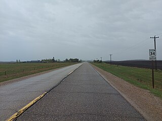
Provincial Trunk Highway 34 is a provincial primary highway located in the Canadian province of Manitoba. It runs from the U.S. border to PTH 16 at the town of Gladstone.

