
Charleswood is a residential community and neighbourhood in Winnipeg, Manitoba, Canada. It is located in the southwest of the city and is bordered by the neighbourhoods of Tuxedo to the east, Whyte Ridge to the south, and the Rural Municipality of Headingley on the west. Its boundaries are Roblin Boulevard and the Assiniboine River to the north, Shaftesbury Boulevard on the east, Wilkes Avenue to the south and the Perimeter Highway to the west.

Turtle Mountain Provincial Park is a provincial park located in the southwestern portion of the Canadian province of Manitoba. Within it are the Adam Lake and Max Lake campgrounds. The park is known for its bike trails, fishing, back country cabins and canoe routes. The park is very popular with families and outdoor enthusiasts.
Emerson is an unincorporated community recognized as a local urban district (LUD) in south central Manitoba, Canada, located within the Municipality of Emerson – Franklin. It has a population of 678 as of the 2016 Canada census.

Morris is a small town in the Pembina Valley region of Manitoba, Canada, located 51 km south of Winnipeg and 42 km north of Emerson. Morris is home to 1,885 people (2016). The town is named after Alexander Morris, the second Lieutenant Governor of Manitoba.
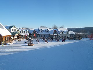
Asessippi Provincial Park is a provincial park in the Rural Municipality of Riding Mountain West, Manitoba, Canada.
Provincial Trunk Highway 75 is a major highway in the Canadian province of Manitoba. It is the main link between the city of Winnipeg and the United States border, where it connects with Interstate 29/U.S. Route 81.
Birds Hill Provincial Park is a provincial park in Manitoba, Canada located in the Boreal Plains ecozone. The park protects areas representative of Aspen/Oak parkland, as well as provides opportunities for recreation. It is located 24 kilometers north of Winnipeg on Highway 59, and covers approximately 8,300 acres or 35.1 km2.

Provincial Trunk Highway 2 is a 315-kilometre (196-mile) highway in the Canadian province of Manitoba. It runs from Highway 13 at the Manitoba-Saskatchewan border to Winnipeg's Perimeter Highway near Oak Bluff.

Provincial Trunk Highway 3 (PTH 3) is a major provincial highway located in the Canadian province of Manitoba. It runs from the Saskatchewan boundary to the southwest city limits of Winnipeg, where it continues as Winnipeg Route 155. Prior before to the implementation of Winnipeg's City Route System, it extended to Pembina Highway.
Provincial Trunk Highway 31 is a provincial highway in the Canadian province of Manitoba. It is a short highway that runs from PTH 3 to the U.S. border where it becomes North Dakota State Highway 1. The entire highway lies within the Municipality of Pembina.
Provincial Trunk Highway 32 is a provincial primary highway located in the Canadian province of Manitoba. It runs from PTH 14 at Winkler to the U.S. border, where it becomes North Dakota State Highway 32. Between its northern end and its intersection with PR 243, PTH 32 follows the Boundary Commission Trail.

Turtle Mountain, or the Turtle Mountains, is an area in central North America, in the north-central portion of the U.S. state of North Dakota and southwestern portion of the Canadian province of Manitoba, approximately 62 miles (100 km) south of the city of Brandon on Manitoba Highway 10 / U.S. Route 281. It is a plateau 2,000 ft above sea level, 300 ft to 400 ft above the surrounding countryside, extending 20 mi (32 km) from north to south and 40 mi (64 km) from east to west. Rising 1,031 feet (314 m), North Dakota's most prominent peak, Boundary Butte, is located at the western edge of the plateau.

Entwistle is a hamlet in Alberta, Canada, within Parkland County. It is at the Yellowhead Highway's intersection with Highway 22/Highway 16A, approximately 95 kilometres (59 mi) west of Edmonton. It sits on the east banks of the Pembina River near the halfway point between Edmonton and Edson.
Provincial Trunk Highway 5 is a provincial primary highway located in the Canadian province of Manitoba.

The Boundary Trail Railway Company is a Canadian short line railway company operating in southern Manitoba. In 2009, the railway purchased 37 kilometres (23 mi) of operational railway linking Morden, Manitoba to the Binney Siding, as well as 89 kilometres (55 mi) of abandoned railway from Binney Siding to the Pembina Valley, and on to Holmfield. Since March 2016, it has also operated with trackage rights on Canadian Pacific Railway's La Riviere sub between Morden and Rosenfeld.
The La Vérendrye Trail is a series of highways in the Canadian province of Manitoba commemorating the oldest waterway fur-trading route in the province. It is named after Pierre Gaultier de Varennes, sieur de La Vérendrye, an explorer and fur-trader who is often credited as being the first European to visit what is now southern Manitoba.

Provincial Road 240 (PR 240) is a 122.8-kilometre-long (76.3 mi) north–south highway in the Pembina Valley and Central Plains regions of Manitoba, connecting the hamlets of Darlingford, Miami, Roseisle, and St. Claude with the city of Portage la Prairie, as well as providing the only road access to the hamlet of Delta Beach on Lake Manitoba.

Provincial Road 253 is a 62.9-kilometre-long (39.1 mi) east–west highway in the Westman and Pembina Valley regions of Manitoba. It serves as a paved connection to Killarney and Pilot Mound, providing access to Pleasant Valley and Glenora along the way. It crosses the Pembina River several times along its journey.

Provincial Road 332 is a 87.2-kilometre-long (54.2 mi) north–south highway in the Pembina Valley and Central Plains regions of Manitoba. Serving as a northern continuation of the much shorter PTH 30, it connects the communities of Rosenfeld, Lowe Farm, Brunkild, Starbuck, and Dacotah.

Provincial Road 342 is a 57.2-kilometre-long (35.5 mi) north–south highway in the Pembina Valley and Westman regions of Manitoba, Canada. Mostly a two-lane gravel road, it connects Clearwater with Glenora, Greenway, and Cypress River.


