
RidingMountain
DuckMountain
PorcupineHills
Pasquia Hills
Location of the Porcupine Hills
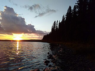
The Porcupine Provincial Forest is a protected boreal forest in Canada which covers the Porcupine Hills on the border of Saskatchewan and Manitoba.
The Porcupine Provincial Forest is a protected boreal forest in Canada which covers the Porcupine Hills on the border of Saskatchewan and Manitoba.

By the end of the 19th century, Eastern Canada had essentially run out of marketable timber due to unsustainable logging techniques, land clearing for settlement and agriculture, and an increase in forest fires caused by settlement. In 1899, the Minister of the Interior Clifford Sifton appointed Elihu Stewart as the chief inspector of timber and forestry for the Dominion of Canada. Stewart's job was to protect undisturbed federal forests from unsustainable logging and settlement practices, and to revitalize lands that had already been deforested. Before 1905, the Porcupine Hills were located entirely within the Northwest Territories in the District of Saskatchewan, which meant that the Porcupine Forest was under full federal control. By 1901, a fire ranging service was established in Western Canada, and plans were made to determine which areas could be used for agriculture, and which areas would be left as forest. [1]
In 1905, the province of Saskatchewan was created, and its eastern border cut through the Porcupine Forest. Approximately 80% of the forest lay within the new province, and the other 20% remained within the Northwest Territories. Unlike the five eastern provinces and British Columbia, the three Prairie Provinces were not given control over their own natural resources. So even though Saskatchewan owned the land beneath the forest, they could not build infrastructure or settlements, or cut any wood, without permission of the federal government. [2]
In 1906, the Canadian government passed the first Dominion Forest Reserves Act, which officially established the Porcupine Forest Reserve as a national forest. They hired forest rangers and built a headquarters at Ushta, Saskatchewan. Many of the first rangers were either forestry engineers from the University of New Brunswick, First World War veterans, or both. By 1914, the new forest reserve was overseen by 11 rangers, and 1 ranger-in-charge, and these rangers also oversaw the Pasquia Forest Reserve. In addition to the headquarters, 4 ranger cabins, 5 stables, and 4 fire towers were built for the rangers. [3]
In 1930, the Saskatchewan Natural Resources Act was passed, which transferred control of Saskatchewan forests (and other natural resources) from the federal government to the Saskatchewan government. [2] [4] Once Saskatchewan officially received ownership of their natural resources, they created the Department of Natural Resources (DNR) to manage them. The rangers that had previously worked for the Dominion Forest Service now worked for the Saskatchewan DNR. [5]
The Canadian Forest Service is a sector of the Canadian government department of Natural Resources Canada. Part of the federal government since 1899, the CFS is a science-based policy organization responsible for promoting the sustainable development of Canada's forests and competitiveness of the forest sector to benefit present and future Canadians. Some of the research areas that the CFS is involved in include; forest fire, climate change, silviculture, soils, insects and disease, remote sensing and forest management. Since 1991 the sector has produced an annual report, The State of the Forest in Canada, which describes the status of the nation's forests and the forest industry.

Northern Manitoba is a geographic and cultural region of the Canadian province of Manitoba. Originally encompassing a small square around the Red River Colony, the province was extended north to the 60th parallel in 1912. The region's specific boundaries vary, as "northern" communities are considered to share certain social and geographic characteristics, regardless of latitude.
Highway 3 is a major provincial highway in the Canadian province of Saskatchewan. It runs from the Alberta border, where it continues west as Alberta Highway 45, to the Manitoba border, and then continues east as Highway 77. Highway 3 is about 615 km (382 mi.) long. The CanAm Highway comprises Saskatchewan Highways 35, 39, 6, 3, as well as 2. 59.7 miles (96.1 km) of Saskatchewan Highway 3 contribute to the CanAm Highway between Melfort and Prince Albert.
The Manitoba Escarpment, or the Western Manitoba Uplands, are a range of hills along the Saskatchewan-Manitoba border. The eastern slopes of the range are considered to be a scarp. They were created by glacial scouring and formed the western shore of prehistoric Lake Agassiz.

Carrot River is a river in Western Canada in the north-eastern part Saskatchewan and the north-western part of Manitoba. The outlet of Wakaw Lake in Saskatchewan marks the beginning of the Carrot River and, from there, it flows north-east past several communities and Indian reserves until it joins the Saskatchewan River in the Cumberland Delta in Manitoba. The river's mouth is west and upstream of the Pasquia River and The Pas on the Saskatchewan River.
Highway 9 is a paved, undivided provincial highway in the Canadian province of Saskatchewan. It runs from North Dakota Highway 8 at the US border near Port of Northgate until it transitions into Provincial Road 283 at the Manitoba provincial boundary.
The Saskota Flyway is known as the International Road to Adventure, because it takes you from Hudson Bay, Saskatchewan, all the way south to Bismarck, North Dakota.

The natural resources acts were a series of Acts passed by the Parliament of Canada and the provinces of Alberta, British Columbia, Manitoba and Saskatchewan in 1930 to transfer control over crown lands and natural resources within these provinces from the Government of Canada to the provincial governments. Alberta, Manitoba and Saskatchewan had not been given control over their natural resources when they entered Confederation, unlike the other Canadian provinces. British Columbia had surrendered certain portions of its natural resources and Crown lands to the federal government, the Railway Belt and the Peace River Block, when it entered Confederation in 1871, as part of the agreement for the building of the transcontinental railway.
Mistatim is a village in the Canadian province of Saskatchewan within the Rural Municipality of Bjorkdale No. 426 and Census Division No. 14. It is just north of Highway 3. Mistatim is 35 miles (56 km) east of the Town of Tisdale and 40 miles (64 km) west of Hudson Bay. The Greenwater Lake Provincial Park is 30 miles (48 km) to the south.
The Porcupine Hills refer to various groups of hills and uplands located in the prairie provinces of Canada, specifically the provinces of Saskatchewan and Manitoba. They are part of the Manitoba Escarpment, which was the shoreline of the ancient glacial Lake Agassiz. The hills are located north-west of Swan River, Manitoba, and are the headwaters of the Swan River. The highest elevation in the Porcupine Hills is Hart Mountain, at an elevation of 823 metres (2,700 ft), which makes it Manitoba's second-highest point. The Porcupine Provincial Forest surrounds the area.
Mountain Cabin Recreation Site is a recreation site, and former settlement, near the north-eastern ridge of the Pasquia Hills in Canadian province of Saskatchewan.
Armit Meadows Ecological Reserve is an ecological reserve located in Porcupine Provincial Forest, Manitoba, Canada. It was established in 2015 under the Manitoba Ecological Reserves Act. It is 2.63 square kilometres (1.02 sq mi) in size.
Porcupine Hills Provincial Park is the newest provincial park in the Canadian Province of Saskatchewan. It was created in 2018 through the amalgamation of five pre-existing provincial recreation sites south-east of the town of Hudson Bay. The park is in the Porcupine Provincial Forest in the Porcupine Hills, which is a geographical feature in eastern Saskatchewan and western Manitoba. The hills are part of a range of hills called the Manitoba Escarpment.
Hudson Bay Regional Park is a regional park in the Canadian province of Saskatchewan. It is located on the south side of the town of Hudson Bay in the RM of Hudson Bay No. 394 along the shores of the Red Deer River. The park is the site of a North West Company fur trading fort called Fort Red Deer River that was built in 1790. About 14 kilometres (8.7 mi) downstream, near Erwood, was a Hudson's Bay Company trading post that was built in 1757.

Red Deer River is a river in the Canadian provinces of Saskatchewan and Manitoba. It has its source at Nut Lake in east central Saskatchewan and from there, it flows east towards Manitoba where it empties into Dawson Bay of Lake Winnipegosis. To the north of Red Deer's basin is the Saskatchewan River, to the south-west is the upper Assiniboine River, and to the south-east is Swan River.
Pasquia Hills are hills in the Canadian province of Saskatchewan. They are located in the east central part of the province in the RM of Hudson Bay No. 394 near the Manitoba border. The hills are the northern most in a series of hills called the Manitoba Escarpment. The Manitoba Escarpment marks the western edge of the pre-historical glacial Lake Agassiz. The other four hills include Porcupine Hills, Duck Mountain, and Riding Mountain.
Fir River is a river in the Canadian province of Saskatchewan. The river's source is in the east central part of the province in the heart of the Pasquia Hills, which is one of four landforms that make up the Manitoba Escarpment. It flows in a southward direction until it meets up with the Red Deer River south of the town of Hudson Bay in Hudson Bay Regional Park. The river is in the boreal forest. Fir River is in the Nelson River drainage basin.
Piwei River is a river in the east-central part of the Canadian province of Saskatchewan in the boreal forest ecozone of Canada. It begins at the western end of the Porcupine Hills at Piwei Lakes and heads in an easterly direction through a glacier-formed valley and into the Etomami River, which is a tributary of the Red Deer River.
Woody River is a river in the Canadian provinces of Manitoba and Saskatchewan. The river's source is in the Porcupine Hills and Porcupine Provincial Forest of eastern Saskatchewan. From there it flows south through boreal forest and then east through Boreal Plains in the Parkland Region of Manitoba en route to Swan Lake. The river parallels the Swan River for much of its route as it travels through Swan River Valley between Duck Mountain and Porcupine Hills of the Manitoba Escarpment. Bowsman is the only notable community along the course of Woody River. Several highways cross it, including Saskatchewan's Highway 980, Manitoba's Roads 588, 587, 366, 268, and Manitoba's Highway 10.
Armit River is a river in the Canadian provinces of Manitoba and Saskatchewan in the Nelson River drainage basin. The river begins in the Porcupine Hills of the Manitoba Escarpment at Armit Lake and flows in a northerly direction closely following the Manitoba / Saskatchewan border and into Red Deer Lake along the course of the Red Deer River.
52°24′57″N101°56′26″W / 52.41583°N 101.94056°W