Sturgeon River is a river in the Hudson Bay drainage basin in the central part of the Canadian province of Saskatchewan. It flows from its source in the Waskesiu Hills in Prince Albert National Park to the North Saskatchewan River, just west of the city of Prince Albert.
McDougal Creek is a river in the Canadian province of Saskatchewan. The river's source is at the southern end of Divide Lake at the northern end of Narrow Hills Provincial Park in a hilly plateau called Cub Hills. The landforms of the Cub Hills, such as the lakes, streams, steeply rolling hills, and flat lowlands, were formed over 10,000 years ago during the last ice age. The entire course of the river is in the boreal forest ecozone of Canada.

Nipekamew River is a river in the Canadian province of Saskatchewan. The river's source is Nipekamew Lake at the north-western edge of the Cub Hills and its mouth is in Nipekamew Bay at the southern shore of Lac la Ronge. From the northern tip of Nipekamew Lake, the river travels from south to north through muskeg and boreal forest en route to Lac la Ronge. Lake la Ronge empties north into the Churchill River through Rapid River.
Nipekamew Lake is a lake in the Canadian province of Saskatchewan. The lake is north-east of Clarence-Steepbank Lakes Provincial Park and north-west of Narrow Hills Provincial Park and the Cub Hills. It is a long and narrow lake that runs in a north to south direction and is surrounded by boreal forest, rolling hills, and muskeg. The outflow, Nipekamew River, is at the northern end of the lake and at the southern end of the lake, neighbouring East Trout Lake flows directly into it through a short channel. Several other smaller rivers, such as Nipekamew Creek, also flow into the lake. The lake is part of the Churchill River watershed, which flows into the Hudson Bay.
East Trout Lake is a lake in the Canadian province of Saskatchewan. The lake is directly north of Clarence-Steepbank Lakes Provincial Park in Saskatchewan's Northern Administration District. It is a long and narrow lake that runs in a west to east direction and is surrounded by boreal forest, rolling hills, and muskeg. Several streams flow into the lake and its outflow is at the eastern end where it flows directly into neighbouring Nipekamew Lake through a short channel and bay. The lake is part of the Churchill River watershed, which flows into the Hudson Bay.
White Gull Creek is a river in the Canadian province of Saskatchewan. The river's source is White Gull Lake, near the south-western boundary of Narrow Hills Provincial Park and near the southern slopes of the Cub Hills. The river travels through boreal forest and muskeg en route to its mouth at the Torch River. The Torch River is a tributary of the Saskatchewan River as it flows into one of North America's largest inland fresh water deltas, the Saskatchewan River Delta. There are no communities nor settlements along the river.
Lost Echo Lake is a lake in the east-central part of the Canadian province of Saskatchewan in Narrow Hills Provincial Park. It is situated in a glacier-formed valley in the Cub Hills and the boreal forest ecozone of Canada. It is south of Summit Lake and is accessed from secondary roads that branch off of Highway 913. While there are no communities nor settlements on the lake, there is the Lost Echo Wilderness Campsite on the western shore.
Summit Lake is a lake in the east-central part of the Canadian province of Saskatchewan in Narrow Hills Provincial Park. It is situated in a glacier-formed valley in the Cub Hills and the boreal forest ecozone of Canada. It is located north of Lost Echo Lake and is accessed from Highway 913. There are no communities or settlements on the lake.
Piprell Lake is a lake in the Canadian province of Saskatchewan in the boreal forest ecozone of Canada. The lake is located in the Northern Saskatchewan Administration District, just south of the geographical centre of Saskatchewan in the Cub Hills. It is west of the western boundary of Narrow Hills Provincial Park and south-east of Clarence-Steepbank Lakes Provincial Park Piprell Lake Recreation Site and Rainbow Lodge are situated at the northern end of the lake and its amenities are accessed from Highway 913.
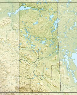
The Cub Hills are a hilly plateau located south-east of the geographical centre of the Canadian province of Saskatchewan. The hills are in the boreal forest ecozone of Canada and the landforms of the hills were shaped more than 10,000 years ago during last ice age. Throughout the Cub Hills, there are dozens of lakes and rivers and several parks. The Cubs Hills are 150 km (93 mi) north-east of Prince Albert and are in the Northern Saskatchewan Administration District and Census Division #18. Several highways criss-cross the plateau to provide access to the various parks and other amenities.
Woody River is a river in the Canadian provinces of Manitoba and Saskatchewan. The river's source is in the Porcupine Hills and Porcupine Provincial Forest of eastern Saskatchewan. From there it flows south through boreal forest and then east through Boreal Plains in the Parkland Region of Manitoba en route to Swan Lake. The river parallels the Swan River for much of its route as it travels through Swan River Valley between Duck Mountain and Porcupine Hills of the Manitoba Escarpment. Bowsman is the only notable community along the course of Woody River. Several highways cross it, including Saskatchewan's Highway 980, Manitoba's Roads 588, 587, 366, 268, and Manitoba's Highway 10.
Midnight Creek is a river in the Canadian province of Saskatchewan. The river begins in the heart of the Porcupine Hills and of the Manitoba Escarpment and heads in a generally south-east direction through the Porcupine Provincial Forest before emptying into Elbow Lake. A short river connects Elbow Lake to Woody Lake, which is the source for Woody River. Highway 980 follows the river for much of its course.
Townsend Lake is a lake in the Canadian province of Saskatchewan. It is located in the east-central part of the province in the Porcupine Hills and Porcupine Provincial Forest. The lake is in the Woody River Block of Porcupine Hills Provincial Park. Highway 980 provides access to the east side of the lake and its amenities. Several small creeks feed into the lake from the surrounding hills, lakes, and muskeg. The outflow is a short river at the eastern end of the lake that flows into the western end of Woody Lake.
Isbister Lake is a lake in the Canadian province of Saskatchewan. It is located in the east-central part of the province along the course of Midnight Creek in the Porcupine Hills and Porcupine Provincial Forest. The lake is in the Woody River Block of Porcupine Hills Provincial Park. Highway 980 provides access to the southern shore of the lake and its amenities. Isbister Lake is situated in boreal forest surrounded by hills, other small lakes, and muskeg.
Cowan River is a river in the west-central part of the Canadian province of Saskatchewan in the boreal forest ecozone of Canada. The river begins at Cowan Lake Dam near the northern end of Cowan Lake and flows north-west through muskeg and forest to meet Beaver River. Beaver River then flows into Lac Île-à-la-Crosse and the Churchill River. The entirety of Cowen River is within the Northern Saskatchewan Administration District and while there are no communities along its course, the towns of Big River and Spiritwood are in its watershed.
Clarence Lake is a lake in Clarence-Steepbank Lakes Provincial Park in the Canadian province of Saskatchewan. The lake is in a glacier-carved valley in the Boreal forest ecozone of Canada and is part of the Bow River chain of lakes at the headwaters of the Bow River, which is a tributary of Lac la Ronge in the Churchill River watershed.
Steepbank Lake is a lake in Clarence-Steepbank Lakes Provincial Park in the Canadian province of Saskatchewan. The lake is in a glacier-carved valley in the Boreal forest ecozone of Canada and is part of the Bow River chain of lakes near the headwaters of the Bow River, which is a tributary of Lac la Ronge in the Churchill River watershed.
Bow River is a river in the Northern Administration District of the Canadian province of Saskatchewan. The river begins at Ridge Lake of Bow River chain lakes in Clarence-Steepbank Lakes Provincial Park and flows in a northerly direction into Lac la Ronge and Lac La Ronge Provincial Park. Rapid River connects Lac la Ronge to the Churchill River. There are no communities nor settlements along the river's course.

Armit River is a river in the Canadian provinces of Manitoba and Saskatchewan in the Nelson River drainage basin. The river begins in the Porcupine Hills of the Manitoba Escarpment at Armit Lake and flows in a northerly direction closely following the Manitoba / Saskatchewan border and into Red Deer Lake along the course of the Red Deer River.
Whiteswan Lakes are a group of lakes in the Canadian province of Saskatchewan. The lakes are in the boreal forest ecozone west of the Cub Hills. At the southern end of the lakes, on Whelan Bay, is a provincial recreation site and a resort with lodging, camping, and recreational access to the lakes.