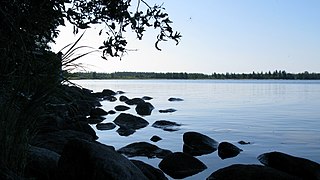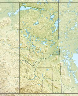
Duck Mountain Provincial Park is a provincial park, located in the Canadian province of Saskatchewan 14 kilometres (8.7 mi) east of the town of Kamsack and stretches about 12 kilometres (7.5 mi) eastward to the Saskatchewan / Manitoba boundary. The park covers approximately 150 km2 (58 sq mi). Road access to the park is via Highway 57, which connects Saskatchewan Highway 5 to Manitoba Highway 83.

Candle Lake is a reservoir in the central part of the Canadian province of Saskatchewan in the boreal forest, approximately 80 kilometres (50 mi) north-east of Prince Albert. A dam completed in 1979 at the southern end of the lake regulates water levels; several small creeks feed into the lake and Torch River flows out of the lake at the dam. Candle Lake Provincial Park surrounds most of the lake and the resort village of Candle Lake is at the southern end.

Meadow Lake Provincial Park is a northern boreal forest provincial recreational park along the Waterhen and Cold Rivers in the Canadian province of Saskatchewan. The park was founded on 10 March 1959, is the largest provincial park in Saskatchewan, and encompasses over 25 lakes in an area of 1,600 km2 (620 sq mi). The park was named "Meadow Lake" after the city of Meadow Lake and Meadow Lake. The city and the lake are not in the park and are located about 40 kilometres (25 mi) south-east of the nearest park entrance, which is about 5 kilometres (3.1 mi) north of Dorintosh. The length of the park stretches about 113 kilometres (70 mi) from Cold Lake on the Saskatchewan / Alberta border in the west to the eastern shore of Waterhen Lake in the east.

Tobin Lake is a reservoir along the course of the Saskatchewan River in the Canadian province of Saskatchewan. Tobin Lake was formed by the building of the E.B. Campbell Dam on the Saskatchewan River in 1963. Tobin Lake is named for William Thorburn, who was a fur trader on the Saskatchewan River. He had built a trading post on the Saskatchewan River where it is met by the Petaigan River. The rapids near the post became known as the "Thornburn Rapids". The name was later shortened to "Tobin Rapids".

Narrow Hills Provincial Park is a northern boreal forest provincial recreational park in the Canadian province of Saskatchewan. It is located in a hilly plateau called the Cub Hills and contains several recreational facilities and over 25 accessible lakes within its boundaries. The geographical features of the park, including the lakes, valleys, and lowlands were formed over 10,000 years ago during the last ice age. The town of Smeaton is the closest community and it is located 70 kilometres (43 mi) to the south.

Echo Valley Provincial Park is a provincial park in the Canadian province of Saskatchewan, located west of the town of Fort Qu'Appelle in the Qu'Appelle Valley between Echo Lake and Pasqua Lake in the RM of North Qu'Appelle No. 187. The three main roads to access the park are Highways 210, 56, and 727.
Crooked Lake is a recreational lake located in the south-eastern region of the Canadian province of Saskatchewan. It is part of a chain of lakes in the Qu'Appelle Valley and, like many of the other lakes in the valley, there's a dam at the eastern end that controls water levels.

Lac la Plonge is a glacial lake in the Canadian province of Saskatchewan in the basin of the Beaver River, near Lac Île-à-la-Crosse. It is located in the boreal forest near the Canadian Shield. On the lake's northern shore, the community of Lac La Plonge, a resort, and campgrounds are accessed via Highway 165.
Greenwater Lake Provincial Park is a provincial park in the Canadian province of Saskatchewan. It is located on the eastern side of the province in the Porcupine Hills on Highway 38. The closest town, Porcupine Plain, is about 28 kilometres (17 mi) to the north-east of the park visitor centre. Founded on 19 February 1932, Greenwater is one of the oldest provincial parks in Saskatchewan. The original six parks were established in 1931 and Greenwater Provincial Park was added one year later. In 1964, the park was expanded to its current size.

Saskatchewan Landing Provincial Park is a provincial park in the Canadian province of Saskatchewan. It is in the valley of the South Saskatchewan River at the western end of Lake Diefenbaker in the RM of Saskatchewan Landing No. 167, about 50 kilometres (31 mi) north of Swift Current. The park is 5,735 hectares in size.
Pierce Lake is a lake in Meadow Lake Provincial Park in the Canadian Province of Saskatchewan. It is situated along the course of the Cold River in the boreal forest ecozone of Canada. Upstream along Cold River from Pierce Lake is Cold Lake and downstream are Lepine Lake and Lac des Îles. Pierce Lake and Cold River are in the Beaver River watershed, which is part of the Churchill River and Hudson Bay drainage basin.
Lac des Îles is a lake in Meadow Lake Provincial Park in the Canadian Province of Saskatchewan in the boreal forest ecozone of Canada. The primary inflow is the Cold River and its outflow is the Waterhen River. The lake and associated rivers are part of the Hudson Bay drainage basin as the Waterhen River flows into Beaver River, which meets the Churchill River, a major river that flows into Hudson Bay, at Lac Île-à-la-Crosse.
Lower Fishing Lake is a lake in the east-central part of the Canadian province of Saskatchewan in Narrow Hills Provincial Park. It is situated in the Cub Hills and the boreal forest ecozone of Canada. The lake is accessed from Highway 920, which connects to Hanson Lake Road and Highway 120. The Fishing Lakes Fire of 1977 burned much of the region upstream and around the lake and now the area is now dominated by jack pine, which is a tree species that is well adapted fire burned forests.

Good Spirit Lake is a lake on the eastern side of the Canadian province of Saskatchewan. It is a shallow lake notable for its naturally sandy beaches, parks, and sand dunes. One of Saskatchewan's six founding provincial parks, Good Spirit Lake Provincial Park, surrounds the western and southern shores of the lake. The lake is in the RM of Good Lake No. 274 and Yorkton, 48 kilometres (30 mi) to the south, is the nearest city. The hamlets of Burgis Beach and Canora Beach — the only two communities on the lake — are located on the eastern shore. The southern shore of the lake is accessed from Highway 229 and the northern shore is accessed from Highway 746. Highway 47 runs north to south west of the lake and Good Spirit Lake Provincial Park.
The Battlefords Provincial Park is a recreational provincial park in the Canadian Province of Saskatchewan. It is about 39 kilometres (24 mi) north of the city of North Battleford in the RM of Meota No. 468 on Jackfish Lake. Highway 4 runs north from North Battleford to the park and Highway 204 runs through the park providing access to the amenities.
Brightsand Lake is a lake in the Canadian Province of Saskatchewan. It is located in the Rural Municipality of Mervin No. 499 in the west-central part of the province in the aspen parkland ecoregion. Brightsand Creek–located on the western side of the lake–is the outflow and it flows in a southerly direction into Turtlelake River, which is a tributary of the North Saskatchewan River. Turtle Lake is about 9.5 kilometres (5.9 mi) to the east and the Meadow Lake Escarpment is to the north-east.
Candle Lake Provincial Park is a provincial park in the central region of the Canadian province of Saskatchewan. Prior to the park's establishment in 1986, it was a provincial recreation site. Located in the Rural Municipality of Paddockwood No. 520, Candle Lake Provincial Park surrounds most of Candle and Torch Lakes in the boreal forest ecozone of Canada. The park has a variety of activities including camping, boating, fishing, swimming, mini golfing, hiking, and golfing. Around the lake there are also boat launches and several marinas. Natural attractions include a purple sand beach, sand dunes, mature forests, crystal clear lake water, and several natural sand beaches.

Douglas Provincial Park is a provincial park in the Canadian province of Saskatchewan. Established in 1973, it is named after Tommy Douglas, the seventh premier of Saskatchewan and father of Canada's first single-payer, universal health care programme. The park is located along the Gordon McKenzie Arm of Lake Diefenbaker and at the Qu'Appelle River Dam, which is the source of the Qu'Appelle River. The closest community is Elbow and access to the park is from Highway 19.
Great Blue Heron Provincial Park is a recreational park in the central region of the Canadian province of Saskatchewan in the boreal forest ecozone of Canada. It is adjacent to the eastern boundary of Prince Albert National Park, about 50 kilometres (31 mi) north of the city of Prince Albert. The provincial park was established in 2013 from two pre-existing provincial recreation sites – Emma Lake and Anglin Lake Recreation Sites – and the addition of a large tract of Crown land.
Makwa Lake Provincial Park is a recreational provincial park in the west-central region of the Canadian province of Saskatchewan in the transition zone between parkland and boreal forest. The park was established in 1986 and is centred around the lakes of Big Jumbo, Little Jumbo, and Makwa. Prior to its establishment, the park was a provincial recreation site. The main entrance to Makwa Lake Park is at the south-east corner of Makwa Lake about 3 kilometres (1.9 mi) west of the village of Loon Lake. Access is from Highway 699.


