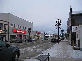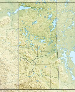
Flin Flon is a mining city, located on a correction line on the border of the Canadian provinces of Manitoba and Saskatchewan, with the majority of the city located within Manitoba. Residents thus travel southwest into Saskatchewan, and northeast into Manitoba. The city is incorporated in and is jointly administered by both provinces.
Cranberry Portage is an unincorporated community recognized as a local urban district located in the Rural Municipality of Kelsey, Manitoba. It was an important part of the pre-European contact trade routes of the Cree and Assiniboine peoples. Long before the fur trade with the Bay and during the Fur Trade, this location was used as a campsite and portage between Grassy River, at the head of a number of well-used routes from Hudson Bay, and Lake Athapapuskow, which connected to the Saskatchewan River system. Once on the Saskatchewan routes were open through the prairies to the foothills of the Rocky Mountains.

Northern Manitoba is a geographic and cultural region of the Canadian province of Manitoba. Originally encompassing a small square around the Red River Colony, the province was extended north to the 60th parallel in 1912. The region's specific boundaries vary, as "northern" communities are considered to share certain social and geographic characteristics, regardless of latitude.

Bakers Narrows, Manitoba, is a small residential community approximately 20 km (12 mi) southeast of Flin Flon on Lake Athapapuskow. There are five subdivisions located near the lakeshore with a total of approximately 150 cottages, many of which are permanent residences.

Cumberland House is a community in Census Division No. 18 in northeast Saskatchewan, Canada on the Saskatchewan River. It is the oldest community in Saskatchewan and has a population of about 2,000 people. Cumberland House Provincial Park, which provides tours of an 1890s powder house built by the Hudson's Bay Company, is located nearby.
Denare Beach is a northern village on the east shore of Amisk Lake, Saskatchewan. Located on Highway 167, the community is 20 kilometres (12 mi) south-west of Flin Flon and 422 kilometres (262 mi) north-east of Prince Albert.

Island Falls is a hydroelectric power station operated by SaskPower, a Saskatchewan crown corporation. It is located on the Churchill River, about 97 km (60 mi) northwest of Flin Flon, Manitoba, Canada.

Fort Carlton was a Hudson's Bay Company fur trading post from 1795 until 1885. It was located along the North Saskatchewan River not far from Duck Lake, in what is now the Canadian province of Saskatchewan. The fort was rebuilt by the government of Saskatchewan as a feature of a provincial historic park and can be visited today. It is about 65 kilometres (40 mi) north of Saskatoon.
Highway 123 is a provincial highway in the Canadian province of Saskatchewan. It runs from Highway 55, 600 metres (2,000 ft) east of its intersection with Highway 23, to Cumberland House on Cumberland Island. It is about 137 kilometres (85 mi) long.

Last Mountain Lake, also known as Long Lake, is a prairie lake formed from glaciation 11,000 years ago. It is located in south central Saskatchewan, Canada, about 40 kilometres (25 mi) north-west of the city of Regina. It flows into the Qu'Appelle River via Last Mountain Creek, which flows past Craven. It is approximately 93 km (58 mi) long, and 3 km (1.9 mi) wide at its widest point. It is the largest naturally occurring body of water in southern Saskatchewan. Only Lake Diefenbaker, which is man-made, is larger. The lake is a popular resort area for residents of south-eastern Saskatchewan.
Transport in Saskatchewan includes an infrastructure system of roads, highways, freeways, airports, ferries, pipelines, trails, waterways, and railway systems serving a population of approximately 1,098,352 inhabitants year-round.
Touchwood Hills Post Provincial Park is the location of a former Hudson's Bay Company (HBC) fur trading post that existed from 1879 to 1909 in the Touchwood Uplands of the Canadian province of Saskatchewan. In 1986, the site was designated a provincial park. It is located along Highway 15 in the RM of Kellross No. 247, about 10 kilometres (6.2 mi) west of Lestock and 16 kilometres (9.9 mi) east of Punnichy.

Amisk Lake is a lake in the east-central part of the Canadian province of Saskatchewan, about 22 kilometres (14 mi) south-west of Flin Flon, Manitoba. 'Amisk' means beaver in Cree. Saskatchewan Highway 167 provides road access. Denare Beach, the largest settlement, is located at the north-east corner of the lake.

Montreal River is a river in the Canadian province of Saskatchewan. It flows 100 kilometres (62 mi) from Montreal Lake to Lac la Ronge and is part of the Churchill River and Hudson Bay drainage basins. Along its course, Montreal River runs through boreal forests, muskeg, and glacier formed valleys. Within its watershed are the Waskesiu Uplands, much of Prince Albert National Park, and several notable lakes, such as Waskesiu, Kingsmere, Crean, Weyakwin, and Bittern.
The Hudson Bay Railway (HBR) is a historic rail line in Manitoba, Canada, to the shore of Hudson Bay. The venture began as a line between Winnipeg in the south and Churchill, and/or Port Nelson, in the north. However, HBR came to describe the final section between The Pas and Churchill.

Lake Athapapuskow is a glacial lake in Manitoba and Saskatchewan, Canada, located 15 km (9.3 mi) southeast of Flin Flon, Manitoba. The lake is in the Hudson Bay drainage basin and is the source of the Goose River.
Hudson Bay Regional Park is a regional park in the Canadian province of Saskatchewan. It is located on the south side of the town of Hudson Bay in the RM of Hudson Bay No. 394 along the shores of the Red Deer River. The park is the site of a North West Company fur trading fort called Fort Red Deer River that was built in 1790. About 14 kilometres (8.7 mi) downstream, near Erwood, was a Hudson's Bay Company trading post that was built in 1757.
Hanson Lake is a lake in the east-central part of the Canadian province of Saskatchewan in the boreal forest ecozone of Canada. The lake is irregularly shaped with many bays, islands, and channels as it was formed by glaciers during the last ice age. It is fed by multiple rivers and creeks from surrounding hills, smaller lakes, and muskeg. Hanson Lake's outflow is through a short river at the eastern end of the lake as it flows into the Sturgeon-Weir River, a tributary of the Saskatchewan River.
The Cub Hills are a hilly plateau located south-east of the geographical centre of the Canadian province of Saskatchewan. The hills are in the boreal forest ecozone of Canada and the landforms of the hills were shaped more than 10,000 years ago during last ice age. Throughout the Cub Hills, there are dozens of lakes and rivers and several parks. The Cubs Hills are 150 km (93 mi) north-east of Prince Albert and are in the Northern Saskatchewan Administration District and Census Division #18. Several highways criss-cross the plateau to provide access to the various parks and other amenities.
Cumberland Island, also known as Pine Island, is a small island in the Saskatchewan River Delta in the east-central region of the Canadian province of Saskatchewan. The Saskatchewan River Delta is one of the largest active inland deltas in North America. Cumberland Island is situated between Cumberland Lake to the north and the Saskatchewan River to the south. The Tearing River runs along the eastern edge of the island and Bigstone River along the western edge. The Bigstone River separates Cumberland Island from Spruce Island to the west. The island is in the Mid-Boreal Lowland region, which consists of mixed coniferous and deciduous forests of white and black spruce, jack pine, tamarack, trembling aspen, balsam poplar, and balsam fir.


