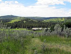
The Cypress Hills are a geographical region of hills in southwestern Saskatchewan and southeastern Alberta, Canada. The hills are part of the Missouri Coteau upland. The hills cover an area of approximately 2,500 km2 (970 sq mi). About 400 km2 (150 sq mi) or 16% of this area is an interprovincial park.

The North-West Mounted Police (NWMP) was a Canadian paramilitary police force, established in 1873, to maintain order in the new Canadian North-West Territories (NWT) following the 1870 transfer of Rupert's Land and North-Western Territory to Canada from the Hudson's Bay Company, the Red River Rebellion and in response to lawlessness, demonstrated by the subsequent Cypress Hills Massacre and fears of United States military intervention. The NWMP combined military, police and judicial functions along similar lines to the Royal Irish Constabulary. A small, mobile police force was chosen to reduce potential for tensions with the United States and First Nations. The NWMP uniforms included red coats deliberately reminiscent of British and Canadian military uniforms.

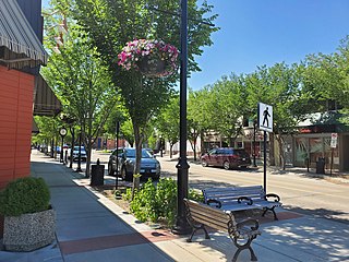
Fort Saskatchewan is a city along the North Saskatchewan River in Alberta, Canada. It is 25 kilometres (16 mi) northeast of Edmonton, the provincial capital. It is part of the Edmonton census metropolitan area and one of 24 municipalities that constitute the Edmonton Metropolitan Region Board. Its population in the 2021 federal census was 27,088.

The Cypress Hills Massacre occurred on June 1, 1873, near Battle Creek in the Cypress Hills region of Canada's North-West Territories. It involved a group of American bison hunters, American wolf hunters or "wolfers", American and Canadian whisky traders, Métis cargo haulers or "freighters", and a camp of Assiniboine people. Thirteen or more Assiniboine warriors and one wolfer died in the conflict. The Cypress Hills Massacre prompted the Canadian government to accelerate the recruitment and deployment of the newly formed North-West Mounted Police.

Fort Calgary was a North-West Mounted Police outpost at the confluence of the Bow and Elbow rivers in present-day Calgary, Alberta, Canada. Originally named Fort Brisebois, after the outpost's first commander, the outpost was renamed Fort Calgary in June 1876.

Fort Macleod is a town in southern Alberta, Canada. It was originally named Macleod to distinguish it from the North-West Mounted Police barracks it had grown around. The fort was named in honour of the then Commissioner of the North-West Mounted Police, Colonel James Macleod. Founded as the Municipality of the Town of Macleod in 1892, the name was officially changed to the already commonly used Fort Macleod in 1952.

Fort Whoop-Up was the nickname given to a whisky trading post, originally Fort Hamilton, near what is now Lethbridge, Alberta. During the late 19th century, the post served as a centre for trading activities, including the illegal whisky trade. The sale of whisky was outlawed but, due to the lack of law enforcement in the region prior to 1874, many whisky traders had settled in the area and taken to charging unusually high prices for their goods.

James Morrow Walsh was a North-West Mounted Police (NWMP) officer and the first commissioner of Yukon.

Fort Battleford was the sixth North-West Mounted Police fort to be established in the North-West Territories of Canada, and played a central role in the events of the North-West Rebellion of 1885. It was here Chief Poundmaker was arrested, and where six Cree and two Stoney men were hanged for murders committed in the Frog Lake Massacre and the Looting of Battleford. In reference to the hanging, Prime Minister John A. Macdonald said in a letter that "the executions... ought to convince the Red Man that the White Man governs."
Wood Mountain Regional Park is a conservation and recreation area in its natural state set aside as a regional park in the south-western region of the Canadian province of Saskatchewan. The park is set in the semi-arid Palliser's Triangle in an upland area called Wood Mountain Hills. It is in the Rural Municipality of Old Post No. 43, 8 kilometres (5.0 mi) south of the village of Wood Mountain along Highway 18.

Writing-on-Stone Provincial Park is located about 100 kilometres (60 mi) southeast of Lethbridge, Alberta, Canada, or 44 kilometres (30 mi) east of the community of Milk River, and straddles the Milk River itself. It is one of the largest areas of protected prairie in the Alberta park system, and serves as both a nature preserve and protection for many First Nations (indigenous) rock carvings and paintings. The park is sacred to the Blackfoot and many other aboriginal tribes.

Maple Creek is a town in the Cypress Hills of southwest Saskatchewan, Canada. It is surrounded by the Rural Municipality of Maple Creek No. 111. The population was 2,176 at the 2021 Census.

Fort Carlton was a Hudson's Bay Company fur trading post from 1795 until 1885. It was located along the North Saskatchewan River not far from Duck Lake, in what is now the Canadian province of Saskatchewan. The fort was rebuilt by the government of Saskatchewan as a feature of a provincial historic park and can be visited today. It is about 65 kilometres (40 mi) north of Saskatoon.

The modern history of Lethbridge extends to the mid-19th century, when the area was developed from drift mines opened by Nicholas Sheran in 1874, and the North Western Coal and Navigation Company in 1882. Prior to the development of drift mines in the area, Lethbridge, Alberta was known as Coal Banks, and was part of the territory of the Blackfoot Confederacy. The Confederacy was made up of the Kainai Nation, the Northern Peigan, the Southern Peigan (Blackfeet), and the Siksika Nation.

The March West was the initial journey of the North-West Mounted Police (NWMP) to the Canadian prairies, made between July 8 and October 9, 1874.

The Red Coat Trail is a 1,300-kilometre (810 mi) route that approximates the path taken in 1874 by the North-West Mounted Police in their March West from Fort Dufferin to Fort Whoop-Up.
Carmichael is a special service area within the Rural Municipality of Carmichael No. 109, Saskatchewan, Canada that held village status prior to 2019. The population was 58 at the 2016 Census. Carmichael lies 1 km (1 mi) south of Highway 1 commonly known as the Trans Canada Highway, approximately 158 km (98 mi) east of city of Medicine Hat, Alberta.

Fort Dufferin is a former Canadian government post near the Canada–United States border at Emerson, Manitoba. The fort was used during the 1870s as a base for the North American Boundary Commission and the North-West Mounted Police (NWMP), and as an immigration station. It was designated a national historic site of Canada in 1937.

Carry the Kettle Nakoda Nation is a Nakota (Assiniboine) First Nation in Canada located about 80 km (50 mi) east of Regina, Saskatchewan and 13 km (8.1 mi) south of Sintaluta. The reservation is in Treaty 4 territory.
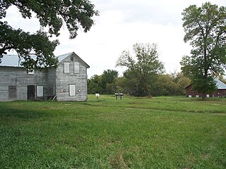
Wood Mountain Post Provincial Park is a 5.48-hectare historical provincial park in the Canadian province of Saskatchewan. The site was designated as an historic site in the 1960s and became a provincial park in 1986. Originally, it was the location of a North-West Mounted Police (NWMP) post that operated from 1887 to 1918. The post was established to develop relations with local Indians, patrol the Canada–United States border, and to perform general policing duties.


