Crichton is an unincorporated community within the Rural Municipality of Wise Creek No. 77, Saskatchewan, Canada. It is located between Admiral and Cadillac on the historic Red Coat Trail, also known as Highway 13. Like so many towns along the Red Coat Trail, Crichton has become a ghost town with only one family remaining and many empty buildings scattered throughout the town site.

Vidora is an unincorporated community within the Rural Municipality of Reno No. 51, Saskatchewan, Canada. The community once had a population of 200 people in 1940 and has since declined to 1 resident. It previously held village status until it was dissolved as an unincorporated community on January 1, 1952. The community is located between Robsart and Consul on highway 21 & highway 13 known as the Red Coat Trail. Very little remains of the former village, only one home that is also used as a post office still stands as of 2008. There are many cement foundations and sidewalks still found scattered around the town site, including the remnants of the old bank vault to the former Municipality Office that was moved to Consul.

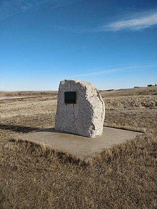
Brooking was once a community in the province of Saskatchewan, Canada. It was named after Brookings, South Dakota.
Baljennie is an unincorporated community in Glenside Rural Municipality No. 377, Saskatchewan, Canada. Its first post office opened in 1891.

Neidpath, is a hamlet in Coulee Rural Municipality No. 136, Saskatchewan, Canada. The hamlet is located on Highway 363 and Highway 720 about 25 km east of the city of Swift Current.
Parkbeg is a hamlet in Wheatlands Rural Municipality No. 163, Saskatchewan, Canada. The hamlet is located at the junction of Highway 1 and Highway 627 approximately 58 km directly west of the City of Moose Jaw on the Trans Canada Highway.
Divide is an unincorporated community within the Rural Municipality of Frontier No. 19, Saskatchewan, Canada. The community is 35 kilometres (22 mi) directly south of the community of Robsart and 85 kilometres (53 mi) southwest of the town of Eastend on Highway 18. Very little remains in Divide. Only a church and post office still stand.
'Loomis, also known as Echo", is an unincorporated community in Frontier Rural Municipality No. 19, Saskatchewan, Canada. The community is located on the intersection of Highway 18 and Highway 614, about 70 km southeast of the community of Robsart and about 38 km south of the town of Eastend.
Ravenscrag is an unincorporated community within the Rural Municipality of White Valley No. 49, Saskatchewan, Canada. The community is located on Highway 614, along the Frenchman River, 60 kilometres (37 mi) east of the Alberta-Saskatchewan border and about 185 kilometres (115 mi) southwest of the city of Swift Current.
Rangeview is an unincorporated community within the Rural Municipality of Reno No. 51, Saskatchewan, Canada. The former town-site is located 5 km west of Highway 18, about 15 km south of the community of Robsart and Highway 13.
Oxarat is an unincorporated community within Rural Municipality of Reno No. 51, Saskatchewan, Canada. The former town-site is located 15 km west of Highway 21, about 15 kilometres (9.3 mi) north of the village of Consul and Highway 13.
Anerley is an unincorporated community in the western region of Saskatchewan located about 4 km north of Highway 44, about 20 km southwest of the Outlook and is about 125 km south west of Saskatoon.
Palisade is an unincorporated community within the Rural Municipality of Reno No. 51, Saskatchewan, Canada. The town site (33-5-24-W3) is located 5 kilometres (3.1 mi) north of Highway 13, about 40 kilometres (25 mi) west of the town of Eastend.

Instow is an unincorporated community within the Rural Municipality of Bone Creek No. 108, Saskatchewan, Canada. The community is on Highway 13 also known as the historic Red Coat Trail, about 10 kilometres (6.2 mi) northeast of the town of Shaunavon.

Bromhead is an unincorporated community and ghost town in Souris Valley Rural Municipality No. 7, Saskatchewan, Canada. The community is approximately 5 km (3.1 mi) north of Highway 18 and 45 km (28 mi) west of the City of Estevan.
Hearne is an unincorporated hamlet in Redburn Rural Municipality No. 130, Saskatchewan, Canada. Located 34 km southwest of Rouleau, Hearne is the birthplace of Canadian newspaper and magazine journalist Allan Fotheringham.
Hatton, also known as Forres, is an unincorporated community in Maple Creek Rural Municipality No. 111, Saskatchewan, Canada. The community is located on Highway 635, 10 km north of the Trans Canada Highway, and 20 km northwest of Maple Creek. Not much is left of the once prosperous town of 800 citizens, but an old pioneer cemetery and schoolhouse that is now a private residence.
Cummings is an unincorporated community within the Rural Municipality of Maple Creek No. 111, Saskatchewan, Canada. The community is located on Range road 295, 30 km northwest of Maple Creek.

Froude is an unincorporated community in the Canadian province of Saskatchewan, located in the Rural Municipality of Griffin No. 66, along the historic Ghost Town Trail, also known as the Red Coat Trail or Highway 13. The community is located approximately 42 km east of the city of Weyburn and 137 km southeast of the provincial capital city of Regina.


